Sold2020Grp: 12 Regional Maps of AfricaGroup of twelve 18th and 19th c. regional maps of Africa. Includes two maps of the North African coast; one map of Madagascar; one page with seven inset maps of the major islands of Africa; one map ofSee Sold Price
Sold2020Grp: 4 Regional Maps Blaeu OrteliusGroup of four hand colored regional maps. Includes three maps by Willem Janszoon Blaeu (1571-1638), "Prima pars Brabantiae cuius caput Lovanium," a map depicting Tienen and Leuven in Belgium, and "ComSee Sold Price
Sold2020Grp: 5 Maps of Africa Jaillot DelisleGroup of five maps of Africa. Includes Hubert Jaillot (1632-1712), "L'Afrique divisee suivant l'estendue de ses principales parties, ou sont distingues les uns des autres les Empires, Monarchies, RoyaSee Sold Price
Sold20201871 Map of AfricaAuthor: Montheith Title: 1871 Map of Africa Medium: Ink on Paper Dimensions: 12"X9" Map of Africa engraved by James Monteith dated 1871. Published by A J Barnes and co.in New York and Chicago. Part ofSee Sold Price
Sold20201871 Map of AfricaAuthor: Montheith Title: 1871 Map of Africa Medium: Ink on Paper Dimensions: 12"X9.5" Description: Map Africa, dated 1871. Engraved by James Montheith. Published by A.J. Barnes and Company in New YorkSee Sold Price
Sold2020Grp: 3 Maps of the Coast of AfricaGroup of three maps of the west coast of Africa by Guillaume Rouille (ca. 1518–1589): "Carte Reduite des Costes Occidentales d'Afrique," 1753; "Carte Generale de la Coste de Guinee," 1750; andSee Sold Price
Sold2023Lot of 2 Africa, Asia Maps 1808-1809. Size 13 1/2 x 10 1/2 inches lengthLot of 2 Africa, Asia Maps 1808-1809. Size 13 1/2 x 10 1/2 inches length. The map shows Africa way before the infamous expedition by John Hanning Speke to the source of the Nile.See Sold Price
Sold2016Malte-Brun: Afrique Septentionale, 1812Map: Afrique Septentionale Maker: M Malte-Brun Date: 1812 Origin: Paris Size: 8.7 x 12.7 inches An excellent map of North Africa, rich with topographical and political division details. It shows the eSee Sold Price
Sold2017Baldwin & Cradock / SDUK: 12 Maps of India, 1835Map: India (11 regional maps + index map) Cartographer: Baldwin & Cradock; Society for the Diffusion of Useful Knowledge Place & Date: London / 1835 Size: 13 3/4" x 16 3/8" [each sheet Condition: b&w;See Sold Price
Sold2019Maps 1819-1911 Mixed Lot of 12 MapsIncl Rome, Yellowstone Park, Europe, Denmark, Switzerland, France, South Africa, West Africa, Austro-Hungary and Italy. Examples by Chambers, Encyclopaedia Britannica, Blackie/Weller, Sidney Hall andSee Sold Price
Sold2023Buffon & Vaugondy 1825 Map. Africa - Carte de L'Ancien ContinentCopper Engraved Map Published 1825, Paris for "Oeuvres Completes De Buffon" by the Comte de Buffon and Bernard Lacepede. Maps by Robert de Vaugondy. Folds as issued. Paper Size: 12 x 9 inch (30 x 23cmSee Sold Price
Sold2021Lochhead (Pub) 1811 Rare Map. AfricaCopper Engraved Map Published 1811 by William Lochhead, Berwick for "Modern Geography: And a Compendious General Gazetteer" Rare. Folds as issued. Paper Size: 12 x 10 inch (30 x 26cm) Very minor toninSee Sold Price
Sold2024Cooke, George 1801 Antique Map. AfricaCopper Engraved Map Published 1801-07 by Macdonald & Son, London for "Modern and Authentic System of Universal Geography" By George A. Cooke. Folds as issued. Paper Size: 12.5 x 10 inch (32 x 26cm) ApSee Sold Price
Sold2023AFRICA. Africa. Britannica 9th edition 1898 old antique vintage map plan chartTITLE/CONTENT OF MAP: 'Africa' DATE PRINTED: 1898 IMAGE SIZE: Approx 26.0 x 32.5cm, 10.25 x 12.75 inches (Large); Please note that this is a folding map. TYPE: Antique coloured map CONDITION: Good; suSee Sold Price
Sold2022National Encyclopedia C1875 Map. AfricaLithograph Map Published C1868-81 by William Mackenzie, London for "The National Encyclopedia: A dictionary of Universal Knowledge" Centre fold as issued. Paper Size: 12 x 9.5 inch (31 x 24cm) Good CoSee Sold Price
Sold20181851 Tallis Map of North Africa -- Northern AfricaTitle/Content of Map: 1851 Tallis Map of North Africa -- Northern Africa Date: 1851, London Cartographer: J Tallis Size: 10 x 12.4 in. A very nice map of North Africa, including Tunisia, Algeria and MSee Sold Price
Sold2018Africa by H. S. TannerTitle/Content of Map: Africa by H. S. Tanner Date Printed: 1847 Cartographer: TANNER, HENRY SCHENK Size: 12.25x15 Excellent pastel coloring. Inset shows Liberia. Margins browned. Please note that thisSee Sold Price
Sold2023Africa 1897Title/Content of Map: Africa 1897 Date Printed: 1897 Material/Medium: Paper Size: approx 12.5x21 inches Cram's Universal Atlas Reserve: $35.00 Shipping: Domestic: Flat-rate of $15.00 to anywhere withSee Sold Price
Sold2018Weller, F. S. C1890 Lot of 12 Antique MapsIncl German Empire, Switzerland, Holland/Belgium, Austria/Hungria, Russia, Asia, Africa, Sweden/Norway & Denmark, France, Australasia, Eastern Australia and New Zealand, and The World. Lot of 12 LithoSee Sold Price
Sold2020Brockhaus (Pub) 1890's Lot of 5 Maps of AfricaAfrica continent, Egypt and Equatorial Africa. Lithograph Maps 1892-98 by F. A. Brockhaus, Leipzig for "Brockhaus' Konversations-Lexikon" by Various. Centre fold as issued. Paper Size: 12 x 10 inch (3See Sold Price
Sold20211628 Munster Map of Africa -- Africae Tabula NovaTitle: 1628 Munster Map of Africa -- Africae Tabula Nova Cartographer: S Munster Year/Place: 1628, Petri Map Dimensions (in.): 12.1 X 14.2 in. Description: This is a superb double-page woodblock map oSee Sold Price
Sold2020Philipss'Regional Wall Map of Central AfricaTitle: Philipss'Regional Wall Map of Central Africa Cartographer: Date: 1962 Publisher: GEORGE PHILIPS & SON Size: 46Height - 38Width Additional Info: Bright, detailed map of Cemtral Africa showing toSee Sold Price
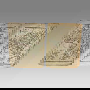
Sold2017J. Rapkin: Map of Africa, 1850Map: Africa Maker: The London Printing and Publishing Company [John Tallis], Rapkin, J. Published: London, 1850 Size: Quarto - 10.00 H x 12.75 W Inches Central Congo unexplored. Decorative border. TakSee Sold Price
3 days LeftJasper521795 Pazzini Carli Map of Southwest England -- Le Provincie Che Sono al Sud Ouest Dell' InghilterraUS$60
3 days LeftJasper521790 Pazzini Carli Map of English Midlands, East and Southeast -- Le Provincie Che Sono al Sud EstUS$60
4 days LeftPotter & Potter AuctionsAUDIBERTI, J. Choain. Afrique Equatoriale Francaise. Paris:...US$100(1 bid)
4 days LeftPotter & Potter AuctionsMEDINA, Miruel Gomez. Pictorial Map of Mexico. 1931. USA: F...US$150
4 days LeftPotter & Potter AuctionsLANGENECKERT. It’s A Dog’s World. 1968. St. Louis: Ralston ...US$100
9 hrs LeftSchilb Antiquarian Rare Books1869 ATLAS 42 MAPS America Africa Australia GERMANY Switzerland Sydow RAREUS$155(4 bids)
May 30NY Elizabeth ANTIQUE MAP-ILLUSTRATED FLORAL ILLUSTRATION 1761 NEW DICTIONARY OF TRADE AND COMMERCE R. ROTHUS$50


![J. Rapkin: Map of Africa, 1850: Map: Africa Maker: The London Printing and Publishing Company [John Tallis], Rapkin, J. Published: London, 1850 Size: Quarto - 10.00 H x 12.75 W Inches Central Congo unexplored. Decorative border. Tak](https://p1.liveauctioneers.com/5584/99784/50895523_1_x.jpg?height=310&quality=70&version=1486164110)


![[MAP]. ORTELIUS, Abraham. Africae Tabula Nova. 1592. (1 of 2)](https://p1.liveauctioneers.com/197/329395/177650533_1_x.jpg?height=282&quality=70&version=1715364962)


