Sold2022Levasseur, Victor 1859 LG Illus. Atlas Title. Ships etcSteel Engraved Decorative Title Page Published 1859, Paris for "Atlas National Illustre" by Victor Levasseur. Paper Size: 20 x 14 inch (51 x 36cm) Some small margin tears/wrinkles, image in Good CondiSee Sold Price
Sold2020Levasseur, Victor 1869 LG Atlas Title Page. Ships etcSteel Engraved Title Page Published C1850, Paris for "Atlas National Illustre" by Victor Levasseur. Paper Size: 20.5 x 15 inch (52 x 38cm) Good ConditionSee Sold Price
Sold2019Levasseur, Victor 1859 Map of The Dordogne & Title Page"Dept. de la Dordogne" and Title Page. Steel Engraved Maps Published 1859, Paris for "Atlas National Illustre" by Victor Levasseur. Paper Size: 20.5 x 14.5 inch (52 x 37cm) Good ConditionSee Sold Price
Sold2018Levasseur, Victor 1859 Lot of 8 Large French MapsIncl The Marne, Deux Sevres, Loire, Vienne, Garonne, Meuse, Saone et Loire, Sarthe. Steel Engraved Maps Published 1859, Paris for "Atlas National Illustre" by Victor Levasseur. Outline hand colour. PaSee Sold Price
Sold2018Levasseur, Victor 1859 Lot of 6 Large French MapsIncl Drome, Lozere, Cher, Loire, Charente, Manche. Steel Engraved Maps Published 1859, Paris for "Atlas National Illustre" by Victor Levasseur. Outline hand colour. Paper Size: 20 x 14.5 inch (51 x 37See Sold Price
Sold2018Levasseur, Victor 1859 Lot of 6 Large French MapsIncl Cantal, Charente, L'Allier, Basses-Alpes, Hautes Alpes, L'Ain. Steel Engraved Maps Published 1859, Paris for "Atlas National Illustre" by Victor Levasseur. Outline hand colour. Paper Size: 20 x 1See Sold Price
Sold2018Levasseur, Victor 1859 Lot of 6 Large French MapsIncl L'Eure, D'Eure et Loir, Finistere, Creuse, Correze, and Cotes du Nord. Steel Engraved Maps Published 1859, Paris for "Atlas National Illustre" by Victor Levasseur. Outline hand colour. Paper SizeSee Sold Price
Sold2018Levasseur, Victor 1859 Lot of 6 Large French MapsIncl Ardennes, D'Ille et Vilaine, L'Indre, L'Aveyron, Calvados. Steel Engraved Maps Published 1859, Paris for "Atlas National Illustre" by Victor Levasseur. Outline hand colour. Paper Size: 20 x 14.5See Sold Price
Sold2018Levasseur, Victor 1859 Lot of 6 Large French MapsIncl Maine et Loire, Doubs, Loir et Cher, Gard, L'Ardeche, L'Aisne. Steel Engraved Maps Published 1859, Paris for "Atlas National Illustre" by Victor Levasseur. Outline hand colour. Paper Size: 20 x 1See Sold Price
Sold2018Levasseur, Victor 1859 Lot of 6 Large French MapsIncl L'Isere, Garonne, Loiret, Lot, L'Aude, L'Aube. Steel Engraved Maps Published 1859, Paris for "Atlas National Illustre" by Victor Levasseur. Outline hand colour. Paper Size: 20 x 14.5 inch (51 x 3See Sold Price
Sold2018Levasseur, Victor 1859 Lot of 6 Large French MapsIncl Seine Inferieuere, Seine et Marne, Vendee, Garonne, Tarn, Somme. Steel Engraved Maps Published 1859, Paris for "Atlas National Illustre" by Victor Levasseur. Outline hand colour. Paper Size: 20 xSee Sold Price
Sold2018Levasseur, Victor 1859 Decorative Map of Algeria"Algerie. Colonie Francaises" Steel Engraved Map Published 1859, Paris for "Atlas National Illustre" by Victor Levasseur. Paper Size: 20.5 x 14.5 inch (52 x 37cm) Good ConditionSee Sold Price
Sold2018Levasseur, Victor 1859 Lot of 6 Large French MapsIncl L'Oise, L'Orne, Calais, Dome, Pyrenees, Saone, . Steel Engraved Maps Published 1859, Paris for "Atlas National Illustre" by Victor Levasseur. Outline hand colour. Paper Size: 20 x 14.5 inch (51 xSee Sold Price
Sold2018Levasseur, Victor 1859 Lot of 6 Large French MapsIncl L'Herault, Mayenne, Meurthe, Moselle, Nievre, Nord. Steel Engraved Maps Published 1859, Paris for "Atlas National Illustre" by Victor Levasseur. Outline hand colour. Paper Size: 20 x 14.5 inch (5See Sold Price
Sold2018Levasseur, Victor 1859 Lot of 6 Large French MapsIncl Gers, Loire, Rhone, Hte Vienne, Vosges, L'Yonne. Steel Engraved Maps Published 1859, Paris for "Atlas National Illustre" by Victor Levasseur. Outline hand colour. Paper Size: 20 x 14.5 inch (51 xSee Sold Price
Sold2018Levasseur, Victor 1859 Pair of Maps of Paris, France"Seine et Oise" and "Dept de la Seine" Steel Engraved Map Published 1859, Paris for "Atlas National Illustre" by Victor Levasseur. Paper Size: 20.5 x 14.5 inch (52 x 37cm) Good ConditionSee Sold Price
Sold2018Levasseur, Victor 1859 Map of Senegal, Madagascar"Colonies Francaises en Afrique" Steel Engraved Map Published 1859, Paris for "Atlas National Illustre" by Victor Levasseur. Paper Size: 20.5 x 14.5 inch (52 x 37cm) Good ConditionSee Sold Price
Sold2018Levasseur, Victor 1859 Map of Guadeloupe. Caribbean"Colonies Francaises en Amerique" Steel Engraved Map Published 1859, Paris for "Atlas National Illustre" by Victor Levasseur. Paper Size: 20.5 x 14.5 inch (52 x 37cm)See Sold Price
Sold2020Levasseur, Victor 1869 Pair of HC Maps of N. & W."Algerie, Colonie Francaise" and " Colonies Francaises en Afrique" showing Senegal etc. Hand Coloured Steel Engraved Decorative Maps Published C1850, Paris for "Atlas National Illustre" by Victor LevaSee Sold Price
Sold2023Maximilien Victor Ringel (Born 1859) FranceMaximilien Victor Ringel (Born 1859) France Title: A Troubador Musician Bronze and enamel Sculpture Signed Measure 32 1/4 inSee Sold Price
Sold2021MITCHELL, SAMUEL AUGUSTUS. Mitchell's New General AtlasMITCHELL, SAMUEL AUGUSTUS. Mitchell's New General Atlas Containing Maps of the Various Countries of the World, Plans of Cities, Etc. Letterpress title-page, list of maps, profusion of hand-colored litSee Sold Price
Sold20201802 Denon Atlas of Egypt Containing Maps, Views, etc.Title: 1802 Denon Atlas of Egypt Containing Maps, Views, etc. -- Planches du voyage dans la Basse et la Haute Egypte Date: 1802 c., Paris Cartographer: D-V Denon Size: 18.2 X 11.4 in. and lagest foldoSee Sold Price
Sold2023Clipper Ship Card for Anglo SaxonHeading: (Clipper Ship Sailing Cards) Author: Title: ANGLO SAXON Place Published: New York Publisher: Date Published: 1859 Description: Clipper ship sailing card, on porcelain coatSee Sold Price
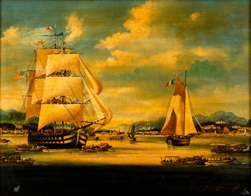
Sold2016Carl Holty Abstract Oil on Canvas Board.Attributed to Carl Holty, Abstract oil on canvas board. Graham Gallery Madison Avenue label on the back states: Artist: Carl Holty, Title: Ship, Date: 1939, Medium: o/c/b. No. 6066. (Approx. 35.5" x 2See Sold Price
2 hrs LeftJasper521869 Mitchell Map of Much of Western Europe -- XXXII Prussia the German States Holland & BelgiumUS$30
5 days LeftBroward Auction GalleryATTR Elliott Daingerfield (NY,NC,1859-1932) oil painting antiqueUS$475(3 bids)
5 days LeftLeonard Auction, a division of The Leonard CompanyHall (American, 19th Century) 'Ship George Skolfield ...' DioramaUS$1,000
Featured2 hrs LeftJasper521716 Homann Map of Northern Germany -- Circulus Saxoniae Inferioris in omnes suos Status etUS$95