Sold2024Map. Portugal. Nicolas SansonPortugal. Nicolas Sanson Hand Colored Map Paris. 1654 17" x 23".See Sold Price
Sold2019Three Maps by Nicolas Sanson (1600-1667, Paris), Two-Three Maps by Nicolas Sanson (1600-1667, Paris), Two- "Carte Generalle d'Espagne .. Royaumes," 1641; together with "Gouvernement General d'Orteans Maine, le Perche, la Beauce..Gastinois," 1650, hand cSee Sold Price
Sold2019Two Maps by Nicolas Sanson (1600-1667, Paris), "Isle deTwo Maps by Nicolas Sanson (1600-1667, Paris), "Isle de France, Champagne, Lorraine," 1679; together with "Le Royaume de France, Toutes ses Provinces, et ses Acquisitions, L'Espagne le Luxembourg," 16See Sold Price
Sold2019Three Maps by Nicolas Sanson (1600-1667, Paris),Three Maps by Nicolas Sanson (1600-1667, Paris), "Lespagne en Plusieurs Peuples suiant Peolomee," 1641; together with two- "Galliae Antiquae Descriptio Geographica," 1629 Geographica- H. - 17 in., W.See Sold Price
Sold2019Two Maps by Nicolas Sanson (1600-1667, Paris), " LaTwo Maps by Nicolas Sanson (1600-1667, Paris), " La France L'Ancienne Gaule Primatiats… ar Evesches et Evesches," 1679; together with "Le Royaume de France et es Acqusitions Pays Bas L'AllemagneSee Sold Price
Sold2019Group of Three Maps by Nicolas Sanson (1600-1667,Group of Three Maps by Nicolas Sanson (1600-1667, Paris), "La Gaule en dixsept provinces Romain," 1641; together with "Gouvernment General du Lyonnois, Forez, Beavoilais," 1679; and "Gouvernment De FrSee Sold Price
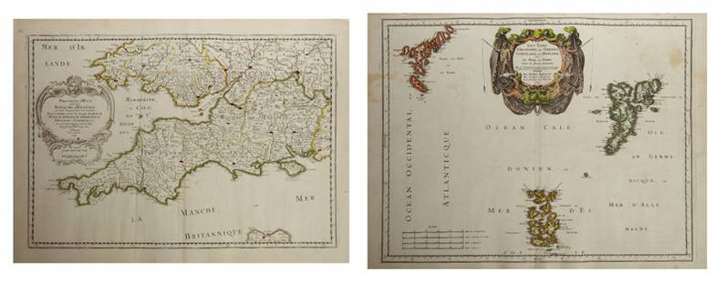
Sold2019Two Maps by Nicolas Sanson (1600-1667, Paris),Two Maps by Nicolas Sanson (1600-1667, Paris), "Provinces d'West Royame d'Westsex," 1679; together with"Les Isles Orcadney, ou Orkney Farre," 1665, Orcadney- H. - 16 in., W. - 23 in., d'Westsex- H. -See Sold Price
Sold2019Two Maps by Nicolas Sanson (1600-1667, Paris), "LeCoursTwo Maps by Nicolas Sanson (1600-1667, Paris), "LeCours de la Riviere du Rhein. Tous LeDauphin les Estats et Souverainetes," 1692; together with "Gallia Vetus ex C.lulii C aefaris comentarii descripaeSee Sold Price
Sold2019Two Maps by Nicolas Sanson (1600-1667, Paris)," AncientTwo Maps by Nicolas Sanson (1600-1667, Paris)," Ancient Royaume de Northumbland and Provinces de Nort," 1679; together with " L'Escosse de la Tay… Provinces… Stralloch," 1665, Stralloch- HSee Sold Price
Sold2019Two Maps by Nicolas Sanson (1600-1667, Paris),Two Maps by Nicolas Sanson (1600-1667, Paris), "L'Estats de'Englise et de Toscane," 1648, together with "Nicens Ory de Mercie," 1654 H. - 17 in., W. - 23 in. (2 Pcs.)See Sold Price
Sold2019Two Maps by Nicolas Sanson (1600-1667, Paris),Two Maps by Nicolas Sanson (1600-1667, Paris), "Principaute de Galles, Nort Walles," 1679; together with "Hispaniae Antiqua Tabulae," 1641, hand colored, Tabulae- H. - 16 in., W. - 23 in., Galles- H.See Sold Price
Sold2019Two Maps by Nicolas Sanson (1600-1667, Paris), "LaTwo Maps by Nicolas Sanson (1600-1667, Paris), "La Judee ou Palestine Herodes," together with "Gouvernement General de L'lsle de France et Pays Circomvoisins," 1679, France- H. - 15 in., W. - 20 in.,See Sold Price
Sold2019Two Maps by Nicolas Sanson (1600-1667, Paris), "CarteTwo Maps by Nicolas Sanson (1600-1667, Paris), "Carte General du Royaume de France Auceq tousles Pays Circomuoisins," 1658; together with "Anciens Royaumes de Kent, D'Essexet de Sussex de Picardie etSee Sold Price
Sold2019Two Maps by Nicolas Sanson (1600-1667, Paris),Two Maps by Nicolas Sanson (1600-1667, Paris), "Picardie et les Pays Bas Catholiques," 1667; together with "Carte des Rivieres de la France," 1641, hand colored, France- H. - 17 in., W. - 23 in., CatoSee Sold Price
Sold2019Two Maps by Nicolas Sanson (1600-1667, Paris),Two Maps by Nicolas Sanson (1600-1667, Paris), "L'Estats de'Englise et de Toscane," 1648, H. - 17 in., W. - 23 in. (2 Pcs.)See Sold Price
Sold2019Two Maps by Nicolas Sanson (1600-1667, Paris), "LeTwo Maps by Nicolas Sanson (1600-1667, Paris), "Le Marquisat et Electorat de Brandeburg," 1692; together with "Partie du Cercle d'Austiche Divise en Haute et Basse," 1696, d'Austiche- H. - 21 in., W.See Sold Price
Sold2019Two Maps by Nicolas Sanson (1600-1667, Paris), "EstatsTwo Maps by Nicolas Sanson (1600-1667, Paris), "Estats de la Couronne de Boheme le Royaume Boheme le Diche/Paris de Silesie," 1696; together with "le Cercle de Franconie Subdivise," 1696, Franconie- HSee Sold Price
Sold2019Two Maps by Nicolas Sanson (1600-1667, Paris),Two Maps by Nicolas Sanson (1600-1667, Paris), "Diocese, Pre Uoste, et Eslection Le Diocese," 1679; together with "La Lorraine et les Estats qui le Duche de Lorraine… Barret les Evesches et BallSee Sold Price
Sold2019Two Maps by Nicolas Sanson (1600-1667, Paris),Two Maps by Nicolas Sanson (1600-1667, Paris), "Champaigne et Brie," 1679; together with "Gouvemement General de la Picardie Artois Boulenois," 1651, hand colored, Picardie- H. - 17 in., W. - 23 in.,See Sold Price
Sold2020Group of French Maps Guillaume de l'Isle SansonGroup of four 17th and 18th century French maps. Guillaume Delisle (1675-1726) hand colored engraved map of Picardie, 1748. Two maps by Nicolas Sanson (1600-1677), "Le Roayaume de France" and "GouvernSee Sold Price
Sold2022Alexis Hubert Jaillot and Nicolas Sanson - Map of the Grand Duchy of Moscow, Etching, 1708.Alexis Hubert Jaillot (French, 1632-1712) and Nicolas Sanson (French, 1600-1667) - Map of the White Russia or the Grand Duchy of Moscow, Etching, 1708. Title: Les Estats du Czaar de Russie Blanche ouSee Sold Price
Sold2020Nicolas Sanson Map of AsiaNicolas Sanson (1600-1667) "L'Asie divisee en ses Principales Regions, et ou se peuvent voir l'estendue, Des Empires, Monarchies, Royaumes, et Estats," Paris: Jaillot, ca. 1719. Hand colored map of AsSee Sold Price
Sold2024Nicolas Sanson - Map of Asia / Asia divided into its Principal RegionsCopper engraving, 1600s/1700s, "Asia divided into its Principal Regions." By Mr. Sanson, Geographer Ordinary to the King. Size: 58 cm x 88 cm.See Sold Price
Sold2020Nicolas Sanson Map of Morea Greece 1692Nicolas Sanson (1600-1677), "La Moree et les Isles de Zante, Cafalonie, Ste Maure, Cerigo, &c." Paris: Hubert Jaillot, 1692. This hand-colored map depicts Morea, the southern part of Greece, with theSee Sold Price
Featured6 days LeftJasper52Il Regno d'Ungaria, Transilvania… Bosnia, Croatia… DE ROSSI / SANSON 1683 mapUS$160
5 days LeftJasper521858 Mitchell Map of Southern Europe and France [verso] Asia -- No. 24 Map of France, Spain,US$30
6 days LeftJasper52Spain, Portugal & Western France ports sea chart. Bordeaux Lisbon LARGE 1952 mapUS$35
6 days LeftJasper52Spain, Portugal & Western France ports sea chart. Bay of Biscay. LARGE 1927 mapUS$35
6 days LeftJasper52Spain, Portugal & Western France ports sea chart. Bordeaux Lisbon LARGE 1959 mapUS$60
1 day LeftTrillium Antique Prints & Rare BooksBonne - Pair of Maps (Eastern & Northern Hemisphere)US$75
5 days LeftJasper521869 Mitchell Map of Much of Western Europe -- XXXII Prussia the German States Holland & BelgiumUS$30
5 days LeftJasper52Coin Types Issued by Various Islamic Rulers in the Indian Subcontinent By ProvostUS$25
Featured5 days LeftJasper521752 Japanese coins and Military Banners during the Tokugawa era, By ProvostUS$35
4 days LeftFleischer's Auctions1755 Map Partie de l'Amerique Septentrionale, qui comprend Le Cours de L'Ohio...US$200(3 bids)
1 day LeftCrescent City Auction GalleryWilliam H. Williams (1817-1886), New Orleans "Map of the Sixth District and Carrollton," 1871, H.-US$650
3 days LeftSchilb Antiquarian Rare Books1977 JRR Tolkien 1st ed 1st Printing Silmarillion Lord of the Rings + MAP + DJUS$200(5 bids)
3 days LeftSchilb Antiquarian Rare Books1859 AFRICA VOYAGES Barth Timbuktu Tripoli SLAVES Illustrated Slavery MAP AfricanUS$105(5 bids)
May 18Blackstone Valley Auctions & Estates LLCRevolutionary Era War Map of the Attack on Ft. Moultrie.US$120(2 bids)
3 days LeftSchilb Antiquarian Rare Books1883 FLORIDA for Tourists & Settlers Illustrated Fort Barrancas MAP Fine BINDINGUS$90(5 bids)
5 days LeftUniversity ArchivesFeb. 1777 Issue of The Gentleman's Magazine with Superb Map of PhiladelphiaUS$140(1 bid)


![1858 Mitchell Map of Southern Europe and France [verso] Asia -- No. 24 Map of France, Spain, (1 of 2)](https://p1.liveauctioneers.com/5584/328338/176911601_1_x.jpg?height=282&quality=70&version=1715113718)


