Sold2020Nicolas Sanson Map of Morea Greece 1692Nicolas Sanson (1600-1677), "La Moree et les Isles de Zante, Cafalonie, Ste Maure, Cerigo, &c." Paris: Hubert Jaillot, 1692. This hand-colored map depicts Morea, the southern part of Greece, with theSee Sold Price
Sold2019Two Maps by Nicolas Sanson (1600-1667, Paris), "LeCoursTwo Maps by Nicolas Sanson (1600-1667, Paris), "LeCours de la Riviere du Rhein. Tous LeDauphin les Estats et Souverainetes," 1692; together with "Gallia Vetus ex C.lulii C aefaris comentarii descripaeSee Sold Price
Sold2019Two Maps by Nicolas Sanson (1600-1667, Paris), "LeTwo Maps by Nicolas Sanson (1600-1667, Paris), "Le Marquisat et Electorat de Brandeburg," 1692; together with "Partie du Cercle d'Austiche Divise en Haute et Basse," 1696, d'Austiche- H. - 21 in., W.See Sold Price
Sold2022Alexis Hubert Jaillot and Nicolas Sanson - Map of the Grand Duchy of Moscow, Etching, 1708.Alexis Hubert Jaillot (French, 1632-1712) and Nicolas Sanson (French, 1600-1667) - Map of the White Russia or the Grand Duchy of Moscow, Etching, 1708. Title: Les Estats du Czaar de Russie Blanche ouSee Sold Price
Sold2020Nicolas Sanson Map of AsiaNicolas Sanson (1600-1667) "L'Asie divisee en ses Principales Regions, et ou se peuvent voir l'estendue, Des Empires, Monarchies, Royaumes, et Estats," Paris: Jaillot, ca. 1719. Hand colored map of AsSee Sold Price
Sold2024Nicolas Sanson - Map of Asia / Asia divided into its Principal RegionsCopper engraving, 1600s/1700s, "Asia divided into its Principal Regions." By Mr. Sanson, Geographer Ordinary to the King. Size: 58 cm x 88 cm.See Sold Price
Sold2019Mercator, map of Morea, Greece, 1630Mercator, map of Morea, Greece, 1630, Gerard Mercator, "Morea olim Peloponnesus", Peloponnese Peninsula, Greece, hand-colored copper engraving, published as part of an atlas by J. Hondius, Jr., AmsterSee Sold Price
Sold2018AFTER NICOLAS SANSON (FRENCH, 1600-1667) MAP OF NORTHAFTER NICOLAS SANSON (FRENCH, 1600-1667) MAP OF NORTH AMERICA, hand-colored, on laid paper, title in cartouche to upper left corner lettered "NORTH AMERICA / Divided into it's Principall Parts / whereSee Sold Price
Sold2023AFTER NICOLAS SANSON (FRENCH, 1600-1667) MAP OF CALIFORNIA AS AN ISLANDAFTER NICOLAS SANSON (FRENCH, 1600-1667) MAP OF CALIFORNIA AS AN ISLAND, hand-colored engraving on laid paper, titled "AUDIENCE DE / GUADALAJARA / NOUVEAU MEXIQUE / CALIFORNIE, &c. / Par N. SSee Sold Price
Sold2023AFTER NICOLAS SANSON (FRENCH, 1600-1667) MAP OF FLORIDAAFTER NICOLAS SANSON (FRENCH, 1600-1667) MAP OF FLORIDA, hand-colored engraving on laid paper, titled "FLORIDA / zoo als het van de / SPAANSCHEN en FRANSCHEN / wordt bezeten. / door N. Sanson. /See Sold Price
Sold2023AFTER NICOLAS SANSON (FRENCH, 1600-1667) MAP OF CANADAAFTER NICOLAS SANSON (FRENCH, 1600-1667) MAP OF CANADA, hand-colored engraving on laid paper, titled "CANADA / of / NIEW VRANKRYK / Getrokken uit verfscheide Franfche, / Engelfche, en HollanSee Sold Price
Sold2020Nicolas Sanson Atlantis Insula Map Hand Colored ENicolas Sanson (1600-1677), "Atlantis Insula," Amsterdam: Mortier, ca. 1700. This wonderful hand colored engraving map of America purportedly shows the Western Hemisphere about 200,000 years ago beforSee Sold Price
Sold2016Hubert Jaillot Sanson 1692 Map of ItalyFrame: 38" x 26" image sight: 36.25" x 24.25"See Sold Price
Sold2017Nicolas Sanson, 17th c. map of Imperial RomeNicolas Sanson, 17th c. map of Imperial Rome, Nicolas Sanson (French, 1600-1667), "Imperii Romani geographica descriptio ad Herodiani historiam", c. 1650, Roman territory throughout Europe and Asia asSee Sold Price
Sold2023AFTER NICOLAS SANSON (FRENCH, 1600-1667) MAP OF GREAT BRITAINAFTER NICOLAS SANSON (FRENCH, 1600-1667) MAP OF GREAT BRITAIN, hand-colored engraving on laid paper, engraving by Robert De Vaugondy. Unframed. Circa 1750. 21 3/4" x 31". Provenance: BSee Sold Price
Sold2024Map. Portugal. Nicolas SansonPortugal. Nicolas Sanson Hand Colored Map Paris. 1654 17" x 23".See Sold Price
Sold2019Three Maps by Nicolas Sanson (1600-1667, Paris), Two-Three Maps by Nicolas Sanson (1600-1667, Paris), Two- "Carte Generalle d'Espagne .. Royaumes," 1641; together with "Gouvernement General d'Orteans Maine, le Perche, la Beauce..Gastinois," 1650, hand cSee Sold Price
Sold2019Two Maps by Nicolas Sanson (1600-1667, Paris), "Isle deTwo Maps by Nicolas Sanson (1600-1667, Paris), "Isle de France, Champagne, Lorraine," 1679; together with "Le Royaume de France, Toutes ses Provinces, et ses Acquisitions, L'Espagne le Luxembourg," 16See Sold Price
Sold2019Three Maps by Nicolas Sanson (1600-1667, Paris),Three Maps by Nicolas Sanson (1600-1667, Paris), "Lespagne en Plusieurs Peuples suiant Peolomee," 1641; together with two- "Galliae Antiquae Descriptio Geographica," 1629 Geographica- H. - 17 in., W.See Sold Price
Sold2019Two Maps by Nicolas Sanson (1600-1667, Paris), " LaTwo Maps by Nicolas Sanson (1600-1667, Paris), " La France L'Ancienne Gaule Primatiats… ar Evesches et Evesches," 1679; together with "Le Royaume de France et es Acqusitions Pays Bas L'AllemagneSee Sold Price
Sold2019Group of Three Maps by Nicolas Sanson (1600-1667,Group of Three Maps by Nicolas Sanson (1600-1667, Paris), "La Gaule en dixsept provinces Romain," 1641; together with "Gouvernment General du Lyonnois, Forez, Beavoilais," 1679; and "Gouvernment De FrSee Sold Price
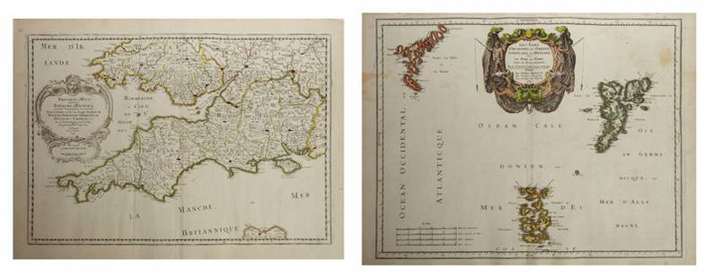
Sold2019Two Maps by Nicolas Sanson (1600-1667, Paris),Two Maps by Nicolas Sanson (1600-1667, Paris), "Provinces d'West Royame d'Westsex," 1679; together with"Les Isles Orcadney, ou Orkney Farre," 1665, Orcadney- H. - 16 in., W. - 23 in., d'Westsex- H. -See Sold Price
Sold2019Two Maps by Nicolas Sanson (1600-1667, Paris)," AncientTwo Maps by Nicolas Sanson (1600-1667, Paris)," Ancient Royaume de Northumbland and Provinces de Nort," 1679; together with " L'Escosse de la Tay… Provinces… Stralloch," 1665, Stralloch- HSee Sold Price
Sold2019Two Maps by Nicolas Sanson (1600-1667, Paris),Two Maps by Nicolas Sanson (1600-1667, Paris), "L'Estats de'Englise et de Toscane," 1648, together with "Nicens Ory de Mercie," 1654 H. - 17 in., W. - 23 in. (2 Pcs.)See Sold Price
Featured4 days LeftJasper52Il Regno d'Ungaria, Transilvania… Bosnia, Croatia… DE ROSSI / SANSON 1683 mapUS$160
6 days LeftAlbion AuctionsStanford, Edward 1901 Large Map. Balkan Peninsula. Greece Turkey MacedoniaUS$5
4 days LeftJasper52GREECE & BALKANS. Albania Bulgaria Serbia Croatia Bosnia Aegean. MALLET 1683 mapUS$25
4 days LeftJasper52Austrian Empire, Italian States, Turkey in Europe & Greece. MITCHELL 1869 mapUS$55
4 days LeftJasper52Johnson's Roman Empire. Imperium Romanorum. Graecia Italia Greece Italy 1861 mapUS$160
4 days LeftJasper52Turquie d'Europe. Turkey in Europe Balkans Greece Wallachia MALTE-BRUN c1871 mapUS$30
4 days LeftJasper52Turkey in Europe & Hungary. Balkans Ukraine Greece Wallachia. WALKER c1795 mapUS$40
4 days LeftJasper52Turquie Européenne. Turkey in Europe. Balkans Greece Aegean. VAUGONDY 1755 mapUS$100
4 days LeftJasper52Eastern Europe Italian Albania Czechosolvakia Carpathian Ruthenia TIMES 1922 mapUS$20
4 days LeftJasper52Balkan Peninsula. Turkish Empire. East Rumelia Greece Servia. THE TIMES 1895 mapUS$20
4 days LeftJasper52Hungary &c with Turky in Europe. Balkans Greece Ukraine. KITCHIN 1782 old mapUS$30
4 days LeftJasper52Turchia d'Europa… Turkey in Europe. Balkans Greece Bulgaria &c. ZATTA 1783 mapUS$55
4 days LeftJasper52Turky [Turkey] in Europe by Herman Moll. Balkans Greece Black Sea 1709 old mapUS$70
4 days LeftJasper52OTTOMAN EMPIRE in Europe & Asia. Greece. British Ionian Islands. SDUK 1844 mapUS$65
4 days LeftJasper52Grecian Archipelago. Aegean Greek Islands Cyclades Dodecanese. HUGHES 1860 mapUS$60


![Turky [Turkey] in Europe by Herman Moll. Balkans Greece Black Sea 1709 old map (1 of 1)](https://p1.liveauctioneers.com/5584/328641/177014336_1_x.jpg?height=282&quality=70&version=1715113718)

