Sold2022Three Framed Maps from the 19th-20th centuriesThree framed maps of Europe and Asia minor from the 19th-20 centuriesSee Sold Price
Sold2023Three Framed Maps, Atlantic, Chesapeake, and the Americasengravings on laid paper with hand color, comprising: Jacques Nicolas Bellin, Carte De La Baye Chesapeack et pays Voisins..., Paris, circa 1757, sight 7-1/2 x 11-1/4 in.; Thomas Bowen, A New & AccuratSee Sold Price
Sold2023Three Framed MapsThree Framed Maps. Up to 26" x 31 1/4" ALL DESCRIPTIONS AND ANY CONDITION STATEMENT GIVEN BY LANGSTON AUCTION GALLERY ARE STRICTLY OPINIONS AND LANGSTON'S SHALL HAVE NO RESPONSIBILITY FOR ERRORS OR OMSee Sold Price
Sold2024Three Framed MapsThree Framed Maps. Up to: 16" x 18" ALL DESCRIPTIONS AND ANY CONDITION STATEMENT GIVEN BY LANGSTON AUCTION GALLERY ARE STRICTLY OPINIONS AND LANGSTON'S SHALL HAVE NO RESPONSIBILITY FOR ERRORS OR OMISSSee Sold Price
Sold2017A Group of Three Framed World Maps, 20th CenturyA Group of Three Framed World Maps, 20th Century20 x 28 inches (50.8 x 71.1 cm) (image, laSee Sold Price
Sold2017Three framed local maps including Dutchess County NY,Three framed local maps including Dutchess County NY, Putnam County NY, and a hand colored City of Poughkeepsie. All in good condition, late 19th to early 20th century.See Sold Price
Sold2024Two (2) Antique 18th C. Copper Engraved Framed Maps - America & EuropeTwo (2) antique 18th C. copper engraved framed maps. One of Amerique and other titled Carte d'Europe. Both framed under glass. Frame Size: 13.5H x 14.5W (each)See Sold Price
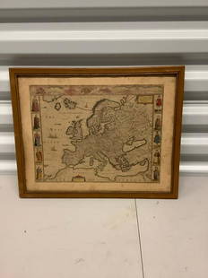
Sold2021Antique Framed Map of Europe, Europa Guilielmo BlaeuwAntique Color Map of Europe, Dutch Cartography. "Europa Recens Descripta" by Guilielmo Blaeuw, a cartographer for the Dutch East India Company. Lots of colorful detail of different nationalitiSee Sold Price
Sold2021Three Framed 19th Century MapsThree Framed 19th Century Mapsto include: Nouvelle Carte De La France (Paris, 1856), steel engraving with color, inset maps of metropolitan Paris and the island of Corsica (Frame dimensions 28-1/4 x 2See Sold Price
Sold2020LOT OF THREE ANTIQUE c.1819 FRAMED MAPSLOT OF THREE ANTIQUE c.1819 FRAMED MAPS - EAST INDIES, DENMARK, SWEDEN, & NORWAY Height: 16 1/2 & 8 in. by Width: 18 1/2 & 10 in.See Sold Price
Sold2023ESTATE OF SEYMOUR STEIN: 4 SMALL FRAMED MAPS (2) OF EUROPE (1) OF N. AMERICA (1) OF ASIA 12" X 15"ESTATE OF SEYMOUR STEIN: 4 SMALL FRAMED MAPS (2) OF EUROPE (1) OF N. AMERICA (1) OF ASIA 12" X 15"See Sold Price
Sold2018Three Framed Prints of MapsThree framed prints of maps, largest measures 17 1/4" x 13 1/4". Provenance: Studio Props of Martha Stewart.See Sold Price
Sold2020Three Historic Maps: New Map of Europe from TheThree Historic Maps: New Map of Europe from The Latest Authorities, 1811, Delaware from the Belt Authorities, 1796, North Carolina published by J.H. Colton Co.,  largest 19 x 21 inSee Sold Price
Sold20223 FRAMED CHARLESTON COUNTY MAPSThree (3) Framed Charleston County Maps showing Neighborhoods. Includes 1- The Peninsula of Charleston.2- East Cooper; Mt. Pleasant, Isle of Palms, Sullivans Island. 3- Sea Islands; Kiawah, Seabrook,See Sold Price
Sold2017SDUK: Three Antique Maps of Turkey in Europe, 1830Map: Turkey I, II and III Cartographer: Baldwin & Cradock, Society for the Diffusion of Useful Knowledge Place & Date: London / 1830/1852 Size: 15" x 12 1/2" (the largest of the three maps) Condition:See Sold Price
Sold2020Three Maps, China & Japan, Brazil, and EuropeComprising, "An Accurate Map of Europe from the latest Observations & Discoveries, Universal Magazine J. Hinton, Newgate Street," "Carte Geographique Statistique et Historique du Bresil," and "China aSee Sold Price
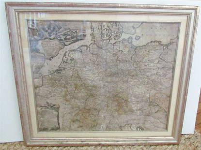
Sold20231769 ANTIQUE MAP of EUROPE framed EUROPEAN POSTAL ROADS & STATIONS1769 ANTIQUE MAP: MAPPA GEOGRAPHICA EXHIBENS POSTAS omnes tam vehiculares quam verdarias Totius Germaniae cum earum accurata distantia Diligentissime propriis sumptibus excudit. Aug. Vindelicor. : TobSee Sold Price
Sold2023Map of Europe, Framed and Under GlassMap of Europe, framed and under glass 24" x 29".See Sold Price
Sold2023Group of 4 Early European MapsGroup of 4 early framed European maps, including; 'De L'Europe, figure III., Isle D'Albion", 'Westmorland', 'Wien in Oesterreich' and 'Milan'. Measures: 12" x 15 1/2" overall, largest.See Sold Price
Sold2024Vintage William Blaeu Colored Map of EuropeVintage William Blaeu Colored Print Map of Europe, Framed. Measures 28 inches x 23 inches.See Sold Price
Sold2021Antique Diagrammatic Road Map of Central EuropeAntique Framed Diagrammatic Road Map of Central Europe by Wood McMurtry. Measures 22 inches high by 28 inches wide.See Sold Price
Jun 04Mark Louis Weseloh Estate LiquidationsSix - 17th c. Maps of Europe, Asia, England, Germany x2, Crete, Greece.8 1/4" x 6 5/8".US$300
BonhamsROYALTY - QUEEN ELIZABETH WILDING (DOROTHY) Fine portrait of Queen Elizabeth II, seated three-qu...£1,100
Jun 07Freeman's | Hindman[MAP]. ORTELIUS, Abraham. Presbiteri Iohannis, sive, Abissinorum Imperii Descriptio. 1592.US$200
11 hrs LeftJasper52Antique French map of Southern America engraving Charles V. Monin (18..-1880)US$45
150 Lots AwayHermann Historica GmbHEmpress Elisabeth of Austria - three framed Austrian prints, 19th centurySee Sold Price
3 days LeftSelkirk Auctioneers & AppraisersTHREE FRAMED WORKS BY LEROY NEIMAN (AMERICAN, 1921-2012)US$50


![[MAP]. ORTELIUS, Abraham. Romani Imperii Imago. 1592. (1 of 2)](https://p1.liveauctioneers.com/197/329395/177650537_1_x.jpg?height=282&quality=70&version=1715364962)


![[MAP]. ORTELIUS, Abraham. Presbiteri Iohannis, sive, Abissinorum Imperii Descriptio. 1592. (1 of 2)](https://p1.liveauctioneers.com/197/329395/177650536_1_x.jpg?height=282&quality=70&version=1715364962)


