Sold20231925-40 17 VIntage Pennsylvania Road MapsIncludes 1931 Commonwealth of PA Tourist Map of Highways; 1927 Commonwealth of PA State Highway Routes; 1925 Commonwealth of PA State Highway Routes; 1932 Commonwealth of PA Tourist Mpa of State HighwSee Sold Price
Sold2021Vintage Maps of Maine Topography MapsVintage Maps of Maine Topography Maps These two maps were drawn out in the early 1900s and then reprinted. The maps we have are vintage reprints and educational with information on how to read topograSee Sold Price
Sold2022Nice 1860 map of Maine with full hand coloringVery nice vintage map of Maine with original hand coloring by county. Features signature floral border that makes Mitchell maps stand apart. Railroads clearly delineated and named. Shows coastal featuSee Sold Price
Sold2022Impressive vintage Colton map of MaineReally nice original vintage map from the very uncommon 1857 Colton General Atlas. (See description of 1857 Colton atlas in item 215-22). Shows highly detailed representation of the coastal features oSee Sold Price
Sold2018PanAm: Vintage Route Map of Caribbean, 1950sTitle/Content of Map: 1950s PanAm Route Map of Caribbean -- PanAmerican Flight Map of New York and Caribbeanan Date Printed: 1950s c. Cartographer: PanAm Size: 14 x 24 in. folded out A very nice routeSee Sold Price
Sold2023Large Book Of Vintage Highway Maps Of Counties In FloridaThis lot contains a Large Book Of Vintage Highway Maps Of Counties In Florida. This book contains approx 200+ maps. It is approx 18 1/2" x 28 3/4" and weighs about 9.7lbs. Overall the mapsSee Sold Price
Sold2018Braniff Airlines: Vintage Map of Americas Routes, 1944Title/Content of Map: 1944 Braniff Airlines Americas Routes -- Braniff Airlines Americas Routes Date Printed: 1944 Cartographer: Braniff Airlines Size: 10 x 7 in. An excellent and off-beat Braniff airSee Sold Price
Sold2021VARIOUS VINTAGE NEW YORK TRANSPORTATION GUIDESVARIOUS VINTAGE NEW YORK TRANSPORTATION GUIDESTravel around New York and surrounding areas by train, trolley, bus, and ferry with these fun vintage route maps and street guides!See Sold Price
Sold2021Vintage Richfield Highway Maps in CaseFour maps are included in this lot with original Richfield Map Case. Maps for California, Alaska, Oregon and Washington.See Sold Price
Sold20221888 FRONT DOOR YARD OF OUR COUNTRY MAINE CENTRAL RAILROAD BOOKHas multiple maps in the book. map of fishing and hunting resorts of Rangeley lakes region Parmachenee & seven ponds. map of mt desert island. map of Maine showing train routes of travel. damage tSee Sold Price
Sold2018Vintage Hawaiian Airline Route Map of Hawaii, 1953Title/Content of Map: 1953 Hawaiian Airline Route Map of Hawaii -- Hawaiian Airline Map of the State of Hawaii Date Printed: 1953 Cartographer: Hawaiian Airline Size: 9.2 x 21 in This is a very nice mSee Sold Price
Sold2021Vintage county and RR map of Maine by Mitchell, 1860Title: Vintage county and RR map of Maine by Mitchell, 1860 Description: Beautiful map of the unique state of Maine with hand coloring by county. Maine, our eastern-most state, is surrounded by anotheSee Sold Price
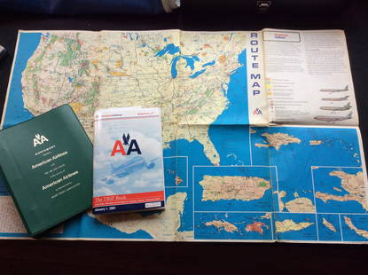
Sold2023Vintage American Airlines Route Map, American Airline Trip Book and BinderVintage American Airlines Route Map, American Airline Trip Book and BinderSee Sold Price
Sold2022Excellent 1850 map of Maine with highlighted Railroad routesHighly detailed and interesting engraved map of Maine, hand colored by counties. Railroads highlighted in orange-red. Locates towns, rivers, mountains, lakes, railroads, coastal features, stage routesSee Sold Price
Sold2024Vintage Verve: Rustic Number 44 Highway ShieldAdd a touch of Americana to your collection with this vintage highway shield, emblazoned with the number 44. Measuring 24 x 24 inches, this substantial piece bears the character of its journey throughSee Sold Price
Sold2023Original Vintage 1950s Tour de France Map Poster RouteAnonymous - France Tour de France (Map Poster) Offset 1950 27.1 x 20 in. (69 x 51 cm) Printer: Mont-Louis, Clermont Condition Details: (A-) was folded, linen-backed #France #Travel #Tour de France #BiSee Sold Price
Sold2023Original Vintage 1950s Tour de France Map Poster RouteAnonymous - France Tour de France (Map Poster) Offset 1958 24 x 19.6 in. (61 x 50 cm) Printer: Dupont, Paris Condition Details: (B+/A-) was folded, linen-backed, small tears at the folds #France #TravSee Sold Price
Sold2023Original Vintage 1960s Tour de France Map Poster RouteAnonymous - France Tour de France (Map Poster) Offset 1965 23.6 x 18.1 in. (60 x 46 cm) Printer: Crete, Paris Condition Details: (A-) was folded, linen-backed #France #Travel #Tour de France #BicyclesSee Sold Price
Sold2022Original Vintage 1960s Tour de France Map Poster RouteAnonymous - FranceTour de France (Map Poster)Offset 196123.6 x 19.2 in. (60 x 49 cm)Printer: CIB, ParisCondition Details: (B+) was folded, mounted on linen, small tears and tiny repaired losses at theSee Sold Price
Sold2022Original Vintage 1950s Tour de France Map Poster RouteAnonymous - FranceTour de France (Map Poster)Offset 195419.6 x 21.6 in. (50 x 55 cm)Printer: Dechaux, ParisCondition Details: (A-) was folded, mounted on linen, printing on reverse shows #France #TravSee Sold Price
Sold2017Vintage New Orleans Pictorial Map, 1928Title/Content of Map: 1928 New Orleans Pictorial Map -- Le Vieux Carre de la Nouvelle Orleans Date Printed: 1928 Cartographer: L Gillican and L Andrews Size: 14.4 x 21.2 in. This is a very nice pictorSee Sold Price
Sold2022Original Vintage 1950s Tour de France Map Poster RouteAnonymous - FranceTour de France (Map Poster)Offset 195525.1 x 19.6 in. (64 x 50 cm)Printer: Georges Lang, ParisCondition Details: (B+) was folded, mounted on linen, names of stage winners filled in wSee Sold Price
Sold2022Original Vintage 1980s Tour de France Map Poster RouteAnonymous - FranceTour de France (Map Poster)Offset 198118.1 x 22.4 in. (46 x 57 cm)Printer: no informationCondition Details: (A-) was folded, mounted on linen #France #Travel #Tour de France #BicycleSee Sold Price
2 days LeftJasper52WW1 WESTERN FRONT. British right attacks, July 1916. Trenches in red 1928 mapUS$20
3 days LeftPotter & Potter Auctions[PICTORIAL MAPS – TRAVEL]. Three Pictorial Maps. 1940s/50s....US$150
3 days LeftPotter & Potter AuctionsBODLEY, Helen (1906 – 1997). A Map of Concord / The Old Mus...US$400
3 days LeftPotter & Potter AuctionsTerritory of Alaska / Alaska Steamship Company. 1936. Seatt...US$100
2 days LeftJasper52EUROPE RAILWAYS. double & single track. Narrow gauge. Steamship routes 1920 mapUS$20
3 days LeftPotter & Potter AuctionsPan American Airways World System Map. 1956. Art by John Br...US$200
2 days LeftJasper52Operation Dragoon 15 August 1944. Assault. Invasion of South of France 1961 mapUS$30
3 days LeftPotter & Potter AuctionsAir France / Reseau Aerien Postal. 1948. Paris: Perceval. L...US$150
3 days LeftPotter & Potter AuctionsArmour’s Food Source Map / The Greatness of the United Stat...US$200
Jun 07Freeman's | Hindman[HARDY, Thomas]. -- WINDLE, C.A. The Wessex of Thomas Hardy. Edmund H. New, illustrator. 1902.US$200
May 29Julien's AuctionsJohn Sebastian | "California Dreaming" by Henry Diltz Contributor Copy Signed Deluxe EditionUS$300
May 29Julien's AuctionsThe Rolling Stones | Bill Wyman "California Dreaming" by Henry Diltz Contributor Copy Signed DeluxeUS$400


![[PICTORIAL MAPS – TRAVEL]. Three Pictorial Maps. 1940s/50s.... (1 of 4)](https://p1.liveauctioneers.com/928/325952/175495561_1_x.jpg?height=282&quality=70&version=1712935174)


![[HARDY, Thomas]. -- WINDLE, C.A. The Wessex of Thomas Hardy. Edmund H. New, illustrator. 1902. (1 of 3)](https://p1.liveauctioneers.com/197/329395/177650387_1_x.jpg?height=282&quality=70&version=1715364962)


