Sold2022Yachting off Texas in Gulf of Mexico, 1845Heading: (Mexico - Texas) Author: Houstoun, Mrs. [Matilda] Title: Texas and the Gulf of Mexico; Or, Yachting in the New World Place Published: Philadelphia Publisher:G.B. Zieber & Co. Date PublisSee Sold Price
Sold2019U S Coast Survey 1896 LG Map. New Orleans Texas Florida"Sketch of General Progress June 30. 1896" Showing Southern, Eastern and Mid West States, incl Florida, Texas, Gulf of Mexico, Georgia etc. Large Lithograph Map Published 1896, Washington for "U.S. CoSee Sold Price
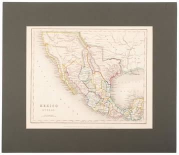
Sold2017Meyer: Antique Map of Mexico & Independent Texas, 1845Map: Neueste Karte von Mexico Cartographer: Bibliographischen Instituts. Place & Date: Hildburghausen / 1845 Size: 14 1/8" x 11 3/8" Condition: original outline color; overall age toning; water stainsSee Sold Price
Sold2023Gilbert Duran, American, Texas, 1936-2023Sail Fish Gulf Of Mexico, Watercolor And Gouache On Paper, Signed Lower Right, Titled On Dust Cover Verso, Sight 29.5 X 39.5 Inches, Distressed Wood Frame, 37 X 46 X 2 Inches, Colors And Paper Stable,See Sold Price
Sold2020Border between Texas & Mexico 1842Heading: (Texas) Author: U.S. Government Title: Map of the River Sabine from its Mouth on the Gulf of Mexico in the Sea to Logan's Ferry...Shewing the Boundary between the United States and the RepublSee Sold Price
Sold2020Mexico with a large independent Texas, c.1845 mapHeading: Author: Gilbert, James Title: Mexico & Texas Place Published: London Publisher:Grattan & Gilbert Date Published: c.1845 Description: Engraved map, hand-colored in outliSee Sold Price
Sold2020Map of Mexico and Texas c.1845Heading: (Texas) Author: Wyld, James Title: Republic of Mexico and Texas Place Published: London Publisher: Date Published: c.1845 Description: Engraved map, with Mexico portionSee Sold Price
Sold2022(WEST--TEXAS.) La Guerra de Tejas, Sin Máscara.(WEST--TEXAS.) La Guerra de Tejas, Sin Máscara. 12 pages. 8vo, stitched; minor dampstaining, repairs to minor worming. Oaxaca, Mexico: Ignacio Rincon, 1845 Second edition. "An anonymous and bitteSee Sold Price
Sold2018Failed treaty negotiations with regards to TexasHeading: (Texas) Author: Title: Ministerio de Relaciones Exteriores, Gobernacion y Politica Place Published: [Mexico City] Publisher: Date Published: [1845] Description: [1See Sold Price
Sold2022Mexico, shows a independent Republic of Texas. Important S.W region map. 1846 by A and C BlackMexico with a independent Republic of Texas, shown at its largest territorial expanse. Although Texas would join the Union in 1845, this map was published in 1846 but was not updated in time making itSee Sold Price
Sold2022Eleven Pieces of Railroad Stationary - National Railways of Mexico, California Zephyr, TexasEleven pieces of railroad stationary with highlighted railroads to include Gulf Mobile and Ohio, Canadian National, Great Northern / Empire Builder, Seaboard Coast Line, National Railways of Mexico, CSee Sold Price
Sold2024Spanish North America. THOMSON. Texas, Mexico & Southwestern USA 1817 mapTitle: "Spanish North America". THOMSON. Texas, Mexico & Southwestern USA 1817 map Description: Spanish North America [northern part] by Drawn & engraved for John Thomson's "New General Atlas" (PublisSee Sold Price
Sold2018Spanish North America. THOMSON. Texas, Mexico &TITLE/CONTENT OF MAP: 'Spanish North America [northern part]' A large map of Texas, Mexico and the American Southwest, published in Edinburgh by John Thompson, based on the explorations of Humboldt anSee Sold Price
2024Spanish North America. THOMSON. Texas, Mexico & Southwestern USA 1817 mapTITLE/CONTENT OF MAP: Spanish North America [northern part] A large map of Texas, Mexico and the American Southwest, published in Edinburgh by John Thompson, based on the explorations of Humboldt andSee Sold Price
Sold2023Spanish North America. THOMSON. Texas, Mexico & Southwestern USA 1830 mapTITLE/CONTENT OF MAP: Spanish North America [northern part] A large map of Texas, Mexico and the American Southwest. There are extensive observations of Native American Indian settlements and huntingSee Sold Price
Sold20231842 Greenleaf Map of Texas, Mexico and Central America -- The United States of MexicoTitle: 1842 Greenleaf Map of Texas, Mexico and Central America -- The United States of Mexico Cartographer: J Greenleaf Year / Place: 1842, Brattleboro, VT Map Dimension (in.): 12.4 X 10.7 in. This isSee Sold Price
2017Flemming: Texas, Mexico, Central AmericaCartographer: Flemming Place & Date: Glogau / 1844 Size: 16 1/2" x 13 1/4" Condition: outline color; some spotting, mostly along the margins The scarce Flemming map of pre-Mexican-American War MexicoSee Sold Price
Sold2017Flemming: Texas, Mexico, Central AmericaCartographer: FlemmingPlace & Date: Glogau / 1844Size: 16 1/2" x 13 1/4"Condition: outline color; some spotting, mostly along the marginsThe scarce Flemming map of pre-Mexican-American War Mexico andSee Sold Price
Sold2020Map of Republic of Texas & Mexico 1838Heading: (Texas) Author: Niles, J.M. & L.T. Pease Title: A Map of Mexico and the Republic of Texas. Drawn & Engraved to accompany the History of Mexico & Texas by J.M. Niles & L.T. Pease, 1838 Place PSee Sold Price
Sold2018LaPie / Tardieu: Antique Map of US, Texas, Mexico, 1809Map: Mexique Cartographer: P. LaPie / Tardieu Place & Date: Paris / 1809/1812 Size: 11 7/8" x 8 3/4" Condition: outline color; light overall age toning, otherwise beautifully preserved A detailed mapSee Sold Price
Sold20191861 Indian Wars Texas & Mexico Frost Native American1861 Indian Wars Texas & Mexico Frost Native American Shawnee Tecumseh John Frost’s portfolio of historical sketches on Native American Indians is an extensive, thorough, and highly detailed suite oSee Sold Price
Sold2022Sketch I Showing the Progress of the Survey in Section No.9 [Texas Gulf Coast]Publication Date: 1853 Title: Sketch I Showing the Progress of the Survey in Section No.9 [Texas Gulf Coast] Cartographer: ANONYMOUS Publisher: U.S. COAST SURVEY Height: 17.5 Width: 21.6 TriangulationSee Sold Price
Sold20231830 Niles Register INDIANS Choctaw Black Canada Colonies TEXAS Mexico SLAVERY1830 Niles Register INDIANS Choctaw Black Canada Colonies TEXAS Mexico SLAVERY Niles Weekly Register was a Baltimore-based periodical known for being one of the most important American magazines of thSee Sold Price
Sold2023Williamson, Lieut. R. S. 1856 Map. California, New Mexico, Texas, Mexico"United States & Mexican Boundary Survery" Lithograph Map Published 1853-61, Washington for "Reports of explorations and surveys, to ascertain the most practicable and economical route for a railroadSee Sold Price
Jun 12Dan Morphy AuctionsBRUE'S MONUMENTAL WALL MAP OF TEXAS, UPPER CALIFORNIA & MEXICO, C. 1845US$500
Jun 02Schilb Antiquarian Rare Books1849 TEXAS 1ed Mexican War Porter Annexation Mexico Americana Peace TreatiesUS$88(4 bids)
7 days LeftJasper52Sketch Showing the Progress of the Survey On The Atlantic, Gulf of Mexico and Pacific Coasts Of TheUS$25
May 30Antiques Online AuctionsVintage Texas 1845 Map Printed in 1986, Compiled by John DavisUS$1(1 bid)
3 days LeftLEAP Auctions40 West Texas & New Mexico Authentic Arrowheads & Bird Point Artifacts in Display CaseUS$20(1 bid)
Jun 02Schilb Antiquarian Rare Books1848 RARE Halls of Montezumas MEXICO Texas America War Zachary Taylor BattlesUS$2(2 bids)
2 days LeftPotter & Potter AuctionsHANDY, R.D. (1879 – 1959). Paul Bunyan’s Pictorial Map of t...US$200(1 bid)
Jun 07Freeman's | HindmanYOUNGBLOOD, Charles L. Adventures of... During Ten Years on the Plains. 1882. FIRST EDITION.US$200
Jun 02Schilb Antiquarian Rare Books1850 Colton Voyages California San Francisco Brazil Slave Trade Peru Deck & PortUS$1(1 bid)
4 days LeftClars Auction GalleryBook, Kendall, George Wilkins. The War Between the United States and Mexico. Austin: Texas StateUS$20
Toystrainsandotheroldstuff LLCFive American Flyer S gauge freight cars with correct original boxesUS$6(1 bid)
3 days LeftLEAP Auctions(2) Decorative Frames of West and New Mexico Authentic Arrowheads ArtifactsUS$20


![Yachting off Texas in Gulf of Mexico, 1845: Heading: (Mexico - Texas) Author: Houstoun, Mrs. [Matilda] Title: Texas and the Gulf of Mexico; Or, Yachting in the New World Place Published: Philadelphia Publisher:G.B. Zieber & Co. Date Publis](https://p1.liveauctioneers.com/642/270500/141582370_1_x.jpg?height=310&quality=70&version=1670438782)


![Failed treaty negotiations with regards to Texas: Heading: (Texas) Author: Title: Ministerio de Relaciones Exteriores, Gobernacion y Politica Place Published: [Mexico City] Publisher: Date Published: [1845] Description: [1](https://p1.liveauctioneers.com/642/125890/64050729_1_x.jpg?height=310&quality=70&version=1533827242)


![Spanish North America. THOMSON. Texas, Mexico & Southwestern USA 1817 map: Title: "Spanish North America". THOMSON. Texas, Mexico & Southwestern USA 1817 map Description: Spanish North America [northern part] by Drawn & engraved for John Thomson's "New General Atlas" (Publis](https://p1.liveauctioneers.com/5584/314775/168780323_1_x.jpg?height=310&quality=70&version=1704837726)
![Spanish North America. THOMSON. Texas, Mexico &: TITLE/CONTENT OF MAP: 'Spanish North America [northern part]' A large map of Texas, Mexico and the American Southwest, published in Edinburgh by John Thompson, based on the explorations of Humboldt an](https://p1.liveauctioneers.com/5584/132181/67157544_1_x.jpg?height=310&quality=70&version=1543975692)
![Spanish North America. THOMSON. Texas, Mexico & Southwestern USA 1817 map: TITLE/CONTENT OF MAP: Spanish North America [northern part] A large map of Texas, Mexico and the American Southwest, published in Edinburgh by John Thompson, based on the explorations of Humboldt and](https://p1.liveauctioneers.com/5584/320546/172232524_1_x.jpg?height=310&quality=70&version=1709072904)
![Spanish North America. THOMSON. Texas, Mexico & Southwestern USA 1830 map: TITLE/CONTENT OF MAP: Spanish North America [northern part] A large map of Texas, Mexico and the American Southwest. There are extensive observations of Native American Indian settlements and hunting](https://p1.liveauctioneers.com/5584/309982/165835454_1_x.jpg?height=310&quality=70&version=1700599538)


![Sketch I Showing the Progress of the Survey in Section No.9 [Texas Gulf Coast]: Publication Date: 1853 Title: Sketch I Showing the Progress of the Survey in Section No.9 [Texas Gulf Coast] Cartographer: ANONYMOUS Publisher: U.S. COAST SURVEY Height: 17.5 Width: 21.6 Triangulation](https://p1.liveauctioneers.com/5584/270923/141842822_1_x.jpg?height=310&quality=70&version=1670433092)


![[MEXICO / SOUTH AMERICA] LOT OF 8 PRINTS TOGETHER (1 of 6)](https://p1.liveauctioneers.com/8124/329546/177689719_1_x.jpg?height=282&quality=70&version=1715469494)