Sold2022Lot of Vintage Ephemera including Advertising, Road Maps, Postcards, Letters, Drivers License, etc.Lot of Vintage Ephemera including Advertising, Road Maps, Postcards, Letters, Drivers License, etc.See Sold Price
Sold2021Mining and Geological Maps. Lot of 31 Maps.Mining and Geological Maps. Lot of 31 Maps. Edite dalla Librairie Polytchnique Ch. Béranger, fine dell’800 - inizi del 900 Il lotto si compone di15 mappe minerarie e geologiche a colori inSee Sold Price
Sold2021Map LotLot (2) maps mounted on cardboard "The Supplement to / NORTH AMERICA" and "The Continent and Islands of AMERICA…", each 21" x 47 1/2".See Sold Price
Sold2023ANTIQUE FLORIDA FRAMED MAPS - LOT OF 2148268 ANTIQUE FLORIDA FRAMED MAPS - LOT OF 2 Antique Florida map framed map to include one 1853 U.S. Coast Survey Chart or Map of St. George's Sound, Florida, and one unsigned map of Florida denotedSee Sold Price
Sold2016Map LotLot (3) framed maps including "Carte De La Baye De Hudson" (sight 9 1/4" x 12 1/4"), "The River St. Laurence" (sight 10" x 14 1/2"), "A Plan of the City and Harbour of Louisburg" (sight 11" x 14 1/2")See Sold Price
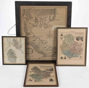
Sold2023ASSORTED EUROPEAN AND ASIAN MAPS, LOT OF FOURASSORTED EUROPEAN AND ASIAN MAPS, LOT OF FOUR, engraving on paper, three with hand-coloring, comprising a map of Buteshire in Scotland by William Home Lizars (Scottish, 1788-1859), two "LA FRANCESee Sold Price
Sold2021ROCKBRIDGE CO., SHENANDOAH VALLEY OF VIRGINIA MAPS, LOTROCKBRIDGE CO., SHENANDOAH VALLEY OF VIRGINIA MAPS, LOT OF THREE, comprising 1877 "Grays new Map of Lexington", a copy of Carmichael's "County of Rockbridge", and 1973 Hildebrand's Rockbridge County hSee Sold Price
Sold2015Map LotLot of (4) maps including "Das Herzogthum Schlesien" (sight 10" x 14 1/2"), "North America" (sight 14" x 10 1/2"), "Columbia Co." (19 1/2" x 15 1/2"), "Hillsdale Quadrangle"(sight 26 1/2" x 15").See Sold Price
Sold2022Map LotLot (5) framed maps including: "LE PAYS DES HOTTENTOTS…" (sight 10 1/2", overall 14 1/2" x 18"), "COLONY of the / CAPE of GOOD HOPE" (sight 8 1/2" x 11", overall 13 1/2" x 17"), Map of Central PSee Sold Price
Sold2020Promised Land Map LotLot of two maps of the Holy Land: 1. "A map of the Land of Promise Compiled by the Author out of the Book of Joshua". Hand-colored copperplate engraving. From: Calmet, Augustin Antoine. A historical,See Sold Price
Sold2022Antique Etchings 17th Century Maps Lot Of 5Antique Maps.Lot of 5 maps are by various makers and have a range of condition issues. This item is from the estate of a gentleman from Gaton Lamps on Melrose Ave. Gaton Lamps worked on the interior oSee Sold Price
Sold2023ASSORTED EUROPEAN / AFRICAN PICTORIAL MAPS, LOT OF TWOASSORTED EUROPEAN / AFRICAN PICTORIAL MAPS, LOT OF TWO, engraving on paper, comprising a bird's-eye view of the siege of the town Oost Ende (Ostend), a Flemish town, during The Eighty Years' WSee Sold Price
Sold2023ASSORTED RAILROAD MAPS, LOT OF FIVEASSORTED RAILROAD MAPS, LOT OF FIVE,including the "Chesapeake and Ohio Railroad", and "ROCKISLAND LINES". Unframed.Rock Island dated 1923.One 9 1/4" x 12 1/4" OA. Provenance: From the Dean and Leann LSee Sold Price
Sold2023Map LotLot (3) framed maps including "PLAN DU CENTRE DE PARIS VOLD' OISEU" (overall in frame 28" x 38 1/2"), Spain (overall 25" x 34 1/2"), "GALLACIA REGNUM" (overall 21" x 23").See Sold Price
Sold2022CIRCA 1950'S MOBIL GULF EXXON TRAVEL MAPS LOTLot of 1950's Gas Station Folding Travel Maps Including 2 MOBIL SOCONY, 2 GULF, and EXXONSee Sold Price
Sold2021LATE 19TH & EARLY 20TH C. KANSAS MAPS LOT OF 6LATE 19TH & EARLY 20TH C. KANSAS MAPS LOT OF 6 Lot of late 19th and early 20th century maps of Kansas. Includes 5 Hand drawn and hand colored maps from the 1880s. Fort Scott, Eldorado, Emporia, SalinSee Sold Price
Sold20231939-45 WW2 MAPS LOT OF 41939-45 WW2 MAPS LOT OF 4 The lot is pre-owned. SHIPPING FEE CANADA 10.00$ USA 15.00$ Combined shipping is available for an extra fee, but only on items won on the same date. *All prices are in USD* TSee Sold Price
Sold2022Cold War US Military Defense Aviation Pilot Maps LotCold War US Military Defense Aviation Pilot Maps Lot. Lot of 5 maps. You will receive the following maps: Global Navigation and Planning Chart GNC 26N, GNC 2, GNC 4, GNC 6 and GNC 8. Prepared and publSee Sold Price
Sold2017Map LotLot (2) early mounted maps. Includes New York (30 1/2" x 22 1/2") and County of Essex (30 1/2" x 22 1/2").See Sold Price
Sold2023Antique English Map LotLot of antique maps, Hertfordshire, and Oxfordshire, England. Including Map of the County of Hertford, C & J. Greenwood 1834. With numerous other maps various sizes, 18th through 20th Centuries.See Sold Price
Sold2022Map LotLot of maps including "CARTE / DE LA / PALESTINE / OF / TERRE SAINTE…1841" (unframed, overall in frame 26 1/2" x 20 1/2"), "CARTE DE L ISLE DE NIEVES" (sight 9" x 6 1/2", overall 16 1/2" x 14"),See Sold Price
3 days LeftRapid Estate Liquidators and Auction Gallery1982 Knoxville World's Fair Information And Maps Lot$35