


![1795 Map of the Tennessee Government: [Tennessee] Map of the Tennessee government, formerly part of North Carolina, taken chiefly from surveys by Gen. D. Smith and others. Engraving by Joseph T. Scott for Careys American Edition of Guthri](https://p1.liveauctioneers.com/5755/336798/182166008_1_x.jpg?height=310&quality=70&version=1721160516)
Engraving Maps & Atlases
40 Results
Sort by:
Best Match
Categories
Location & Shipping
Payment Method
House Rating
Material / Technique
Auction House
Current Bid
Est. Price Range
Sponsored. Your ad here?
Engraving×

Est. $1,000-$2,000
$300


Est. $800-$1,200
$200


Est. $150-$250
$80

Est. $500-$1,000
$150


View:
24
News about Engraving Maps & Atlases
Colonial Boston engraving and Paul Revere war bond lead Early American’s June 8 sale
WINCHESTER, VA — An original printing of a well-known image of colonial Boston will be offered at Early American History Auctions on Saturday, June 8. The circa-1761 engraving of a view of the city after a drawing by the Royal Governor of Massachusetts, Thomas Pownall (1722-1805), has an estimate of $10,000-$12,000. The complete catalog is […]
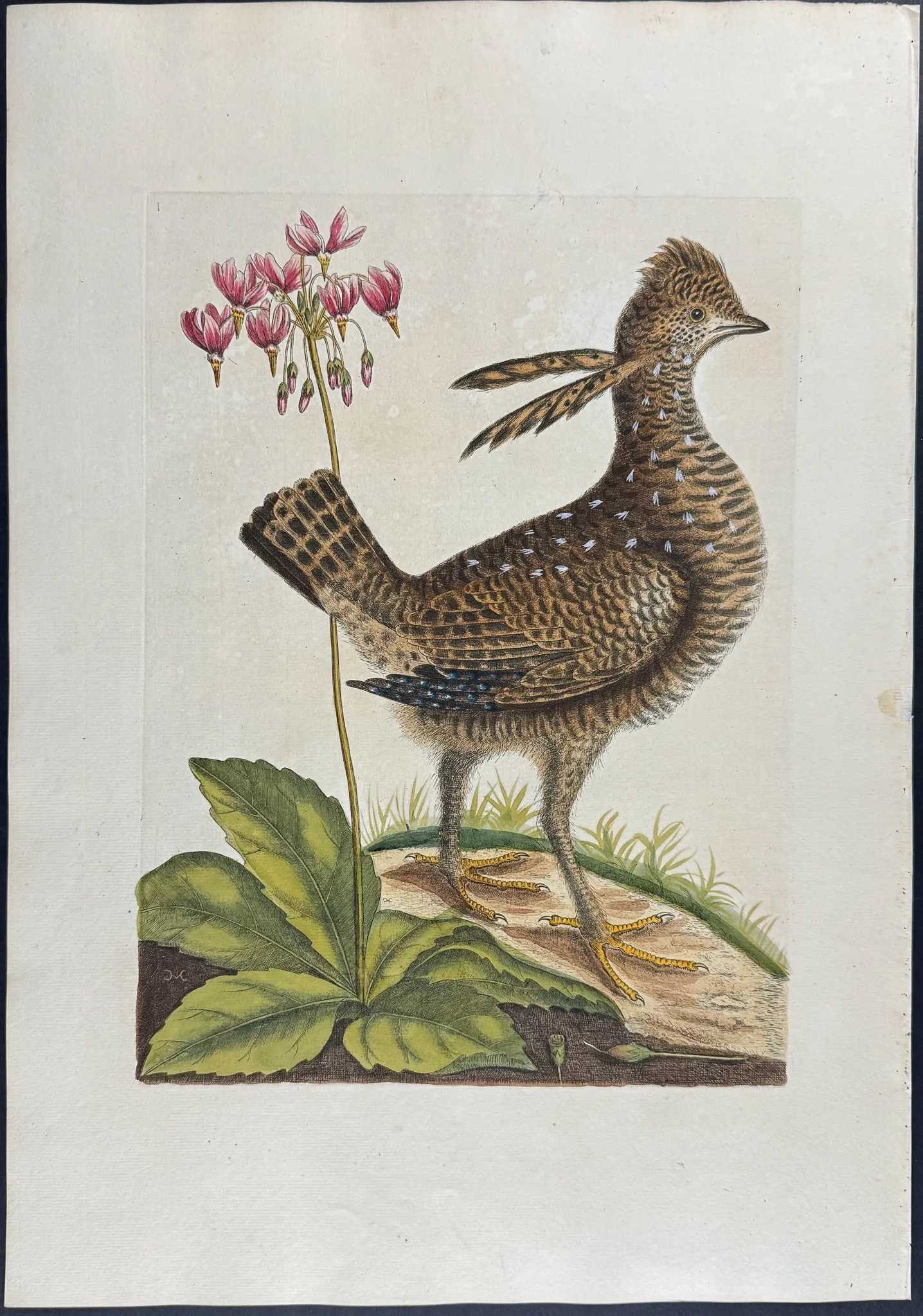
Mark Catesby’s Heath Hen and Eastern Shooting Star Hand-colored Engraving leads our five auction highlights
Mark Catesby, Heath Hen and Eastern Shooting Star Hand-colored Engraving, $5,555 FRANKLIN, TN – Mark Catesby (1683-1749) was born in England, but after traveling to South Carolina, he became America’s first naturalist and illustrator. A century before Audubon, he published the seminal Natural History of Carolina, Florida and the Bahama Islands: Containing the Figures of […]
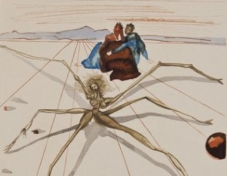
Original Salvador Dali engraving turns up at thrift shop
NAGS HEAD, N.C. (AP) – An original Salvador Dali wood engraving hangs on the wall of Seaside Art Gallery in Nags Head after being discovered among the donated items of an Outer Banks thrift shop.

Museum reveals engraving hidden in Lincoln watch
WASHINGTON (AP) – For nearly 150 years, a story has circulated about a hidden Civil War message engraved inside Abraham Lincoln’s pocket watch. On Tuesday, museum curators confirmed it was true. A watchmaker used tiny tools to carefully pry open the antique watch at the National Museum of American History, and a descendant of the […]
TOP