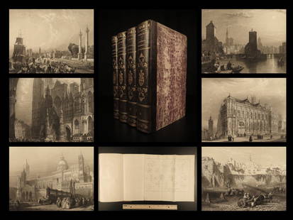
Sold20221841 BEAUTIFUL Geography by Malte-Brun Illustrated1841 BEAUTIFUL Geography by Malte-Brun Illustrated Jerusalem Edinburg Ruins 4v Conrad Malte-Brun was a French geographer and cartographer known for his impressive journal-like atlases and geography boSee Sold Price
Sold20181850 MAPS Atlas Geography Illustrated Jerusalem CHINA1850 MAPS Atlas Geography Illustrated Jerusalem CHINA 8v Malte-Brun Conrad Malte-Brun was a French geographer and cartographer known for his impressive journal-like atlases and geography books. UnfortSee Sold Price
Sold20191843 Geography WORLD VIEWS Atlas Illustrated Jerusalem1843 Geography WORLD VIEWS Atlas Illustrated Jerusalem Israel India 6v Malte-Brun Conrad Malte-Brun was a French geographer and cartographer known for his impressive journal-like atlases and geographySee Sold Price
Sold2021Ten 19th C. Books Prison Life J. Davis, Clarke'sTen 19th C. Books Prison Life J. Davis, Clarke's Commentary Etc. (2) Vol. Clarke's Commentary 1837. (1) Prison life of Jefferson Davis 1866. (1) Vol 7 Malte-Brun's Geography 1829. (1) J. G. Wood InsecSee Sold Price
Sold2019Hindoostan.Title: Hindoostan. Publication Date: 1834 Cartographer: G. Boynton Publisher: Samuel WalkerSize: 9.3Height - 7.75Width Attractive map from System of Geography by M. Malte Brun containing a descriptionSee Sold Price
Sold2018SicilyReserve Reduced! Title/Content of Map: SicilyDate: 1834 Cartographer: G. Boynton Material/Medium: SAMUEL WALKER Size: 7.65 x 9.5 inches Attractive map from System of Geography by M. Malte Brun containSee Sold Price
Sold20181956 History of EGYPT Persia Geography Illustrated Map1956 History of EGYPT Persia Geography Illustrated Map Pyramids Nile Hieroglyphs An impressive and absolutely beautiful second edition of James Breasted’s ‘History of Egypt.’ This incredible worSee Sold Price
Sold20173 Vol Universal Geography/Description of the World 1824Volumes 1-3 Book Title: Universal Geography or a Description of All Parts of the World Author: M. Malte-Brun Publishing: Boston, Wells and Lilly, 1824 Conrad Malte-Brun (1775-1826) born Malthe ConradSee Sold Price
Sold2017Malte-Brun: Map of Asia, 1830Map: Asia Maker: John Grigg, Malte-brun, Conrad/j. H. Young, Sc. Publication Date: 1830 Publisher: John Grigg Size: Quarto – 8.00 H x 9.75 W Inches From Malte-Brun's "A new General atlas, exhibitingSee Sold Price
Sold2017Malte-Brun: Antique Map of Northern Africa, 1812Map: 1812 Malte-Brun Map of Northern Africa -- Afrique Ancienne Cartographer: M Malte-Brun Year / Place: 1812, Paris Map Dimensions: 8.7 X 12.7 in. Condition: Very Good - Excellent. Color outlined onSee Sold Price
Sold20171812 Malte-Brun Map of Siberian and Alaskan RussiaTitle: 1812 Malte-Brun Map of Siberian and Alaskan Russia -- Siberie avec lAmerique RussePartie Meridionale de la Russie d'Europe Cartographer: M Malte-Brun Origin/Date: 1812, Paris Size: 8.7 inches XSee Sold Price
Sold2017Malte-Brun: Map of Europe, Barbarian Invasions, 1811Map: 1811 Malte-Brun Map of Europe during the Barbarian Invasions -- L'Europe apres l'invasion des Barbares Cartographer: M Malte-Brun Year / Place: 1811, Paris Map Dimensions: 8.7 X 11.7 An outstandiSee Sold Price
Sold2017Malte-Brun: Antique Map of the World per Herodotus 1812Title/Content of Map: 1812 Malte-Brun Map of the Known World per Herodotus -- Geographie d'Herodote Date Printed: 1812, Paris Cartographer: M Malte-Brun Size: 8.7 X 11.7 in. An excellent and very inteSee Sold Price
Sold2018Malte-Brun: Antique Map of Central Oceanica, 1830Title/Content of Map: Central Oceanica Date Printed: 1830 Cartographer: MALTE-BRUN, CONRAD/J. H. YOUNG, sc. Size (inches): 7.5x7.5 From Malte-Brun's "A new General atlas, exhibiting the five great divSee Sold Price
Sold2017Malte-Brun: Antique Map of Europe in 1829Title/Content of Map: 1829 Malte-Brun Map of Europe in 1829 -- Europe en 1829 Date Printed: 1829, Paris Cartographer: M Malte-Brun Size: 8.7 X 11.7 in. An attractive map of Europe showing its politicaSee Sold Price
Sold20171834 Malte-Brun Map of Ireland1834 Malte-Brun Map of Ireland -- Ireland. M. Malte-Brun / S. Walker. 1834, Boston. 9.3 x 7.5 in. An attractive and highly detailed map with topographical and settlement details. From the American ediSee Sold Price
Sold2017Malte-Brun: Map of Europe during Hun invasion in 370Map: 1812 Malte-Brun Map of Europe during the Hun invasion in 370 -- L'Europe avant l'invasion des Huns vers l'an 370 Date Printed: 1812, Paris Cartographer: M Malte-Brun Size: 8.7 X 11.7 in. ConditioSee Sold Price
Sold20171812 Malte-Brun Map of the Known WorldTitle: 1812 Malte-Brun Map of the Known World -- Systemes Geographiques de Ptolemee… Cartographer: M Malte-Brun Origin/Date: 1812, Paris Size: 8.7 inches X 11.7 inches An excellent and very interestSee Sold Price
Sold2017Malte-Brun: Antique Map of Italy, 1834Title/Content of Map: 1834 Malte-Brun Map of Italy -- Italy Date Printed: 1834, Boston Cartographer: M. Malte-Brun / S. Walker Size: 9.3 x 7.5 in. An attractive and highly detailed map with topographiSee Sold Price
Sold2017Malte-Brun: Antique Double Map of Europe in 1500 & 1789Title/Content of Map: 1812 Malte-Brun Map Double Map of Europe in 1500s and 1789 -- Europe sons Charles-Quint [together with] Europe en 1789 Date Printed: 1812, Paris Cartographer: M Malte-Brun Size:See Sold Price
Sold2017Malte-brun: Double Map of Europe in 900 and 1100, 1812Malte-brun Map Double Map of Europe in 900 and 1100 -- Europe En 900 [together With] Europe En 1100. 1812, Paris. 8.7 X 11.7 in. An interesting double map of Europe in the middle ages -- 900 and 1100.See Sold Price
Sold2017Malte-Brun Map of the Spice Islands, 18341834 Malte-Brun Map of the Spice Islands -- East India Islands (S China Sea). An attractive and highly detailed map the East India Islands with topographical and settlement details. From the AmericanSee Sold Price
Sold20201812 Malte-Brun Map of Ancient Civilized World -- MondeTitle/Content of Map: 1812 Malte-Brun Map of Ancient Civilized World -- Monde Connu des Anciens Cartographer: M Malte-Brun Year/Place: 1812, Paris Size: 8.7 X 11.7 in. An excellent map showing the geoSee Sold Price
Sold20191812 Malte-Brun Map of Germany -- Confederat du RhinTitle/Content of Map: 1812 Malte-Brun Map of Germany -- Confederat du Rhin Date: 1812, Paris Cartographer: M Malte-Brun Size: 11.7 x 8.8 in. An attractive map of German states, showing its political dSee Sold Price
Jun 09Worthington GalleriesAntique Hand-colored Hemisphere Map Mappemonde Revue par E. Cortambert 1864$25
Jun 02Schilb Antiquarian Rare Books1880 BEAUTIFUL William Hogarth ART Illustrated 150 Plates Political Satire FOLIO$26(2 bids)
Jun 02Schilb Antiquarian Rare Books1927 William Blake ART Songs Experience British Museum Poetry Color Illustrated$54(3 bids)
Jun 23Schilb Antiquarian Rare Books1904 MAXFIELD PARRISH Art 1ed Poems of Childhood Eugene Fields Illustrated$1(1 bid)
3 days LeftJasper52BIRD WORLD Stickney & Hoffmann 1st Ed. 1898HC Ginn & Co. ForChildren Illustrated$85
3 days LeftJasper52The Guns Of Shiloh Joseph Altscheler 1914 First Edi. HC Appleton’s Illustrated$200
3 days LeftJasper521850 COMIC HISTORY of ENGLAND SIGNED BINDING 2 VOLS illustrated by LEECH antique$200


![Malte-Brun: Antique Double Map of Europe in 1500 & 1789: Title/Content of Map: 1812 Malte-Brun Map Double Map of Europe in 1500s and 1789 -- Europe sons Charles-Quint [together with] Europe en 1789 Date Printed: 1812, Paris Cartographer: M Malte-Brun Size:](https://p1.liveauctioneers.com/5584/112159/57581953_1_x.jpg?height=310&quality=70&version=1510710796)
![Malte-brun: Double Map of Europe in 900 and 1100, 1812: Malte-brun Map Double Map of Europe in 900 and 1100 -- Europe En 900 [together With] Europe En 1100. 1812, Paris. 8.7 X 11.7 in. An interesting double map of Europe in the middle ages -- 900 and 1100.](https://p1.liveauctioneers.com/5584/102658/52470396_1_x.jpg?height=310&quality=70&version=1492118289)


