Sold2022Antique French Engraving Felix Delamarche set of celestial and solar system 1838Charles-Francois Delamarche (1740-1817), the founder of the family firm was one of the most important French geographers and mapmakers of the second half of the eighteenth century. Successor to NicolaSee Sold Price
Sold2023Antique French Engraving Felix Delamarche map South America 1838Charles-Francois Delamarche (1740-1817), the founder of the family firm was one of the most important French geographers and mapmakers of the second half of the eighteenth century. Successor to NicolaSee Sold Price
Sold2022Antique French Engraving Felix Delamarche Francea 1838Charles-Francois Delamarche (1740-1817), the founder of the family firm was one of the most important French geographers and mapmakers of the second half of the eighteenth century. Successor to NicolaSee Sold Price
Sold2020Antique French Engraving Felix Delamarche map UnitedCharles-Francois Delamarche (1740-1817), the founder of the family firm was one of the most important French geographers and mapmakers of the second half of the eighteenth century. Successor to NicolaSee Sold Price
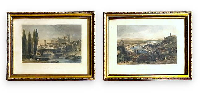
Sold2024Pair of Antique 1841 Thomas Allom Hand-Colored EngravingsPair of Antique 1841 Thomas Allom Hand-Colored Engravings: 1) View of Auch - Midi-Pyr?n?es (Gers - France) - Original steel engraving drawn by Pair of Antique 1841 Thomas Allom Hand-Colored EngravingsSee Sold Price
Sold20241800s Felix Martin Miller Antique Engraving ARIEL Gallery FramedFelix Martin Miller (1820-1880). Ariel. Antique engraving on wove paper after the original bas-relief by master engraver H C Balding (British, 1869-1876 fl.). Year: 1873. Image Size 6 1/8 x 7 5/8 inchSee Sold Price
Sold2019Delamarche, Felix 1829 Astronomy Print, Globes Spheres"Tableau Analytique des Differens Systemes du Monde" Copper Engraved Map Published 1829, Paris for "Atlas de La Geographie..." by Felix Delamarche. Contemporary outline hand colour. Centre fold as pubSee Sold Price
Sold2019Delamarche, Felix 1829 Pair of Maps. Roman Empire etc"Orbis Antiqui Mappa Nova" and "Imperii Romani Tabula" Copper Engraved Maps Published 1829, Paris for "Atlas de La Geographie..." by Felix Delamarche. Contemporary outline hand colour. Centre fold asSee Sold Price
Sold2019Delamarche, Felix 1829 Map of World Hemispheres"Mappe-Monde ou Carte Generale du Globe Terrestre" Copper Engraved Map Published 1829, Paris for "Atlas de La Geographie..." by Felix Delamarche. Contemporary outline hand colour. Centre fold as publiSee Sold Price
Sold2019Delamarche, Felix 1829 Map of the Old World"Orbis Antiqui Mappa Nova" Copper Engraved Map Published 1829, Paris for "Atlas de La Geographie..." by Felix Delamarche. Contemporary outline hand colour. Centre fold as published. Paper Size: 18.5 xSee Sold Price
Sold2019Delamarche, Felix 1829 Group of 3 Maps of Italy"Royaumes de Naples Sicile et Sardaigne" "Italiae Antiquae Mappa Nova" and "Italie Septentrionale" Copper Engraved Map Published 1829, Paris for "Atlas de La Geographie..." by Felix Delamarche. ContemSee Sold Price
Sold2019Delamarche, Felix 1829 Map of North America. USA"Amerique Septentrionale" Copper Engraved Map Published 1829, Paris for "Atlas de La Geographie..." by Felix Delamarche. Contemporary outline hand colour. Centre fold as published. Paper Size: 18.5 xSee Sold Price
Sold2023Delamarche, Felix C1830 Map of Israel Palestine Holy Land"Judee ou Terre Sainte" Based on Vaugondy's earlier Map. Copper Engraved Map Published C1830, Paris for "Atlas de La Geographie..." by Felix Delamarche. Contemporary outline hand colour. Centre fold aSee Sold Price
Sold2019Delamarche, Felix 1829 Lot of 6 Ancient Europe MapsIncl Ancient France, Spain, Germany, Greece, Alexander the Great Empire, and Asia Minor. Copper Engraved Maps Published 1829, Paris for "Atlas de La Geographie..." by Felix Delamarche. Contemporary ouSee Sold Price
Sold2019Delamarche, Felix 1829 Pair of French Maps"Royaume de France divise en 52 Gouvernemens" and "Royaume de France divise en 86 Departemens" Copper Engraved Map Published 1829, Paris for "Atlas de La Geographie..." by Felix Delamarche. ContemporaSee Sold Price
Sold2019Delamarche, Felix 1829 Map of Ancient Italy"Italie Antiquae Mappa Nova" Copper Engraved Map Published 1829, Paris for "Atlas de La Geographie..." by Felix Delamarche. Contemporary outline hand colour. Centre fold as published. Paper Size: 18.5See Sold Price
Sold2019Delamarche, Felix 1829 Map Dispersion of People, World"Carte de la Dispersion des Peuples apres le Deluge" Copper Engraved Map Published 1829, Paris for "Atlas de La Geographie..." by Felix Delamarche. Contemporary outline hand colour. Centre fold as pubSee Sold Price
Sold2019Delamarche, Felix 1829 Map of Austria Empire & Poland"Confederation Germanique Royaume de Prusse Empire d'Autriche royaume de Pologne" Copper Engraved Map Published 1829, Paris for "Atlas de La Geographie..." by Felix Delamarche. Contemporary outline haSee Sold Price
Sold2023Delamarche, Felix C1830 Map of Israel Palestine Holy Land"Judee ou Terre Sainte" Based on Vaugondy's earlier Map. Copper Engraved Map Published C1830, Paris for "Atlas de La Geographie..." by Felix Delamarche. Contemporary outline hand colour. Centre fold aSee Sold Price
Sold2019Delamarche, Felix 1829 Map of South America"Amerique Meridionale" Copper Engraved Map Published 1829, Paris for "Atlas de La Geographie..." by Felix Delamarche. Contemporary outline hand colour. Centre fold as published. Paper Size: 18.5 x 13See Sold Price
Sold2019Delamarche, Felix 1829 Lot of 3 Maps. Asia Minor etc"Tableau de la Retraite des dix Mille" "Alexandri Magni Imperium" and "Asiae Minoris Tabula" Copper Engraved Maps Published 1829, Paris for "Atlas de La Geographie..." by Felix Delamarche. ContemporarSee Sold Price
Sold2019Delamarche, Felix 1829 Pair of Maps. Egypt & IsraelCopper Engraved Maps Published 1829, Paris for "Atlas de La Geographie..." by Felix Delamarche. Contemporary outline hand colour. Centre fold as published. Paper Size: 18.5 x 13 inch (47 x 33cm) MinorSee Sold Price
Sold2019Delamarche, Felix 1829 Map Naples Sicily Sardinia ItalyCopper Engraved Map Published 1829, Paris for "Atlas de La Geographie..." by Felix Delamarche. Contemporary outline hand colour. Centre fold as published. Paper Size: 18.5 x 13 inch (47 x 33cm) SmallSee Sold Price
Sold2019Delamarche, Felix 1829 Map of Turkey in Europe"Turquie d'Europe" Copper Engraved Map Published 1829, Paris for "Atlas de La Geographie..." by Felix Delamarche. Contemporary outline hand colour. Centre fold as published. Paper Size: 18.5 x 13 inchSee Sold Price
3 days LeftJasper52Antique French Engraving Felix Delamarche set of celestial and solar system 1838$95
2 days LeftKCM Galleries1800s DORE Divine Comedy Wood Engraving "Dante and the Eagle" FRAMED Signed$650
11 hrs LeftTrillium Antique Prints & Rare BooksKohler & Weigel - Pair of Maps of the Americas: Map of North America (Part of Canada, Greenland,$75(1 bid)
11 hrs LeftTrillium Antique Prints & Rare BooksBraun & Hogenberg, pub. 1575 - View of Schleswig, Germany$100
11 hrs LeftTrillium Antique Prints & Rare BooksBraun & Hogenberg, pub. 1575 - View of Bethune, France$100
11 hrs LeftTrillium Antique Prints & Rare BooksBraun & Hogenberg, pub. 1575 - View of Serravalle, Italy$100
11 hrs LeftTrillium Antique Prints & Rare BooksBraun & Hogenberg, pub. 1575 - Views of Brixen, Italy and Lauingen, Germany$100
11 hrs LeftTrillium Antique Prints & Rare BooksBraun & Hogenberg, pub. 1575 - View of Avignon, France$100(1 bid)
11 hrs LeftTrillium Antique Prints & Rare BooksSanson - 4 Maps of Europe (Germany, Spain & Portugal, Hungary, & Poland)$75
Jun 22Trillium Antique Prints & Rare BooksKohler & Weigel - Celestial Chart with Draco, Ursa Major & Minor, Cepheus, Cassiopea, Cygnus, & More$75
11 hrs LeftTrillium Antique Prints & Rare BooksSanson - 3 Maps of South America (Chili, Peru, Paraguay)$75
11 hrs LeftTrillium Antique Prints & Rare BooksBraun & Hogenberg, pub. 1575 - View of Saint-Omer, France$100
11 hrs LeftTrillium Antique Prints & Rare BooksSanson - 5 Maps of Africa (Egypt, Barca, Tunis & Tripoli, Morocco, & Barbary & Alger)$75