Sold2022Antique Japanese MapAntique Japanese Map, Marked Ishi-Kawa-Ryugi, Genroku Yonen-Ban-Nippon-zu, Tokyo, Sagamiya, 1691, Maps Of Japan. Folded Approximately 10.375L x 7.0625W in. Unfolded Approximately 66L x 40.25W in.See Sold Price
Sold2022Large Antique Japanese Map, SignedLarge Antique Japanese Map, Signed with Japanese characters in upper portion of the image as well as lower left. Multiple punctures in map. Provenance: important North Carolina estate. Overall framedSee Sold Price
Sold2018Antique Edo Period Japanese Map of Tokyo, 1864Title/Content of Map: 1864 Edo Period Japanese Map of Tokyo -- [Tokyo] Date Printed: 1864 c. Cartographer: Anonymous Size: 28 x 36 in. This is a fantastic folding map of Tokyo from the latter part ofSee Sold Price
Sold2022Antique Japanese Color Woodblock Map of Yedo PrintKeisai Yeisen ( Japanese, 1789 - 1851 ). Subject matter is that of a colored woodblock print depicting a map on paper of Yedo, Japan. Features character marked name to left center. Verso with printedSee Sold Price
Sold2017Japan & Korea map in 1871_Meiji D.Japanese Antique&Old Map in 1871//Luxury version for Bureaucrat in Meiji dynasty(明治時代)//its condition is so mint.it's a rare item and valuable map for history between KoreaSee Sold Price
Sold2017Hondius/Mercator: Antique Map of Japan & Korea, 1630Map: 1630 Hondius / Mercator Map of Japan and Korea - Iaponia Cartographer: J. Hondius / G. Mercator Year / Place: 1630 c. Amstredam Dimensions: 13.4 x 17.4 in. Condition: Sharp strike with the issuedSee Sold Price
Sold20211658 Nova et Accurata Iaponiae, Terrae Esonis, acBy: Johannes JanssonDate: 1658 (published) AmsterdamDimensions: 18 x 22 inches (45.7 x 55.9 cm)This is an authentic antique map of Japan and Korea, showing portions of China, Landt van Eso and CompagnSee Sold Price
Sold2024ANTIQUE TRAVEL GUIDE MAP OF JAPANAntique (1843 - 1865) Woodblock Travel Guide Map of Japan. The vibrantly colored map was created in three stages: Tempo (1843), Ansei (1857), Keio (1865). The map is set on a scroll and accompanied bySee Sold Price
Sold2017Antique Hand Colored Map of JapanA striking map of the island of Japan. Shows provinces, islands, towns, mountains, rivers, islands etc.Sight size: 8.25 x 12 inches.See Sold Price
Sold2017Janssonius: Antique Map East Asia. Japan & Korea, 1630Title/Content of Map: East Asia. Japan and Korea (as an island), Amsterdam Date Printed: 1630's Cartographer: Janssonius Joannes Material/Medium: Paper Size: 22" x 19" French text on verso. PublishedSee Sold Price
Sold2018Santini/Vaugondy: Antique Map of Empire of Japan, 1784TITLE/CONTENT OF MAP: 'l'Empire du Japon divisé en sept principales parties, savoir, Ochio, Quanto, Jetsegen, Jetsen, Jamaisoit, Xicoco et Ximo, et subdivisé en soixante et six Royaumes, par les Sr.See Sold Price
Sold2023Corea and Japan by John Thomson. East Asia. Korea 1817 old antique map chartTitle: "Corea and Japan" by John Thomson. East Asia. Korea 1817 old antique map chart Description: Corea and Japan' by Drawn & engraved by John & George Menzies for John Thomson's "New General Atlas"See Sold Price
Sold2022AN ANTIQUE PRINTED MAP 'IAPONIA REGNUM' BY M. MARTINI, J. BLAEU, P. MORTIER, Amsterdam 1655-c.AN ANTIQUE PRINTED MAP 'IAPONIA REGNUM' BY M. MARTINI, J. BLAEU, P. MORTIER, Amsterdam 1655-c.1700. Copperplate, original outline colour. An elegant and finely engraved map of Japan, important and infSee Sold Price
Sold2022Corea and Japan by John Thomson. East Asia. Korea 1817 old antique map chartTITLE/CONTENT OF MAP: 'Corea and Japan' DATE PRINTED: Published in 1817. Engraved on 16th August 1815; this date is marked on the map IMAGE SIZE: Approx 52.5 x 67.0cm, 20.75 x 26.5 inches (Large); PleSee Sold Price
Sold2022Corea and Japan by John Thomson. East Asia. Korea 1830 old antique map chartTITLE/CONTENT OF MAP: 'Corea and Japan' DATE PRINTED: 1830 IMAGE SIZE: Approx 52.0 x 66.5cm, 20.5 x 26.25 inches (Large); Please note that this is a folding map. TYPE: Antique early 19th century atlasSee Sold Price
Sold2020Group Collections of Photography,Letters and MapsGroup collections of Japanese occupied Nanking in World War II. 2 military maps. 2 photography album included 293 pieces photos . One Japanese Bowl.See Sold Price
Sold2022A FRAMED ANTIQUE CHINESE MAP ON PAPERColor and ink on paper, the map depicting the area south of great wall of china, also including korea, parts of Japan, and Vietnam Early Qing Dynasty period. Height: 18 1/2 in (47.0 cm) Width: 15 in (See Sold Price
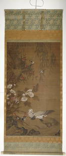
Sold2017Large 4ft Image Antique Japanese Meiji Scroll PaintingONLINE ONLY EVENT! NO RESERVES ABOVE STARTING BIDS! Large over 4ft image height antique Japanese Meiji or Chinese Qing circa 19C ink and gouache on silk painted scroll featuring ducks and other birdsSee Sold Price
Sold2023Antique Japanese Carved wood Articulated Dragon.This wood dragon is finely constructed of numerous parts jointed within the body, the mouth opens revealing a red tongue, the body bends, and the head is applied with elaborate branch form horns, spinSee Sold Price
Sold2016PAIR ANTIQUE JAPANESE SIX-PANEL SCREENSPAIR ANTIQUE JAPANESE SIX-PANEL SCREENSPair of antique, Japanese six-panel screens; each with mirror-image design of sixteen scattered hand fans, each painted with a finely detailed motif, from narratSee Sold Price
Sold2023ANTIQUE JAPANESE SAMURAI KATANA SWORD.An antique Japanese Samurai Katana with lacquered scabbard and tsuba, in a fitted signed wood box, sword 39”L.See Sold Price
Sold2016Antique Japanese 6-panel painted paper screenAntique Japanese 6-panel painted paper screen, 17th c., four cranes bathing near a peony bush, 54.5"h x 19.75"w (each panel), 54.5"h x 118.5"w (open), plexi case/frame Provenance: Property from a MajoSee Sold Price
Sold2024Antique Japanese Finely Crafted Cloisonne Covered UrnDESCRIPTION: Masterpiece specimen of antique Japanese cloisonné enamel art crafted as a lidded globe form vase decorated with two principal medallions - one depicting two fenghuang ("Chinese phoenix"See Sold Price
Sold2016Antique Japanese Calligraphy, Miniature Painting BookAntique Japanese Calligraphy, Miniature Painting BookSee Sold Price
3 days LeftTrillium Antique Prints & Rare BooksSanson - Map of Canada or New France with the Great Lakes$75(1 bid)
3 days LeftTrillium Antique Prints & Rare BooksSanson - Map of Florida (encompassing most of Southeast North America)$95(2 bids)
3 days LeftTrillium Antique Prints & Rare BooksSanson - Map of the British Isles (Ireland, Scotland, England)$75
Jun 16Moving Miss Daisy LLC (DBA-Miss Daisy's Consignment & Auction House)Antique Japanese Kannon Biraki Tansu Chests On Black Lacquer Stand (3 Piece Set)$60(2 bids)
4 days LeftCollective HudsonFine Antique Japanese Shibayama Silver and Enamel Cane/Walking Stick, Late 19th to Early 20th$850(2 bids)
Jun 15Hess Fine AuctionsHiroshi Yoshida Himeji Castle Old to Antique Japanese Woodblock Print$20(2 bids)


![Antique Edo Period Japanese Map of Tokyo, 1864: Title/Content of Map: 1864 Edo Period Japanese Map of Tokyo -- [Tokyo] Date Printed: 1864 c. Cartographer: Anonymous Size: 28 x 36 in. This is a fantastic folding map of Tokyo from the latter part of](https://p1.liveauctioneers.com/5584/116691/60001785_1_x.jpg?height=310&quality=70&version=1519176922)