Sold2019Tobias Conrad Lotter (1717-1777, German), "MappaTobias Conrad Lotter (1717-1777, German), "Mappa Geographica Regionem Mexicanem et Floridam", 1740, hand colored, H. - 21 1/2 in., W. - 25 1/2 in.See Sold Price
Sold2019Tobias Conrad Lotter (1717-1777, German), "MappaTobias Conrad Lotter (1717-1777, German), "Mappa Geographica Regionem Mexicanem et Floridam," 1740, hand colored, H.- 21 1/2 in., W.- 25 1/2 in.See Sold Price
Sold2018Lotter: Grand Sicily Map with Malta InsetMap: Mappa Geographica totius Insulae et Regni Siciliae Cartographer: Lotter Place/Date: Augsburg / 1760 Size: 22" x 19 1/2" Condition: "wash color, cartouches in b&w; overall age toningminor stainingSee Sold Price
Sold2019TOBIAS CONRAD LOTTER (German 1717-1777) A MAP,TOBIAS CONRAD LOTTER (German 1717-1777) A MAP, "SPATIOSISSIMUM IMPERIUM RUSSIAE MAGNAE JUXTA RECENTIFSIMAS OBFERVATIONES MAPPA GEOGRAPHICA..." "...accuratifsime delineatum opera et fumtibus Tobiae ConSee Sold Price
2023Henry Popple, Amerique Septentrionale. Nova Mappa Geographica Americae Septentrionalis insulasTitle: Amerique Septentrionale. Nova Mappa Geographica Americae Septentrionalis insulas praecipuas Partes divisa. Artist: Henry Popple Publisher: Published by J. M. Probst, Augsburg. Hand colored coSee Sold Price
Sold2019Matthias Seutter (1678-1781), " Mappa GeographicaMatthias Seutter (1678-1781), " Mappa Geographica Regionem Mexicanem et Floridam… Americae Unsulas Cursus," c. 1740, hand colored, H.-20 in., W.- 23 1/2 in.See Sold Price
Sold20231730 MAP UKRAINE CRIMEA RUSSIA BLACK & AZOV SEA antique NOVA MAPPA GEOGRAPHICANOVA MAPPA GEOGRAPHICA MARIS ASSOVIENSIS vel de ZABACHE et PALUDIS MAEOTIDIS accuratè aeri incisa et in lucem edita per Matthaeum Seutter chalcograph. Augsburg; 1730 Overall size 21.5 by 25.5" ImSee Sold Price
Sold2019Johann Baptist Homann (1661-1774), "Mappa GeographicaJohann Baptist Homann (1661-1774), "Mappa Geographica Complectens lndiae Occidentalisi, lsthmum Panamensemii, Lchnographiam, Preaecipuorum Locorum Portum iii. Carte des Isles L'Amerique iv. Ver Cruzv.See Sold Price
Sold2022(CARIBBEAN.) Homann Heirs. Mappa Geographica Complectens I. Indiae Occidentalis Partem Mediam Circum(CARIBBEAN.) Homann Heirs. Mappa Geographica Complectens I. Indiae Occidentalis Partem Mediam Circum Isthmum Panamensem. Double-page engraved map of the Caribbean and Gulf of Mexico bordered by insetsSee Sold Price
Sold2018Seutter. Nova Mappa Geographica Maris...[Eastern Europe/Western Asia] Nova Mappa Geographica Maris Assoviensis Vil De Zabache Et Paludis Maetidis, accurate aeri incise et in luce edita per Matthaeum Seutter Chalcograph. Map of the Sea of AzSee Sold Price
Sold2024Adam Friedrich Zurner (German 1679 - 1742) and Peter Schenk (German 1660 - 1711)Adam Friedrich Zurner (German 1679 - 1742) and Peter Schenk (German 1660 - 1711) "Americae tam Septentionalis quam Meridionalis in Mappa Geographica Delineato", circa 1709 Hand colored map engraving 2See Sold Price
Sold2021A LATE BAROQUE MAP OF COLONIAL AMERICA, "MappaA LATE BAROQUE MAP OF COLONIAL AMERICA, "Mappa geographica Regionem Mexicanam et Floridam," AUGSBURG, CIRCA 1740, hand colored engraving on paper, "Terrasque adjacentes, ut et Anteriores Americæ insuSee Sold Price
Sold20211757 Homann Map of Poland and the Baltic States --Title: 1757 Homann Map of Poland and the Baltic States -- Mappa Geographica Regni Poloniae ex Novissimis quot quot sunt Mappis Specialibus Composita et ad LL. Stereographica Projectionis Revocata a ToSee Sold Price
Sold2020Homann Heirs Map of the West Indies and Mexico 17Homann Heirs, "Mappa Geographica complectens I. Indiae Occidentalis Partem Mediam Circum Isthmum Panamensem," Nuremberg, 1740. Hand colored map of the Gulf Coast, Florida, and the Caribbean, with inseSee Sold Price
Sold20211749 Homann Map of British Isles -- Regnorum MagnaeTitle: 1749 Homann Map of British Isles -- Regnorum Magnae Britanniae et Hiberniae Mappa Geographica... Cartographer: J. Homann Year / Place: 1749 Nurnberg Map Dimension (in.): 18.7 X 21.5 in. This isSee Sold Price
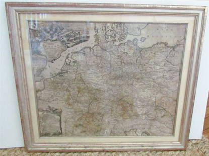
Sold20231769 ANTIQUE MAP of EUROPE framed EUROPEAN POSTAL ROADS & STATIONS1769 ANTIQUE MAP: MAPPA GEOGRAPHICA EXHIBENS POSTAS omnes tam vehiculares quam verdarias Totius Germaniae cum earum accurata distantia Diligentissime propriis sumptibus excudit. Aug. Vindelicor. : TobSee Sold Price
Sold20241738 Homann Heirs / Hase Map of ChinaRegni Sinae Vel Sinae Propriae Mappa et Descriptio GeographicaSee Sold Price
Sold2019Wilhelm Brandenburg, Oil Painting.German (1824-1901). Finely Rendered 19th Century Oil On Canvas Of A Rocky River Landscape With Figure. Signed Wilhelm Brandenburg. Good Antique Condition. See Photos For Typical Crazing and Aging. SliSee Sold Price
Sold2024Lidded goblet with the coat of arms of the Brandenburg arch-treasurerLidded goblet with coat of arms of the Brandenburg Archchamberlain Brandenburg, dated 1693 Colourless glass with tear-off. On the upper side of the slightly rising base of the disc is engraved leaf anSee Sold Price
Sold2022VISSCHER, NICOLAS. Nova Tabula Geographica Complectens Borealiorem Americae Partem...VISSCHER, NICOLAS. Nova Tabula Geographica Complectens Borealiorem Americae Partem... [and] Carte Nouvelle Contenant la Partie d'Amerique la Plus Septentrionale... Large engraved two-sheet map of eastSee Sold Price
Sold2017Fine example of Lotter's edition of Scull & Heap'sPlan of the City and Environs of Philadelphia... Nicholas Scull & George Heap. Hand-colored engraving. Augsburg: Matthew Albert Lotter, 1777. 24 x 18 1/2 inches visible, 32 x 26 1/2 inches framed. FinSee Sold Price
Sold2022Lotter's Atlas Minor Containing 19-Hand-colored Engraved Maps & Title Page, C.1744Lotter, Tobias, Conrad, (Germany,1717-1777) & Seutter, Matthaus, (Germany,1678-1757) "Atlas Minor Pracipuaorbis Terrarum Imperia, Regna Et Provincias, Germania Potissimum, Tabelli 20. ExSee Sold Price
Sold2018Framed "Planiglobii Terrestris Mappa Universalis" 1746"Planiglobii Terrestris Mappa Universalis Utrumqs Hemisphaerium Orient et Occidentale …. MDCCXXXXVI." Published in Nuremberg in 1746 by G.M. (George Moritz) Lowitz (1722-1774), Johann Matthias HaseSee Sold Price
Sold2018ALBERT CAASMANN 1886 Berlin - 1968 Brandenburg an derALBERT CAASMANN 1886 Berlin - 1968 Brandenburg an der Havel Antiker Krieger Bronze, braun patiniert, hellbrauner Marmor. Ges.- H. 43 cm, H. 35 cm (Figur). Auf der Plinthe bezeichnet 'A. Caasmann', seiSee Sold Price
20 hrs LeftMynt Auctions1943 Germany Brandenburg Euthanasia Center Cover Switzerland Concentration Camp$640
BonhamsA matched set of four 18th century Dutch cast silver candlesticks Three with maker's mark for Wi...£5,500
Featured5 days LeftJasper521734 HISTORY OF CHRISTIANITY & IDOLATRY ILLUSTRATED antique FOLIO in GERMAN$300
2 days LeftFichter KunsthandelJ. SCHLEUEN (1739-1784), Hill of ruins in Sanssouci Palace Park, 1775, Etching€600
May 17Five Star AuctionsGateway To Freedom, A Theo Faberge Crystal 24K Gold & Sterling Silver Egg, Closed Edition$4,500
Crawford Family Auctions LLCBenchmade Bali-song branded Folding Pocket Knife, Made in USA, nylon case and original box$23(4 bids)


![Seutter. Nova Mappa Geographica Maris...: [Eastern Europe/Western Asia] Nova Mappa Geographica Maris Assoviensis Vil De Zabache Et Paludis Maetidis, accurate aeri incise et in luce edita per Matthaeum Seutter Chalcograph. Map of the Sea of Az](https://p1.liveauctioneers.com/179/117971/60557754_1_x.jpg?height=310&quality=70&version=1520636872)


![VISSCHER, NICOLAS. Nova Tabula Geographica Complectens Borealiorem Americae Partem...: VISSCHER, NICOLAS. Nova Tabula Geographica Complectens Borealiorem Americae Partem... [and] Carte Nouvelle Contenant la Partie d'Amerique la Plus Septentrionale... Large engraved two-sheet map of east](https://p1.liveauctioneers.com/199/251723/130782443_1_x.jpg?height=310&quality=70&version=1655133895)


