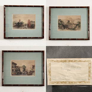
Sold2016Antique Tinted Engraving from China IllustratedThis steel engraving was drawn by English architect, Thomas Allom ca. 1840s. It is one of the hand-tinted steel engravings in the 4 volume edition from the 1840's book, "China Illustrated".This sceneSee Sold Price
Sold2016Antique Tinted Engraving from China IllustratedThis steel engraving was drawn by English architect, Thomas Allom ca. 1840s. It is one of the hand-tinted steel engravings in the 4 volume edition from the 1840's book, "China Illustrated".This sceneSee Sold Price
Sold2016Antique Tinted Engraving of Buddha China IllustratedThis steel engraving was drawn by English architect, Thomas Allom ca. 1840s. It appears as one of the hand-tinted steel engravings in the 4 volume edition from the 1840's book, "China Illustrated".ThiSee Sold Price
Sold2016Antique Tinted Steel Engraving from China IllustratedThis steel engraving was drawn by English architect, Thomas Allom ca. 1840s. It is one of the hand-tinted steel engravings in the 4 volume edition from the 1840's book, "China Illustrated".This sceneSee Sold Price
Sold2016Antique Tinted Steel Engraving from China IllustratedThis steel engraving was drawn by English architect, Thomas Allom ca. 1840s. It is one of the hand-tinted steel engravings in the 4 volume edition from the 1840's book, "China Illustrated".This sceneSee Sold Price
Sold2016Antique Tinted Steel Engraving from China IllustratedThis steel engraving was drawn by English architect, Thomas Allom ca. 1840s. It appears as one of the hand-tinted steel engravings in the 4 volume edition from the 1840's book, "China Illustrated".ThiSee Sold Price
Sold20241630 MAP OF TARTARY CHINA RUSSIA copper engraving ANTIQUEEarly 17th century map of Tartary, reduced from the larger edition of the map which appeared in the French Mercator-Jodocus Hondius Atlas Minor in the 1630s. Very fine and decorative engraving showingSee Sold Price
Sold20231630 MAP OF TARTARY CHINA RUSSIA copper engraving ANTIQUEEarly 17th century map of Tartary, reduced from the larger edition of the map which appeared in the French Mercator-Jodocus Hondius Atlas Minor in the 1630s. Very fine and decorative engraving showingSee Sold Price
Sold2016Tinted Steel Engraving of Bridge China IllustratedThis steel engraving was drawn by English architect, Thomas Allom ca. 1840s. It is one of the hand-tinted steel engravings in the 4 volume edition from the 1840's book, "China Illustrated".This sceneSee Sold Price
Sold2024Prevost - Map of China, Korea, Japan, Phlippines and Surrounding IslandsThis fine engraving is from Antoine-Francois Prevost d'Exiles's Histoire G?n?rale des Voyages, ou nouvelle collection de toutes les relations de voyages par mer et par terre, qui ont ?t? publi?es jusqSee Sold Price
Sold2024Matthaus Merian 1627 Antique Map Engraving "Virginia" from Theodore de Bry's "Grand Voyages" #1Antique 1627 map of Virginia by Matthaus Merian after John Smith's 1612 map, from Theodore de Bry's "Grand Voyages". Please see "The Philidelphia Print Shop" sheet shown in final photo. Good conditionSee Sold Price
Sold2023Four Antique Maps, China & Asia, Gerard Mercator, Jacques BellinDescription: To include a 1628 map of China and Asia by from the Gerard Mercator Atlas Minor (framed), a 1748 copper engraved Jacques Bellin map of Cathay (Northern China & Southern Mongolia), a 1749See Sold Price
Sold2019Barclay, James 1809 Antique Map. ChinaOutline Hand Coloured Copper Engraved Map Published 1809, Leeds for "Barclay's Complete and Universal Dictionary of the English Language..." by the Rev. James Barclay. Paper Size: 10 x 8 inch (26 x 20See Sold Price
Sold2023Barclay, James 1808 Antique Map. China from the most recent AuthoritiesCopper Engraved Map Published 1806, London for "Barclay's Complete and Universal English Dictionary" by the Rev. James Barclay. Paper Size: 10 x 8 inch (26 x 21cm) Good ConditionSee Sold Price
Sold2024Cooke, George 1801 Antique Map. ChinaCopper Engraved Map Published 1801-07 by Macdonald & Son, London for "Modern and Authentic System of Universal Geography" By George A. Cooke. Folds as issued. Paper Size: 12.5 x 10 inch (32 x 26cm) ApSee Sold Price
Sold2022Rapkin, John 1860 Antique Map. China & BurmaSteel Engraved Map Published 1860 by The London Printing & Published Company, London for "The Royal Dictionary-Cyclopedia for Universal Reference" by Thomas Wright. Drawn & Engraved by John Rapkin. FoSee Sold Price
Sold2021SIX ANTIQUE MAP ENGRAVINGSeach framed under glass each: 15 x 21 1/4 inches; 17 x 23 1/2 inches frameSee Sold Price
Sold2021Lot of 4 Antique Tinted Engravings / EtchingsLot of 4 colored prints; subjects include Napoleon, Cock Fighting, Smolensko (landscape) and Ships off Brittany Coast. [Largest frame: 20" H x 16 1/4" W]. All with toning and/or foxing.See Sold Price
Sold2024Thomas Allom Antique Tinted Engravings FramedUp for auction are three antique hand-tinted engravings by Thomas Allom in vintage bamboo frames ; "Melon Islands and Irrigating Wheel", Ancient Tombs Near Amay (1830), and "Scene on the Hunan Canal NSee Sold Price
Sold20244 Antique Maps & Engravings: Kitchin / Stockdale / Thelott / Van Londerseel.4 Antique Maps & Engravings: Kitchin / Stockdale / Thelott / Van Londerseel.See Sold Price
Sold2022Antique Map "Nova totivs terrarvm orbis geographica ac hydrographica tabvla"DESCRIPTION: Antique map engraving originally created by Hendrik Hondius in 1630 titled "Nova totivs terrarvm orbis geographica ac hydrographica tabvla". Mounted in lacquered beveled wood frame. CIRCASee Sold Price
Sold2020FREDERIK KAEMMERER WEDDING PROCESSIONAn antique tinted engraving by Frederik Hendrik Kaemmerer titled, The Wedding Procession. Framed 22" x 14.5". Some losses to frame.See Sold Price
Sold2023La Peche Au Fanal Tinted Engraving [Vernet]Antique tinted engraving titled 'La Peche Au Fanal'. Pierre-Jacques Duret and Claude-Joseph Vernet. Sheet measures 22 in. x 29.75 in. Unframed, loose and not mounted or glued down. Provenance: EstateSee Sold Price
Sold2023TWO ANTIQUE MAPS OF CHINA.Two antique maps of China, including Chinae by Abraham Ortelius, 1595, image 14.25” x 18.25”, with map of Eastern Asia, Le table de la region orientale, image 10” x 13.5”.See Sold Price
9 hrs LeftTrillium Antique Prints & Rare BooksMoore & Conder - Map of the East India Islands (Includes Philippines, Cambodia, China, Borneo,$75(1 bid)
Jun 29Trillium Antique Prints & Rare BooksHarris - Map of India and East Indies Islands (Part of China & East Asia)$75
9 hrs LeftTrillium Antique Prints & Rare BooksPrevost after Bellin - Map of Australia (New Holland) with part of New Zealand$100(1 bid)
9 hrs LeftTrillium Antique Prints & Rare BooksValentijn - Early Views and Map of Tasmania, Australia; Anthony van Diemen's Land$100
9 hrs LeftTrillium Antique Prints & Rare BooksSanson - Map of the Antilles Islands or West Indies with part of Florida$75
Jun 29Trillium Antique Prints & Rare BooksPrevost - Chart of the Pacific Ocean with part of the Americas, China, and New Holland (Australia)$75
Jun 29Trillium Antique Prints & Rare BooksPrevost - 5 Botanical or Flora Engravings (Banana, Mango, Pineapple, Papaya, Coconut)$75
9 hrs LeftTrillium Antique Prints & Rare BooksValentijn - First Published View of Swan River, Perth, Western Australia with Black Swans (lowest$100
Jun 29Trillium Antique Prints & Rare BooksPrevost - Chart of the South Pacific Ocean with part of New Holland (Australia), New Zealand, and$75
Jun 29Trillium Antique Prints & Rare BooksPrevost - Chart of the lower Atlantic Ocean and Indian Ocean with Africa, part of South America,$75
Jun 29Trillium Antique Prints & Rare BooksOxley - Map of the New South Wales, Australia (New Holland)$100
4 days LeftJasper52Antique map of Andalusia and Grenade (Spain) - 1715 - Antique steel engraving - Pieter Van der Aa$50
Jun 29Trillium Antique Prints & Rare BooksKircher, pub. 1682 - Pair of Engravings: Map of South Africa & Three Maps to One sheet of the$75
9 hrs LeftTrillium Antique Prints & Rare BooksHarris - Map of the World (With Australia and part of New Zealand)$160(4 bids)


![Lot of 4 Antique Tinted Engravings / Etchings: Lot of 4 colored prints; subjects include Napoleon, Cock Fighting, Smolensko (landscape) and Ships off Brittany Coast. [Largest frame: 20" H x 16 1/4" W]. All with toning and/or foxing.](https://p1.liveauctioneers.com/1221/212259/109126817_1_x.jpg?height=310&quality=70&version=1628181822)


![La Peche Au Fanal Tinted Engraving [Vernet]: Antique tinted engraving titled 'La Peche Au Fanal'. Pierre-Jacques Duret and Claude-Joseph Vernet. Sheet measures 22 in. x 29.75 in. Unframed, loose and not mounted or glued down. Provenance: Estate](https://p1.liveauctioneers.com/5755/278851/146722120_1_x.jpg?height=310&quality=70&version=1676336215)


