Sold2017Mallet: Antique Map of South Asia, 1683Inde' The map encompasses the whole of India & Indochina including Burma, Thailand, Malaysia/Singapore and South East Asia. The Maldive islands are shown. The map shows the mythical Lake Chiamay, theSee Sold Price
Sold2018ANCIENT INDOCHINA. 'Inde Ancienne a l'Orient du Gange'Reserve Reduced! TITLE OF THE MAP: 'Inde Ancienne a l'Orient du Gange' ancient India from the Ganges eastwards. The map shows the mythical Lake Chiamay, the supposed source of the 5 great river systemSee Sold Price
Sold2018ANCIENT INDOCHINA. 'Inde Ancienne a l'Orient du Gange'TITLE OF THE MAP: 'Inde Ancienne a l'Orient du Gange' ancient India from the Ganges eastwards. The map shows the mythical Lake Chiamay, the supposed source of the 5 great river systems of Southeast AsSee Sold Price
Sold20211683 Sanson Map Great Lakes to Newfoundland -- LeTitle: 1683 Sanson Map Great Lakes to Newfoundland -- Le Canada, ou Nouvelle France, &c. Tiree de diverses Relations des Francois, Anglois, Hollandois, &c. Cartographer: N Sanson Year / Place: 1683 c.See Sold Price
Sold20151867 Map of California and NevadaLeander Ransom & Amos Doolittle: A New Map of the States of California and Nevada, Exhibiting the Rivers, Lakes, Bays and Islands, with the principal Towns, Roads, Railroads and Transit Routes to theSee Sold Price
Sold20181683 Sanson Map of the Great Lakes and the Upper EastTitle/Content of Map: 1683 Sanson Map of the Great Lakes and the Upper East Coast -- Le Canada, ou Nouvelle France, &c. Tiree de diverses Relations des Francois, Anglois, Hollandois, &c. Date: 1683, PSee Sold Price
Sold20181683 Sanson Map of the Great Lakes and the Upper EastTitle/Content of Map: 1683 Sanson Map of the Great Lakes and the Upper East Coast -- Le Canada, ou Nouvelle France, &c. Tiree de diverses Relations des Francois, Anglois, Hollandois, &c. Date Printed:See Sold Price
Sold2022[MANUSCRIPT MAP-FLORIDA & MISSISSIPPI RIVER] Map Showing Raiford's Proposed Artificial River and[MANUSCRIPT MAP-FLORIDA & MISSISSIPPI RIVER] Map Showing Raiford's Proposed Artificial River and Plan to Continue the Western and Southern Inland System of Navigation to Harbors in the Atlantic. [FernSee Sold Price
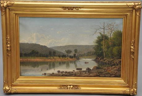
Sold2017William Guy Wall. "Rowers on the Lake". River landscapeWilliam Guy Wall. "Rowers on the Lake". River landscape with figures in a boat. Oil on canvas in original gilt Hudson River style frame. S.L.R. Sight size: 15" x 25". Overall size: 23" x 32".See Sold Price
Sold2023Paul Weber 1852, Fine Quality 19th C. HUDSON RIVER VALLEY AUTUMN LAKE LANDSCAPEPaul Weber 1852, Fine Quality 19th C. HUDSON RIVER VALLEY AUTUMN LAKE LANDSCAPE. Signed on front and signed on back, Philadelphia Label on Verso. Framed. size: 20.25 x 25, 23.5 x 28.5 outside frameSee Sold Price
Sold2016Map, Hudson River, Rev. War, Sauthier, 1776At the top of the map is written: "A Topographical Map of Hudsons River, with the Channels Depth of Water, Rocks, Shoals, &c. and the Country Adjacent, from Sandy-Hook, New York and Bay to Fort EdwardSee Sold Price
Sold2023DING ERZHONG: CRYSTAL INSIDE PAINTED 'LANDSCAPE AND ROCK' SNUFF BOTTLEChinese. Painted on one main side with an idyllic landscape scene with country residences beneath large trees beside a lake or river with two sailing boats beneath more distant peaks, inscribed in scrSee Sold Price
Sold2022James Suydam Major Luminous Hudson River Artist Sunset River LandscapeJames Augustus Suydam (1819 - 1865) An original oil by one of the rarest of the Hudson River School artist! Depicting a luminous sunset lake or river scene with boaters. Initialed lower left and alsoSee Sold Price
Sold2024Anna Pottery Railroad and River Guide FlaskAmerican Second Half 19th Century. Pig Shaped with river and railroad map and inscribed "With a little good old rye in hogs.."See Sold Price
Sold2015Large Daum Nancy Cameo Landscape GlassFrance, early 20th century, tall waisted form flaring slightly at top and bottom, enameled cameo lake or river sunset landscape against a yellow sky, signed in cameo "DAUM/NANCY" with cross of LorrainSee Sold Price
Sold2023IIMPORTANT 18TH C. REVOLUTIONARY WAR PERIOD MAP: SURVEY OF LAKE CHAMPLAIN, 1776IMPORTANT 18TH C. REVOLUTIONARY WAR PERIOD MAP: SURVEY OF LAKE CHAMPLAIN, 1776, SURVEY OF LAKE CHAMPLAIN INCLUDING LAKE GEORGE , CROWN POINT, AND ST. JOHN. SURVEYED, BY ORDER OF HIS EXCELLENCY MAJOR-GSee Sold Price
Sold2023Regis Francois Gignoux 1816-1882 Sunset Lake Signed Hudson River School Oil PaintingAntique American Hudson River School landscape painting by Regis Francois Gignoux (1816 - 1882). Oil on canvas. Framed. Signed lower right. Image size, 12L x 18H. Cleaned by Yost Conservation, LLC.See Sold Price
Sold2024De Fer Map of the Mississippi RiverDE FER, Nicolas (1646-1720). Partie Meridionale de la Riviere de Missipi, et ses environs, dans l'Amerique Septentrionale. Mis au jour par N. de Fer. Geographe de sa Majeste Catolique 1718. Engraved mSee Sold Price
Sold2023Original Vintage Indochine Francaise Map by Lucien Boucher 1935 Vietnam Laos CambodiaAs one can only imagine, travel in the Far East in the 1920's must have been a challenging adventure. This well illustrated map poster by master artist, Lucien Boucher shows the various routes once coSee Sold Price
Sold2023Lemuel Wiles 1826-1905 Signed Hudson River School Framed Oil Painting Silver Lake NYUp for sale here is one of two really nice oil paintings by Lemuel Maynard Wiles (1826 - 1905). The paintings are scenes of Silver Lake, NY. Finely painted and nicely framed. Signed. Image size, 11.5LSee Sold Price
Sold2022(MISSISSIPPI RIVER.) John Ross. Course of the River Mississipi, From the Balise to Fort Chartres.(MISSISSIPPI RIVER.) John Ross. Course of the River Mississipi, From the Balise to Fort Chartres. Engraved folding map of the lower Mississippi River on two sheets joined. 44¾x15 inches sheet sizSee Sold Price
Sold2022H.M.S. AJAX CAPTAIN'S MAP OF THE BATTLE OF THE RIVER PLATEOriginal map depicting the Battle of the River Plate, 37 x 29 in. coated linen map fabric, prepared by Capt. Douglas H. Everett, commander of the H.M.S. AJAX only days after the December 13, 1939 engaSee Sold Price
Sold2020Keith Haring - Untitled, Drawing on New York MapKEITH HARING (1958-1990) Untitled (Crawling Baby) Ink on paper 27 1/2" x 22" Signed lower left side and inscribed "To Mike" Drawn on a 1983 New York City Transit Authority mapSee Sold Price
Sold2023RARE BUCHOLTZ-LUDWIG ANTEBELLUM POCKET MAP OF VIRGINIARARE BUCHOLTZ-LUDWIG ANTEBELLUM POCKET MAP OF VIRGINIA, hand-colored lithograph, Map of the State of Virginia Containing the Counties, Principal Towns, Railroads, Rivers, Canals & All Other Internal ISee Sold Price
Featured2 hrs LeftJasper521716 Homann Map of Northern Germany -- Circulus Saxoniae Inferioris in omnes suos Status et$95
2 hrs LeftJasper521869 Mitchell Map of Much of Western Europe -- XXXII Prussia the German States Holland & Belgium$30
2 hrs LeftJasper521914 Rand McNally Map of Austria-Hungary [verso] German Empire -- Austria-Hungary [verso] German$30
2 hrs LeftJasper521858 Mitchell Map of Great Britain and Ireland [verso] Germany and Switzerland -- No. 22 Map of$25
2 hrs LeftJasper521858 Mitchell Map of Southern Europe and France [verso] Asia -- No. 24 Map of France, Spain,$30
2 hrs LeftJasper521890s Cram Map of Vermont [verso] New Hampshire -- Vermont [verso] New Hampshire$30
2 hrs LeftJasper521860 Mitchell Map of Kentucky and Tennessee -- County Map of Kentucky and Tennessee$40
Featured2 hrs LeftJasper521720 c. Homann Map of Southern Belgium -- Comitatus Hannoniae in Suas Quasque Castellanias$60
2 hrs LeftJasper521730 Covens & Mortier Map of North Coast of Africa and Southern Europe -- In Notitiam Ecclesiasticam$80
2 hrs LeftJasper521887 Cram Map of Texas [verso] Indian Territory [verso] Arkansas -- Texas [verso] Indian Ty. [verso]$95
Featured2 hrs LeftJasper521744 Bowen Map of Europe -- A New and Accurate map of Europe Drawn from the Best Authorities,$110
2 hrs LeftJasper521760 Kitchin Map of the German Romantic Road Area -- A Map of the Circle of Franconia from the$45


![[MANUSCRIPT MAP-FLORIDA & MISSISSIPPI RIVER] Map Showing Raiford's Proposed Artificial River and: [MANUSCRIPT MAP-FLORIDA & MISSISSIPPI RIVER] Map Showing Raiford's Proposed Artificial River and Plan to Continue the Western and Southern Inland System of Navigation to Harbors in the Atlantic. [Fern](https://p1.liveauctioneers.com/292/250642/130213644_1_x.jpg?height=310&quality=70&version=1654271664)


![1914 Rand McNally Map of Austria-Hungary [verso] German Empire -- Austria-Hungary [verso] German (1 of 2)](https://p1.liveauctioneers.com/5584/328338/176911532_1_x.jpg?height=282&quality=70&version=1715113718)

![1888 Rand McNally Map of Louisiana -- [Louisiana] (1 of 1)](https://p1.liveauctioneers.com/5584/328338/176911517_1_x.jpg?height=282&quality=70&version=1715113718)
![1858 Mitchell Map of Great Britain and Ireland [verso] Germany and Switzerland -- No. 22 Map of (1 of 2)](https://p1.liveauctioneers.com/5584/328338/176911589_1_x.jpg?height=282&quality=70&version=1715113718)
![1858 Mitchell Map of Southern Europe and France [verso] Asia -- No. 24 Map of France, Spain, (1 of 2)](https://p1.liveauctioneers.com/5584/328338/176911601_1_x.jpg?height=282&quality=70&version=1715113718)
![1890s Cram Map of Vermont [verso] New Hampshire -- Vermont [verso] New Hampshire (1 of 2)](https://p1.liveauctioneers.com/5584/328338/176911596_1_x.jpg?height=282&quality=70&version=1715113718)


![1887 Cram Map of Texas [verso] Indian Territory [verso] Arkansas -- Texas [verso] Indian Ty. [verso] (1 of 3)](https://p1.liveauctioneers.com/5584/328338/176911685_1_x.jpg?height=282&quality=70&version=1715113718)

