Sold2017Bradford: Map of Hindostan, 1835Hindostan, T. G. Bradford, 1835 7.75 x 10. Antique hand colored map of Hindostan (India) including New Delhi and Ceylon (Sri Lanka). With hand colored border detailing. Very good condition. By T.G. BrSee Sold Price
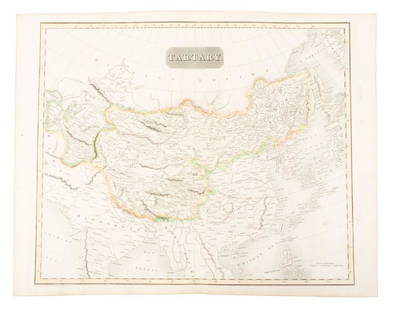
Sold2019Map of Tartary comprising most of AsiaHeading: (Maps) Author: Thomson, John Title: Tartary Place Published: Edinburgh Publisher: Date Published: 1814 Description: Engraved map, hand-colored in outline. 49.8x59.5See Sold Price
Sold20221814 map of Romanum Imperium by Robt. WilkinsonVintage hand colored map from the unique Atlas of Ten Select Maps of Ancient Geography by John P. Watson. This is the only known edition of this atlas. The map is by Robert Wilkinson. A legend on theSee Sold Price
Sold2021H/C Map of France The Treaty of Paris, Charles SmithRare Antique Hand-Colored Map Entitled France According to The Treaty of Paris (1814) | Plate 14, Copper Plate Engraving | Cartographer : Charles Smith (1768 - 1854); Smith, Charles & Son (active 1800See Sold Price
Sold2017Mitchell, Thomas: Antique Map of Hindostan, 1854Title: Map of Hindostan by Mitchell, Thomas,DeSilver Date: 1854 Dimensions: 14 x 17 Medium: Hand Colored Lithograph Samuel Augustus Mitchell (1790-1860) was an American geographer born in ConnecticutSee Sold Price
Sold2017Colton: Antique Map of Hindostan or British India, 1861Map: Colton's Hindostan or British India Date Printed: 1861 Cartographer: J. H. Colton Material/Medium: Paper Size: 17 1/4" x 14" Condition: Excellent Hand colored, steel engraved. Printed in New YorkSee Sold Price
Sold2017Colton: Map of Hindostan Or British India, 1857Title: Map of Hindostan Or British India by Colton Date: 1857 Dimensions: 14 x 17 Medium: Hand Colored Lithograph Please note that this lot has a confidential reserve. When you leave a bid in advanceSee Sold Price
Sold2017Mitchell, Thomas, Cowperthwait: Map of Hindostan, 1851Title: Map of Hindostan by Mitchell, Thomas, Cowperthwait Date: 1851 Dimensions: 14 x 17 Medium: Hand Colored Lithograph Please note that this lot has a confidential reserve. When you leave a bid inSee Sold Price
Sold2017Colton: Antique Map of India Hindostan, 1861Title/Content of Map: India Hindostan Date Printed: 1861 Cartographer: J.H. Colton Material/Medium: Paper Size: 14" x 17 1/4" Hand colored, steel engraved. From Colton's 'General Atlas'. Published inSee Sold Price
Sold2017Browning: Antique Map of Hindostan/British India, 1860Title: Map of Hindostan Or British India by Johnson Browning Date: 1860 Dimensions: 15 x 17.5 Medium: Hand Colored Lithograph Please note that this lot has a confidential reserve. When you leave a bidSee Sold Price
Sold2016ANTIQUE NEW-FRANCE HAND COLORED MAPANTIQUE NEW-FRANCE HAND COLORED MAP, H 27 1/2" IMAGE, W 20 1/2":Framed, measures H.30" x 23" overall.See Sold Price
Sold2024Matthaus Merian 1627 Antique Hand Colored Map "Virginia" from Theodore de Bry's "Grand Voyages" #2Antique 1627 hand-colored map of Virginia by Matthaus Merian after John Smith's 1612 map, from Theodore de Bry's "Grand Voyages". Good condition overall, with age-appropriate wear, repairs (see photosSee Sold Price
Sold20161666 Original Hand Colored Map of Virginiaapprox 21" X 17"...... Pas Caerte van Nieu Nederlandt en de Engelsche Virginies, van Cabo Cod tot Cabo Canrick. (Chart of New Netherland and the English Virginias from Cape Cod to Cape Canrick [i.e. HSee Sold Price
Sold2024Henricus Hondius 1630 "Nova Virginiae Tabula" Hand Colored Map of Virginia and Chesapeake #1Antique, original hand-colored map of Virginia and the Chesapeake Bay originally by Henricus Hondius in 1630 titled "Nova Virginiae Tabula". With French text on reverse final catchword "n'en" and signSee Sold Price
Sold2024John Speed 1676 Antique Hand Colored "Map of Virginia and Maryland" #2Antique 1676 hand-colored map of Virginia and Maryland engraved by Francis Lamb and republished by Thomas Basset & Richard Chriswell after John Speed's 1611 atlas. Good overall, apparent repairs, minoSee Sold Price
Sold2020F. B. Werner, "Roma" hand-colored map, 1730F. B. Werner, "Roma" hand-colored map, 1730, Panoramic view of Rome, hand-colored engraving on laid paper, no watermark observed, two sheets joined at center, marked "F. B. Werner delin Ao 1730" and "See Sold Price
Sold2024Very Rare Mexico Nova Hispania 1579 Hand Colored MapORTELIUS, Abraham (1527-1598). Theatrum Orbis Terrarum. 1570. It is considered to be the first modern atlas. Map of New Spain (Mexico), 1579. Printed in Antwerp by Christophe Plantin (1588). Etching.See Sold Price
Sold2021Hand colored map, Africa. 23” x 20.5”Hand colored map, Africa. 23” x 20.5”See Sold Price
Sold2020Small Hand-Colored Map of Nantucket by William SchontzeSmall Hand-Colored Map of Nantucket by William Schontzeler,rare pictorial map of Nantucket in original frame, signed, l.r William Cotton Schontzeler, trained as a draftsman in NY, he owned and workedSee Sold Price
Sold2021French Hand-Colored Map of America, 1750Antique French Hand-Colored Map of America , "Amerique Septentrionale, dressee, sur les Relations les plus modernes...", 1750, Robert de Vaugondy, the cartouche with an alligator flanked by figures, 1See Sold Price
Sold2023Antique Hand Colored Map of the Western Part of CanadaAntique Hand Colored Map of the Western Part of CanadaNice hand colored engraved on paper an antique, 1755 map of the western part of New France or Canada by M. Bellin, Engineer of the king. FeaturingSee Sold Price
Sold2018GEORG BRAUN & FRANS HOGENBERG HAND COLORED MAPGEORG BRAUN & FRANS HOGENBERG HAND COLORED DOUBLE-PAGE ENGRAVED MAP, H 13 1/4", W 19", "LUTETIA, VULGARI NOMINE PARIS":DEPICTING 16TH CENTURY PARIS, WITH A DECORATIVE TITLE-CARTOUCHE FEATURING COAT OFSee Sold Price
Sold2024Willem Blaeu 1640 "Nova Virginiae Tabula" Original Hand Colored Map of VirginiaThis loose (unframed) and very scarce original antique 1640 hand-colored "Nova Virginiae Tabula" map of Virginia is in good overall condition, with light-age appropriate wear and apparent repairs-oneSee Sold Price
Sold2020Early Hand Colored Map North America by T ConderAntique framed hand colored early map of North America. Top left image of Native man and foliage, reads "North America agreeable to the most approved Maps and Charts, by Thomas Condor" Frame: 14 3/4 iSee Sold Price
4 days LeftAlbion AuctionsClarke & Russell 1814 Hand Col Map. Canada - British Dominions in North America$25(3 bids)
May 26Ararity AuctionsThomson's 1817 Hand Colored Map Comparative Heights of the World's Great Mountains$50
4 days LeftAlbion AuctionsPrichard & Walker 1844 Hand Colored Map. Ethnological Map of Asia$15(2 bids)
May 22Thomaston Place Auction GalleriesHAND COLORED MAP OF PERU & COUNTRY OF THE AMAZONS, 1747, BY EMANUEL BOWEN, FRAMED$250
5 days LeftBlackstone Valley Auctions & Estates LLCRevolutionary Era War Map of the Attack on Ft. Moultrie.$225(3 bids)