Sold2017[MAP] FREDERICK DE WIT (DUTCH, 1630-1706)Map of Frankfurt in Hesse, Germany, c. 1680See Sold Price
Sold2017[MAP] FREDERICK DE WIT (DUTCH, 1630-1706)Map of the Archbishopric Treves, Germany, c. 1680See Sold Price
Sold2017[MAP] FREDERICK DE WIT (DUTCH, 1630-1706)Map of North Rhine-Westphalia, Germany, c. 1680See Sold Price
Sold2017[MAP] FREDERICK DE WIT (DUTCH, 1630-1706)Map of Cologne and the Lower Rhine Region, Germany, c. 1690See Sold Price
Sold2019AN ANTIQUE MAP, "Poli Arctici et CircumiacentiumAN ANTIQUE MAP, "Poli Arctici et Circumiacentium Terrarum Descriptio Novissima," CIRCA 1676, hand colored engraving on paper, published by Frederick de Wit (1630-1706), a banner cartouche U/L, "GedrucSee Sold Price
Sold2019AN ANTIQUE MAP, "Accuratissima Angliæ Regni et WalliæAN ANTIQUE MAP, "Accuratissima Angliæ Regni et Walliæ Principatus," AMSTERDAM, CIRCA 1680, hand colored engraving on paper, published by Frederick de Wit (1630-1706), showing most of the British IslSee Sold Price
Sold2023De Wit Map of Zeeland, HollandDE WIT, Frederick (c. 1630-1706). Comitatus Zelandiae tabula... Engraved map with original hand color. Amsterdam, c. 1680. 21 1/2" x 24 3/8" sheet, approx. Antique Map of Zeeland, Netherlands showingSee Sold Price
Sold2022MAP- Frederick De. Wit:MAP- Frederick De. Wit: MAP- Frederick De. Wit: NOVISSIMA PRAE CETERISALIIS ACCURATISSIMA REGNORUM ANGLIAE SCOTIAE HIBERNIAE. Ca. 1690, hand coloured and laid down (560x490mm)See Sold Price
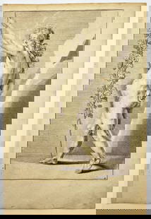
Sold2023Antique Engraving - Frederick de Wit - Female Form - Drawing of Woman FigureTitle/Artist: Antique Engraving - Frederick de Wit - Female Form - Drawing of Woman Figure Medium: Antique engraving originates from "Lumen Picturae: A Classical Drawing Manual" by Frederick de Wit. TSee Sold Price
Sold20211690 de Wit Map of Saxony Germany -- Circuli SaxoniaeTitle: 1690 de Wit Map of Saxony Germany -- Circuli Saxoniae Superioris pars meridionalis… Cartographer: F de Wit Year / Place: 1690 c. , Amsterdam Map Dimension (in.): 19.2 X 22.1 in. This is aSee Sold Price
Sold2017de Wit: Antique Map of Portugal & Parts of Spain, 1690Title/Content of Map: 1690 de Wit Map of Portugal and Parts of Spain -- Tabula Portugalliae et Algarbia Date Printed: 1690, Amsterdam Cartographer: F de Wit Size: 18.5 x 22.2 in. Condition: Good. ExceSee Sold Price
Sold2023Antique Map Print - Frederick de Witt - Map of The Kingdom of Denmark - EuropeTitle/Artist: Antique Map Print - Frederick de Witt - Map of The Kingdom of Denmark - Europe Date/Period: 1690 Material: Paper Dimensions: 56 cm x 67 cm Description: The Kingdom of Denmark, ComprisingSee Sold Price
Sold2017De Wit Map of AfricaTotius Africa Accuratissima Tabula. Frederick de Wit (1629/1630-1706). Engraved map with original hand color. Amsterdam, c. 1660. 19 1/4 x 23 inches visible, 24 3/4 x 28 1/2 inches framedSee Sold Price
Sold2016A Group of Four Hand-colored Engraved Maps, 19th/20thA Group of Four Hand-colored Engraved Maps, 19th/20th Century, Including three maps by Gerardus Mercator depicting Austria Archiducatus, Saltzburg and Flanders, and one map by Frederick de Wit depictiSee Sold Price
Sold2017(MAP, SICILY) DE WIT, FREDERICK. Insula sive regnumMAP, SICILY by DE WIT, FREDERICK, Insula sive regnum Siciliae urbibus praecipuis exornatum. Amsterdam, circa 1680. Hand-colored engraved map of Sicily. With inset plans of Messina, Milazzo and PalermoSee Sold Price
Sold2024Two Antique Maps of the Arabian PeninsulaProperty from the Estate of a Swiss UBS Executive, Zurich and Hilton Head Island, SC Description: Two Antique Maps of the Arabian Peninsula , E. de Wit map of 'New Persia, Armenia, Anatolia and ArSee Sold Price
Sold2023Antique Map of England - 1670F. De Wit Antique Print 1670 - Amsterdam Map of England Image Size: 23.5 x 20 in. Overall Framed Size: 33 x 28.75 in. Framed behind glass.See Sold Price
Sold2018Early Map Egypt Nubia AfricaDe l'Egipte. Antique map by Clouet, Paris, 1730. Egypt, Nubia, Abyssinia, Middle East, Asia. . 16" x 24.See Sold Price
4 days LeftJasper521804 TRAVELS of Ledyard & Lucas in Africa antique w/ MAPS Voyages de MM. Lédyard$240
Featured5 days LeftJasper52Europe after the Congress of Vienna. 4 sheets. 128x106cm. THOMSON 1817 old map$550
May 18Trillium Antique Prints & Rare BooksDe Jode, Rare, pub. 1593 - Map of Kingdom of Napoli, Italy (Neapolitani Regni exacta ac diligens$110(2 bids)
May 18Trillium Antique Prints & Rare BooksDe Jode, Rare, pub. 1593 - Map of Hainut, Belgium (Hannoniae Comitatus Descriptio)$100(1 bid)
5 days LeftJasper52BENELUX & NE FRANCE. Burgundy. Comté/'Cercle de Bourgogne'. MALLET 1683 map$35
5 days LeftJasper52L'Allemagne, La Boheme, et La Hongrie; avec…partie de Pologne. BONNE 1780 map$60
12 hrs LeftTrillium Antique Prints & Rare BooksPrevost - Map of Japan with part of Korea and China$50
12 hrs LeftTrillium Antique Prints & Rare BooksPrevost - Map of the South Pacific Ocean with New Holland (Australia), New Zealand, and part of the$50(1 bid)
12 hrs LeftTrillium Antique Prints & Rare BooksPrevost - Map of the Philippines, Celebes, Moluccas$50
12 hrs LeftTrillium Antique Prints & Rare BooksBonne - Pair of Maps (Eastern & Northern Hemisphere)$75


![[MAP] FREDERICK DE WIT (DUTCH, 1630-1706): Map of Frankfurt in Hesse, Germany, c. 1680](https://p1.liveauctioneers.com/3820/102962/52635987_1_x.jpg?height=310&quality=70&version=1492789342)


![[MAP] FREDERICK DE WIT (DUTCH, 1630-1706): Map Lower Saxony, Germany](https://p1.liveauctioneers.com/3820/102962/52635937_1_x.jpg?height=310&quality=70&version=1492789342)
![[MAP] FREDERICK DE WIT (DUTCH, 1630-1706): Map of the Alsace, Germany, c. 1680](https://p1.liveauctioneers.com/3820/102962/52635901_1_x.jpg?height=310&quality=70&version=1492789342)
![[MAP] FREDERICK DE WIT (DUTCH, 1630-1706): Map of the Archbishopric Treves, Germany, c. 1680](https://p1.liveauctioneers.com/3820/102962/52635920_1_x.jpg?height=310&quality=70&version=1492789342)
![[MAP] FREDERICK DE WIT (DUTCH, 1630-1706): Map of North Rhine-Westphalia, Germany, c. 1680](https://p1.liveauctioneers.com/3820/102962/52635921_1_x.jpg?height=310&quality=70&version=1492789342)
![[MAP] FREDERICK DE WIT (DUTCH, 1630-1706): Map of Cologne and the Lower Rhine Region, Germany, c. 1690](https://p1.liveauctioneers.com/3820/102962/52635857_1_x.jpg?height=310&quality=70&version=1492789342)


![[MAP] FREDERICK DE WIT (DUTCH, 1630-1706): Circulus Bavaricus](https://p1.liveauctioneers.com/3820/102962/52635903_1_x.jpg?height=310&quality=70&version=1492789342)
![[MAP] FREDERICK DE WIT (DUTCH, 1630-1706): Totius Flumenis Rheni Novissima](https://p1.liveauctioneers.com/3820/102962/52635922_1_x.jpg?height=310&quality=70&version=1492789342)
![[MAP] FREDERICK DE WIT (DUTCH, 1630-1706): Electoratus et Palatinatus Rheni](https://p1.liveauctioneers.com/3820/102962/52635902_1_x.jpg?height=310&quality=70&version=1492789342)
![[MAP] FREDERICK DE WIT (DUTCH, 1630-1706): Circulus Franconicus](https://p1.liveauctioneers.com/3820/102962/52635856_1_x.jpg?height=310&quality=70&version=1492789342)


