Sold2019Mexico.- Dufour (Auguste-Henri) Mexique Antilles,Americas.- Mexico.- Dufour (Auguste-Henri) Mexique Antilles, Etats-Unis, French map depicting the United States, Mexico, Central America, and the Caribbean, with two small inset maps of the CaribbeanSee Sold Price
Sold201919th C. French Map - The Port of Vera Cruz Mexico100% of the Hammer price of all lots sold in this auction will be donated to Community Food Share by Artemis Gallery. $1.00 = 3 meals! **First Time At Auction** Europe, France, ca. 19th century CE.See Sold Price
Sold2019.18th Century French Map of Cuba, Florida and Louisiana21 1/4 x 16 3/4 in. (framed).18th Century French Map of Cuba, Florida and LouisianaGulf of Mexico antique map Golfe du Mexique Zannoni 1762Title: Carte Geo-Hydrographique du Golfe du Mexique et de sesSee Sold Price
Sold20241782 Janvier/Lattre French Map of North America1782 Janvier/Lattre, L'Amerique Septentrionale Divisee en ses Principaux map of North America including the present day United States, Canada, Mexico, Central America, the Caribbean, Cuba, Florida, thSee Sold Price
Sold2017JACQUES NICOLAS BELLIN (FRENCH, 1703-1772) MAP OFJACQUES NICOLAS BELLIN (FRENCH, 1703-1772) MAP OF LOUISIANA AND THE GULF OF MEXICO engraving on laid paper, "Carte De La Louisiane et Pays Voisins Pour servir a l'Historie Generale des Voyages", publiSee Sold Price
Sold2024W Indies Mexico Central America 1873Title/Content of Map: W Indies Mexico Central America 1873 Date Printed: 1873 Cartographer: John Barthomolew Material/Medium: paper Size: approx. 13.25"x18" T. Elwood Zell, Phila. Reserve: $40.00 ShipSee Sold Price
Sold2024Map Of The Gulf Of Mexico In French By Rizzi ZannoniCarte Geo-Hydrogeaphique Du Golfe Du Mexique Site 12.5" x 17.75"See Sold Price
Sold2018Johnston: Antique Map of China and Japan, 1873Title/Content of Map: China and Japan Cartographer: JOHNSTON, KEITH Size: 12X16.25 by Keith Johnston, F.R.S.E. Sheet 49 from an American and French Joines and Hamilton atlas edition printed by Ferd. MSee Sold Price
Sold2021Gray's Atlas Southwest U.S. Hand-Colored EngravingGray's Atlas, "Map of California, Nevada, Utah, Colorado, Arizona & New Mexico," hand-colored engraving on wove paper, 1873. Image: 16.5" H x 26" W; frame: 26" H x 35.5" WSee Sold Price
Sold2018Bellin: Gulf of Mexico / West Indies, 1771Carte du Golphe de Mexique et des Isles de l'Amerique/Kaart van de Golf van Mexico The prolific French cartographer Bellin's West Indies and Gulf Coast map for Prévost's influential Histoire GénéraSee Sold Price
Sold2023Map of Colorado Territory and Northern Portion of New MexicoShowing the system of parcs. William Gilpin, Philadelphia 1873 Map Parcs - Cleaning of the Woods ca. 1873 Sight 22 x 21Frame 28 x 27See Sold Price
Sold2023After Marie Adrien Persac (French/Louisiana, 1823-1873), "Plantations on the Mississippi River fromAfter Marie Adrien Persac (French/Louisiana, 1823-1873), "Plantations on the Mississippi River from Natchez to New Orleans, 1858," map on paper board, reproduced in 1965 by Pelican Publishing Co., priSee Sold Price
Sold2023After Marie Adrien Persac (French/Louisiana, 1823-1873), "Plantations on the Mississippi River fromAfter Marie Adrien Persac (French/Louisiana, 1823-1873), "Plantations on the Mississippi River from Natchez to New Orleans, 1858," map on paper board, reproduced in 1931 by Pelican Publishing Co., priSee Sold Price
Sold201718th C. French Map w/ Oiled Paper, ex-Sotheby'sEurope, France, map from 1709 CE, oiled paper overlays from 1756 to 1763 CE, owned by Louis-Alexandre Berthier (1753 to 1815 CE), Marshal, Vice-Constable of France, and Chief of Staff (Major general)See Sold Price
Sold2021Antique French Map of MississippiAntique French Map of Mississippi , "Carte Geographique, Statistique et Historique du Mississipi", Paris, Buchon, 1825, sight 21 in. x 27 1/2 in., framed Provenance: Estate of Julia Evans ReedSee Sold Price
Sold2021Antique French Map of United States- Etats-Unis De L'Amerique Septentrionale Avec Les Isles Royale, De Terre Neuve, De St. Jean, L'Acadie &c.; Hand-colored; Ches Boudet Imprimeur du Roi; Paris; undated (circa 1785). One of the early maSee Sold Price
Sold2022Mannevillette French Map of the Indian Ocean, 1753D'APRES DE MANNEVILLETTE, Jean-Baptiste-Nicolas-Denis (1707-1780). [Indian Ocean] Carte Reduite de l'Ocean Oriental depuis le Cap de Bonne Esperance... Engraved map with original hand color in part. PSee Sold Price
Sold2023CARL FLEMMING (c. 1840-1879) A REPUBLIC OF TEXAS MAP, "Mexico, Mittel America, Texas," GLOGAU, CIRCACARL FLEMMING (c. 1840-1879) A REPUBLIC OF TEXAS MAP, "Mexico, Mittel America, Texas," GLOGAU, CIRCA 1846, a German lithograph on paper with hand color showing territories claimed by the Republic of TSee Sold Price
Sold2024Georges Kugelmann Benda (French 1873 - 1961)Georges Kugelmann Benda (French 1873 - 1961) "Mistinguett", circa 1913 Lithograph Signed lower right in plate GK Benda and inscribed "Affiche Déposée Philippe-G-Dreyfus Éditeur 13 Rue LaFayette, PaSee Sold Price
Sold20241812 large French map of Paris plan routier de la Ville et faubourgLarge engraving of Paris and its surrounding area dated 1812 , cooper engraving in the manner of the Turgot map ,Jean Pierre printer , a Paris, chez Jean, Rue St Jean de Beauvais, N° 10, It is thSee Sold Price
Sold20221738 Antique French Map of North America1738 Antique French Map of North America, 1783 - Antique Map of North America, with documentation, This map is 221 years old - it is not a modern reproduction or copy, This map comes from: ATLAS DE TOSee Sold Price
Sold201718th Century French Map of North AmericaL’Amerique Septentrionale. Daniel de la Feuille (1640-1709). Engraved map with hand color in full. Amsterdam, 1702 or 1706. 6 x 8 inches visible, 13 x 14 1/2 inches framed. Nicely colored early 18thSee Sold Price
Sold2022c. 1788 French Map of the Eastern United StatesHistoric Maps c. 1788 Map, "Les Etats Unis de L'Amerique Septentrionale, Partie Orientale" (Eastern Part of the Northern United States of America) by M. (Rigobert) Bonne c. 1788 Map titled, "Les EtatsSee Sold Price
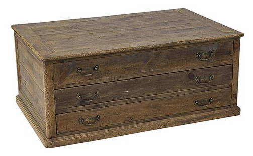
Sold2020Country French Map CabinetThree drawer case in pine with original brass hardware. Drawers pull out from both sides. 49w x 31 1/2d x 20 1/2hSee Sold Price
2 days LeftOriental Art AuctionsA RARE NON COLORED PRINTED FRENCH MAP OF THE ARABIC WORLD DURING THE OTTOMAN EMPIRE (ARABIA€1,000
May 24Eldred'sSCHOOL OF ERNEST LAWSON (New York/Connecticut/Canada/France, 1873-1939), "The Bathers"., Oil on$1,000
BonhamsGEORGES FRÉDÉRIC ROTIG (French, 1873-1961) Hunting Dogs in Pursuit of a Deer (framed 1...$1,000(2 bids)
6 days LeftKCM GalleriesJoseph Kuhn-Regnier 1929 Color Engraving At the Water's Edge LIMITED Framed Signed$125
May 22Thomaston Place Auction GalleriesHAND COLORED MAP OF PERU & COUNTRY OF THE AMAZONS, 1747, BY EMANUEL BOWEN, FRAMED$250
6 days LeftKCM GalleriesJoseph Kuhn-Regnier 1929 Color Engraving "Her Majesty" Limited Framed Signed$200
3 days LeftPotter & Potter AuctionsMEDINA, Miruel Gomez. Pictorial Map of Mexico. 1931. USA: F...$150(1 bid)
2 days LeftJasper52Operation Dragoon 15 August 1944. Assault. Invasion of South of France 1961 map$30
2 days LeftJasper52WORLD WAR 2. Siegfried & Maginot line defences. Pre-invasion of France 1940 map$30
2 days LeftJasper52WORLD WAR 2. Maginot & Siegfried line defences. Pre-invasion of France 1940 map$25
3 days LeftPotter & Potter AuctionsAUDIBERTI, J. Choain. Afrique Equatoriale Francaise. Paris:...$100(1 bid)
6 days LeftHELIOS AUCTIONSA CUT-CRYSTAL CUP FROM THE PERSONAL SERVICE OF EMPEROR MAXIMILIAN I OF MEXICO, 19TH C.$500


![Mannevillette French Map of the Indian Ocean, 1753: D'APRES DE MANNEVILLETTE, Jean-Baptiste-Nicolas-Denis (1707-1780). [Indian Ocean] Carte Reduite de l'Ocean Oriental depuis le Cap de Bonne Esperance... Engraved map with original hand color in part. P](https://p1.liveauctioneers.com/1968/250616/130196497_1_x.jpg?height=310&quality=70&version=1654190895)


![[MAPS]. A group of 3 engraved maps, most with hand-coloring. (1 of 4)](https://p1.liveauctioneers.com/197/328642/177014805_1_x.jpg?height=282&quality=70&version=1714760103)


