Sold20164 Anyique Framed MapsLot includes 4 gold framed antique maps, in order 1 map is marked on bottom Series M2 Hoffmann-Laroche Inc. Nutley 10, NJ and Totled at the top in the map Geographia Sacra emphasis on land continents,See Sold Price
Sold20164 Anyique Framed MapsLot includes 4 gold framed antique maps, in order 1 map is marked on bottom Series M2 Hoffmann-Laroche Inc. Nutley 10, NJ and Totled at the top in the map Geographia Sacra emphasis on land continents,See Sold Price
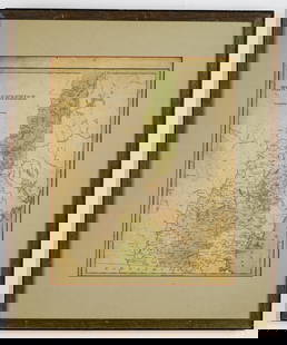
Sold2023Group of 4 Framed Antique MapsLargest overall is 24" x 21 1/2" Condition, some scratches and scuffs and missing paint to frames, some waves and creases to mapsSee Sold Price
Sold2023ESTATE OF SEYMOUR STEIN: 4 SMALL FRAMED MAPS (2) OF EUROPE (1) OF N. AMERICA (1) OF ASIA 12" X 15"ESTATE OF SEYMOUR STEIN: 4 SMALL FRAMED MAPS (2) OF EUROPE (1) OF N. AMERICA (1) OF ASIA 12" X 15"See Sold Price
Sold2019(4) FRAMED EARLY EUROPEAN MAPS BY MERCATOR & HONDIUSHand colored engravings, in matching mahogany panel frames with malachite stone corners, including: "Veronae Vicentiiae et Patavii" per Gerardum Mercatorem (Mercator); PLUS "Saxonia Inferior et MeklenSee Sold Price
Sold2023Group of 4 Early European MapsGroup of 4 early framed European maps, including; 'De L'Europe, figure III., Isle D'Albion", 'Westmorland', 'Wien in Oesterreich' and 'Milan'. Measures: 12" x 15 1/2" overall, largest.See Sold Price
Sold2023Large Grouping of 13 PrintsLarge Grouping of 13 Prints, to include 4 framed vintage town maps, 5 portrait prints, 1 pen and ink, 1 religious "Holy Trinity" gilded woodblock, along with 2 decorative Greek mythological scenes; laSee Sold Price
Sold2020Herman MollHerman Moll 18th Century Three maps, framed. 8 1/4 x 10 inches. Property from Christa's Ltd., Chicago, IllinoisSee Sold Price
Sold20204 Framed Works: Prints, Deed and Map1) James Montgomery Flagg color supplement to North American Philadelphia Sunday "Uncle Sam - I Need You", December 2, 1917, in a red, white & blue mat [Image: 11 x 8 1/2 inches; Frame: 18 x 14 inchesSee Sold Price
Sold2019Two Framed Maps: Paris by J. Shury & HavanaA framed reproduction of an 1853 map of Havana [Framed dimensions: 17 1/4 x 21 3/4 inches], and a framed antique map of Paris, engraved by J. Shury. [Framed dimensions: 16 3/8 x 22 1/8 inches]. In gooSee Sold Price
Sold2018* Dorn, Frank, TienTsin-Peiping: The Peiyang Press,* Dorn, Frank, TienTsin-Peiping: The Peiyang Press, Ltd., 1936 map, framed. 33 3/4 x 29 5/8 inches. Estimate $500-700 Property from the Estate of Ms. Ruth Ann Koesun, Chicago, IllinoisSee Sold Price
Sold2017Andersonville Prison Civil War MapEuphemia Prison at Andersonville GA 1864 Map - framed, 10 3/4 x 13 1/2". Water stains.See Sold Price
Sold2019.18th Century French Map of Cuba, Florida and Louisiana21 1/4 x 16 3/4 in. (framed).18th Century French Map of Cuba, Florida and LouisianaGulf of Mexico antique map Golfe du Mexique Zannoni 1762Title: Carte Geo-Hydrographique du Golfe du Mexique et de sesSee Sold Price
Sold2023[ANTIQUE MAP] ANTIQUE MAP OF SOUTHERN SCOTLAND. c. 1650s[ANTIQUE MAP] CARTE L'ECOSSE SUIVANT LES DERNIERES RELATIONS par N...Sanson, Circa 1650s Framed size (approx): 8.1/4"x10.1/4" Image size: (approx):6.3/4"x7.1/2" Framed. This map hasn't been examined uSee Sold Price
Sold2015THOMSON'S NEW GENERAL ATLAS MAPSTHOMSON'S NEW GENERAL ATLAS MAPS (23), 18'' X 24 1/4'', NOT FRAMED:Engraved and hand colored maps, c. 1827. Maps vary from two images on one page to larger images covering two pages. The map depictionSee Sold Price
Sold2019Vintage New Canaan Map C 1868Vintage New Canaan map, 1868, framed. 13 1/4" H x 10" W.See Sold Price
Sold2022Seventeenth Century Map of Northern ScotlandHand colored map titled "Is DE FARO DE SCHELAND ORKNAY ET HEBRIDES" by French cartographer Mallet Alain, Paris, 1683. Framed map measures 5.5" x 4" (sight) and shows northern Scotland as well as the HSee Sold Price
Sold2023Framed Map of ParisFramed Map of Paris. 41 3/4" x 33" ALL DESCRIPTIONS AND ANY CONDITION STATEMENT GIVEN BY LANGSTON AUCTION GALLERY ARE STRICTLY OPINIONS AND LANGSTON'S SHALL HAVE NO RESPONSIBILITY FOR ERRORS OR OMISSISee Sold Price
SoldEASTERN EUROPEAN MAPS. Four framed maps.EASTERN EUROPEAN MAPS. Four framed maps. Comprising: Magni Ducatus Lithuaniae (18 1/4 x 22 1/2 in.); Emanuel Bowen's A New and Accurate Map of the Whole Russian Empire (15 x 20 in.); Polonia et SilesiSee Sold Price
Sold2023Three Framed Maps, Atlantic, Chesapeake, and the Americasengravings on laid paper with hand color, comprising: Jacques Nicolas Bellin, Carte De La Baye Chesapeack et pays Voisins..., Paris, circa 1757, sight 7-1/2 x 11-1/4 in.; Thomas Bowen, A New & AccuratSee Sold Price
Sold2017Group of twelve framed maps to include Africa,Group of twelve framed maps to include Africa, Johnson's Russia, Mississippi, Arkansas, Ohio, Missouri, Kentucky, Africa, Asia, Asia, Greece, and China. 11 1/4" x 13 1/2" to 14" x 16 3/4" Provenance:See Sold Price
Sold2021Large Hand Colored Framed Map of Italy, StanfordsLarge Hand Colored Framed Map of Italy, Stanfords. Dated 1859. Sight size: 4'8"h x 47-1/2"w Overall: 5'4"h x 4'7"w. Item cannot be unframed as it consists of multiple hand colored maps completing theSee Sold Price
Joe R. Pyle Complete Auctions & Real EstateSet of 4 framed Keith Haring 'Pop Shop' prints; Circa 1980's$85(13 bids)


![Two Framed Maps: Paris by J. Shury & Havana: A framed reproduction of an 1853 map of Havana [Framed dimensions: 17 1/4 x 21 3/4 inches], and a framed antique map of Paris, engraved by J. Shury. [Framed dimensions: 16 3/8 x 22 1/8 inches]. In goo](https://p1.liveauctioneers.com/1221/144060/73206131_1_x.jpg?height=310&quality=70&version=1562178741)


![[ANTIQUE MAP] ANTIQUE MAP OF SOUTHERN SCOTLAND. c. 1650s: [ANTIQUE MAP] CARTE L'ECOSSE SUIVANT LES DERNIERES RELATIONS par N...Sanson, Circa 1650s Framed size (approx): 8.1/4"x10.1/4" Image size: (approx):6.3/4"x7.1/2" Framed. This map hasn't been examined u](https://p1.liveauctioneers.com/8321/286473/155324781_10_x.jpg?height=310&quality=70&version=1687035305)


![[ENGRAVINGS]. Group of 4 Framed Engravings. [V.p., ca. 1800... (1 of 4)](https://p1.liveauctioneers.com/928/328184/176813384_1_x.jpg?height=282&quality=70&version=1714496988)


