Sold2016Map of New Hampshire, Carey & Lea 1829Title: Geographical, Historical and Statistical Map of New Hampshire Subject: New Hampshire Maker: Carey & Lea Date: 1827, Carey & Lea: Philadelphia Size: 11.8 x 8.8 inches Very detailed map showing cSee Sold Price
Sold2016Statistical & Historical Map of New York 1827Map Title: Geographical, Statistical, and Historical Map of New York Date: 1827 Publisher: Carey & Lea: New York Size: 11.9 x 17.2 inches Shows counties, towns, townships, roads, topography, & more. SSee Sold Price
Sold20241822 MAP of NEW YORK GEOGRAPHICAL STATISTICAL HISTORICAL antique 17.5x 22"1822 MAP of NEW YORK GEOGRAPHICAL STATISTICAL HISTORICAL # 16 from Carey & Lea’s Complete Historical, Chronological, and Geographical American Atlas. Overall size 17 1/2 by 21 3/4" Very good conditiSee Sold Price
Sold2021ROBERT SPEAR DUNNING (Massachusetts/New Hampshire,ROBERT SPEAR DUNNINGMassachusetts/New Hampshire, 1829-1905Still life of fruit. Signed and dated "R.S. Dunning 1885". Signed and dated verso "R.S. Dunning Painter. 1885".Oil on canvSee Sold Price
Sold2022Robert Spear Dunning Fruit Still Life PaintingRobert Spear Dunning Massachusetts, New Hampshire, 1829-1905 Fall River School depiction of peaches, a pear, and bundles of red and green grapes glistening under light. Dunning was a founder alongsideSee Sold Price
Sold2017Bradford: Antique Map of New Hampshire, 1838Title/Content of Map: New Hampshire by Bradford Date Printed: 1838/1841 Cartographer: Thomas G. Bradford Material/Medium: Paper Size: 13" x 16 1/2" Hand colored. A General Atlas of the World with a SeSee Sold Price
Sold2020New Hampshire & Vermont, 1845Title/Content of Map: New Hampshire & Vermont, 1845 Date Printed: 1845, Hildburghausen Cartographer: Joseph Meyer/Bibliographisches Instituts. Size: 11 3/4" x 14 3/4" The beautifully detailed and coloSee Sold Price
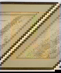
Sold2020New Hampshire 1886Title/Content of Map: New Hampshire 1886 Date Printed: 1886 Material/Medium: paper Size: 13.5x21 inches Additional Info: he People's Unrivaled Family Atlas of the World. People's Publishing Co, ChicagSee Sold Price
Sold2020New Hampshire & Vermont, 1849Title/Content of Map: New Hampshire & Vermont, 1849 Date Printed: 1849/1857, Hildburghausen Cartographer: Meyer/Bibliographisches Instituts. Size: 11 3/4" x 14 3/4" The beautifully detailed and coloreSee Sold Price
Sold2024Carey & Lea: Post-revolutionary South America, 1823Title/Content of Map: Carey & Lea: Post-revolutionary South America, 1823 Date Printed: 1823, London Cartographer: Carey & Lea Size: 7 3/8" x 9 5/8" A detailed and well colored map of post-revolutionaSee Sold Price
Sold2018Colton: Antique Map of New Hampshire, 1859Title/Content of Map: New Hampshire by Colton Date Printed: 1859 Cartographer: H.J. Colton Material/Medium: Paper Size: 17 1/2" x 15" Hand colored,engraved. Published in New York in 'Colton's GeneralSee Sold Price
Sold2018New Hampshire by ColtonTitle/Content of Map: New Hampshire by Colton Date Printed: 1861 Cartographer: J.H. Colton Material/Medium: Paper Size: 14" x 17" Provenance: New York From Colton's 'General Atlas.' Published in New YSee Sold Price
Sold2017Bradford: Antique Map of New Hampshire & Vermont, 1835Title/Content of Map: New Hampshire & Vermont Date Printed: 1835 Cartographer: T. G. Bradford Material/Medium: Paper Size: 9 1/2" x 13" A Comprehensive Atlas Geographical, Historical & Commercial. PubSee Sold Price
Sold2021Tennessee Map, Lucas, Carey, & Lea, 1822GEOGRAPHICAL, STATISTICAL, AND HISTORICAL MAP OF TENNESSEE drawn by Fielding Lucas, Jr., engraved by William Kneass, from A COMPLETE HISTORICAL, CHRONOLOGICAL, AND GEOGRAPHICAL AMERICAN ATLAS, publishSee Sold Price
Sold2017James Carter MAP OF NEW HAMPSHIRE Portsmouth March 1831Details: CARTER, James G. (1795-1849). A Map of New Hampshire. Portsmouth: Nathaniel March, [1831]. Engraved folding pocket map, full period hand colouring. Statistical table at right side. Folds intSee Sold Price
Sold2019Early map of New HampshireOne of the few maps specifically of New Hampshire published in the mid- 19th century. Shows superb detail regarding the cities, transportation system, geographical features and counties. Detailed mapSee Sold Price
Sold20181861 Johnson Map of New Hampshire and Vermont --Title/Content of Map: 1861 Johnson Map of New Hampshire and Vermont -- Johnson's New Hampshire and Vermont Date: 1861, New York Cartographer: Johnson & Ward Size: 24 x 17 in. This is a fantastic, verySee Sold Price
Sold20211938 R Taylor White Pictorial Map of New Hampshire --Title: 1938 R Taylor White Pictorial Map of New Hampshire -- New Hampshire Cartographer: Ruth Taylor White Year / Place: 1938, Boston Map Dimension (in.): 11.6 x 8.5 in. This is Ruth Taylor White's chSee Sold Price
Sold20211835 map of New Hampshire & Vermont, T. G. BradfordTitle: 1835 map of New Hampshire & Vermont, T. G. Bradford Description: Nice map that isolates New Hampshire and Vermont by completely filling up the frame. Signature light blue frame with red and greSee Sold Price
Sold20221862 Johnson Map of New Hampshire and Vermont --Title: 1862 Johnson Map of New Hampshire and Vermont -- Johnson's New Hampshire and Vermont Cartographer: Johnson & Browning Year/Place: 1862, New York Dimensions: 24 x 17 in. Description: This is a fSee Sold Price
Sold20221890 c. Cram Map of New Hampshire [verso] Adirondacks and White Mountain -- New Hampshire [verso]Title: 1890 c. Cram Map of New Hampshire [verso] Adirondacks and White Mountain -- New Hampshire [verso] Adirondack Mts. and White Mountains Cartographer: G Cram Year / Place: 1890 c., Chicago Map DimSee Sold Price
Sold2016Map of Washington, DC by Carey & Lea, 1825Original map by Carey & Lea from American Atlas published in Philadelphia, 1825. Dimensions: 23” x 27” No Reserve Buyer pays shipping. This item ships from Ocean View, DE.See Sold Price
Jun 06Freeman's | HindmanCOOPER, James Fenimore (1789-1851). The Prairie. Philadelphia: Carey, Lea & Carey, 1827.$150(1 bid)
20 hrs LeftJasper521822 MAP of SOUTH AMERICA GEOGRAPHICAL STATISTICAL HISTORICAL antique 17.5x 22"$75
20 hrs LeftJasper521822 MAP of LEEWARD ISLANDS GEOGRAPHICAL STATISTICAL HISTORICAL antique 17.5x22"$120
4 days LeftTrillium Antique Prints & Rare BooksWilkes - 4 Engravings of Trees & Mountains in Nu?uanu Pali, Hawaii / Upolu, Samoa / New South Wales,$100
5 days LeftEagles Corps International LLC12TH New Hampshire Civil War Veterans Cast Iron Musket$5(1 bid)
3 days LeftMeander Auctions by Andrew Richmond and Hollie DavisPAIR OF NEW HAMPSHIRE WHITE MOUNTAINS LANDSCAPES (AMERICAN, LATE 19TH CENTURY)$100(1 bid)
5 days LeftEagles Corps International LLC(16) Civil War New Hampshire Veterans Medals and Ribbons$32(5 bids)
3 days LeftMeander Auctions by Andrew Richmond and Hollie DavisNEW HAMPSHIRE SCHOOLGIRL SAMPLER$150(1 bid)
May 31Freeman's | Hindman[CIVIL WAR]. Items related to two 7th New Hampshire Volunteers KIA at Fort Wagner, SC, incl. Captain$200
3 days LeftMeander Auctions by Andrew Richmond and Hollie DavisCHESTER TRAIN DEPOT BY ALBERT W. DAVIES (NEW HAMPSHIRE, 1889-1967)$400(1 bid)
3 days LeftEldred'sGEORGE MCCONNELL (Maine/Ohio, 1852-1929), Eagle Cliff, Franconia Notch, New Hampshire., Oil on$250
5 days LeftHeartland Artifact Auctions Inc2000 United States of America New Hampshire State Quarter, Off Center Strike$14(2 bids)


![James Carter MAP OF NEW HAMPSHIRE Portsmouth March 1831: Details: CARTER, James G. (1795-1849). A Map of New Hampshire. Portsmouth: Nathaniel March, [1831]. Engraved folding pocket map, full period hand colouring. Statistical table at right side. Folds int](https://p1.liveauctioneers.com/5671/105076/53811303_1_x.jpg?height=310&quality=70&version=1496954235)


![1890 c. Cram Map of New Hampshire [verso] Adirondacks and White Mountain -- New Hampshire [verso]: Title: 1890 c. Cram Map of New Hampshire [verso] Adirondacks and White Mountain -- New Hampshire [verso] Adirondack Mts. and White Mountains Cartographer: G Cram Year / Place: 1890 c., Chicago Map Dim](https://p1.liveauctioneers.com/5584/270923/141842413_1_x.jpg?height=310&quality=70&version=1670433092)


![[CIVIL WAR]. Items related to two 7th New Hampshire Volunteers KIA at Fort Wagner, SC, incl. Captain (1 of 4)](https://p1.liveauctioneers.com/197/329785/177758299_1_x.jpg?height=282&quality=70&version=1715625218)


