Sold20241864 Map1864 map "JOHNSON'S UNITED STATES". Sight 17" x 25 1/2", overall 19" x 27".See Sold Price
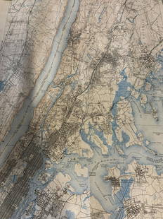
Sold2023Group lot of NEW YORK State Topographical MapsGroup lot of NEW YORK State Topographical Maps, maps measure 17 x 21 inches, wear consistent with age and use. not framed. Art, wall art, artwork, home decor, maps, topographic, topography, New York SSee Sold Price
Sold2022Group lot of NEW YORK State Topographical MapsGroup lot of NEW YORK State Topographical Maps, maps measure 17 x 21 inches, wear consistent with age and use. not framed. Art, wall art, artwork, home decor, maps, topographic, topography, New York SSee Sold Price
Sold2017Johnson: New York State Map, 1866Map: 1866 Johnson's New York State Map -- Johnson's New York Cartographer: A Johnson & Co. Year/Place: 1866 New York Dimensions: 17 x 24 in. This is a large double page map of New York state with muchSee Sold Price
Sold2023Southern provinces of the United States. THOMSON. West & East Florida 1830 mapTITLE/CONTENT OF MAP: 'Southern provinces of the United States' The map shows the United States including the first 17 states to acceed, including "Tenasee" (Tennessee), which had joined in 1796. OhioSee Sold Price
Sold2023Southern provinces of the United States. THOMSON. West & East Florida 1817 mapTITLE/CONTENT OF MAP: 'Southern provinces of the United States' The map shows the United States including the first 17 states to acceed, including Tennessee, which had joined in 1796. Ohio, LouisianaSee Sold Price
2017Thomson: Antique Map of the United States, 1817United States of America' The map shows the United States including the first 17 states to acceed, including Tennessee, which had joined in 1796. Ohio, Louisiana and Indiana, which had all joined theSee Sold Price
Sold2018Map of the United States and Part of Louisiana.Map: Map of the United States and Part of Louisiana. Publication Date: 1802 Cartographer: KNEASS, WM. Publisher: THOMAS & ANDREWS Size (inches): 8X10.25 Shows the U.S. with 17 states including Ohio asSee Sold Price
Sold2015MITCHELL UNITED STATES MAP 1833Hand colored map by J.H. Young, Phila. PA. Some spotting and light edge wear. 21 1/2'' x 17 1/4''See Sold Price
Sold20181843 William Woodbridge United States Map1843 William C. Woodbridge Physical Map of the United States. Measures 12" x 17 5/8" (sheet size). G-Vg/Vg condition. Unframed, loose and not mounted or glued down. We ship all items in this auction iSee Sold Price
Sold2018Southern provinces of the United States. THOMSON. WestTITLE/CONTENT OF MAP: 'Southern provinces of the United States' The map shows the United States including the first 17 states to acceed, including Tennessee, which had joined in 1796. Ohio, LouisianaSee Sold Price
Sold2017Australia Showing 1856 States 1863 MapAustralia Showing 1856 States Pre-queensland 'north Australia'. Weller, 1863 Map. Title/content of Map: 'australia' date Printed: 1863 image Size: Approx 31.0 X 43.5cm, 12.25 X 17.25 Inches (large) tySee Sold Price
Sold20191876 Mitchell Map of the United States -- VII Map ofReserve Reduced! Title/Content of Map: 1876 Mitchell Map of the United States -- VII Map of the United States Date: 1876, Philadelphia Cartographer: S Mitchell Size: 10.6 X 17 in. This is a very niceSee Sold Price
Sold2017Johnson’s New Military Map of the US, 1863Johnson’s New Military Map shows states rather than military zones. 1863. 17 x 23.75 inches. Johnson’s New Military Map of the United States Showing the Forts, Military Posts with Enlarged Plans oSee Sold Price
Sold2021A group of five American state and city maps,A group of five American state and city maps, comprising: Wisconsin. Philadelphia: Thomas, Cowperthwait & Co., N.d. 19 1/2 x 17 1/8 In. -- Ohio. New York: J.H. Colton, 1855. 17 1/2 x 20 1/2 In. Some gSee Sold Price
Sold2019[Map] The State of South Carolina 1796Tanner, Benjamin. "The State of South Carolina: from the best Authorities." New York: John Reid, [ca. 1796.] On heavy laid. Measuring from neat-lines 17" x 15". Lower edge remargined, mild toning, oneSee Sold Price
Sold2018Map of Charleston Harbor S. C.Reserve Reduced! Title/Content of Map: Map of Charleston Harbor S. C. Date: 1860 Cartographer: Gratiot, C. et al. Publisher: American State Papers Size: 17.5 x 22.5 inches Large map from "The ConstrucSee Sold Price
Sold20231819 LIZARS MAP UNITED STATES.W & D Lizars Edinburgh map of the United Sates of America 1819, image 15” x 17,5” framed under glass overall 23” x 25”See Sold Price
Sold20191858 Mitchell Map of United States -- No. 5 Map of theTitle/Content of Map: 1858 Mitchell Map of United States -- No. 5 Map of the United States Date: 1858, PhiladelphiaCartographer: S Mitchell Size: 10.6 X 17 in. A nice double page pre-Civil War map ofSee Sold Price
Sold2021Pair of Texas Maps and CompassPair of bound Texas Bureau of Economic Geology maps, to include "Atlas of Major Texas Oil Reserves" by Galloway and Ewing, "County Maps of Texas" by the State of Texas, compass 17"h x 22"w/ largest PrSee Sold Price
Sold2017Melish: Map of America, 1821Map: United States of America Compiled from the Latest & Best Authorities Maker: John Melish Publisher: M. Carey, Philadelphia Publishing Date: 1821 Size: 17 x 21.375 inches An important map by the AmSee Sold Price
Sold20184- EARLY GAMES w/ BOXESIncludes Messenger Boy and Checkers, Sectional Steam Hose, Dissected Map United States, and Postal Delivery Boys. All look mostly complete. Boxes with wear and loss. Largest 17" Very GoodSee Sold Price
Sold20211861 Civil War Military Map of the U.S.Johnson's New Military Map of the United States. NY: Johnson & Browning, 1861. 17.5 x 24", in 26.25 x 32.5" frame, under glass.See Sold Price
Sold2019Two Copies of Johnson & Ward, "New Military Map of theTwo Copies of Johnson & Ward, "New Military Map of the United States," 1861, hand colored, H.- 17 7/8 in., W.- 26 3/4 in. (2 Pcs.)See Sold Price
5 days LeftDoyle New YorkThe scarce and important first edition of this 1766 anti-slavery tract$1,500
4 days LeftJasper52Reconnoissance of the Western Coast of the United States from Monterey Bay to The Columbia River in$240
4 days LeftJasper52VERY RARE. Washington D.C & Georgetown Land Reclamation. From a Supreme Court Exhibit 1879-1899$480
May 12Schilb Antiquarian Rare Books1869 American Emigrants Immigration Illustrated US State MAPS Railroad Alaska$1(1 bid)


![[Map] The State of South Carolina 1796: Tanner, Benjamin. "The State of South Carolina: from the best Authorities." New York: John Reid, [ca. 1796.] On heavy laid. Measuring from neat-lines 17" x 15". Lower edge remargined, mild toning, one](https://p1.liveauctioneers.com/3532/146911/74242458_1_x.jpg?height=310&quality=70&version=1564368564)


![[WWI] P.T. Sherman's WWI Service Record & Books (1 of 8)](https://p1.liveauctioneers.com/7226/322253/173251586_1_x.jpg?height=282&quality=70&version=1710004847)


![[Lot of 3] Ortelius, 16th c. Maps (1 of 7)](https://p1.liveauctioneers.com/3532/326332/175680386_1_x.jpg?height=282&quality=70&version=1713150771)
