Sold2023Scarce 1854 wall map of N. America in exceptional condition, Jacob MonkSurprisingly clean and sound wall map of North America showing significant evolution of territories west of the Mississippi River following the Mexican-American War and during the height of the CalifoSee Sold Price
Sold2022Jacob Monk Wall Map of North America 1860Monk's Standard American Map exhibiting the larger portion of North America Embracing The United States and Territories, Mexico, Central America, including the West India Islands, Canada, New BrunswicSee Sold Price
Sold2019Huge/clean 1867 wall map of North America, J. T. LloydHuge antique wall map in rare condition...varnish appears nearly fresh with absolutely no cracking. Includes original rollers which are also in great condition. Great hand-coloring and strong print. TSee Sold Price
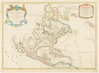
Sold2020Jacques Chiquet North America Map 1719 CaliforniaJacques Chiquet (1673-1721), "L'Amerique Septentrionale qui fait partie des Indes Occidentales," Paris, 1719. This excellent hand colored map of North America includes a depiction of California as anSee Sold Price
Sold2020Large D'Anville Wall Map of South America 1794A stunning wall map based on d'Anville's map of South America, including new discoveries by explorers along the coast, printed over two sheets and published by Laurie & Whittlemin 1794. This was likelSee Sold Price
Sold20191755 Three Panel Wall Map of South America BoltonRare three panel wall map of South America “Performed Under the Patronage of Louis Duke of Orleans .. by the Sieur D’Anville, Improved by Mr. (Samuel) Bolton for Mr. Postlethwayt’s Dictionary ofSee Sold Price
Sold20211752 Four Section Maps North AmericaAll four sections of a wall map of North America arranged for Malachy Postlethwayte for his publication "Dictionary of Trade and Commerce". The maps are based on a work by the French mapmaker D'AnvillSee Sold Price
Sold2022Great Colton map of IowaAn excellent 1855 first edition example of Colton's map of Iowa. Like most of Colton's state maps, this map was derived from an earlier wall map of North America produced by Colton and D. Griffing JohSee Sold Price
Sold2022(COLONIAL NORTH AMERICA.) Jean-Baptiste Bourguignon d'Anville. Canada Louisiane et Terres Angloises.(COLONIAL NORTH AMERICA.) Jean-Baptiste Bourguignon d'Anville. Canada Louisiane et Terres Angloises. Large hand-colored engraved wall map of eastern North America. 4 sheets trimmed and joined, 37x45&#See Sold Price
Sold20241719 Map of Colonial era North America, by Sanson - JaillotTitle: 1719 Map of Colonial era North America, by Sanson - Jaillot Date/Period: 1719 Materials: Copperplate engraved Size: 25 1/2 x 18” This map is a rare and valuable map of history, showing NoSee Sold Price
Sold2020Hubert Jaillot Map South America 1719Hubert Jaillot (1632-1712), "Amerique Meridionale divisee en ses pricipales Parties ou sont distingues les uns des autres les Estats suivant qu'ils appartiennent presentement aux Francois, Castillans,See Sold Price
Sold20181853 WALL MAP OF NORTH and CENTAL AMERICAPublished by Jacob Monk, Baltimore, MD. color lithograph back with cloth and mounted to hangers. 58 x 59 inches.See Sold Price
Sold2015Map of North America 1719Heading: (North America) Author: Sanson, Nicolas/ Hubert Jaillot Title: Amerique Septentrionale divisée en ses Principales Parties, ou sont distingués les uns des autres les Estats suivant quils appSee Sold Price
Sold2019J. Calvin Smith, "Colton's The United States ofJ. Calvin Smith, "Colton's The United States of America," 16 Maps comprising the wall map of the United States, 1853, paper mounted on linen, Each- H. - 16 in., W. - 20 1/4 in.See Sold Price
Sold2020Colton's 1849 wall map of United StatesHeading: Author: Colton, George Woolworth Title: Map of the United States of America, The British Provinces, Mexico, the West Indies and Central America with part of New Granada and Venezuela Place PSee Sold Price
Sold2021[WALL MAP]. Colton's map of the U.S.A . NY: 1853J.H. COLTON (publisher) [WALL MAP]. Colton's map of the United States of America, the British provinces, Mexico and the West Indies. [WALL MAP]. Colton's map of the United States of America, the BritiSee Sold Price
Sold2020Early Map of America, Eastern United States, M. SeutterTitled "Novi Belgii in America Septentrionali" with very elaborate cartouche and with vignette view of New Amsterdam (New York). Exquisite color, well preserved, laid down. Size: 19 7/8" x 22 3/4" (siSee Sold Price
Sold2020John Senex Map of North and South America 1719-17John Senex (1678–1740), "A New Map of America from the Latest Observations," London, ca. 1719-1721. Hand colored copperplate engraved map of North and South America, from Senex's "New General ASee Sold Price
Sold20241792 MAP OF NORTH AMERICA BY JACQUES CHIQUETSuperb engraved and hand-colored map of North America by French cartographer Jacques Chiquet, 9 x 6.75 in. (sight), very boldly and sharply printed. Set into an elaborate and most attractive double maSee Sold Price
Sold2015Modern Aluminum Wall Sculpture of USA MapAmerican, 20th century. Modern aluminum metal wall sculpture depicting a geographical map rendering of the United States of America with incised borders demarcating states. Flattened sculptural map wiSee Sold Price
Sold2017Chatelain: Carte Paraguai Chili Detroit Magellan, 1719Map: Carte du Paraguai, du Chili, du Detroit de Magellan Cartographer: Chatelain Place & Date: Amsterdam / 1719 Size: 20 1/4" x 15 3/4" Chatelain's superbly detailed map of southern South America exteSee Sold Price
Sold2019J.H. Colton Map of the United States of America, c 1849J.H. Colton Map of the United States of America, c 1849. 1st edition wall version drawn by George W. Colton and engraved by John M. Atwood with the grapevine border design with small vignettes done anSee Sold Price
Sold2021A GEORGE II FRENCH AND INDIAN WAR PERIOD MAP, "A Map ofA GEORGE II FRENCH AND INDIAN WAR PERIOD MAP, "A Map of the British and French Settlements in North America," LONDON, CIRCA 1755, hand-colored engraving on paper, by John Lodge Cowley (1719-1797), carSee Sold Price
Featured5 days LeftJasper521719 Chatelain World Map -- Mappe-Monde pour Connoitre les Progres & les Conquestes les Plus$280
2 days LeftSouth Jersey Auction by Babington Auction IncFramed map of North America and Central America$25
May 05Tremont Auctions18th century original map of South America. "Charles Earl of Sunderland and Baron Spencer. This Map$150(1 bid)
May 15University ArchivesDeclaration of Independence, Very Early British Publ. in Gentleman's Magazine & Rare Map$1,000
May 09Hunt and Peck Estate Services, Inc.1794 Laurie & Whittle after Thomas Jefferys Map Of The United States Of America$340(1 bid)
2 days LeftJuliet and FriendsA PAIR OF VINTAGE VICTORIAN GILT SHADOW BOXES WITH FRENCH MINIATURE ELEGANT LADY PORTRAIT PAINTINGS$40
1 day LeftTrillium Antique Prints & Rare BooksBonne - Map of the Eastern Coast of North America$85(3 bids)
8 hrs LeftAlexander Historical Auctions LLCBATTLE OF ST. MIHIEL BATTLE MAP, USED BY COL. WILLIAM J. DONOVAN$200(1 bid)
5 days LeftDoyle New YorkThe top sheet of the famous Ratzer Map - with additions relating to an 1810 real estate dispute$7,500


![[WALL MAP]. Colton's map of the U.S.A . NY: 1853: J.H. COLTON (publisher) [WALL MAP]. Colton's map of the United States of America, the British provinces, Mexico and the West Indies. [WALL MAP]. Colton's map of the United States of America, the Briti](https://p1.liveauctioneers.com/7142/218924/116475153_1_x.jpg?height=310&quality=70&version=1636469267)


