Sold2018Ortelius Antique Map: Basiliensis TerritoriiTitle/Content of Map: Basiliensis Territorii Descritorii Nova. - Circulus sive Liga Sueviae Date Printed: 1579 Cartographer: Abraham Ortelius Material/Medium: No color, good impression. Latin text onSee Sold Price
Sold2018Ortelius Antique Map: Persici Sive Sophorum Regni TypusTitle/Content of Map: Persici Sive Sophorum Regni Typus Date Printed: 1609 Cartographer: Abraham Ortelius Material/Medium: No color. Spanish text on verso. From the first modern atlas- the Theatrum OrSee Sold Price
Sold2019Ortelius: Basiliensis Territorii Descritorii Nova -No Reserve! Title/Content of Map: Basiliensis Territorii Descritorii Nova - Circulus sive Liga Sueviae Date: 1588 Cartographer: Abraham Ortelius Material/Medium: No color, good impression. Spanish texSee Sold Price
2021Michael Mercator RARE Antique Map of the AmericasAntique map of "America and New India" (America Sive India Nova) produced by Michael Mercator (c. 1567-1600), Gerard Mercator’s grandson. Hand colored engraved map. Duisburg, 1595 (Amsterdam, 1See Sold Price
Sold20211613 America sive India Nova ad magnae GerardiBy: Michael MercatorDate: 1613 / DuisbergDimensions: 16 x 19.5 inches (40.7 x 49.5 cm)This is an authentic antique map of the Western Hemisphere by Michael Mercator. The map is based on Rumold MercatoSee Sold Price
Sold2017Ortelius: Antique Map of North & South America, 1598Map: America sive Novus Orbis Date Printed: 1598 Cartographer: Abraham Ortelius Size: 4 x 3 Condition: Good condition. A few brown thumbprints and one repaired marginal tear at the Northwest coast ofSee Sold Price
Sold2020Antique Map (18th Century)IMPERII MAGNI MOGOLIS SIVE INDICI PADSCHACH, hand-colored double-page atlas engraving, engraved by Albrecht Carl Seutter, sheet 19 ½ x 22 ½”.See Sold Price
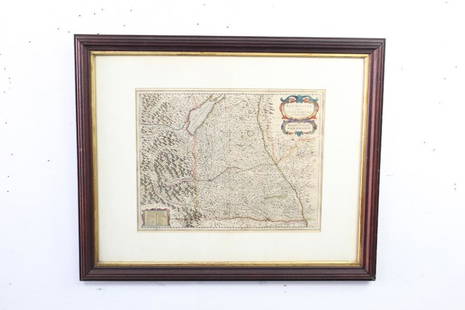
Sold2023Four Antique MapsComprising "Circuli Super Saxoniae pars Meridionalis sive Ducatus, Electoratus, et Principatus Ducum Saxoniae..." by Johann Baptiste Homann, 1734; "Comitatus Principalis Tirolis..." by Johann BaptisteSee Sold Price
Sold2021Antique Framed Map of Germany by A Christophoro HurteroAntique Framed Map of Germany by A Christophoro Hurtero. Full title: Alemannia Sive Svevia Superior. Date of printing is somewhere in 1640's, and possibly engraved. Golden painted inner frame. DimSee Sold Price
Sold2022Antique H/C Map of Ancient Northern Africa - AFRICA SEPTENTRIONALISAntique Hand-colored Detailed Map of Ancient Northern Africa Entitled AFRICA SEPTENTRIONALIS, SIVE REGIO LITTORALIS INTRA SOLIS MONTEM ET AEYPTUM SITA | Copperplate Engraving | Marked in upper and lowSee Sold Price
Sold20231693 HISTORY of BELGIUM ILLUSTRATED w/ MAP FOLIO antique CHRONICON vellumCHRONICON BALDUINI AVENNENSIS TOPARCHAE BELLIMONTIS SIVE HISTORIA GENEALOGICA COMITUM HANNONIAE ALIORUMQUE PRINCIPUM ANTE ANNOS QU[ADR]INGENTOS CONSCRIPTA [...]. by BAUDOUIN of AVESNES Antwerp; 1693 FSee Sold Price
Sold20231632 EUROPE DESCRIPTION by MERCURII GALLOBEGICI antique VELLUM BOUND w/ MAPMERCURII GALLOBEGICI sive, rerum in Gallia et Belgio potissimum; Hispania quoqve Italia, Anglia, Germania, Ungaria, Bohemia... Frankfurt; 1632 Illustrated with one plate and the map of Western EuropeSee Sold Price
Sold2023ENGRAVED DOUBLE HEMISPHERE WORLD MAPS BY ZURNERAdam Friedrich Zurner, 1679 to 1742, two engraved double-hemisphere world map Planisphaerium Terrestre cum utroque Coelesti Hemisphaerio, sive Diversa Orbis Terraquei, colored by a contemporary hand.See Sold Price
Sold2022ENGRAVED DOUBLE HEMISPHERE WORLD MAPS BY ZURNERAdam Friedrich Zurner, 1679 to 1742, two engraved double-hemisphere world map Planisphaerium Terrestre cum utroque Coelesti Hemisphaerio, sive Diversa Orbis Terraquei, colored by a contemporary hand.See Sold Price
Sold2017Ortelius: Antique Map of the World, 1587Map: World Date Printed: 1587-1612 Cartographer: Abraham Ortelius Material/Medium: Paper Size: *** Approx 16" x 21" Original hand color. Copperplate engraved.One of the most famous and iconic world maSee Sold Price
Sold2017Levasseur: Antique Map of North America, 1840Title/Content of Map: 1840 Levasseur Map of North America - Amerique Septrentionale Date Printed: 1840 Paris Cartographer: V. Levasseur Size: 11 x 16.5 in. Condition: Excellent. Minor age toning; issuSee Sold Price
Sold2021Four Antique MapsFour antique maps. Including a very early hand made paper map of Florida and Virginia. Fragment of old newspaper on back dated 1630. Unframed, each approx H 21" W 24". All in excellent condition, minoSee Sold Price
Sold2023TWO ANTIQUE MAPS OF CHINA.Two antique maps of China, including Chinae by Abraham Ortelius, 1595, image 14.25” x 18.25”, with map of Eastern Asia, Le table de la region orientale, image 10” x 13.5”.See Sold Price
Sold2017Jaillot: Antique Map of North America, 1696Map: 1696 Jaillot Map of North America (California as an Island) -- Amerique Septentrionale Divisee en ses Principales Parties Date Printed: 1696 Amsterdam Cartographer: H. Jaillot Size: 19.3 x 23 in.See Sold Price
Sold2018Homann: Antique Map of New England, 1720The map names New England as "Almouchi Cosen" as well as Nova Anglia, while present-day New York State is named variously as New Jork, Nieuw Nederland and Novum Belgium (New York, New Netherlands andSee Sold Price
Sold2024Matthaus Merian 1627 Antique Map Engraving "Virginia" from Theodore de Bry's "Grand Voyages" #1Antique 1627 map of Virginia by Matthaus Merian after John Smith's 1612 map, from Theodore de Bry's "Grand Voyages". Please see "The Philidelphia Print Shop" sheet shown in final photo. Good conditionSee Sold Price
Sold2017Forlani: Antique Map, Town View of Venice, 1569Title: Venetia, Splendid 1569 Lafreri-school town view of Venice Map maker: Paolo Forlani, De’ disegni delle più illustri città et fortezze del mondo Place and Year: Venice, 1569 Dimensions: 19.2See Sold Price
Sold2024John Speed 1676 Original Antique Map of Virginia and Maryland No ColorAntique 1676 map of Virginia and Maryland engraved by Francis Lamb and republished by Thomas Basset & Richard Chriswell after John Speed's 1611 atlas. With "The Description of Mary-Land" text on reverSee Sold Price
Sold2024Antique map of Virginia - Florida by Blaeu W. 1642-43Virginia and Florida. "Virginiae partis australis, et Floridae partis orientalis, interjacentiumque regionum nova descriptio". Orig. copperplate engraving, W. J. Blaeu, published by C. and J. Blaeu inSee Sold Price
4 days LeftJasper521720 antique MAP of LOWER SAXONY GERMANY 18th CENT. Circulus Saxoniae inferioris$75
May 04Trillium Antique Prints & Rare BooksBesler - Pair of Botanical Engravings: Lily, Iris, Meadow-Rue, Fumitory$200
19 hrs LeftTrillium Antique Prints & Rare BooksPtolemy & Magini, pub. 1620 - Map of the World with Six Windheads$130(4 bids)
19 hrs LeftTrillium Antique Prints & Rare BooksPtolemy & Magini, pub. 1620 - Double Hemisphere Map of the World$400(5 bids)
19 hrs LeftTrillium Antique Prints & Rare BooksBonne - Map of the Eastern Coast of North America$85(3 bids)
19 hrs LeftTrillium Antique Prints & Rare BooksCarey, pub. 1814 - Map of the State of Tennessee$50(1 bid)
19 hrs LeftTrillium Antique Prints & Rare BooksCarey, pub. 1814 - Map of the Mississippi Territory$60(2 bids)
Featured5 days LeftJasper52PACIFIC OCEAN currents British French German US Spanish colonies. LETTS 1889 map$15
19 hrs LeftTrillium Antique Prints & Rare BooksDe Jode, pub. 1593 - Map of Hesse, Germany (Hessiae Seu Cattorum Nobilissimorum?)$100
19 hrs LeftTrillium Antique Prints & Rare BooksDe Jode, pub. 1593 - Map of part of Germany (Reiterata Episcopatus Monasteriensis geographica?)$100
5 days LeftJasper52World War 2. Guadalcanal Campaign 7-8 Aug 1942 Tulagi Landing Schedule 1959 map$10


![1693 HISTORY of BELGIUM ILLUSTRATED w/ MAP FOLIO antique CHRONICON vellum: CHRONICON BALDUINI AVENNENSIS TOPARCHAE BELLIMONTIS SIVE HISTORIA GENEALOGICA COMITUM HANNONIAE ALIORUMQUE PRINCIPUM ANTE ANNOS QU[ADR]INGENTOS CONSCRIPTA [...]. by BAUDOUIN of AVESNES Antwerp; 1693 F](https://p1.liveauctioneers.com/5584/273386/143235584_1_x.jpg?height=310&quality=70&version=1672180773)


