Sold2020Early Civil War era map of AmericaNice example of A. J. Johnson's 1862 map of North America. Presents a fascinating snapshot of North America just after the outbreak of the American Civil War. States generally follow the 1861 configurSee Sold Price
Sold2024Civil War era map of N. America with unsettled state bordersOne of the key maps in the 1860s Johnson series of North America. In this map Idaho Territory encompasses what would eventually become Idaho, Montana and Wyoming. Dakota Territory has yet to split intSee Sold Price
Sold2023Civil War era map of N. America with unsettled state bordersOne of the key maps in the 1860s Johnson series of North America. In this map Dakota Territory has yet to split into its north and south divisions while it stretches to encompass what will eventuallySee Sold Price
Sold2023Civil War era map of North America from S. A. Mitchell Jr.Wonderful map of the North American continent with 1860 date but published in the 1863 Mitchell New General Atlas. Shows the United States at the height of the Civil War. Depicts the North American coSee Sold Price
Sold2022Civil War era map of N. America with unsettled state bordersOne of the key maps in the 1860s Johnson series of North America. In this map Idaho Territory encompasses what would eventually become Idaho, Montana and Wyoming. Dakota Territory has yet to split intSee Sold Price
Sold2023Early Civil War Map of North AmericaEntitled Supplement to the Illustrated London News, July 1, 1861, Stephenson colortoned to show the Union states and Seceded or Rebel states. Full title being: Map of the United States of America, UppSee Sold Price
Sold2022AN AMERICAN CIVIL WAR ERA MAP, "United States of North America (Eastern & Central)," LONDON,AN AMERICAN CIVIL WAR ERA MAP, "United States of North America (Eastern & Central)," LONDON, 1861-1873, THEODORE ETTLING (b. 1823), hand colored lithograph on paper, by T. Ettling, published by CasselSee Sold Price
Sold20221893 Government Map of Civil War Era United States -- Map of the United States of America ShowingTitle: 1893 Government Map of Civil War Era United States -- Map of the United States of America Showing the Boundaries of the Union and Confederate Geographical Divisions and Departments CartographerSee Sold Price
Sold20221893 Government Map of Civil War Era United States -- Map of the United States of America ShowingTitle: 1893 Government Map of Civil War Era United States -- Map of the United States of America Showing the Boundaries of the Union and Confederate Geographical Divisions and Departments; Plate CLXIVSee Sold Price
Sold20221893 Government Map of Civil War Era United States -- Map of the United States of America ShowingTitle: 1893 Government Map of Civil War Era United States -- Map of the United States of America Showing the Boundaries of the Union and Confederate Geographical Divisions and Departments; Plate CLXIISee Sold Price
Sold202319C Antique 1855 Rockland Maine Early American MapAn antique American pre Civil War era map on paper. Printed 1855 by Wagner and McGuigan (Philadelphia), published by Edgar M. Woodford (1824-1862). Depicting the city of Rockland, Maine. Map shows theSee Sold Price
Sold2023Civil War era map of Florida, 1863Lovely early map of Florida, vividly hand colored by county, with a large inset of the Florida Keys. Shows towns, railroads, villages, post offices, forts, etc. Only five counties shown in the southerSee Sold Price
Sold2017Ettling: Map of United States of North America, 1860United States of North America (Eastern & Central) T. J. Ettling, c1860 17 x 25. This great Civil War era map covers the country from the Rocky Mountains to the Atlantic seaboard. The map is engravedSee Sold Price
Sold2022Antique Civil War Era Map of North American by by S. Augustus Mitchell, Jr., 1860Antique Civil War Era Map of North American by by S. Augustus Mitchell, Jr., 1860 | Full Title: Map of North America Showing Its Political Divisions, and Recent Discoveries in the Polar Regions | ConsSee Sold Price
Sold2022Antique Civil War Era County Map of Kentucky and Tennessee by by S. Augustus Mitchell, Jr., 1860Antique Civil War Era Map of Kentucky and Tennessee by by S. Augustus Mitchell, Jr., 1860 | Full Title: Map of North America Showing Its Political Divisions, and Recent Discoveries in the Polar RegionSee Sold Price
Sold2018Two Civil War Era Mitchell MapsMap of North America Showing Its Political Divisions and county maps of North Carolina, South Carolina, and Florida on one sheet (Philadelphia: S. Augustus Mitchell, 1860). Not framed. 15.25 x 12.25 iSee Sold Price
Sold2019Civil War N. America with odd DakotaThis uncommon Civil War era engraved map shows a very unusual configuration for Dakota. West Virginia hasn’t separated from Virginia, which puts the map sometime before 1863. In this map the bordersSee Sold Price
Sold2023Civil War era 1863 map of Mexico & Caribbean nationsLovely and vintage double-page map showing all of Mexico, Central America, Texas, Indian Territory and states of the Deep South during the middle of the American Civil War. Map has an 1860 copyright bSee Sold Price
Sold2021U. S. & N. America w/odd Dakota--Ettling c1860This uncommon Civil War era engraved map shows a very unusual configuration for Dakota. In this map the borders of Wyoming and Utah have yet to be finalized. Numerous Indian tribes are located throughSee Sold Price
Sold2021Civil War era county map of Georgia & AlabamaS. Augustus Mitchell published some of the nicer atlases during the mid-19th century in America. Maps from these atlases are desirable documents showing what the different states looked like at the tiSee Sold Price
Sold20221755 Map of North America by De VaugondyHistoric Maps 1755 French & Indian War Era Map of North America by De Vaugondy 1755-Dated French & Indian War Era, Large Hand-Colored Map titled, "PARTIE DE L'AMERIQUE SEPTENTRIONALE, QUI COMPREND LESee Sold Price
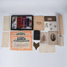
Sold2023Civil War Era Itemsitems to include: Epaulette, Solider tin type, brass bleeder in case, pewter snuff box, powder horn with dog, early 1800's fork in leather case, Burr's map of New York State 1835 in poor condition, 18See Sold Price
Sold2020CIVIL WAR USA showing Union Confederate & BorderTITLE/CONTENT OF MAP: 'United States of North America (Eastern & central)' The map depicts the United States as divided in the early part of the Civil War between the Union states, the Confederate staSee Sold Price
Sold20219 Books Related to Civil War/Post Civil War era AmericaNine (9) Books Related to Civil War/Post Civil War era America. 1st-2nd items: THE RISE AND FALL OF THE CONFEDERATE GOVERNMENT, Vol. I & II, by Jefferson Davis, published by D. Appleton and Company, NSee Sold Price
4 days LeftEarly American History Auctions1863 JOHN ARCHIBALD CAMPBELL ALS Re: a Friends Prisoner Exchange Confederate Asst. Secretary of War$450
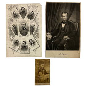
Jun 22Lakeshore Event CenterEphemera, Civil War Generals, Abraham Lincoln, Ulysses Grant, Lot of 3$30(1 bid)
4 days LeftEarly American History AuctionsAbraham Lincoln Gettysburg Address on Muslin Cotton Fabric measuring 21.5 x 15.5$100
4 days LeftEarly American History Auctions1905 Civil War General OLIVER OTIS HOWARD Typed Letter Signed as President of the Lincoln Memorial$300
4 days LeftEarly American History AuctionsLot of 47 Civil War Prints of the First U.S. Ironclad St. Louis or Baron de Kalb and 5 Iron Caltrops$750
Jun 23Schilb Antiquarian Rare Books1918 Robert E Lee Civil WAR Confederate General CSA Battles MAPS Illustrated$9(3 bids)
Jun 23Schilb Antiquarian Rare Books1890 1ed Confederate Memoirs of Joseph Johnston & Jefferson Davis Civil War CSA$66(3 bids)
5 days LeftHolabird Western Americana CollectionsJefferson Davis Confederate Stamp Sheet, Scott 11 [179366]$750
2 days LeftWeatherham Estate TreasuresAbraham Lincoln Bronze Bust Sculpture On Marble Base - Signed Original - 10lbs$400
7 days LeftJasper52c1863 Civil War era Virginia with Washington D.C. and View of The Capital. By C. Magnus$220
4 days LeftEarly American History AuctionsRinggold Light Artillery FIRST DEFENDERS, Rare Civil War Reunion Printed Silk Ribbon, Reading, PA.$150
4 days LeftEarly American History Auctions1862 Civil War Dated, Union General David Hunter Autograph Letter Signed Involving 3 Union Generals$600
4 days LeftEarly American History Auctions1864 Abraham Lincoln Presidential Campaign Rally Round The Boys theme San Francisco, CA National$150(1 bid)
4 days LeftEarly American History AuctionsALS, Civil War Veteran, Member of Honor Guard for Assassinated President Lincoln as he Laid in State$1,000
4 days LeftEarly American History Auctions1864 Civil War General Order, President Lincoln Commutes the Death Sentences for Two Soldiers$120
4 days LeftEarly American History AuctionsLaSALLE CORBELL PICKETT, Prolific author and the 3rd Wife of Confederate General George E. Pickett$240
4 days LeftEarly American History AuctionsAbraham Lincoln 1864 Message from the President of the United States Ship Illegally Captured in 1862$150(1 bid)
4 days LeftEarly American History Auctions1862 Abraham Lincoln Satirical Political Cartoon, District of Columbia Compensated Emancipation Act$200
4 days LeftEarly American History Auctions1865 Treasury Department Circular, Canal Boats Doing Business With Indian Tribes Are Exempt From Tax$220


![Jefferson Davis Confederate Stamp Sheet, Scott 11 [179366] (1 of 1)](https://p1.liveauctioneers.com/2699/331499/178846702_1_x.jpg?height=282&quality=70&version=1717095214)