Sold20181943 US Air Force Silk Escape Map of Northern HonsuTitle/Content of Map: 1943 US Army Air Force Silk Escape Map of Northern Honsu (main island) and Hokkado Islands, Japan -- [Escape Silk Map] Hakodate [verso] Nemuro Date Printed: 1943, Washington DC CSee Sold Price
Sold2015Map of Battlefields Nashville US Major General TowerPeseux, M. and Brigadier General Zealous Bates Tower. Battlefields in front of Nashville where the United States forces commanded by Major General George H. Thomas defeated and routed the Rebel Army uSee Sold Price
Sold2023US Army 3rd Infantry Division Framed Detail Map CollageUnited States of America Army Korean War 3rd Infantry Division Framed Detailed Map Photo Membership Card etc. and a Hardcover Handbook post ww wwii vietnam militaria Out of a Southshore Long Island NeSee Sold Price
Sold2017USCGS: Antique Map of South Carolina Coast, 1870Title/Content of Map: 'U.S. Coast survey Benjamin Peirce Superintendent entrance to Bull and Combahee rivers South Carolina 1871' Morgan's Island. USCGS Date Printed: 1870 Image Size: Approx 40.0 x 57See Sold Price
Sold202440+ Asst 1940s-Newer Maps- Army, Declassified, More - Army Corps Engineers, US Army Maps - Maps from40+ Asst 1940s-Newer Maps- Army, Declassified, More - Army Corps Engineers, US Army Maps - Maps from around the World - 1:50,000 + 1:1,000,000 ScaleSee Sold Price
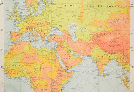
Sold2022WW2 Army MapsA collection of (8) WW2 U.S. Army Map Service maps of the world. Large, in vivid color.See Sold Price
Sold2022US DEPARTMENT OF DEFENSE. KOREAN WAR MAPS (1950-1953)US DEPARTMENT OF DEFENSE. KOREAN WAR MAPS (1950-1953) INCLUDING SANGYONG, MAJON-NI, AND YANGHOP-TONG. Washington DC: US Army Map Service. Seven maps from the country, of Sangyong (17), Majon-Ni (8), YSee Sold Price
Sold2022US DEPARTMENT OF DEFENSEUS DEPARTMENT OF DEFENSE. KOREAN WAR MAPS (1950-1953) YONCH'ON, CH'ORWON AND OTHERS. Washington DC: US Army Map Service. Seven maps from the country, of Yonch'on (7), Ch'orwon (7), Tuksom (9), UijongbSee Sold Price
Sold2022US DEPARTMENT OF DEFENSE. WORLD WAR 2, SUMATRA, INDONESIA AND DUTCH EAST INDIES MAPS (1944-1946)US DEPARTMENT OF DEFENSE. WORLD WAR 2, SUMATRA, INDONESIA AND DUTCH EAST INDIES MAPS (1944-1946). US Army Map Service. Eight maps from Dutch Sumatra and Timor: Gle Jeueng (paper) and Lho'Nga (paper) eSee Sold Price
Sold2022US DEPARTMENT OF DEFENSE. WORLD WAR 2, SUMATRA, INDONESIA AND DUTCH EAST INDIES MAPS (1943-1946)US DEPARTMENT OF DEFENSE. WORLD WAR 2, SUMATRA, INDONESIA AND DUTCH EAST INDIES MAPS (1943-1946). US Army Map Service. Eight maps, from Dutch East Indies: Dutch Timor, Isle of Roti; Portuguese Timor;See Sold Price
Sold20221882 1st ed CIVIL WAR General Ambrose Burnside Union1882 1st ed CIVIL WAR General Ambrose Burnside Union Army MAPS Rhode Island Ambrose Burnside was a notable American politician and Civil War general from Rhode Island. During the civil war, he led manSee Sold Price
Sold20211882 1st ed CIVIL WAR General Ambrose Burnside Union1882 1st ed CIVIL WAR General Ambrose Burnside Union Army MAPS Rhode Island Ambrose Burnside was a notable American politician and Civil War general from Rhode Island. During the civil war, he led manSee Sold Price
Sold2018Group of Five U.S. Army Battle Maps of Okinawa, Japan.[WWII] Group of Five U.S. Army Battle Maps of Okinawa, Japan. Army Map Service, 1945. Printed reference maps prepared “For use by War and Navy Department Agencies Only”. Includes air traffSee Sold Price
Sold20211849 Wilkes Pacific US Expedition FIJI MAP Pacific1849 Wilkes Pacific US Expedition FIJI MAP Pacific Islands Australia Illustrated The ‘Wilkes Expedition’ was one of the most important exploration voyages ever taken on by the United States. It heSee Sold Price
Sold2022US DEPARTMENT OF DEFENSE ARMY MAP SERVICE. KOREAN WAR MAPS (1950-1953)US DEPARTMENT OF DEFENSE ARMY MAP SERVICE. KOREAN WAR MAPS (1950-1953). INCLUDING KAESONG, TONGJIN AND KOYANG. Washington D. C.: Army Map Service. Seven maps from the country, of Kaesong (8), TongjinSee Sold Price
Sold20221842 US Army Map of Lake St. Clair by Detroit -- Map of the Delta of the St. Clair…Title: 1842 US Army Map of Lake St. Clair by Detroit -- Map of the Delta of the St. Clair… Cartographer: US Army Year/Place: 1842 Dimensions: 27.8 X 47 in. Description: This superb and quite uncSee Sold Price
Sold2018U.S Coast Survey 1853 Map. Ship Island Shoal, Louisiana"Preliminary Chart of Ship Island Shoal Louisiana" Electrotype Map Published 1843-65, Washington for "Report of the Superintendent of the U.S. Coast Survey..." Published under the supervision and direSee Sold Price
Sold2017U.S. Navy: Antique Map Mouth of Roanoke River. 1881Title/Content of Map: Mouths of Roanoke River Showing Scene of Naval Operations Connected with the Capture of of Plymouth, N.C. April 1864 Date Printed: 1881 Cartographer: Naval War Records Office SizSee Sold Price
Sold2018Pease and Niles Gazetteer of the States of ConnecPease and Niles Gazetteer of the States of Connecticut and Rhode Island, Hartford, 1813 Map.-- Dimensions: --- US Shipping charge: $20See Sold Price
Sold2024A Scarce And Delicate Lot Of 12 WW1 Army Military Maps, Printed In 1919 By The Base Printing PlantA Scarce And Delicate Lot Of 12 WW1 Army Military Maps. Printed In 1919 By The Base Printing Plant, 29th Engineers, U.S. Army., Each Map Covers The Range Of Operation In Twelve European Locations InclSee Sold Price
Sold20201946 Map of War Damaged Tokyo and Bombed-out Areas --Title/Content of Map: 1946 Map of War Damaged Tokyo and Bombed-out Areas -- [Tokyo] Date: 1946 Cartographer: US Army? Size: 28.8 x 40.8 in. A large, detailed map of Tokyo from the Showa era. It showsSee Sold Price
Sold2023WWII US Army 1942 Map Case BagOriginal WWII map case. See pictures for dates and maker marks. Good condition for its age, with signs of use and age.See Sold Price
Sold20221943 US Army Photo Map of Cape Killerton, Papua New Guinea -- Photo Map of Cape KillertonTitle: 1943 US Army Photo Map of Cape Killerton, Papua New Guinea -- Photo Map of Cape Killerton Cartographer: US Army Year / Place: 1943 Map Dimension (in.): 18.8 x 15 in. This is a highly detailed aSee Sold Price
Sold2023MAP: MOUNT SCOTT - FORT SILL, OKLAHOMA/ COMANCHE COUNTY 1949Description: MOUNT SCOTT - FORT SILL, OKLAHOMA/ COMANCHE COUNTY 1949. Prepared by the army map Army Map Service (AM), Corps of Engineers, US Army, Washington D.C. Compiled in 1949.Material: PaperMeasuSee Sold Price
5 days LeftSwann Auction Galleries(CIVIL WAR--PRINTS.) Ethan Blodgett. Map of a Portion of Roanoke Island, Showing the Battlefield of$750
4 days LeftJasper52Descrittione dell' Isola Iamaica…. PORCACCHI. Jamaica 1590 old antique map$200
4 days LeftEldred'sU.S. COAST SURVEY MAP OF EASTON'S POINT, NEWPORT CO., RHODE ISLAND 1874 14" x 16.5" sight. Framed$100
4 days LeftJasper52Cuba, the Bahamas & Bermuda "or Summer Islands". Turks & Caicos THOMSON 1830 map$170
Featured4 days LeftJasper52The Bahamas, Cuba & Bermuda "or Summer Islands". THOMSON 1817 old antique map$190
Featured4 days LeftJasper52Dominica, British West Indies. Caribbean. US Navy sea chart 1892 (1917) map$140
22 hrs LeftSchilb Antiquarian Rare Books1877 Geology Geography Surveys 1ed Nevada Wyoming Utah George Wheeler US West 2v$13(3 bids)
4 days LeftJasper52Jamaica. Kingston Port Royal Bluefields/Savanna-la-Mar inset. THOMSON 1830 map$100
4 days LeftJasper52Puerto Rico & Virgin Islands. Haiti, Hispaniola or St. Domingo. THOMSON 1817 map$140
4 days LeftJasper52Amér Sep Porto Rico #69 Puerto Rico & Virgin Islands VANDERMAELEN 1827 old map$140
4 days LeftJasper52Isles Antilles Extrait des Cartes Angloises. British West Indies. BONNE 1780 map$70
4 days LeftJasper52St Christophers, Nevis & St Lucia. St Kitts. West Indies. THOMSON 1817 old map$120
4 days LeftJasper52St Christophers, Nevis & St Lucia. St Kitts. West Indies. THOMSON 1830 old map$120
4 days LeftJasper52Anguilla St. Martin/Maarten Barts. Caribbean. US Navy sea chart 1899 (1917) map$280
4 days LeftJasper52Puerto Rico & Virgin Islands. Haiti, Hispaniola or St. Domingo. THOMSON 1817 map$140
4 days LeftJasper52West Indies. Caribbean islands Antilles Gulf of Mexico Florida. THOMSON 1830 map$160


![1943 US Air Force Silk Escape Map of Northern Honsu: Title/Content of Map: 1943 US Army Air Force Silk Escape Map of Northern Honsu (main island) and Hokkado Islands, Japan -- [Escape Silk Map] Hakodate [verso] Nemuro Date Printed: 1943, Washington DC C](https://p1.liveauctioneers.com/5584/117342/60336934_1_x.jpg?height=310&quality=70&version=1520389291)


![Group of Five U.S. Army Battle Maps of Okinawa, Japan.: [WWII] Group of Five U.S. Army Battle Maps of Okinawa, Japan. Army Map Service, 1945. Printed reference maps prepared “For use by War and Navy Department Agencies Only”. Includes air traff](https://p1.liveauctioneers.com/928/124137/63148928_1_x.jpg?height=310&quality=70&version=1530051387)


![1946 Map of War Damaged Tokyo and Bombed-out Areas --: Title/Content of Map: 1946 Map of War Damaged Tokyo and Bombed-out Areas -- [Tokyo] Date: 1946 Cartographer: US Army? Size: 28.8 x 40.8 in. A large, detailed map of Tokyo from the Showa era. It shows](https://p1.liveauctioneers.com/5584/165933/83741854_1_x.jpg?height=310&quality=70&version=1586907661)


![Landing Troops Roanoke Island [Civil War] (1 of 2)](https://p1.liveauctioneers.com/5614/332486/179313455_1_x.jpg?height=282&quality=70&version=1717612636)


