Sold2017William Faden 1796 Map Eastern US, North AmericaFaden, William (BRITISH, 1749-1836); Map of the Eastern United States, North American with British Territories and Those of Spain according to the Treaty of 1784 (from a larger atlas), 1796; handcolorSee Sold Price
Sold2024A general chart of the West India Islands… DELAROCHETTE/FADEN Caribbean 1796 mapTitle: A general chart of the West India Islands… DELAROCHETTE/FADEN Caribbean 1796 map Description: A general chart of the West India Islands with the adjacent coasts of the Spanish continent by L.See Sold Price
Sold20211796 MAP OF NORTH & SOUTH CAROLINA, DENISON, FRAMEJ. Denison (American, 18th century). "Map of North and South Carolina" -1796, from "Morse's Universal Geography", engraving. Framed. Provenance: From the Lifetime Collection of Billy S. Arant, Jr., ChSee Sold Price
Sold2024Carey, pub. 1796 - Map of the State of MarylandThis fine map engraving is from one of the ealiest American atlases published in the states: Mathew Carey's General Atlas. The work was published in Philadelphia by Carey in 1796. It was an importantSee Sold Price
Sold2024Carey, pub. 1796 - Map of the Tennassee State formerly part of North Carolina (Tennessee)This fine map engraving is from one of the ealiest American atlases published in the states: Mathew Carey's General Atlas. The work was published in Philadelphia by Carey in 1796. It was an importantSee Sold Price
Sold2021Ethel B Fowler 1931 Boothbay Harbor Maine MapEthel B Fowler; The Bridge House Studio, 1931 Vintage "Boothbay Harbor and Vicinity" Maine Historical map, mixed media print or Poster, signed and dated in the art and framed. Height of art 24 1/2 incSee Sold Price
Sold20191796 MAP OF THE BRITISH ISLESItalian map. Caleographia Camerale. Engraving. Dimensions: (Frame) H 22.25"x W 16.75", (Sight) H 21.25" x W 15.75" Condition: Some creases to paper.See Sold Price
Sold2021Wilkes, John 1796 Map. North AmericaCopper Engraved Map Published 1796-1828 London for "Encyclopaedia Londinensis, or universal dictionary of arts, sciences and literature" by John Wilkes et al. Paper Size: 10.5 x 8.5 inch (27 x 22cm) ISee Sold Price
Sold20161796 Map Africa PropriaANTIQUE MAP “AFRICA PROPRIA” CARTGAHE LIBYA, TRIPOLI, MALTA, BY CELLARIUS 1796. From: Geographia Antiqua London. Very Good, measures 15 x 10”, central fold. No Reserve Free shipping for this iteSee Sold Price
Sold2021Wilkes, John 1796 Map. Modern AfricaCopper Engraved Map Published 1796-1828 London for "Encyclopaedia Londinensis, or universal dictionary of arts, sciences and literature" by John Wilkes et al. Paper Size: 10.5 x 8.5 inch (27 x 22cm) GSee Sold Price
Sold2019Colton's Maine Map [N. Atlantic States]Colton's Maine Map. J. H. Colton Cartographer. Published by J. H. Colton, New York. Stamped 'Entered according to Act of Congress in the Year 1855 by J. H. Colton and Co. in in the Clerks Office of thSee Sold Price
Sold2021Wilkes, John 1796 Map. South AmericaCopper Engraved Map Published 1796-1828 London for "Encyclopaedia Londinensis, or universal dictionary of arts, sciences and literature" by John Wilkes et al. Paper Size: 10.5 x 8.5 inch (27 x 22cm) GSee Sold Price
Sold2019LAWRENCE IRVINE (ME, 1918-1998)Brook Trout mounted on State of Maine Map, signed verso "Carved & Painted by Lawrence C. Irvine, Winthrop, Maine", along with long handwritten description. Painted carved wood on plywood plaque, 15" fSee Sold Price
Sold20181796 State of Rhode Island Hand Colored MapNew York,Dated 1796 Map of the State of Rhode Island as updated by the latest surveys,1796, hand colored on laid paper, engraved for the American edition of Winterbothams America, published by John ReSee Sold Price
Sold202319C Antique 1855 Rockland Maine Early American MapAn antique American pre Civil War era map on paper. Printed 1855 by Wagner and McGuigan (Philadelphia), published by Edgar M. Woodford (1824-1862). Depicting the city of Rockland, Maine. Map shows theSee Sold Price
Sold2023THREE ANTIQUE MAPS OF VERMONT, LOW, SCOTT AND WHITE.A George White map of VT, Overall 18.5” x 14.5”; Joesph Scott 1796 Map of VT from Atlas of US, Overall 11.5” x 10”; J. Low 1799 Map of VT, Overall 17” x 13”.See Sold Price
Sold2018Colton's MaineTitle: Colton's Maine Publication Date: 1872 Cartographer: COLTON, G.W. & C.B. Publisher: G.W. & C.B. COLTON & CO. Size: 14X11 Scarce Pocket Map of Maine. Map detailing counties, many towns, townshipsSee Sold Price
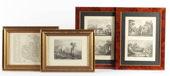
Sold2023Four Antique European EngravingsDescription: Each professionally framed, to include a 1796 map of Milan by J. J. De La Lande, a 19th century steel engraving after J.M.W. Turner of Ehrenbreitstein, and two plates depicting scenes ofSee Sold Price
Sold2017Four piece lot including Charles Wysocki print, DavidFour piece lot including Charles Wysocki print, David Clark shipyard print Kennebunkport Maine, map, and print. sight sizes: 9" x 22 1/2" to 18" x 37"See Sold Price
Sold2018Mary Bradford Crowninshield ALL AMONG THE LIGHTHOUSESMary Bradford Crowninshield ALL AMONG THE LIGHTHOUSES OR THE CRUISE OF THE GOLDENROD 1886 Decorative Gilt & Silver Binding Illustrated Maine Map New Brunswick Coastal Landscapes & Towns Technical DetaSee Sold Price
Sold2023Northern provinces of the United States. THOMSON. District of Main[e] 1817 mapTITLE/CONTENT OF MAP: 'Northern provinces of the United States' The map shows the "District of Maine", prior to its accession to the Union as the state of Maine in 1820. Some Native American Indian viSee Sold Price
Sold20221796 Reid Map of Connecticut -- Connecticut from the Best AuthoritiesTitle: 1796 Reid Map of Connecticut -- Connecticut from the Best Authorities Cartographer: J Reid Year/Place: 1796 Dimensions: 13.9 X 17.1 in. Description: This is an excellent, early and uncommon mapSee Sold Price
Sold2019MAPS - Maine. U.S. Gov.Maine. U.S. Gov., [Lot of 2] Map of the Northern Part of the State of Maine and of the Adjacent British Provinces... [and] Extract from a Map of the British and French Dominions in North America, 1838See Sold Price
Jun 13Swann Auction Galleries(MAINE.) J.H. Colton; and C.C. Hall. Railroad & Township Map of the State of Maine with Portions$375
7 days LeftJasper52North America Sheet II East Canada and New Brunswick With Part of New York, Vermont and Maine$30
Featured7 days LeftJasper521796 VOYAGES of CAPTAIN COOK 3 vols 1st US EDITION ILLUSTRATED antique ENGLISH$1,000
Jun 13Swann Auction Galleries(NORTH AMERICA.) Group of 4 late-eighteenth/early-nineteenth-century engraved maps.$500
Jun 13Swann Auction Galleries(AMERICAN NORTHEAST.) Nicolas Visscher. Nova Tabula Geographica Complectens Borealiorem Americae$1,100
Featured7 days LeftJasper521775-1780. New York, New Jersey, Pennsylvania, Maryland, Virginia and New England states. By Bonne &$120


![Colton's Maine Map [N. Atlantic States]: Colton's Maine Map. J. H. Colton Cartographer. Published by J. H. Colton, New York. Stamped 'Entered according to Act of Congress in the Year 1855 by J. H. Colton and Co. in in the Clerks Office of th](https://p1.liveauctioneers.com/5755/154409/77936952_1_x.jpg?height=310&quality=70&version=1573094011)


![Northern provinces of the United States. THOMSON. District of Main[e] 1817 map: TITLE/CONTENT OF MAP: 'Northern provinces of the United States' The map shows the "District of Maine", prior to its accession to the Union as the state of Maine in 1820. Some Native American Indian vi](https://p1.liveauctioneers.com/5584/309982/165835410_1_x.jpg?height=310&quality=70&version=1700599538)

![MAPS - Maine. U.S. Gov.: Maine. U.S. Gov., [Lot of 2] Map of the Northern Part of the State of Maine and of the Adjacent British Provinces... [and] Extract from a Map of the British and French Dominions in North America, 1838](https://p1.liveauctioneers.com/6576/142214/71976779_1_x.jpg?height=310&quality=70&version=1557929467)
![Maine Map, 1840 [181582] (1 of 1)](https://p1.liveauctioneers.com/2699/331495/178785758_1_x.jpg?height=282&quality=70&version=1717094933)


![French Map of America Southeast [179304] (1 of 1)](https://p1.liveauctioneers.com/2699/331495/178785746_1_x.jpg?height=282&quality=70&version=1717094933)


