Sold20191847 Map Chippeway Land District Wisconsin"Provisional Geological Map of Part of the Chippeway Land District of Wisconsin with Part of Iowa & of Minnesota Territory". "To Illustrate the Report of a Geological Reconnoissance made in 1847 by DaSee Sold Price
Sold20201848 Owen Geological Survey Map of Wisconsin and PartsTitle: 1848 Owen Geological Survey Map of Wisconsin and Parts of Minnesota and Iowa -- Provisional Geological Map of Part of the Chippeway Land District of Wisconsin with Part of Iowa & of Minnesota TSee Sold Price
Sold20191847 Geological Map of Lake Superior & Michigan"Geological Map of the Lake Superior Land District in the State of Michigan". J. W. Foster and J. D. Whitney, U.S. geologists. Lithographed by J. Ackerman, Broadway, New York. Areas of hand coloring wSee Sold Price
Sold2022Cadastral map of land in Portola district SF 1869Heading: -1869 Author: Title: Plan of the Haley Purchase, west of and adjoining the Hudson Tract. To be sold by Maurice Dore & Co. April 27th, 1869. Title U.S. Patent, and Bernal Rancho Place PublishSee Sold Price
Sold2022FOSTER & WHITNEY GEOLOGICAL MAP OF LAKE SUPERIOR LAND DISTRICT, AS IS H 25" W 38'FOSTER & WHITNEY GEOLOGICAL MAP OF LAKE SUPERIOR LAND DISTRICT, AS IS H 25" W 38' Not framed but is under plastic. J.W. Foster and J. D. Whitney US geologists. I. Ackerman lithograph, 379 Broadway, N.See Sold Price
Sold2023Shanghai District Land Survey map, 1937Title/Content of Map: Shanghai District Land Survey map, 1937 Date Printed: 1937 Cartographer: Land Survey Department Material/Medium: paper Size: 108cm x 78cm Provenance: Bought from long time AsianSee Sold Price
Sold2023ANTIQUE c.1850 MAP of LOUISIANA w LAND DISTRICT s by W R BOYD SURVEYOR GEN'L, LAANTIQUE c.1850 MAP of LOUISIANA w LAND DISTRICT s by W R BOYD SURVEYOR GEN'L, LA ANTIQUE c.1850 MAP of LOUISIANA w LAND DISTRICT s by W R BOYD SURVEYOR GEN'L, LA Description Antique 1850 Map of LouisiSee Sold Price
Sold20181855 Land Office Survey Map of Louisiana -- (H) Map ofReserve Reduced! Title/Content of Map: 1855 Land Office Survey Map of Louisiana -- (H) Map of Louisiana Representing the Several Land Districts Prepared to Accompany the Surveyor Generals Report Date:See Sold Price
Sold2018(I) Map of Louisiana Representing the Several LandTitle: (I) Map of Louisiana Representing the Several Land Districts... Publication Date: 1851-10-25 Cartographer: BOYD, R.W. (SURVEYOR GENERAL, LA) Publisher: BOYD, R.W. Size: 15 X 16.5 Prepared to acSee Sold Price
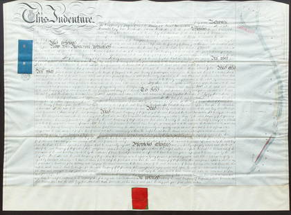
Sold2020British Greywell Indenture Map 1847British land indenture from 1847, ink on vellum, contract between Basingstoke Canal Navigation and the landowner, Baron Dorchester, to do work on the Greywell Canal, a road and tunnel which still exisSee Sold Price
Sold20221868 1ed Dakota Land History INDIANS Minnesota Wisconsin Michigan MAP Hankins1868 1ed Dakota Land History INDIANS Minnesota Wisconsin Michigan MAP Hankins Colonel Hankins Dakota Land is a fascinating post-Civil War survey of the geography and history of Minnesota, Wisconsin, aSee Sold Price
Sold2020c1920s WESTGATE DISTRICT Columbus OH HOUSINGc1920s WESTGATE DISTRICT Columbus OH HOUSING DEVELOPMENT PLAN TROLLEY SUBURB MAP c1920s WESTGATE DISTRICT Columbus OH HOUSING DEVELOPMENT PLAN TROLLEY SUBURB MAP Circa 1920s Vintage Land Development PSee Sold Price
Sold2021(WISCONSIN.) [Charles Lapham]. Map of the Lakes &(WISCONSIN.) [Charles Lapham]. Map of the Lakes & Drives, Around Oconomowoc, Wisconsin: A Favorite Summer Resort. Lithographed map of the Oconomowoc lake district west of Milwaukee. 14¾x19½See Sold Price
Sold2018Gold rush Australia showing gold districts in yellow.TITLE/CONTENT OF MAP: 'Australia [inset: Van Diemen's Land]' The top image on the right hand side shows the entire map. To view a close up of the map showing the level of printed detail, please clickSee Sold Price
Sold20221878 GLO Map of Wisconsin -- State of WisconsinTitle: 1878 GLO Map of Wisconsin -- State of Wisconsin Cartographer: General Land Office Year / Place: 1878, Washington Map Dimension (in.): 19.9 X 18 in. in. This is a highly informative, larger mapSee Sold Price
Sold20221851 Geological Map Wisconsin Iowa Minnesota"Geological Map of Wisconsin, Iowa, and Minnesota: Exhibiting, also, the extension of the Iowa Coal-field in Missouri and its relation to the Illinois Coal-field", by David Dale Owen, M.D. Includes inSee Sold Price
Sold20191816 Plat Map Wabash Saline Indian Reservation"Boundaries of the Reservation for Wabash Saline". "Exhibited by the Green Lines" (Green is crossed out and replaced by ink written "Dotted"). General Land Office Dec. 10th 1816, J. Meigs. The 98,500See Sold Price
Sold2019Antique Map US Rail Roads and Wagon Roads"Map of the Untied States showing the Limits Within Which Land Grants were Made by the Federal Government to Aid in the Construction of Railroads and Wagon Roads". Engraved and printed for the 9th CenSee Sold Price
Sold20191848 S. Breese Rail Road and Seaboard Map"Skeleton map showing the Rail Roads completed and in progress in the United States, and those projected through the Public Lands and their connection with the principal harbours on the Lakes and on tSee Sold Price
Sold20171815 South Carolina Land Survey & 1829 DeedPen & ink, hand drawn survey map with coloring, dated July 28, 1815 describing 211 acres on Tiger River in Union District belonging to William Linam, William Lucas and heirs of Jeremiah Hamilton, Esq.See Sold Price
Sold2021Civil War era map of Wisconsin & Michigan, 1860/62Title: Civil War era map of Wisconsin & Michigan, 1860/62 Description: "Detailed vintage map of two of the Great Lakes states, including the Upper Peninsula of Michigan. “Mineral Lands” in MichigaSee Sold Price
Sold20231847 MAP OF UNITED STATES.Published New York, 1847, by Pratt, Woodford & Co., hand colored engraved map on paper. "Olney's Outline Map for Common Schools and General Use" showing the United States and Territories with correspoSee Sold Price
Sold2022BRITISH ISLES LILY (GEORGE) Britanniae insulae quae nunc Angliae et Scotiae regna continet cum H...BRITISH ISLES LILY (GEORGE) Britanniae insulae quae nunc Angliae et Scotiae regna continet cum Hibernia adiacente nova descriptio, double-page engraved map, land masses hand-coloured, title cartoucheSee Sold Price
Sold20221847 Phelpss National Map of the United States..Historic Maps 1847 Map "Phelps's National Map of the United States..." 1847-Dated, "Phelps's National Map of the United States, A Traveller's Guide...", Hand-Colored Folding Map of the United States,See Sold Price
5 days LeftAlbion AuctionsMarmocchi, F. C. 1845 Hand Col Map. Holy Land. Persia Empire, Alexander the Great$5
1818 AuctioneersMaps. Lake District interest. Cumberland and Westmorland Antiquarian and Archaeological Society£16
6 days LeftTrillium Antique Prints & Rare BooksDe Jode, Rare, pub. 1593 - Map of the Holy Land (Descriptio Et Situs Terrae Sanctae Alio Nomine$100(1 bid)
6 days LeftTrillium Antique Prints & Rare BooksPtolemy & Magini, pub. 1620 - 4 Maps of the Holy Land, Palestine, Persia, Turkey, Egypt$50
Jun 12Dan Morphy AuctionsINDIAN TERRITORY - DEPARTMENT OF THE INTERIOR GENERAL LAND OFFICE, C.1883$100
5 days LeftAlbion AuctionsSale & Psalmanazar 1779 Map. Paradise Mount Ararat & Babel. Holy Land$10(2 bids)
3 days LeftJasper52North Sea & Baltic. Cables Wireless Stns Land visibility Shipping lines 1952 map$40
3 days LeftJasper52British Isles Railways companies regions. Ireland. GWR LMSR LNER. LARGE 1927 map$60
2 days LeftJasper521650 c. Stella Map of Germany's Harz Mountain Area -- Comitatus Mansfeldiae Descriptio$95


![(WISCONSIN.) [Charles Lapham]. Map of the Lakes &: (WISCONSIN.) [Charles Lapham]. Map of the Lakes & Drives, Around Oconomowoc, Wisconsin: A Favorite Summer Resort. Lithographed map of the Oconomowoc lake district west of Milwaukee. 14¾x19½](https://p1.liveauctioneers.com/199/204863/103966399_1_x.jpg?height=310&quality=70&version=1621570993)
![Gold rush Australia showing gold districts in yellow.: TITLE/CONTENT OF MAP: 'Australia [inset: Van Diemen's Land]' The top image on the right hand side shows the entire map. To view a close up of the map showing the level of printed detail, please click](https://p1.liveauctioneers.com/5584/124870/63536078_1_x.jpg?height=310&quality=70&version=1531863645)


