Sold20211860 Prussia MapAuthor: Mitchell Title: 1860 Prussia Map Medium: Ink on Paper Dimenions: 15.5"X12.5" Description: Map of Prussian and the German States. Engraved and published by Augustus Mitchell in 1860. PublishedSee Sold Price
Sold20191812 Malte-Brun Map of Germany -- Confederat du RhinTitle/Content of Map: 1812 Malte-Brun Map of Germany -- Confederat du Rhin Date: 1812, Paris Cartographer: M Malte-Brun Size: 11.7 x 8.8 in. An attractive map of German states, showing its political dSee Sold Price
Sold2017UNITED STATES 1860 MAP, J.W. LOWRY, TERRITORIESFramed map of "The United States of North America (General Map)", c. 1860, "drawn and engraved by" J.W. Lowry (Joseph Wilson Lowry, British, 1803-1879), published by Blackie & Son, Glasgow, EdinburghSee Sold Price
Sold2019Map of Prussia & German StatesHeading: (Maps) Author: Mitchell, Samuel Augustus Title: Prussia and the German States Place Published: Philadelphia Publisher: Date Published: c.1870 Description: LitographSee Sold Price
Sold2022Antique Map Print - Map of Rheinprovinz - Map of Germany - Prussian StateAntique outline hand colored map from edition of Meyer’s world atlas, edited by Ludwig Ravenstein, published by Bibliographic Institute in 1872. Technique: Engraving. Place: Leipzig, Germany. SSee Sold Price
Sold2024Albert von Le Coq book: Chotscho, Turpan Expedition, 1913, Color PlatesChotscho : Koeniglich Preussische Turfan-Expeditionen by Albert von Le Coq (Prussian/German, 1860-1930), Berlin: Dietrich Reimer (Ernst Vohsen), 1913. Complete folio with forty-five (45) color platesSee Sold Price
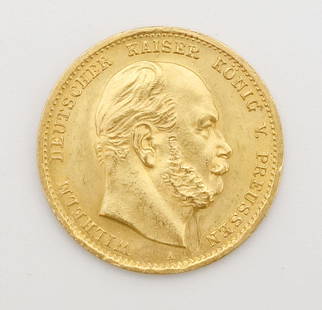
Sold20221872 Gold German States Prussia 10 Mark CoinThis is an 1872 0.9 fine gold German States Prussian 10 Mark coin 19.5mm diameter. 4 grams.See Sold Price
Sold2017Mitchell: Map of the Austrian Empire, 1879Map of Prussia and the German States. Map of the Austrian Empire, Italian States. Turkey in Europe and Greece. Maltese Islands. Mitchell, Samuel Augustus Jr. 1880. Two maps on either side of the sheetSee Sold Price
Sold2019Samuel Augustus Mitchell (1790-1868), "Prussia and theSamuel Augustus Mitchell (1790-1868), "Prussia and the German States," 1860, H. - 12 1/4 in., W. - 15 3/8 in.See Sold Price
Sold20211860 Ettling Map of United States -- United States ofTitle: 1860 Ettling Map of United States -- United States of North America (Eastern & Central) Cartographer: T Ettling Year / Place: 1860 c., London Map Dimension (in.): 33.5 X 35.5 in. joined This isSee Sold Price
Sold2023An 1860 Map of New York State by J.H. French and an 1846 Mitchell's Reference & Distance Map of theAn 1860 Map of New York State by J.H. French and an 1846 Mitchell's Reference & Distance Map of the United States by J.H. Young58 x 72 1/2 inchesOther Notes: Fontaine's Auction Gallery can arrange shiSee Sold Price
Sold2024Rapkin, John 1860 Hand Col Map. United StatesHand Colored Steel Engraved Map Published 1860 by The London Printing & Published Company, London for "The Royal Dictionary-Cyclopedia for Universal Reference" by Thomas Wright. Drawn & Engraved by JoSee Sold Price
Sold20201860 Map of the United StatesAuthor: Stockley Title: 1860 Map of the United States Medium: Ink on Paper Dimensions: 10.5"X9" Map of the United States dated 1860. Engraved by James Stockley. Published by James Wyld engraver to QueSee Sold Price
Sold2023Colombia Peru New Granada Ecuador Venezuela. Andean States. BRITANNICA 1860 mapTitle: Colombia Peru New Granada Ecuador Venezuela. Andean States. BRITANNICA 1860 map Description: Colombia Peru &c.' by Engraved by S. Hall Bury Sirt, Bloomsbury (1860). Antique engraved map, 38.0 xSee Sold Price
Sold2017Mitchell: Map of Prussia & the German States, 1864Title: Map of Prussia and the German States by Mitchell Date: 1864 Dimensions (inches): 15.2 x 12.2 Medium: Hand Colored Lithograph Condition: Good Condition Please note that this lot has a confidentiSee Sold Price
Sold2019Eight (8) Augustus Mitchell MapsCollection of eight maps including New Jersey/Maryland Delaware 1872, Two north and South Carolina 1872 maps (15" x 12"), Minnesota 1890 , Florida and the Carolinas 1860, County map of the state of ArSee Sold Price
Sold2024Early 1860 school map of New York State, From New & Original surveys Under the direction of J.H.Early 1860 school map of New York State, From New & Original surveys Under the direction of J.H. French C.E.Syracuse 1860, loss on sides, foldmarks, paper on linen, map is 68.5" by 72"See Sold Price
Sold2018NEW YORK STATE MAP, J.H. FRENCH 1860NEW YORK STATE MAP, J.H. FRENCH 1860 W. 73 1/2" H. 64"See Sold Price
Sold2022[MAPS]. Map of the Pacific Rail Road and its Connections with the Seaports of the United States of[MAPS]. Map of the Pacific Rail Road and its Connections with the Seaports of the United States of America. New York: Johnson & Browning, 1860.  Lithographed map of the United States, hand-coloreSee Sold Price
Sold2019Mitchell: Prussia and the German States, 1870The beautifully detailed and colored map of Prussia and the German States from the 1870 edition of Mitchell's popular New General Atlas of the world. Framed by the decorative vine motif border typicalSee Sold Price
Sold20181860 Mitchell Map of the US Northeast States -- CountyTitle/Content of Map: 1860 Mitchell Map of the US Northeast States -- County Map of the States of New York, New Hampshire, Vermont, Massachusetts, Rhode Id. & Connecticut Date: 1860, Philadelphia CartSee Sold Price
Sold2020Rapkin, John 1860 Hand Col Map of the United StatesSteel Engraved Map Published 1860 by The London Printing & Published Company, London for "The Royal Dictionary-Cyclopedia for Universal Reference" by Thomas Wright. Drawn & Engraved by John Rapkin. FoSee Sold Price
Sold2018With State Seals /Presidents Surrounding U.S. MapAtwood, J. M. (1818-c. 1880) & Phelps, Humphrey (fl. c. 1830-1860). Phelps's National Map of the United States, a Travellers Guide... Engraved map. Ensign & Thayer, 1851. 20 ½" x 25 ¾" sheet. "ESee Sold Price
Sold2016George Cram: Ratification of the Constitution 1889Map: United States (1845-1860) Maker: George Franklin Cram Publishing: Chicago Date: 1889 Size: 11.5 x 14.5 inches Medium: Color lithograph From Cram's Unrivaled Atlas of the World George F. Cram (184See Sold Price
Featured5 days LeftJasper52United States of North America, Pacific States by Joseph Wilson Lowry 1860 map$340
6 days LeftSwann Auction Galleries(CASE MAPS.) Group of 7 nineteenth-and-early-twentieth-century engraved or lithographed maps of$500
5 days LeftJasper52Central Africa. Congo Free State Rhodesia German East Africa. STANFORD 1896 map$280
5 days LeftJasper52Central Africa. Congo Free State Rhodesia German East Africa. STANFORD 1894 map$280
5 days LeftJasper52Europe after the Congress of Vienna. 4 sheets. 128x106cm. THOMSON 1817 old map$550
6 days LeftSwann Auction Galleries(NEW JERSEY.) Group of 2 mid-nineteenth-century wall maps of Garden State counties.$600
6 days LeftSwann Auction Galleries(JUDAICA.) L.N. Rosenthal. Service on the Day of Atonement by the Israelite Soldiers of the Prussian$500
Jun 29Shapiro AuctionsA PAIR OF RUSSIAN NEO-ROCOCO STYLE GILT PORCELAIN CANDLE STICKS, BY AUGUST SPIESS (GERMAN$7,500
6 days LeftSwann Auction Galleries(BOTANICAL.) Anton Hartinger; and Dr. Stephan Endlicher. Paradisus Vindobonensis Auswahl Seltener$1,900
Jun 15Trillium Antique Prints & Rare BooksKollner, Rare - President's House, Washington, DC$200(1 bid)


![[MAPS]. Map of the Pacific Rail Road and its Connections with the Seaports of the United States of: [MAPS]. Map of the Pacific Rail Road and its Connections with the Seaports of the United States of America. New York: Johnson & Browning, 1860.  Lithographed map of the United States, hand-colore](https://p1.liveauctioneers.com/197/265300/138516599_1_x.jpg?height=310&quality=70&version=1666052782)


