Sold2015Original Vintage PosterLili Rethi (1894-1971) Post Office Underground Mail Train: London , original GPO poster PRD 208 1937 - 102 x 127 cm This is the rare quad royal format posterSee Sold Price
Sold2016Lili Rethi (1894-1971) Post Office Underground MailLili Rethi (1894-1971) Post Office Underground Mail Train: London, original GPO poster PRD 208 1937 - 102 x 127 cm This is the rare quad royal format posterSee Sold Price
Sold2020Antique View and MapColossus of Rhodes. View of one of seven Wonders of Ancient World. Antique engraving. With antique double hemisphere world map, published London, 1822. Sights 10 1/2" x 16 1/2" and 7" x 9".See Sold Price
Sold20231902 National Publishing Company Wall Map1902 roll down wall map printed by the National Publishing Company New Railroad, Post office, Township, and County Map of New York which measures approximately 48" by 41". Condition - fine.See Sold Price
Sold2016scarborough's map of new york 19031903 Scarborough's new railroad, post office, township and county map of New York with distances between stations. Tears; stained; needs repair. 49 1/2 inches wide x 40 inches high.See Sold Price
Sold2021Antique New York State Map 1903 Color Roll Up RR Map1903 Scarborough's New Railroad, Post Office, Township and County Map of New York. Color map, compiled from the latest government and state surveys and original sources of the era. Insets: Map of NewSee Sold Price
Sold2020Bowles, Carrington 1782 Road Map. Devon, CornwallShowing Dorchester, Axminster, Bridport, Falmouth, Truro etc. Copper Engraved Map Published 1782, London for "Bowles's Post-chaise Companion, Or, Travellers Directory Through England and Wales" by CarSee Sold Price
Sold2021Orographical Map of the Environs of London.Publication Date: 1884 Title: Orographical Map of the Environs of London. Cartographer: LETTS Height: 12.5Width: 15.5 Mile circles from the General Post Office. Indicates heights in feet above sea levSee Sold Price
Sold2022Excellent antique map of Vermont from scarce Gray’s Nat’l AtlasJ. H. Colton 1855 map of Vermont, republished in the very scarce 1884 edition of Gray’s National Atlas. The ornamental border was dropped when it was republished. Shows railroads, post offices,See Sold Price
Sold2017Map of India, 1857Original engraving from the London Illustrated News, December 5, 1857. Features chronological acquisitions of the British in India and distances between the principal cities and towns of India. DimensSee Sold Price
Sold20231893 SKETCHES AT STRATFORD ON AVON BY QUATREMAINWilliam Wells Quatremain, English, 1857 to 1930, an uncolored engraving print titled Sketches at Stratford on Avon. Published by Boys Own Paper Office in London, 1893. Matted and framed. William WellsSee Sold Price
Sold2022Kitchin, MAP OF NORTH AMERICA, 1787MAP OF NORTH AMERICA DRAWN FROM THE LATEST AND BEST AUTHORITIES, drawn by Thomas Kitchin, engraved by G. Terry, published by Jonathan Harrison, London, 1787. Copperplate engraving with handcoloring deSee Sold Price
Sold20231702 Antient & Present State of the Empire of Germany antique w/ MAP in ENGLISHThe Antient and Present State of the Empire of Germany... London, 1702 With 1 map and a frontispiece copper engraving. Original leather binding, covers are reinforced inside of the endpapers Very goodSee Sold Price
Sold2022Antique Map Print - Map of Ireland - Europe - Alexander Keith JohnstonMap of Ireland by Keith Johnston, F.R.S.E. Engraved & printed by W. & A.K. Johnston, Edinburgh. William Blackwood & Sons, Edinburgh & London, (1861). Technique: Engraving. Date: 1861. Artist: AlexandeSee Sold Price
Sold2022Antique Map - Map of Europe - Austrian Empire - Vienna - Salzburg - John DowerOriginal antique map of Austrian Empire by John Dower, published by Orr & Co. Technique: Steel Engraving. Date: 1840. Place: London, England. Size: 9” x 12” inches / 24 cm x 30 cm.See Sold Price
Sold20231702 ILLUSTRATED HISTORY OF GERMANY antique WITH MAP & 23 PORTRAITS in ENGLISHA Compleat History of Germany comprehending the Lives and Reigns of All Emperors... London, 1702 With 1 map and 23 copper engravings portraits of German emperors and rulers. Original leather binding,See Sold Price
Sold2019'A New General Map of America' Dated 1747Antique map of America in copper plate engraving by Emanuel Bowen dated 1747, London. COA from Marlborough Antiques on verso. Has been hand colored, framed in burl wood. Measures 20.25"H x 23.25"W fraSee Sold Price
Sold2022Antique Map - Map of Europe - Switzerland - Zurich - Geneva - Bern - James BarloAntique map of Turkey in Switzerland from the best authorities, 1806. Technique: Engraving. Artist: James Barlow. Place: London, England. Size: 10” x 8” inches / 25 cm x 21 cm.See Sold Price
Sold2023Cary's New Map of London & its Vicinity, 1840Cary's New Map of London and its Vicinity, hand-colored engraving, inscribed "Cary's New Map of London and its Vicinity / Showing the limits of the two penny post-delivery / Published by the AuthoritySee Sold Price
Sold2022Antique Map of Africa - Nigeria - Ethiopia - Algeria - Kenya - Samuel John NeeleA new map of Africa from the best authorities, 1791. Technique: Engraving. Artist: Samuel John Neele. Place: London, England. Size: 10” x 8” inches / 25 cm x 21 cm.See Sold Price
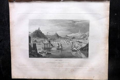
Sold2023Barclay, James 1834 Antique Print. Naples, Italy. ShipsSteel Engraving Published 1834 by Thomas Kelly, London for "A New and Universal English Dictionary" by the Rev. James Barclay. Maps Drawn & Engraved by Alexander Findlay. Paper Size: 10.5 x 8 inch (27See Sold Price
Sold2023Barclay, James 1834 Antique Print. Algiers, Ships, AlgeriaSteel Engraving Published 1834 by Thomas Kelly, London for "A New and Universal English Dictionary" by the Rev. James Barclay. Maps Drawn & Engraved by Alexander Findlay. Paper Size: 10.5 x 8 inch (27See Sold Price
Sold2023Barclay, James 1834 Antique Print. Madrid, SpainSteel Engraving Published 1834 by Thomas Kelly, London for "A New and Universal English Dictionary" by the Rev. James Barclay. Maps Drawn & Engraved by Alexander Findlay. Paper Size: 10.5 x 7 inch (27See Sold Price
Sold2023Barclay, James 1834 Antique Print. Paris, FranceSteel Engraving Published 1834 by Thomas Kelly, London for "A New and Universal English Dictionary" by the Rev. James Barclay. Maps Drawn & Engraved by Alexander Findlay. Paper Size: 10.5 x 8 inch (27See Sold Price
Featured3 days LeftJasper52View of Tiber with Triumphal Bridge (Rome, Italy), after Turner. Antique engraving, 1878$100
Featured3 days LeftJasper52Fairlee House, the Seat of John White (Newport - Isle of Wight). Antique engraving by Godfrey, 18th$150
3 days LeftJasper52Antique engraving. Two portraits from drawing book. After George Morland (1801)$360
2 days LeftClaydon Auctioneers LtdA quantity of assorted Victorian and later ephemera to include a Goldsmith almanack for the year£30
159 Lots AwayTrillium Antique Prints & Rare BooksKarl Bodmer - Sih-Chida & Mahchsi-Karehde, Mandan Indians. 20$300(1 bid)
158 Lots AwayTrillium Antique Prints & Rare BooksKarl Bodmer - View of the Rocky Mountains. 44$300(1 bid)
84 Lots AwayTrillium Antique Prints & Rare BooksDonovan - Pair or Fish Engravings: Streaked Wrasse & Ancient Wrasse or Old Wife$25
134 Lots AwayTrillium Antique Prints & Rare BooksCatesby, Folio - Bald Eagle or White-headed Eagle. 1-1$200
68 Lots AwayTrillium Antique Prints & Rare BooksDonovan - Pair of Bee-Eater Engravings: Nubian Bee-Eater & Scarlet-throated or Bullock's Bee-Eater$25
53 Lots AwayTrillium Antique Prints & Rare BooksGreene - Pair: Red and Blue Macaw & Masked Parrakeet$25(1 bid)
91 Lots AwayTrillium Antique Prints & Rare BooksBloch, Folio - Trunck-Fish; Ostracion Triqueter. 130$50