Sold2018Arrowsmith: Antique Map of Ancient Germany, 1828TITLE/CONTENT OF MAP: 'Germania; Vel Regiones intra Rhenum f1. Oceanum, Sinum Codanum, Vistulam f1. Montes Sarmaticos et Danubium f1. Sitae' DATE PRINTED: 1828 IMAGE SIZE: Approx 25.5 x 28.5cm, 10 x 1See Sold Price
Sold20211828 Map of Ancient GermanyAuthor: Hall Title: 1828 Map of Ancient Germany Materials: Ink on Paper Dimensions: 10.5"X8.5" Description: Map of Ancient Germany dated 1828. Part of Butler's Antique World Atlas. Drawn and engravedSee Sold Price
Sold2018Arrowsmith: Antique Map of Northern Italy, 1828TITLE/CONTENT OF MAP: 'North Italy' Papal States. Sardinia Lombardy Tuscany. DATE PRINTED: 1828 IMAGE SIZE: Approx 24.5 x 31.0cm, 9.5 x 12.25 inches (Large) TYPE: Antique copperplate map CONDITION: GoSee Sold Price
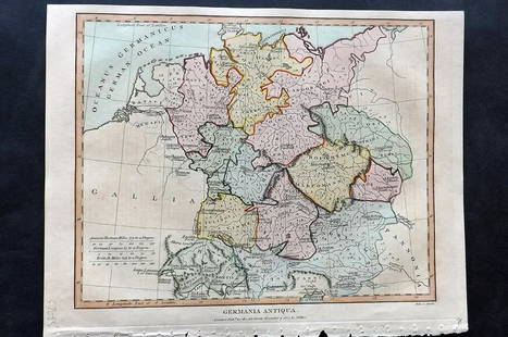
Sold2021Wilkes, John 1807 Hand Col Map. Ancient Germany"Germania Antiqua" Finely Hand Colored Copper Engraved Map Published 1796-1828 London for "Encyclopaedia Londinensis, or universal dictionary of arts, sciences and literature" by John Wilkes et al. PaSee Sold Price
Sold2022Maps 1816-1922 Mixed Lot of 21 Antique MapsIncl Australia, Pacific, USA, North America, and Ancient - Italy, France, Germany, Spain. Examples by Bartholomew, Encyclopaedia Britannica, National Encyclopedia and Cellarius & Patrick. Paper Size:See Sold Price
Sold20211828 Ancient Armenia MapAuthor: Hall Title: 1828 Ancient Armenia Map Medium: Ink on Paper Dimenions: 11"X8.5" Description: Map of Ancient Armenia dated 1828. Part of Butler's Antique World Atlas. Drawn and engraved by SydneySee Sold Price
Sold20211828 Ancient Greece MapAuthor: Hall Title: 1828 Ancient Greece Map Medium: Ink on Paper Dimensions: 8.5"X11" Map of Ancient Greece dated 1828. Part of Butler's Antique World Atlas. Drawn and engraved by Sydney Hall. PublishSee Sold Price
Sold20211828 Ancient Armenia MapAuthor: Hall Title: 1828 Ancient Armenia Map Medium: Ink on Paper Dimensions: 11"X8.5" Map of Ancient Armenia dated 1828. Part of Butler's Antique World Atlas. Drawn and engraved by Sydney Hall. PubliSee Sold Price
Sold20211828 Ancient World MapAuthor: Hall Title: 1828 Ancient World Map Medium: Ink on Paper Dimensions: 10.5"X8.5" Map of the Ancient World dated 1828. Part of Butler's Antique World Atlas. Drawn and engraved by Sydney Hall. PubSee Sold Price
Sold20211828 Map of Ancient EgyptTitle: 1828 Map of Ancient Egypt Medium: Ink on Paper Dimensions: 10.5"X8.5" Map of Ancient Egypt dated 1828. Part of Butler's Antique World Atlas. Drawn and engraved by Sydney Hall. Published by LongSee Sold Price
Sold20211828 Map of Ancient SicillyAuthor: Hall Title: 1828 Map of Ancient Sicilly Medium: Ink on Paper Dimensions: 10.5"X8.5" Map of Ancient Sicilly dated 1828. Part of Butler's Antique World Atlas. Drawn and engraved by Sydney Hall.See Sold Price
Sold20211828 Map of Ancient GreeceTitle: 1828 Map of Ancient Greece Medium: Ink on Paper Dimensions: 10"X8.5" Description: Map of Ancient Greece dated 1828. Part of Butler's Antique World Atlas. Drawn and engraved by Sydney Hall. PublSee Sold Price
Sold20211828 Map of Ancient PalestineAuthor: Hall Title: 1828 Map of Ancient Palestine Medium: Ink on Paper Dimensions: 8.5"X10.5" Map of Ancient Palestine dated 1828. Part of Butler's Antique World Atlas. Drawn and engraved by Sydney HaSee Sold Price
Sold20211828 Map of Ancient GreeceAuthor: Hall Title: 1828 Map of Ancient Greece Medium: Ink on Paper Dimensions: 10.5"X8.5" Map of Ancient Greece dated 1828. Part of Butler's Antique World Atlas. Drawn and engraved by Sydney Hall. PuSee Sold Price
Sold20211828 Map of Ancient ArmeniaAuthor: Hall Title: 1828 Map of Ancient Armenia Materials: Ink on Paper Dimensions: 10.5"X8.5" Description: Map of Ancient Armenia dated 1828. Part of Butler's Antique World Atlas. Drawn and engravedSee Sold Price
Sold20211828 Map of Ancient BritainAuthor: Hall Title: 1828 Map of Ancient Britain Medium: Ink on Paper Dimensions: 8.5"X10.5" Map of Ancient Britain dated 1828. Part of Butler's Antique World Atlas. Drawn and engraved by Sydney Hall.See Sold Price
Sold20211828 Map of Ancient Greek IslesTitle: 1828 Map of Ancient Greek Isles Medium: Ink on Paper Dimensions: 8.5"X10.5" Description: Map of Ancient Greek Isles dated 1828. Part of Butler's Antique World Atlas. Drawn and engraved by SydneSee Sold Price
Sold20211828 Map of Ancient Asia MinorAuthor: Hall Title: 1828 Map of Ancient Asia Minor Medium: Ink on Paper Dimensions: 10.5"X8.5" Map of Ancient Asia Minor dated 1828. Map captures modern day Turkey. Part of Butler's Antique World AtlaSee Sold Price
Sold20211828 Map of Ancient Syria and PalestineAuthor: Hall Title: 1828 Map of Ancient Syria and Palestine Materials: Ink on Paper Dimensions: 10"X9" Description: Map of Ancient Syria and Palestine dated 1828. Part of Butler's Antique World Atlas.See Sold Price
Sold2023Findlay, Alexander 1828 Mixed Lot of 10 Antique MapsIncl Low Countries, Austrian Dominions, Spain & Portugal, Russian Empire, Switzerland, Turkey in Asia, Turkey in Europe, Asia Continent, Germany, Prussia. Copper Engraved Map Published 1828, London foSee Sold Price
Sold2018Arrowsmith: Antique Map of Asia, 1842Title/Content of Map: Asia Cartographer: ARROWSMITH, J. Size: 19X23.8 Very bright outline colored map. Excellent detail of topography, towns, villages, etc. Also shows roads. Please note that this lotSee Sold Price
Sold2017Arrowsmith: Antique Map of Jamaica, 1842Title/Content of Map: Map of Jamaica Publication Date: 1842-04-22 Authors: J. ARROWSMITH, ARROWSMITH, JOHN Publisher: J. ARROWSMITH Size: Folio – 12.80 H x 23.75 W Inches "compiled chiefly fromSee Sold Price
Sold2017Mallet: Antique Map, Ancient Conception of the UniverseTitle/Content of Map: Du Globe Terrestre : Globe de Mella; Globe de Posidonius; Globe de Ptolomee. Ancient Conceptions of the Universe Date Printed: 1683 Cartographer: Allain Manesson Mallet Size (in)See Sold Price
Sold2017Arrowsmith: Antique Map of China and Korea, 1823Title/Content of Map: 1823 Arrowsmith Map of China and Korea -- China Date Printed: 1823, London / Edinburgh Cartographer: A Arrowsmith Size: 10 x 8 in. A striking Arrowsmith map, with wonderful colorSee Sold Price
2 days LeftTrillium Antique Prints & Rare BooksPtolemy & Magini, pub. 1620 - Map of the Ancient World with Africa, Europe, Asia$50
2 days LeftTrillium Antique Prints & Rare BooksDe Jode, Rare, pub. 1593 - Map of Part of Germany (Sveviae Utriusq cum Germicae tum Rheticae$100
2 days LeftTrillium Antique Prints & Rare BooksDe Jode, Rare, pub. 1593 - Map of Austria (Austriae Ducatus Seu Pannoniae Superioris?)$100
May 15Japan Ancient Art Co. LTDLi Keran's Ten Screen Paper Vertical Axis of the Red Map of Wanshan$500
2 days LeftTrillium Antique Prints & Rare BooksBraun & Hogenberg, pub. 1575 - View of Innsbruck, Germany$100(1 bid)
2 days LeftTrillium Antique Prints & Rare BooksHamilton - Pair of Engravings of a Painting from a Grecian Vase$100
2 days LeftTrillium Antique Prints & Rare BooksHamilton - Pair of Engravings of a Painting from a Grecian Vase$100
2 days LeftTrillium Antique Prints & Rare BooksHamilton - Pair of Engravings of a Painting from a Grecian Vase$100
May 09Hunt and Peck Estate Services, Inc.1788 Henry Boswell "Historical Descriptions of New and Elegant Picturesque Views of the Antiquities$50(1 bid)
1 day LeftConestoga Auction Company Division of Hess Auction GroupTwo Antique German Bisque Head Girl Dolls.$50