Sold2023Book, "Atlas De Filipinas" By P. Jose Algue, 1900"Atlas de Filipinas, Coleccion de 30 Mapas: Trabajados por delineantes filipinos, bajo la direction Del P. Just Algue, S.J. (Washington: Government Printing Office, 1900), Folio, hardcover, 24pp. & 30See Sold Price
Sold2019Atlas of the Philippines, 1899Heading: (Philippines) Author: Algué, P. José Title: Atlas de Filipinas, Colección de 30 Mapas Place Published: Manila Publisher:P. José Algué, Director del Observatorio de Manila Date Published:See Sold Price
Sold2018Rand-McNally Indexed Atlas. Philippine IslandsTitle/Content of Map: Rand-McNally Indexed Atlas. Philippine Islands Date: 1904 ca. Cartographer: RAND, MCNALLY & CO. Size: 26 X 19 Page xxii, xxiii from Rand, McNally & Co.'s Enlarged business atlasSee Sold Price
Sold2020de Vaugondy / la Porte: Isle de St. Domingue, 1806L’Abbé de la Porte's 1806 edition of Robert de Vaugondy's detailed Atlas Portatif map of Hispaniola showing the island united under the French and divided into 5 departements, from de la Porte'See Sold Price
Sold2017Ferrer: Antique Nautical Chart of Norman Island, 18091809 Nautical Chart of Norman Island BVI (Treasure Island). Original engraving from José Joaquín de Ferrer y Cafranga's sea atlas, the 'Portulano de los Estados Unidos', published in Madrid in 1818.See Sold Price
Sold2017Ferrer: Antique Nautical Chart of Nassau River, 18091809 Nautical Chart of Nassau River and Part of Amelia Island and Talbot Island (Florida). Original engraving from José Joaquín de Ferrer y Cafranga's sea atlas, the 'Portulano de los Estados UnidosSee Sold Price
Sold2017Ferrer: Antique Nautical Chart of St. Mary's, 18091809 Nautical Chart of St. Mary's & Cumberland Island, Georgia. Original engraving from José Joaquín de Ferrer y Cafranga's sea atlas, the 'Portulano de los Estados Unidos', published in Madrid in 1See Sold Price
Sold20211886 Map of the Philippine IslandsAuthor: Blackie Title: 1886 Map of the Philippine Islands Medium: Ink on Paper Dimensions: 10.5"X15" Map of the Philippine Islands dated 1886. Part of the Imperial Atlas of Modern Geography. This wasSee Sold Price
Sold2020Philippine Islands 1901Title: Philippine Islands 1901 Date Printed: 1901 Material/Medium: paper Size: 14.5x 22 inches Additional Info: The National Standard Family and Business Atlas of the World. Fort Dearborn Publishing CSee Sold Price
Sold2020Island.Island. Kupferstichkarte, 1632. Blattgröße 16,5 x 21 cm. Aus: Atlas sive cosmographicae meditationes de fabrica mundi.See Sold Price
Sold2022Scarce 1705 map of North America by Nicolas de Fer (Calif. as island)Nice example of de Fer's scarce map of North America, first published in Paris in 1693. This specimen with a 1705 date is from the 1723 edition of de Fer’s Petit et Nouveau Atlas and features laterSee Sold Price
Sold2020West India Islands. Martinico. Dominica.Two islands on one sheet, from Thomson's New General Atlas, both with dramatic topography and numerous place names. The Martinique map includes an inset of the "Cul de Sac Royal," or Fort Royal bay.;See Sold Price
Sold2016Map of Massachusetts, Connecticut & Rhode Island, 1868Original engraving from Johnson's Atlas of the World, 1868. Map includes vignette of Boston & details cities, towns and territories. Dimensions: 18" x 26". This item ships from Ocean View, DE.See Sold Price
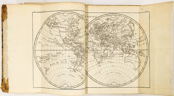
Sold2022BONNE, RIGOBERT; and GUILLAUME THOMAS FRANÇOIS RAYNAL. Atlas de Toutes les Parties Connues duBONNE, RIGOBERT; and GUILLAUME THOMAS FRANÇOIS RAYNAL. Atlas de Toutes les Parties Connues du Globe Terrestre. Letterpress title, [3], 28 pages, 50 double-page engraved maps (1-49, including 17biSee Sold Price
Sold20241780's Atlas de Toutes les Parties ConnuesAtlas de Toutes les Parties Connues du Globe Terrestre. Half-title, letterpress title, 22 pages and 50 double-page engraved maps (1-49). Folding maps are in very good condition with the exception of NSee Sold Price
Sold2020Atlas. RAYNAL – BONNE. Atlas de toutes lesRAYNAL, Guillaume – BONNE, Rigobert. Atlas de toutes les parties connues du globe terrestre.Genève, 1781 ca 4to, 250x200 mm; Legatura coeva mezza pelle, titolo in oro su tassello al dorso;See Sold Price
Sold2021Ten Works from Atlas de Voyage a la recherche de laTen Works from Atlas de Voyage a la recherche de la Perouse CIRCA 1811 10 plates, engraved by Copia after Piron; each framed. Framed dimensions 17 x 22 1/2 inches. Property of Mr. Akko van Acker, MiamSee Sold Price
Sold2019Atlas de la Géographie Ancienne, du moyen age,Heading: Author: Delamarche, Félix Title: Atlas de la Géographie Ancienne, du moyen âge, et moderne, Adopté par le Conseil Royal de l'Instruction Publique...par Félix Delamarche, Successeur de RSee Sold Price
Sold2019Delamarche's Atlas De La Ge?ographie 1824Heading: Author: Delamarche, Felix Title: Atlas De La Ge?ographie Ancienne Et Moderne, Adopte? Par Le Conseil Royal De L'Instruction Publique ... Place Published: Paris Publisher:Fx Delamarche DSee Sold Price
Sold2019Johann Jacob Scheurmann," Atlas de la Suisse Zurich",Johann Jacob Scheurmann," Atlas de la Suisse Zurich", folding vellum on linen Map Set of 18 Folders in original box, 1822, Each- H. -9 in., W. -13 in.See Sold Price
Sold2020VOLUME Joseph Romain Joly "Atlas de l’ancienneVOLUME Joseph Romain Joly "Atlas de l’ancienne géographie universelle comparè a la moderne" Parigi, Lottin e Bertrand, 1801. In 4°. Copia in mezza pelle coeva con angoli e piatti marmoSee Sold Price
Sold2024ATLAS DE LA HISTORIA CARTOGRAFICA LEATHERBOUND SPANISH MAPSA rare Atlas de la Historia Cartográfica, bound in luxurious leather for a timeless and elegant appearance. This exceptional volume showcases a comprehensive collection of historical maps, all presenSee Sold Price
Sold2021de la Tour - Atlas de Monnaies GauloisesPublished 1968 AD. de la Tour, Henri, Atlas de Monnaies Gauloises, Spink reprint, 1968 of the plates volume, originally published 1892; hardback green cloth, 55 excellent plates; with David Miller booSee Sold Price
Sold2022De La Tour - Atlas de Monnaies GauloisesPublished 1982 A.D. de la Tour, Henri, Atlas de Monnaies Gauloises, Maastricht, reprint of 1892 first edition; large paperback; brief French text, LV plates. 328 grams, 34 x 23 cm (13 3/8 x 9 in.). ExSee Sold Price
Sep 29Artelisted18th C. Geographie Moderene Historique et Politique: Les Isles de Sardaigne et de Corse$150
3 days LeftJasper52Empire du Japon divisée en sept principales parties. Japan. DE VAUGONDY 1750 map$260
3 days LeftJasper52Océanique. Partie de l'ile de Java #27 Bali Lombok Sumbawa VANDERMAELEN 1827 map$260
3 days LeftJasper52Isola di Malta, Gozo, Comino e Cominotto. DE ROSSI 1686 old antique map chart$1,200
3 days LeftJasper52Océanique Partie de la Nle Zélande 59 New Zealand North Is VANDERMAELEN 1827 map$260
3 days LeftJasper52Océanique. Partie de la Nouvelle Guinée #30. Torres Strait VANDERMAELEN 1827 map$260
3 days LeftJasper52Océanique Partie de la Nle Zélande 60 New Zealand South Is VANDERMAELEN 1827 map$300
3 days LeftJasper52Océanique. Partie de la Nouv Hollande #45 Queensland coast VANDERMAELEN 1827 map$320
3 days LeftJasper52Océanique. Partie… Nlle Hollande #56. Victoria S Australia VANDERMAELEN 1827 map$260
3 days LeftJasper52Océanique. Partie… Nlle Hollande #54 South Australia coast VANDERMAELEN 1827 map$320
Sep 29Artelisted18th C. Geographie Moderene Historique et Politique: Etats de L’Eglise, de Toscane, Modene et$150
Sep 29Artelisted18th C. Geographie Moderene Historique et Politique: Cercles de Baviere de Franconie et de Souabe$150
Sep 29Artelisted18th C. Geographie Moderene Historique et Politique: Cercles de Westphalie Haut et Bas Rhin$150
6 days LeftTrillium Antique Prints & Rare BooksDe Wit after Blaeu - Map of China and Japan, eastern Asia$75(1 bid)


![BONNE, RIGOBERT; and GUILLAUME THOMAS FRANÇOIS RAYNAL. Atlas de Toutes les Parties Connues du: BONNE, RIGOBERT; and GUILLAUME THOMAS FRANÇOIS RAYNAL. Atlas de Toutes les Parties Connues du Globe Terrestre. Letterpress title, [3], 28 pages, 50 double-page engraved maps (1-49, including 17bi](https://p1.liveauctioneers.com/199/251723/130782453_1_x.jpg?height=310&quality=70&version=1655133895)