


DALSHIRE ELITE FLASH AUCTION FREE US SHIPPING
Explore AuctionDalshire InternationalSponsored. Your ad here?
Maps & Atlases
1,900 Results
Sort by:
Best Match
Categories
Location & Shipping
Payment Method
House Rating
Creator
Style / Period
Material / Technique
Origin
Auction House
Current Bid
Est. Price Range

Sponsored. Your ad here?


Est. —
$45(12 bids)

![1803 The Journal of Andrew Ellicott w/Maps: [All 14 Folding Maps and Charts are Present] ELLICOTT, Andrew (1754-1820). The Journal of Andrew Ellicott, late Commissioner on Behalf of the United States During Part of the Year 1796, the Years 1797](https://p1.liveauctioneers.com/5755/336176/181789449_1_x.jpg?height=310&quality=70&version=1720647667)


![[1839] The North American Tourist with Maps: The North American Tourist. [Travel]. [John Melish]. The North American Tourist. NY: A.T. Goodrich, (1839). [1840]. 12mo. ix,506pp. 8 maps and 5 plates. 2nd edition of ''The Traveller's Manual'' - How](https://p1.liveauctioneers.com/5755/336176/181789684_1_x.jpg?height=310&quality=70&version=1720647667)
![[Map] 1834 Mitchell's Traveler's Guide U.S.: Mitchell's Traveler's Guide Through the United States. A Map of the Roads, Distances, Steam Boat & Canal Routes. Published by S Augustus Mitchell and engraved on steel by J.H. Young and D. Haines of P](https://p1.liveauctioneers.com/5755/336176/181789694_1_x.jpg?height=310&quality=70&version=1721145598)

![1803 The Journal of Andrew Ellicott w/Maps: [All 14 Folding Maps and Charts are Present, First Edition] ELLICOTT, Andrew (1754-1820). The Journal of Andrew Ellicott, late Commissioner on Behalf of the United States During Part of the Year 1796,](https://p1.liveauctioneers.com/5755/336176/181789450_1_x.jpg?height=310&quality=70&version=1720647667)
![Novae insulae. The New World. North & South America. SEBASTIAN MÜNSTER 1572 map: CAPTION PRINTED BELOW PICTURE: Novae insulae [The New World - The Americas] The 1572 edition of Sebastian Munster's map of the Americas, the earliest map to show all of the continents of North and Sou](https://p1.liveauctioneers.com/5584/336936/182258300_1_x.jpg?height=310&quality=70&version=1721772323)


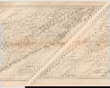
![[181-] Alabama Map of the Late Surveys: [Alabama Territory] Map of the Late Surveys in the Southern District of the Alabama Territory. Drawn by Tanner, Vallance, Kearny & Co. Sc. Image size is 17.25 x 30.75, sheet size is 21 x 32 inches. Al](https://p1.liveauctioneers.com/5755/336798/182166010_1_x.jpg?height=310&quality=70&version=1721160516)


Est. —
$40(1 bid)


![LSE POVERTY OS PROOF MAP Chelsea Harbour - Sands End - Walham - Fulham 1928: CAPTION PRINTED BELOW PICTURE: [Ordnance Survey] Edition of 1916 - London Sheet VIII. 8. Chelsea Harbour - Sands End - Walham - Eel Brook Common - Fulham Broadway An original unpublished “povert](https://p1.liveauctioneers.com/5584/336936/182258201_1_x.jpg?height=310&quality=70&version=1721772323)
View:
24
News about Maps & Atlases
Historic maps and atlases chart course to Swann Dec. 7
[av_heading heading=’Historic maps and atlases chart course to Swann Dec. 7′ tag=’h1′ style=” subheading_active=” show_icon=” icon=’ue800′ font=’entypo-fontello’ size=” av-desktop-font-size-title=” av-medium-font-size-title=” av-small-font-size-title=” av-mini-font-size-title=” subheading_size=” av-desktop-font-size=” av-medium-font-size=” av-small-font-size=” av-mini-font-size=” icon_size=” av-desktop-font-size-1=” av-medium-font-size-1=” av-small-font-size-1=” av-mini-font-size-1=” color=” custom_font=” subheading_color=” seperator_color=” icon_color=” margin=’,,35px,’ av-desktop-margin=” av-desktop-margin_sync=’true’ av-medium-margin=” av-medium-margin_sync=’true’ av-small-margin=’,,20px,’ av-mini-margin=” av-mini-margin_sync=’true’ headline_padding=” headline_padding_sync=’true’ av-desktop-headline_padding=” av-desktop-headline_padding_sync=’true’ av-medium-headline_padding=” av-medium-headline_padding_sync=’true’ av-small-headline_padding=” av-small-headline_padding_sync=’true’ av-mini-headline_padding=” av-mini-headline_padding_sync=’true’ […]

Celebration of Scottish engineering on display at Lyon & Turnbull Feb. 7
EDINBURGH – A cache of material from a well-known Scottish engineering dynasty will be offered at Lyon & Turnbull. The Rare Books, Manuscripts, Maps & Photographs auction on Wednesday, February 7 includes 50 lots from the Stevenson family – designers across four generations of many of the U.K.’s lighthouses. Absentee and Internet live bidding will […]
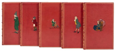
Dickens & Twain set world records at Potter & Potter Aug. 28
CHICAGO – Potter and Potter‘s spectacular August 28 Fine Books and Manuscripts Sale was the company’s highest-grossing auction to date. After a day of spirited bidding, 107 lots realized between $1,000-4,999; 22 lots realized between $5,000-9,999; and 16 lots broke the five digit mark.
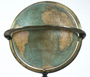
Jasper52 vintage map auction Nov. 5 going global
NEW YORK – A 19th century French terrestrial globe tops an auction of vintage maps that will be conducted by Jasper52 on Tuesday, Nov. 5. Fifteen globes and more than 130 maps and atlases are offered in the online auction. Bid absentee or live online exclusively through LiveAuctioneers.
TOP