Sold2023Railway Interest:Railway Interest: Railway Interest: Official Railway Clearing House Map of London and its Environs, 1899. Silk lined, and folding into the original covers (128 x 102 cm). VG; Plus: Roscoe: Two works iSee Sold Price
Sold2021London.- Railways.- Map of London. The DistrictLondon.- Railways.- Map of London. The District Railway, fifth edition, colour-printed lithograph, 658 x 1062 mm., linen-backed and dissected, some staining and pencil writing / drawing to verso, foldSee Sold Price
Sold2022LONDON UNDERGROUND tube map diagram plan. First STINGEMORE edition 1925TITLE/CONTENT OF MAP: Underground Railways of London [694 11.5.25] This is the first edition of an Underground geographic map designed by F H Stingemore. It is one of the first designs not to show anySee Sold Price
Sold2023LONDON UNDERGROUND LINE CAR TUBE MAP DIAGRAMSLONDON UNDERGROUND LINE CAR TUBE MAP DIAGRAMS Three London Underground Line Car diagrams, including Northern Line, Central Line, and District Line (unframed). Framed pieces are adhered to foam boardSee Sold Price
Sold2022(LONDON.) George Philip & Son; The London Geographical Institute. Philips' New Library Map of London(LONDON.) George Philip & Son; The London Geographical Institute. Philips' New Library Map of London and Its Environs. Large chromolithographed map of London with postal divisions and district boundarSee Sold Price
Sold2022London Tube Railways. 11 proposed new/extended Underground lines HMSO 1901 mapTITLE/CONTENT OF MAP: 'London tube railways 1901' This fascinating map, drafted by the Civil Engineer Sir Alexander Binnie in his capacity as Chief Engineer of London County Council, shows the developSee Sold Price
Sold2018LONDON. Vintage Underground / Tube map 1933 old vintageTITLE/CONTENT OF MAP: 'Map of the Underground Railways of London' DATE: 1933 IMAGE SIZE: Approx 18.5 x 30.5cm, 7.25 x 12 inches (Medium) TYPE: Colour vintage street atlas map CONDITION: Good; suitableSee Sold Price
Sold2018CENTRAL LONDON TRANSPORT. Railways & underground tubeCENTRAL LONDON TRANSPORT. Railways & underground tube DATE: 1906 IMAGE SIZE: Approx 22.0 x 27.5cm, 8.5 x 10.75 inches (Medium); Please note that this is a folding map. TYPE: Antique colour travel mapSee Sold Price
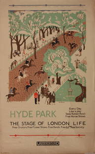
Sold2023Vintage PosterEdward Bawden (1903-1989) Hyde Park The Stage of London Life, original poster printed for the Underground (London Electric Railway) 1925 - 102 x 63 cm One the Bawden's first commercial design commissiSee Sold Price
Sold2020The Wonderground Map of London Town 1915 MacDonalLeslie MacDonald Gill (1884-1947), "The Wonderground Map of London Town," London, 1915. This highly detailed and eye-catching map was commissioned by the London Underground to entertain passengers waiSee Sold Price
Sold2022SOL LEWITT (1928-2007) R706 Map of London with the area between the underground stations at Marb...SOL LEWITT (1928-2007) R706 Map of London with the area between the underground stations at Marble Arch, St. James Park, Leicester Square, Waterloo Station, Pimlico, Sloane Sq., Knightsbridge, BayswatSee Sold Price
Sold2022SMITH, CHARLES Smith's New General Atlas Containing District Maps of All the Principal Empires,SMITH, CHARLES Smith's New General Atlas Containing District Maps of All the Principal Empires, Kingdoms & States throughout the World. London: C. Smith, 1809. Old calf-backed boards. 15 3/4 x 12 5/8See Sold Price
Sold2023Vintage PosterClifford and Rosemary Ellis (1907-1998) Wood The busy Woodpecker, original poster printed for London Underground by Baynard Pres 1933 - 102 x 64 cmSee Sold Price
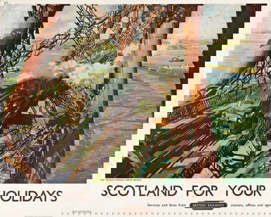
Sold2023TERENCE CUNEO (1907-1996). SCOTLAND FOR YOUR HOLIDAYS / BRITISH RAILWAYS. 1952. 40x50 inches, 101&#TERENCE CUNEO (1907-1996) SCOTLAND FOR YOUR HOLIDAYS / BRITISH RAILWAYS. 1952. 40x50 inches, 101½x127 cm. Waterlow, London. Condition A- / B+: minor repaired tears at edges; minor creases and abrSee Sold Price
Sold2017Coast of West Florida and Louisiana Map"Coast of West Florida and Louisiana", by Thomas Jefferys (English, 1719-1771) copperplate engraved map, with the New Orleans environs heightened with hand-colored gold, published London, 1775. MattedSee Sold Price
SoldTERENCE CUNEO (1907-1996) CLEAR ROAD AHEAD / BRITISH RAILWAYS. 1949.TERENCE CUNEO (1907-1996) CLEAR ROAD AHEAD / BRITISH RAILWAYS. 1949. 40x50 inches, 101½x127 cm. Waterlow and Sons, Ltd., London. Condition B+: creases and abrasions in margins and image; minor rSee Sold Price
SoldTERENCE CUNEO (1907-1996) ROYAL BORDER BRIDGE, British RailwaysTERENCE CUNEO (1907-1996) ROYAL BORDER BRIDGE, British Railways lithographic poster in colours, printed by Chromoworks, London, cond. A, backed on linen, 40 x 50in. (102 x 127cm.) For further informatSee Sold Price
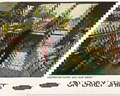
Sold2023TERENCE CUNEO (1907-1996). ON EARLY SHIFT / BRITISH RAILWAYS. 1948. 39¾x50 inches, 101x127 cm.TERENCE CUNEO (1907-1996) ON EARLY SHIFT / BRITISH RAILWAYS. 1948. 39¾x50 inches, 101x127 cm. Waterlow and Sons, Ltd., London. Condition B / B-: extensive replaced losses, overpainting and repairSee Sold Price
Sold2021Eight London Underground and Other Travel PostersEight London Underground and Other Travel Posters 20th Century including two Espana posters, Biarritz, and Mont-Revard, a Shop By Underground poster, From 430 to 1, By Tram to Hampton Court, and See TSee Sold Price
Sold2024Original c. 1930s London Underground Travel PosterBudd, Herbert Ashwin 1881 - 1950 Travel Underground between 10 & 4 Lithograph ca. 1930 40.1 x 24.8 in. (102 x 63 cm) Printer: Vincent Brooks Day & Son. London Condition Details: (B) on linen (old), teSee Sold Price
Sold2015Kingdom of IrelandJohn Speed (1552-1629). Engraved map. London: 1610 (1676). 17 1/4 x 22 inches. A rare, early printing of John Speed’s renowned map of Ireland. The map is decorated with a panel of costume figures deSee Sold Price
Sold2022Faden Map of the Battle of Hobkirk's Kill, Revolutionary War, 1781FADEN, William (1749 – 1836). Sketch of the Battle of Hobkirks Hill, near Camden on the 25th April, 1781. Engraved map. London: Faden, Aug. 1, 1783. 21 3/4" x 15 1/8" sheet. This RevolutionarySee Sold Price
Sold2022A PAIR OF ARTS AND CRAFTS SILVER CANDLESTICKSA PAIR OF ARTS AND CRAFTS SILVER CANDLESTICKS, by Goldsmiths & Silversmiths Co Ltd, London 1907, with square-section tapering stems continuing to a conforming 'riveted' base, loaded. (2) 22cm highSee Sold Price
Sold2023LONDON MAP:LONDON MAP: LONDON MAP: Cary's New and Accurate Plan of London and Westminster, the Borough of Southwark and parts adjacent: viz. Kensington, Chelsea, Islington, Hackney, Walworth, Newington &c with aSee Sold Price
2 days LeftJasper52London's Underground. What to See/How to Travel. Macdonald Gill. March 1922 map$700
2 days LeftJasper52LONDON UNDERGROUND tube map plan diagram. HARRY BECK. 33-2791 September 1933$1,000
2 days LeftJasper52LONDON UNDERGROUND tube map diagram of lines. Middle Circle. HARRY BECK #2 1936$320
2 days LeftJasper52LONDON UNDERGROUND tube map diagram plan. Northern Heights SCHLEGER/ZERO #2 1939$260
Featured2 days LeftJasper52Metropolitan Railway and Connections. London Underground. SELBIE c1930 old map$460
2 days LeftJasper52LONDON UNDERGROUND tube map plan diagram. Northern Heights SCHLEGER/ZERO #1 1939$260
Featured2 days LeftJasper52London Electric Railways. Underground tube network map 1909 old antique$480
2 days LeftJasper52Underground Map of London. Tube network. Print code 419-25000-3/4/24. April 1924$950
2 days LeftJasper52Underground Map of London. Tube network. No print code. June-August/mid 1924$1,200
2 days LeftJasper52LONDON UNDERGROUND tube map diagram plan. Piccadilly extension. STINGEMORE 1931$300


![LONDON UNDERGROUND tube map diagram plan. First STINGEMORE edition 1925: TITLE/CONTENT OF MAP: Underground Railways of London [694 11.5.25] This is the first edition of an Underground geographic map designed by F H Stingemore. It is one of the first designs not to show any](https://p1.liveauctioneers.com/5584/263211/137236971_1_x.jpg?height=310&quality=70&version=1664917902)