Sold2022LARGE HAND-COLORED MAP OF ASIA 20” x 24” sight. Framed 29.5” x 33.5”.LARGE HAND-COLORED MAP OF ASIA“Asia, Concinnata Secundum Observationes Academia Regalis Scientiarum et nonnullas alias, et juxta annotations recentissimas per G. de L'Isle”, Tobias ConradSee Sold Price
Sold2022HAND-COLORED MAP OF WEST INDIAN ISLANDS 19th CenturyHAND-COLORED MAP OF WEST INDIAN ISLANDS 19th Century By Tomson. Depicts Guadaloupe, Mariegalante and Antigua. 20" x 24" sight. Framed 22.5" x 26".See Sold Price
Sold2020Hand colored map of AtlantaHand colored map of Atlanta dated 1871 published by A. Ruger. Framed size 19 3/4"h x 24"w, sight size 16 1/2"h x 20 1/2"wSee Sold Price
Sold2022THREE HAND-COLORED MAPS OF ASIATHREE HAND-COLORED MAPS OF ASIA1) “Asia”, from a miniature Ortelius atlas, Brescia, after 1598. 3.75” x 5” sight. Framed 9” x 10.5”.2) “A New Map of Asia̶See Sold Price
Sold2022Hand colored map of Berkshire. double glass framed 24.5" x 20"Hand colored map of Berkshire. double glass framed 24.5" x 20"See Sold Price
Sold2022HAND-COLORED MAP OF ENGLAND AND WALES 15” x 18.5” sight. Framed 20.5” xHAND-COLORED MAP OF ENGLAND AND WALES“Regni Florentissimi Nova", Abraham Ortelius, Antwerp, 1603. Van den Broecke 19.3 L12.15” x 18.5” sight. Framed 20.5” x 24.25”.See Sold Price
Sold2016Colored Albumen Print of St Marks, Venice, c. 1880Hand-Colored Albumen Print of St. Marks, Venice, c. 1880 with square filled with pedestrians and pigeons.(FMAL7202)(WK) Measurements:Sight: 16 x 20 Framed: 24 x 29.5 Property Title:See Sold Price
Sold2018MATTHAUS SEUTTER (LUXEMBOURG C. 1730) MAPMap of fort and city of Luxembourg. Hand colored engraving. Dimensions: (Frame) H 20.75" x W 24.25", (Sight) H 19.75" x W 23" Condition: Foxing. Age toning.See Sold Price
Sold2021Map of City and Harbour of MacauA Plan of the City and Harbour of Macao" engraved by B. Baker, Islington 27" x 20 1/2" (sight) hand-colored engraved map 18th century framed- 32 1/2" x 40See Sold Price
Sold2021George Edwards (1694-1773) 4 hand-colored engravingsGeorge Edwards (1694-1773) 4 hand-colored engravings. Each Framed. Size: 9.5'' x 7.75'', 24 x 20 cm (sight); 14'' x 11.75'', 36 x 30 cm (frame).See Sold Price
Sold2023America Aurea Pars Altera Mundi MapCirca 1700, North And South America With California As An Island, Hand Colored Engraving, Sight 20 X 23 Inches, Matted And Framed 29 X 32 X 0.5 Inches. See Photos For Additional Condition Information.See Sold Price
Sold202118TH / 19TH C HAND COLORED ENGRAVING MAP OF IRELAND18th / 19th century hand colored engraving map of Ireland. Marked in lower margin left and right "P.F. Tardieu Sculp" and "Andre Scrip". Framed measuring a total of 20.5" tall x 24" wide. Condition: vSee Sold Price
Sold201818th C. Milan Ducatus Mediterranean Map18th C. framed copper engraved map, hand colored of Milan, Genoa, Lake Como and Mantua Cartouche. By Matthai Serteri, S.C.M. GEOGR Augustani. Visible paper measures approximately 20.25" H X 24" W, witSee Sold Price
Sold2017Korean Map of Capital of Korea19th century. Possibly hand-colored. Signed. Approx. 11" H x 16" W sight, 19" H x 24" W framed.See Sold Price
Sold2021Large Hand Colored Framed Map of Italy, StanfordsLarge Hand Colored Framed Map of Italy, Stanfords. Dated 1859. Sight size: 4'8"h x 47-1/2"w Overall: 5'4"h x 4'7"w. Item cannot be unframed as it consists of multiple hand colored maps completing theSee Sold Price
Sold2023Abraham Ortelius, Mediterranean mapAbraham Ortelius, Mediterranean map, "Aeneae Troiani Navigatio Ad Virgilij Sex priores Aeneidos", hand-colored engraving, possibly 1624 or later, matted and framed under glass, 14"h x 20"w (sight), 23See Sold Price
Sold2024J.H. Colton and Co., Map of Mexico, 1854Framed hand-colored map of Mexico and the Southwest, published by J.H. Colton and Company in 1854 sight: 13 x 16 in., sheet: 15.5 x 19.5 in., matting 20 x 22 in. Shipping available for this lot throuSee Sold Price
Sold2021After John James Audubon (1785 - 1851)Large folio lithograph with hand-coloring on paper, from the Viviparous Quadrupeds of North America, plate XXVII. Has been trimmed. 24"h x 20"w sight and 26"h x 21.5"w framedSee Sold Price
Sold2020Joan Blaeu Map of Amersfoort ca. 1650Joan Blaeu (1596-1673), "Amisfurtum," Amsterdam, ca. 1650. Hand colored map of the town of Amersfoort in the Netherlands. Dimensions: Sight; height: 16 1/4 in x width: 20 1/4 in. Framed; height: 17 3/See Sold Price
Sold2022Large Rare Map of Waterford Maine by Daniel Chaplin1850, hand colored, 37 x 29.5 inches, sight. Framed, wrinkles and limited splitting.See Sold Price
Sold2018JACQUES HNIZDOVSKY (UKRAINE/AMERICAN 1915-1985), HANDJACQUES HNIZDOVSKY (UKRAINE/AMERICAN 1915-1985), HAND COLORED WOODCUT, "BOX OF CORN", SIGNED AND TITLED 1976, #15/120. SIGHT 18 3/4 X 15 3/8"; FRAMED AND GLAZED-24 1/2 X 20 1/2"See Sold Price
Sold2024J&G Menzies, engraved map of AfricaJ&G Menzies, engraved map of Africa, Early 19th c., hand-colored engraving on paper, labeled "No 47" upper right, matted and framed under glass, 20.5"h x 23"w (sight), 28.5"h x 31"w (frame)See Sold Price
Sold2021Early Map of Hungary, FramedMap of Hungary 1684, with hand colored yellow boundaries, framed. .Overall size: 19 3/4 x 25 1/4 in.Sight size: 14 3/4 x 20 1/2 in.See Sold Price
Sold2022HAND-COLORED MAP OF NEW JERSEY 16” x 13” sight. Framed 23” x 20”.HAND-COLORED MAP OF NEW JERSEYTogether with a framed miniature map of Northern California. “New Jersey” published by J.H. Colton, New York, 1855. Covering the region in great detail includSee Sold Price
1 day LeftWillow Creek Coin & CollectiblesCurrier and Ives, Large Format Hand Colored Lithograph, "A Midnight Race on the Mississippi".$1,000
4 days LeftMerrill's Auctioneers and AppraisersFour early 19th c hand colored allegorical Mezzotints$300(1 bid)
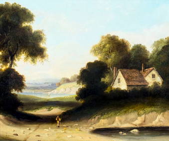
6 days LeftTremont AuctionsMid 19th century American school "Indians Travelling". Large painting. Oil on canvas. Framed.$1,000(1 bid)
6 days LeftBroward Auction GalleryKarl Witkowski (NJ,Poland,1860-1910) oil painting antique$30(3 bids)