Sold2021Map of "Oil & Gas of the United States", 1983Map of "Oil & Gas of the United States", 1983 (ESCR3090)(WT) Dimensions: 40" x 56"See Sold Price
Sold2023George Deem (1932-2008) CaliforniaPRESIDENTS OF THE UNITED STATES, 1983, oil painting on canvas, signed and dated lower right, signed and dated and titled on verso, 70 x 50”, frame 71 x 51”.See Sold Price
Sold20241963 SOUTHWESTERN BELL SYSTEM GAS OIL GARAGE MAN CAVE PORCELAIN SIGNThis colorful advertisement features the Southwestern Bell logo and the year "1963." Southwestern Bell was a major telecommunications company that operated in the Southwestern United States throughoutSee Sold Price
Sold2018BOX OF VINTAGE ROAD MAPSBOX OF VINTAGE ROAD MAPS - SAN FRANCISCO COLOR CODED TRAVEL GUIDE; 1978 RENO SPARKS STREET MAPS; ENCO FUEL WESTERN UNITED STATES; UNION OIL COMPANY LONG BEACH CITY MAP; VINTAGE DIAL-A-MILE FOR CALIFORSee Sold Price
SoldUNION 76 GAS STATION LIGHT UP SIGNUnion 76 gas station light up sign in good working condition. Union Oil, for many years based in El Segundo, California, introduced "76" gasoline in 1932. The name referred to the 1776 United States DSee Sold Price
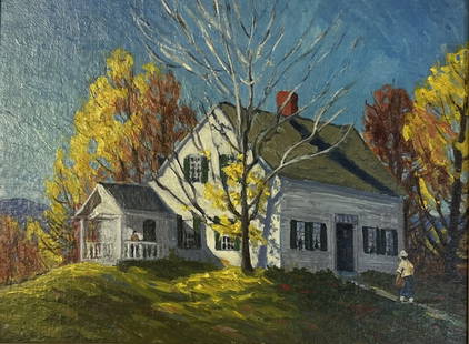
Sold2023Antonio Cirino (1889 - 1983) AmericanAntonio Cirino (1889 - 1983) Oil on Canvasboard, Signed, Measures ( 8.5 x 11.5 inches ) w/frame ( 13 x 16 inches Born in Italy, March 23, 1888, Antonio Cirino came to the United States as a child of tSee Sold Price
Sold2021Shell Oil Company Game Tokens [132545]Shell gas stations had several games during the 1960s: Man In Space; Famous Faces & Facts; States of the Union; Presidents of the United States. Here are two quart sized Ziploc bags of these tokens. HSee Sold Price
Sold2022Vintage Map - Map of San Diego Zoo - Zoological Society of San Diego - United StatesA whimsically colorful vintage map of San Diego Zoo - a fun cartoon print illustration from the 1983. You will receive the exact antique map in the photos. The condition is very good considering the aSee Sold Price
Sold2021Barry Bichler 1983, American, Abstract Oil PaintingBarry Bichler 1983, American, Abstract Oil Painting on canvas. Signed and dated. Listed American Artist. size: 30 x 40. ASKart: Barry Bichler (Born 1961) is active/lives in United States.See Sold Price
Sold20221929 RICHFIELD GASOLINE NEW YORK ADVERTISING MAPS2 Rare 1920's Richfield Oil Corp of New England and New York Fold Out Motor Routes Road Maps in Full Color covering parts of the United States. Vibrant Graphics with Early Automobiles, Race Cars, BoatSee Sold Price
Sold2021Igor Korotash. Mixed-Media, Statue of LibertyIgor Korotash (Russian, 1957-). An oil depicting the Statue of Liberty painted on a map of the United States. Signed lower right and gilt framed under glass. Mat opening: 23in x 35in.See Sold Price
Sold2021Karl C Lippard 'The Warriors' U.S. Marines 1st EdLippard, Karl C. THE WARRIORS United States Marines, 1st Ltd Edition of 100. Publisher: Vietnam Marine Publications, 1983. 50/100. Signed and inscribed by author. Illustrated with maps and photographsSee Sold Price
Sold2020Lot of Vintage Gas Station Maps includes many states,Lot of Vintage Gas Station Maps includes many states, Ontario, Long Beach and East Bay Cities From Standard Oil and Chevron.See Sold Price
Sold2018Map, United States, 1784, first map of the nationMap, United States, 1784,"Carte Des Etats-Unis De L'Amerique Suivant le Traite de Paix de 1783. Dediee et Presentee A.S. Excellence M. Benjamin Franklin Ministre Pleinipotentaire des Etats-Unis", theSee Sold Price
Sold2021Pictorial Map United States IndiansIndians of the U.S.A. Louise E. Jefferson. Friendship Press, New York: 1944. Novelty map showing native American tribes. Vintage color print. 22 1/2" x 34 1/2", overall 26" x 40".See Sold Price
Sold2016John Haven Map: United States and MexicoNew York: Haven & Emmerson, 1846 wood engraved, hand colored map created during the time of the Mexican American War. The map shows the United States and Mexico and includes the Oregon Territory, TexaSee Sold Price
Sold20231819 LIZARS MAP UNITED STATES.W & D Lizars Edinburgh map of the United Sates of America 1819, image 15” x 17,5” framed under glass overall 23” x 25”See Sold Price
Sold201718thc Map: United States of America, Wilkes, 1797Framed antique map, United States of America, Published London 1797 by J. Wilkes. Engraved by Neele, 352 Strand, London. Hand colored, the map shows the United States in the Decade after the AmericanSee Sold Price
Sold2022JOHN TALLIS (1817-1876) AN AMERICAN CIVIL WAR MAP, "United States," LONDON, CIRCA 1863,JOHN TALLIS (1817-1876) AN AMERICAN CIVIL WAR MAP, "United States," LONDON, CIRCA 1863, hand-colored lithograph on wove paper showing, "Federal, Non Slave Holding States (Red); Border, Slaveholding (BSee Sold Price
Sold2021CIVIL WAR-ERA JOHNSON'S MILITARY MAP UNITED STATESFramed engraving with color on paper, "Johnson's New Military Map of the United States, Showing the Forts, Military Posts & c., with Enlarged Plans of Southern Harbors from Authentic Data Obtained atSee Sold Price
Sold20221864 Civil War MAP United States Statistics Commerce1864 Civil War MAP United States Statistics Commerce American Trade Gold Silver The United States Department of Treasury published this Civil War-era report analyzing the commerce of the US GovernmentSee Sold Price
Sold2021Colton Railroad and County Map United States 1878Colton, after G. W., Colton's Railroad and County Map of the United States, The Canadas, &c, 1878, antique map on paper, folded as originally issued, 33 x 42 inches, in a wood frame 36.5 x 47.5 inchesSee Sold Price
Sold2016Antique Map United States Thomson's 1817Antique Map United States Thomson's 1817, authentic antique map, inscribed, "drawn & engraved for Thomson's new general atlas 1817", along with "Northern Provinces of the United States", hand coloredSee Sold Price
Sold2019John A. Kohl (20th Century) Oil (United States)Oil on canvas. Line of people walking. Signed lower right. 30 x 36 sight.See Sold Price
Featured6 days LeftJasper52Rand, McNally & Co.'S New Commercial Railroad Map of the United States [Chicago to Denver]$25
Featured6 days LeftJasper52Railroad Map of the United States Showing the Through Lines of Communication...$50
Featured6 days LeftJasper52Johnson's New Military Map of the United States Showing the Forts, Military Posts &C. With Enlarged$65
3 days LeftActivity AuctionsAntique 1787 French Maritime Hydrography Map Eastern Coast United States M Bonne$150


![Shell Oil Company Game Tokens [132545]: Shell gas stations had several games during the 1960s: Man In Space; Famous Faces & Facts; States of the Union; Presidents of the United States. Here are two quart sized Ziploc bags of these tokens. H](https://p1.liveauctioneers.com/2699/202327/102450123_1_x.jpg?height=310&quality=70&version=1619654794)


![Rand, McNally & Co.'S New Commercial Railroad Map of the United States [Chicago to Denver] (1 of 1)](https://p1.liveauctioneers.com/5584/329422/177662153_1_x.jpg?height=282&quality=70&version=1715717898)


