Sold2019A Plan of the City of New York by James LyneA Plan of the City of New York from an actual Survey, made By Hames Lyne, measuring 18.5 by 23.25 inches.See Sold Price
Sold202019th C. Plan of the city of New York from an actual19th C. - A plan of the city of New York from an actual survey Known as the Bradford Plan. By James Lyne and Publisher:New-York : Pubed. by G. Hayward. Notes: Facsimile of an original map [New York :See Sold Price
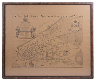
Sold2023REPLICA OF LAING'S MAP OF MANHATTAN"A Plan of the City of New York from an actual Survey" for His Excellency John Montgomerie, by William Bradford, printed on tan paper, in a faux tortoiseshell frame, under glass, 23" x 26", good condiSee Sold Price
Sold2021Antique Guy Arnoux Art BarometerAntique Guy Arnoux Art Barometer, signed and dated at bottom. Together with "A Plan of the City of New York City from an actual Survey" hand colored printUsed condition, heavy wear, worn, staining, loSee Sold Price
Sold2017Plan of the City and Suburbs of New Orleans"Plan of the City and Suburbs of New Orleans; from An Actual Survey Made in 1815", by Jacques Tanesse, facsimile published Ithaca, New York: Historic Urban Plans, 1967, after the original published bySee Sold Price
Sold2020Bradford Map of New York City 1/170Heading: (New York) Author: Andrews, William Loring Title: James Lyne's Survey Or, as It is More Commonly Known the Bradford Map: a Plan of the City of New York at the Time of the Granting of the MontSee Sold Price
Sold20181813 but 1854 Grim's Map of New York CityTitle/Content of Map: 1813 but 1854 Grim's Map of New York City -- A Plan of the City and Environs of New York as they were in the Years 1742, 1743 and 1744 Drawn by D. G. in the 76th Year of his ageSee Sold Price
Sold2022VINTAGE HAND DRAWN PLAN FOR PARCELLATION OF NYCA rare hand drawn and hand inscribed urban plan for parcellation of New York City. Historical American Architectural Documents, Urban Maps, Vintage Gifts And Collectibles. Dimensions: 17" x 12 1/4" inSee Sold Price
Sold2017EARLY NEW YORK STATE ACTUAL SURVEY MAPEARLY NEW YORK STATE ACTUAL SURVEY MAP FOR COUNTIES ALONG SUSQUAHANNAH RIVER, INCL. CLINTON, CHENANGO, GREEN, ETC. 18TH C. 15 1/2" X 21"See Sold Price
Sold2018Map, "Delaware County, New York, Philadelphia, 1856Map, "Delaware County, New York, From Actual Survey by Jay Could, Published by Collins G. Keeney, Philadelphia, 1856, various county scenes on top margin, map is damages with some loss at top, size isSee Sold Price
Sold2017Harrison, Ballard, Allan Plan for City of New York 1950Harrison, Ballard, Allan: Plan for Rezoning the City of New York - 1950 - Well Illustrated! Harrison, Ballard, Allan NYC/ urban planning 1st ed. 1950, D'Arcy Lithographing & Printing Corp., New York 1See Sold Price
Sold2016Plan of City of New York in 1791, c. 1851Engraved by George Hayward for D.T. Valentine's Manual. Map features historic buildings and landmarks in key grid on upper left corner. Dimensions: 10" x 15" This item ships from Ocean View, DE.See Sold Price
Sold2023BELLIN, JACQUES-NICOLAS. Two eighteenth-century engraved city plans (New York and Philadelphia) fromBELLIN, JACQUES-NICOLAS. Two eighteenth-century engraved city plans (New York and Philadelphia) from Le Petit Atlas Maritime. 12½x9½ inches each sheet size, wide margins; original hand-colorSee Sold Price
Sold2019New York Antique Maps (2)Plan of City of New York by Lyne, c. 1900. Map of Provinces of New York and New Jersey by Sauthier, 1878 edition. 26" x 19 1/2".See Sold Price
Sold2018after James Lyne Plan of the City of New Yorkafter James Lyne 1728 A Plan of the City of New York engraved map, on thin laid paper, differs from the 19th c facsimiles, has different writing below lower edge commensurate with an early engraved imSee Sold Price
Sold20181859 version of 1664 New York City Plan -- The "Duke'sReserve Reduced! Title/Content of Map: 1859 version of 1664 New York City Plan -- The "Duke's Plan" A Description of the Towne of Mannados or New Amsterdam as it was in September 1661 . . . Anno DominSee Sold Price
Sold2023After Bernard Ratzer Cantographe "Plan of the City of New York"After Bernard Ratzer Cantographe "Plan of the City of New York In North America Surveyed in the Years 1766 & 1767", a 20th century facsimile of the original hand colored engraving, matted and framSee Sold Price
Sold2016Map of New York City & Plan of Fort Washington (PortEngraved by George Hayward for D.T. Valentine's Manual. Map features northern Manhattan with Revolutionary War battles and troop movements, hightlighted by number on right side of map. The full titleSee Sold Price
Sold2020Major Holland A Plan of the City of New York 1776Major Holland, "A Plan of the City of New York," engraved map from the 1863 version by G. Hayward. The map was originally from 1776 and is considered one of the earliest and most iconic maps of LowerSee Sold Price
Sold2021FACSIMILE FRAGMENT PLAN OF THE CITY OF NEW YORK, 19TH CFACSIMILE FRAGMENT PLAN OF THE CITY OF NEW YORK, 19TH C., 20" X 25"See Sold Price
Sold2015A Fine & Rare Map of New York.Bernard Ratzer "Plan of the City of New York". Signed lower right in the plate "T. Kitchin Sculpt" (Kitchin recorded the cartographer's name as Ratzen (sic) rather than Ratzer). The map backed, rolledSee Sold Price
Sold2020(3pc) MAPS OF NEW YORK: JOHN MONTRESORIncluding; "A Plan of the City of New York & Its Environs to Greenwich", for D.T. Valentine's Manual 1855; Bernard Ratzer,[29-3/4 x 23-3/4 in, framed]; "Plan of the City of New York in North America SSee Sold Price
3 days LeftDoyle New YorkThe top sheet of the famous Ratzer Map - with additions relating to an 1810 real estate dispute$7,500
25 mins LeftNo1 AuctionsKeith Haring Letter and Drawing Skating certified 1987 No Reserve£200(2 bids)
May 16Potter & Potter AuctionsPENNELL, Joseph (1857 – 1926). That Liberty Shall Not Peris...$100
3 days LeftThe Art's WorldKEITH HARING - ANDY MOUSE - PAINTING - ACRYLIC ON CANVAS - IN THE STYLE OF€2,500
3 days LeftThe Art's WorldKEITH HARING - THE FERTILITY 3 SUITE – LITHOGRAPHY ON PAPER - IN THE STYLE OF€250
3 days LeftThe Art's WorldKEITH HARING - POP ART RED FIGURE – ACRYLIC ON PAPER - IN THE STYLE OF€250
3 days LeftDoyle New YorkGoerck's 1785 working survey of the Common Lands that became Fifth Avenue$1,000
May 12Schilb Antiquarian Rare Books1881 Westchester County New York Yonkers Illustrated MAPS 2v SET Bolton History$16(2 bids)


![(3pc) MAPS OF NEW YORK: JOHN MONTRESOR: Including; "A Plan of the City of New York & Its Environs to Greenwich", for D.T. Valentine's Manual 1855; Bernard Ratzer,[29-3/4 x 23-3/4 in, framed]; "Plan of the City of New York in North America S](https://p1.liveauctioneers.com/522/173495/87372920_1_x.jpg?height=310&quality=70&version=1594330064)


