Sold2018after James Lyne Plan of the City of New Yorkafter James Lyne 1728 A Plan of the City of New York engraved map, on thin laid paper, differs from the 19th c facsimiles, has different writing below lower edge commensurate with an early engraved imSee Sold Price
Sold2020Major Holland A Plan of the City of New York 1776Major Holland, "A Plan of the City of New York," engraved map from the 1863 version by G. Hayward. The map was originally from 1776 and is considered one of the earliest and most iconic maps of LowerSee Sold Price
Sold2016Map of New York City & Plan of Fort Washington (PortEngraved by George Hayward for D.T. Valentine's Manual. Map features northern Manhattan with Revolutionary War battles and troop movements, hightlighted by number on right side of map. The full titleSee Sold Price
Sold20191832 Marshall Revolutionary War Map of New York City --Title/Content of Map: 1832 Marshall Revolutionary War Map of New York City -- Plan of New York Island and Part of Long Island Shewing the Position of the American & British Armies before, at, and afteSee Sold Price
Sold2019New York Antique Maps (2)Plan of City of New York by Lyne, c. 1900. Map of Provinces of New York and New Jersey by Sauthier, 1878 edition. 26" x 19 1/2".See Sold Price
Sold2021Hayward Map of New York City -- A Plan of the City ofTitle: Hayward Map of New York City -- A Plan of the City of New York & its Environs to Greenwich … Cartographer: J Hayward / Valentine's manual Year / Place: 1855, New York Map Dimension (in.): 24.See Sold Price
Sold20181813 but 1854 Grim's Map of New York CityTitle/Content of Map: 1813 but 1854 Grim's Map of New York City -- A Plan of the City and Environs of New York as they were in the Years 1742, 1743 and 1744 Drawn by D. G. in the 76th Year of his ageSee Sold Price
Sold2017Rand McNally: Antique City Plan of Brooklyn, NY, 1912Title/Content of Map: 'Main Portion Brooklyn ' Brooklyn town city map plan. New York. Date Printed: 1912 Image Size: Approx 27.5 x 33.5cm, 10.75 x 13 inches (Large) Type: Antique colour (color) city pSee Sold Price
Sold2022Nineteenth Century Map of New YorkFramed map titled "Plan of the City of New York Engraved from the original map by G. Hayward from D.T. Valentines Manual for 1855". Map printed on blue paper measures 18.5" x 14" and exhibits folds, aSee Sold Price
Sold2016Plan of City of New York in 1791, c. 1851Engraved by George Hayward for D.T. Valentine's Manual. Map features historic buildings and landmarks in key grid on upper left corner. Dimensions: 10" x 15" This item ships from Ocean View, DE.See Sold Price
Sold20181859 version of 1664 New York City Plan -- The "Duke'sReserve Reduced! Title/Content of Map: 1859 version of 1664 New York City Plan -- The "Duke's Plan" A Description of the Towne of Mannados or New Amsterdam as it was in September 1661 . . . Anno DominSee Sold Price
Sold2015A Fine & Rare Map of New York.Bernard Ratzer "Plan of the City of New York". Signed lower right in the plate "T. Kitchin Sculpt" (Kitchin recorded the cartographer's name as Ratzen (sic) rather than Ratzer). The map backed, rolledSee Sold Price
Sold2023After Bernard Ratzer Cantographe "Plan of the City of New York"After Bernard Ratzer Cantographe "Plan of the City of New York In North America Surveyed in the Years 1766 & 1767", a 20th century facsimile of the original hand colored engraving, matted and framSee Sold Price
Sold2020Bradford Map of New York City 1/170Heading: (New York) Author: Andrews, William Loring Title: James Lyne's Survey Or, as It is More Commonly Known the Bradford Map: a Plan of the City of New York at the Time of the Granting of the MontSee Sold Price
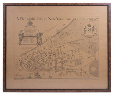
Sold202019th C. Plan of the city of New York from an actual19th C. - A plan of the city of New York from an actual survey Known as the Bradford Plan. By James Lyne and Publisher:New-York : Pubed. by G. Hayward. Notes: Facsimile of an original map [New York :See Sold Price
Sold20191832 Marshall Revolutionary War Map of Lower New YorkTitle/Content of Map: 1832 Marshall Revolutionary War Map of Lower New York from Tappan Sea to New York City -- Plan of the Country from Frogs Point to Croton River Shewing the Positions of the AmericSee Sold Price
Sold2023REPLICA OF LAING'S MAP OF MANHATTAN"A Plan of the City of New York from an actual Survey" for His Excellency John Montgomerie, by William Bradford, printed on tan paper, in a faux tortoiseshell frame, under glass, 23" x 26", good condiSee Sold Price
Sold2020(3pc) MAPS OF NEW YORK: JOHN MONTRESORIncluding; "A Plan of the City of New York & Its Environs to Greenwich", for D.T. Valentine's Manual 1855; Bernard Ratzer,[29-3/4 x 23-3/4 in, framed]; "Plan of the City of New York in North America SSee Sold Price
Sold2022Encyclo. Britannica C1880 Lot 3 Maps. New York City & StateTwo City Plans and a State Map. Lithograph Maps Published 1875-98, Edinburgh & London for "Encyclopaedia Britannica" Ninth Edition. Paper Size: 10.5 x 8 inch (27 x 21cm) and 15.5 x 10.5 inch (39 x 27cSee Sold Price
Sold2018Bridges: Antique Plan for New York City, 1870Title/Content of Map: 1870 Bridges Plan for New York City -- A Plan of New York City with Recent and Intended Improvements Date Printed: 1870 New York City Cartographer: J Hardy Size: 12.8 x 12.2 in.See Sold Price
Sold2018Johnson's Map of New York and Adjacent Cities.Title: Johnson's Map of New York and Adjacent Cities. Date: 1862 Cartographer: Size: 15 X 24.8 Detailed city plan of streets, parks, principal buildings, railroads, etc. Shows Brooklyn and part of JerSee Sold Price
Sold2022HYDE & CO. WESTCHESTER COUNTY WALL MAP 1900"Map of the Greater Portion of Westchester County including Greenwich and Stamford, CT and the Upper Part of New York City." Wall map on linen with hand-colored outlines plus editions of plan of VillaSee Sold Price
Sold2021Scarce SDUK map of New York City, 1840Elusive vintage 1840 Society for the Diffusion of Useful Knowledge (S.D.U.K.) city map or plan of New York City. Shows southern Manhattan from the Battery northwards to 42nd Street and portions of adjSee Sold Price
7 days LeftPotter & Potter Auctions[NEW YORK CITY – PICTORIAL MAPS]. Group of 3 pictorial maps...$200(1 bid)
7 days LeftPotter & Potter AuctionsBOLLMANN, Hermann (1911 – 1971). Map of New York City. 1962.$100
May 17Royal Treasures Warehouse LLC1876 New York City, New York Vintage Old Panoramic NY City Map$100(1 bid)
May 22Thomaston Place Auction GalleriesCOLLECTION OF TRAVEL EPHEMERA, BROCHURES, BOOKLETS, MAPS 1900-1950$100
7 days LeftPotter & Potter AuctionsCrosby Service Pictorial Map of Manhattan (New York City). ...$250
7 days LeftPotter & Potter AuctionsBOURNE, Emma (1906 – 1986). America – A Nation of One Peopl...$125(1 bid)
Jun 12Dan Morphy AuctionsPHELPS’S TRAVELERS GUIDE THROUGH THE UNITED STATES; CONTAINING UPWARDS OF SEVEN HUNDRED$1,000
Featured2 days LeftHess Fine AuctionsHistoric 19k Gold Pocket Watch S.W. Benedict Owned By A Mayor Of New York$2,800(1 bid)
3 days LeftSchilb Antiquarian Rare Books1881 Westchester County New York Yonkers Illustrated MAPS 2v SET Bolton History$26(3 bids)
3 days LeftSchilb Antiquarian Rare Books1869 American Emigrants Immigration Illustrated US State MAPS Railroad Alaska$1(1 bid)


![(3pc) MAPS OF NEW YORK: JOHN MONTRESOR: Including; "A Plan of the City of New York & Its Environs to Greenwich", for D.T. Valentine's Manual 1855; Bernard Ratzer,[29-3/4 x 23-3/4 in, framed]; "Plan of the City of New York in North America S](https://p1.liveauctioneers.com/522/173495/87372920_1_x.jpg?height=310&quality=70&version=1594330064)


![[NEW YORK CITY – PICTORIAL MAPS]. Group of 3 pictorial maps... (1 of 3)](https://p1.liveauctioneers.com/928/325952/175495562_1_x.jpg?height=282&quality=70&version=1712935174)


