Sold2024Prewar Antique Silk Double Sided Map of Europe Germany France Belgium HollandPrewar Antique Silk Double Sided Map of Europe Germany France Belgium Holland. Measurements in inches: 29 x 28 1/2 Condition:Has browning along one edge on both sides of map Shipping:We offer in-houseSee Sold Price
Sold2021Pilot's Silk map, double sidedTitle: Pilot's Silk map, double sided Date: 1940's Medium: Silk Description: Pilot's Silk map, two sided depicting France, Belgium, Holland, the Pyrenees, Spain and German-Swiss frontier Genre: WorldSee Sold Price
Sold20162 maps on silk2 maps on silk including Holland-Belgium-France-Germany; & Zones of France second edition. Stains; Measures 19 1/2 inches x 21 1/2 inches; & 29 inches x 27 1/2 inches.See Sold Price
Sold2017Homann: Antique Map of Belgium Holland Germany FranceTitle: Map of Belgium, Holland, Germany, and France by Homann Date: c 1747 Medium: Hand Colored Copper Plate Engraving Dimensions (in.): 22.5 x 20 No Reserve: This lot starts at $1 and has no reserveSee Sold Price
Sold2023RARE WWII British Cloth Escape Maps European Theater 1943 Series #43 C/D.WWII British Cloth Escape Maps European Theater 1943 Series #43 C/D. This Silk map is in Excellent Condition as pictured. Side C has maps of Holland, Belgium, France and Germany while Side D has mapsSee Sold Price
Sold2021Barclay, James C1835 Lot of 4 Hand Col Europe MapsGermany, Holland/Belgium, France and Spain/Portugal. Hand Colored Steel Engraved Maps Published C1835, London for "A Complete and Universal English Dictionary" by the Rev. James Barclay et al. EngraveSee Sold Price
Sold2024Central Europe roads canals railways Germany, Holland & Belgium. HUGHES 1854 mapCAPTION PRINTED BELOW PICTURE: 'Map of Central Europe, embracing Germany, Holland, Belgium, with parts of France & Switzerland; showing the roads, canals and railways' DATE PRINTED: 1854 IMAGE SIZE: ASee Sold Price
Sold2022Universal Atlas 1893 Lot of 22 Maps of EuropeIncl Ireland, Ethnographic, France, Belgium/Luxemburg, Holland, Denmark, Germany, Austria/Hungary, Greece, Italy, Scandinavia, Norway/Sweden, Bohemia, Sicily/Sardinia etc. Lithograph Maps Published 18See Sold Price
Sold2021Tallis, John (Pub) 1852 Lot of 12 European MapsIncl Northern Italy, Southern Italy, Brussels, Germany, Spain and Portugal, Prussia, Europe Continent, Greece, Denmark, Belgium, Holland and France. Steel Engraved Maps with Original Outline Hand ColoSee Sold Price
Sold2022Antique Map - Map of Europe - Map of Holland & Belgium - Amsterdam - BrusselsAntique map of Holland & Belgium by Becker, published in London, c 1860. This antique map was engraved by the omnigraph method by Francis Paul Becker & Company, Patentees circa 1842, with contemporarySee Sold Price
Sold2022LUFTWAFFE FLIGHT MAP OF GERMANY, FRANCE AND ENGLANDDouble-sided ‘Luft-Navigationskarte’ (‘Air Navigation Map’), 26.5 x 24 in., printed on weatherproofed canvas and produced by the General Staff of the Luftwaffe, circa 1941. BSee Sold Price
Sold20181944 British Air Force Escape Map (C & D) of France,Reserve Reduced! Title/Content of Map:1944 British Air Force Escape Map (C & D) of France, Benelux, Switzerland and Germany -- Sheet C Holland, Belgium, France (Northeast), Germany (West & Central) [vSee Sold Price
Sold2024Brockhaus (Pub) 1880's Lot of 21 Antique MapsIncl Balkans, World, Switzerland, Italy, Great Britain, France, Germany, Ethnographic Maps, Europe, Africa, Australia/Polynesia, Asia, South America, Hungary, Scandinavia and others. Lithograph Maps PSee Sold Price
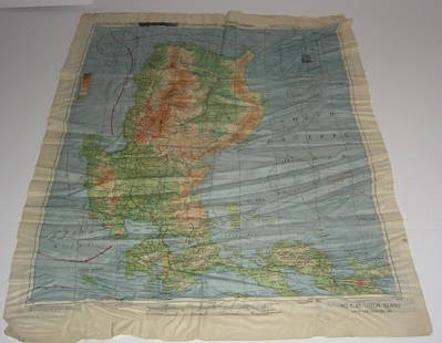
Sold2017WWII Pilot Escape Survival map handkerchief map1944 AAF Cloth Chart Philippine series silk double sided WWII Pilot Escape Survival handkerchief map. Foxing/stains. 20 inches x 25 inches.See Sold Price
Sold2018Europe 19th Cent. Lot of 8 Antique PrintsSteel Engravings & Etchings, one hand coloured. Incl Italy, Ireland, Germany, Holland, Belgium and Switzerland. Examples by Bartlett, Batty, Payne and Allom. Paper Size: Up to 12 x 9.5 inch (30 x 24cmSee Sold Price
Sold2023Reclus, Elisee C1880 Lot of 6 Antique Maps of EuropeIncl Belgium/Netherlands, Scandinavia, British Isles, Volcanoes of Central France, Russia, and Central Europe. Lithograph Map Published 1876-94, London for "The Universal Geography" by Elisee Reclus.See Sold Price
Sold2018Weller, F. S. C1890 Lot of 12 Antique MapsIncl German Empire, Switzerland, Holland/Belgium, Austria/Hungria, Russia, Asia, Africa, Sweden/Norway & Denmark, France, Australasia, Eastern Australia and New Zealand, and The World. Lot of 12 LithoSee Sold Price
Sold2019Bartholomew, John 1922 Lot of 8 Large Maps of EuropeIncl Belgium/Holland, Spain/Portugal - East & West, Northern Italy/Austria, Southern Italy, Central European States, Germany - South & West. Large Lithograph Maps Published 1922 by The Times, London fSee Sold Price
Sold2019Bryce, James 1881 Mixed Lot of European MapsIncl Europe Continent, Britain under Saxons/Romans, Russia, Italy, Spain/Portugal, Swtizerland, Holland/Belgium, and France. Lithograph Maps Published 1881, London for ""The International Atlas and GeSee Sold Price
Sold2020Europe 1903 Lot of 9 Maps. Germany, France, AustriaIncl France, Spain/Portugal, Netherlands/Belgium, German Empire, Norway/Sweden, and Austria/Hungary. Lithograph Maps Published 1903 by Adam & Charles Black, Edinburgh & London for "Encyclopaedia BrittSee Sold Price
Sold2022Nat. Encyclo. 1891 Lot of 6 Antique MapsIncl Turkey in Europe and Turkey in Asia, Switzerland, France, Spain/Portugal, Empire of Germany. Lithograph Maps Published 1891-1901 by William Mackenzie, London for "The National Encyclopedia: A dicSee Sold Price
Sold2023Gross, Alexander 1920 Lot of 26 Large Maps. EuropeIncl Germany, Austria, Russia, Netherlands, Belgium/Luxembourg, Norway/Sweden, Denmark/Iceland, Switzerland, Italy, France/Switzerland, Spain/Portugal, Europe Continent. Large Lithograph Maps PublisheSee Sold Price
Sold2023WWII U.S MILITARY WAR MAPS OF FRANCE/BELGIUM - (9)171281 WWII U.S MILITARY WAR MAPS OF FRANCE/BELGIUM - (9) WWII U.S. military war maps of France/Belgium to include one sheet 79 Defenses Vierville-Sur-Mer France (12500) war map, two sheet 31/18 S.E.See Sold Price
Sold2021ANTIQUE ILLUMINATED DOUBLE SIDED GREGORIAN CHANTANTIQUE ILLUMINATED DOUBLE SIDED GREGORIAN CHANT Large framed illuminated manuscript doubled sided Gregorian chant sheet music on vellum parchment. 22"See Sold Price
5 days LeftJasper521792 Elwe Map of Southern Netherlands to Belgium to Northern France -- Carte Nouvelle des Pais Bas$80
5 days LeftJasper521575 NORDLINGEN GERMANY LEAF BELLEFOREST EDITION of MUNSTER COSMOGRAPHY antique$160
10 hrs LeftConestoga Auction Company Division of Hess Auction GroupAntique Double-Sided Wood Game Board.$130(2 bids)
1 day LeftBright Star Antiques Co.International Harvester Neon Sign porcelain / works / double sided / 51 1/4"H x 46 1/4"L x$2,250(9 bids)
1 day LeftBright Star Antiques Co."OFFICE NO VACANCY" Neon Can Sign double sided / *works / 31"H, 84 1/4"L, 17"W$600(7 bids)
1 day LeftBright Star Antiques Co.Double Sided Lone Star Lodge Neon Can Sign *work / 24 1/2"H, 57 1/2"L, 15 1/2"W$1,200(10 bids)
13 hrs LeftBright Star Antiques Co.New York Big Apple Bar Can Sign - metal double sided / 67 3/4"H( 5 ft. 7 3/4 in.), 65"L, 10$375(7 bids)
1 day LeftBright Star Antiques Co.BEER Neon Sign - metal / double sided works / 14 1/2"H, 50"L(bracket), 13 1/2"W$175(6 bids)
13 hrs LeftBright Star Antiques Co.ICE Can Neon Sign - No Neon metal / double sided / 10 3/4"H, 12 1/4"H(hook), 19 1/4"L, 8$325(4 bids)
1 day LeftBright Star Antiques Co.Hotel Roellers Neon Sign - *works double sided / 16 1/2"H, 41"L, 11 1/4"W$350(7 bids)