Sold2022NOVISSIMA ET ACCURATISSIMA TOTIUS AMERICAE FRAMED MAPNOVISSIMA ET ACCURATISSIMA TOTIUS AMERICAE FRAMED MAP Novissima et Accuratissima Totius Americae Descriptio map, circa 19th century, by Nicholas Visscher. Double-page map of North and South AmeriSee Sold Price
Sold2017Framed Geographica Map Engraving (28E-EK)Framed Authentic Nova Totius Terrarum Orbis Geographica AC Hydrographica Tabula Map. Mixed Engraving printed in the late 1800's to early 1900's. All have the Mixed stamp from the Museum. These are theSee Sold Price
Sold2023[MAPS]. HOMANN, Johann Baptist (1663-1724). Four engraved continent maps with hand-coloring, each[MAPS]. HOMANN, Johann Baptist (1663-1724). Four engraved continent maps with hand-coloring, each matted and framed, comprising: Totius Americae… Nuremberg, [ca 1720]. Overall sheet 508 x 590 mmSee Sold Price
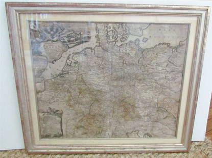
Sold20231769 ANTIQUE MAP of EUROPE framed EUROPEAN POSTAL ROADS & STATIONS1769 ANTIQUE MAP: MAPPA GEOGRAPHICA EXHIBENS POSTAS omnes tam vehiculares quam verdarias Totius Germaniae cum earum accurata distantia Diligentissime propriis sumptibus excudit. Aug. Vindelicor. : TobSee Sold Price
Sold2022Historic Map Print, Nova Totius Terrarum Orbis Tabula, Framed31.5in w x 1in d x 28.5in hSee Sold Price
Sold2017Framed Colored Engraved 17th C. World Map"Nova Totius Terrarum Sive Novi Orbis Tabula" Framed Colored Engraved 17th C. World Map by Willem Janszoon Blaeu - This interesting piece is an early world map created by Willem Janszoon Blaeu. The maSee Sold Price
Sold2017De Wit Map of AfricaTotius Africa Accuratissima Tabula. Frederick de Wit (1629/1630-1706). Engraved map with original hand color. Amsterdam, c. 1660. 19 1/4 x 23 inches visible, 24 3/4 x 28 1/2 inches framedSee Sold Price
Sold2021Ca 1720 Homann Map of AfricaCa 1720 Johan Baptiste Homann (German 1664-1724) "Totius Africae Nova Representatio" hand colored two sheet map of Africa, plate size 19" x 22", well framed, overall size 23 1/2" x 27"See Sold Price
Sold2021VINTAGE GOLD FOIL 1630 ANTIQUE WORLD MAPVINTAGE GOLD FOIL 1630 ANTIQUE WORLD MAP "Nova Totius Terrarum Orbis Geographica Ac Hydrographica TAbvla" Print, Framed. Size: 23 X 19 inches. Private Collection.See Sold Price
Sold2021MAP OF RUSSIA BY JOHANN BAPTIST HOMANN.Published Nurnberg, 1716, hand colored engraving on paper. "Generalis Totius Imperii Moscovitici" from east of Moscow to China. Repaired corners, crease and some foxing. Framed, 25"h. 27.75"w. Ex CollSee Sold Price
Sold2021MAP OF RUSSIA BY JOHANN BAPTIST HOMANN.Published Nurnberg, 1716, hand colored engraving on paper. "Generalis Totius Imperii Moscovitici" from east of Moscow to China. Repaired corners, crease and some foxing. Framed, 25"h. 27.75"w. Ex CollSee Sold Price
Sold2024"Accurata totius Archipelagi et Graeciae Universae Tabula..." by Josua and Renier OttensAmsterdam, ca. 18th cen. Map of Greece, the Aegean Sea, Crete, part of Turkey and Cyprus, a compass rose and a mileage indicator, with old hand coloring, matted and framed under glass. Sight size 20 xSee Sold Price
Sold2024World Map Print "Nova Totius Terrarum Orbis" by Willem Blaeu - Dutch circa 1606World Map Print "Nova Totius Terrarum Orbis" by Willem Blaeu - Dutch circa 1606. Matted and framed Old World brought forward in the piece both colorful and detailed. Measures H 29" x W 35" and weightSee Sold Price
Sold2017De Wit Portolan Sea Chart of EuropeTotius Europae Victoria... Frederic De Wit (1630-1706). Engraved map with original hand color. Amsterdam, 1675. 20 x 35 1/2 inches sheet, 27 1/2 x 43 inches framed. “The most striking and decorativeSee Sold Price
Sold2020Framed Map of ManhattanMap of Manhattan. [Map: 20" H x 50" W; Frame: 23 1/2" H x 53 1/2" W].See Sold Price
Sold2022FRAMED MAP OF HOUSTON TEXAS, RESTRIKE 1891FRAMED MAP OF HOUSTON TEXAS, RESTRIKE 1891. Height: 36 in. by Width: 56 in.See Sold Price
Sold2021Large Matted and Framed Map of Norfolk Virginia:Large Matted and Framed Map of Norfolk Virginia: Stylized Blazon Coat of Arms of Howard Duke of Norfolk (Premier Duke of England) Motto is "Virtuecont Alone is Invincible". Labeled JH DINGEE, Banker,See Sold Price
Sold2023FRAMED MAP OF SUSSEX CO. NEW JERSEYPUBLISHED PHILADELPHIA 1860. FRAMED UNDER GLASS. 55" X 52". Terms: PLEASE READ CAREFULLY - Terms for Purchasing and Shipping of Auction Items. Please read carefully before bidding. All payments for puSee Sold Price
SoldEASTERN EUROPEAN MAPS. Four framed maps.EASTERN EUROPEAN MAPS. Four framed maps. Comprising: Magni Ducatus Lithuaniae (18 1/4 x 22 1/2 in.); Emanuel Bowen's A New and Accurate Map of the Whole Russian Empire (15 x 20 in.); Polonia et SilesiSee Sold Price
Sold2021Antique Framed Map. Virginia Marylandia et Carolina. JoAntique Framed Map. Virginia Marylandia et Carolina. Johannes Baptisa Homann-- Dimensions: Image Size: H: 21 inches: W: 24.5 inches -- FRAME SIZE: Frame Height 25 inches - Frame Width 28.5 inches ---See Sold Price
Sold2023Framed Map of Fort Worth StockyardsVintage map of the U.S. Department of Agriculture's 1937 master plan for the Fort Worth Stockyards, framed sight: 22 x 30 in., frame: 33 x 45 in. Provenance: The Dallas, Texas collection of a lSee Sold Price
Sold2022Framed Map of Nantucket Printed in Colors on CanvasFramed Map of Nantucket, 20th Century, printed in colors on canvas in floater frame 33 in. x 50 in.See Sold Price
5 days LeftKellie's Estate SalesAcadia National Park Framed Map 1966 Sunrise over Acadia map by August D. Phillips of Northeast$5
20 hrs LeftRapid Estate Liquidators and Auction GalleryVintage Framed Cat Island Nautical Map Print$55
2 days LeftDixon's Crumpton AuctionPre-Central Park Map of New York City, David H. Burr / Simeon DeWitt 1829$125(3 bids)
5 days LeftTremont Auctions18th century map "Americae Septentrion" by Homann. Rarer early edition. Framed. Holes around outer$250(1 bid)
5 days LeftTremont Auctions18th century map of New Jersey. "A New and Accurate Map of New Jersey". W. Long, London. Map size 13$100
5 days LeftTremont Auctions1778 "Il Canada" original map depicting Canada and the US. Hand colored. Fold down center. Framed.$150(1 bid)


![[MAPS]. HOMANN, Johann Baptist (1663-1724). Four engraved continent maps with hand-coloring, each: [MAPS]. HOMANN, Johann Baptist (1663-1724). Four engraved continent maps with hand-coloring, each matted and framed, comprising: Totius Americae… Nuremberg, [ca 1720]. Overall sheet 508 x 590 mm](https://p1.liveauctioneers.com/197/284572/150193668_1_x.jpg?height=310&quality=70&version=1680880467)


![Framed Map of Manhattan: Map of Manhattan. [Map: 20" H x 50" W; Frame: 23 1/2" H x 53 1/2" W].](https://p1.liveauctioneers.com/1221/185484/93762114_1_x.jpg?height=310&quality=70&version=1606596560)


![[MAP - TOURS] (1 of 1)](https://p1.liveauctioneers.com/292/326828/175962850_1_x.jpg?height=282&quality=70&version=1713473479)