


Paper Collectibles
1,427 Results
Sort by:
Best Match
Categories
Advertisements & Signs
Books, Magazines & Papers
Breweriana & Beer Collectibles
Cameras & Photo Equipment
Coins, Currency & Stamps
Comic Books
Entertainment Memorabilia
Historical Memorabilia
Militaria & War Memorabilia
Musical Instruments
Pens & Writing Instruments
Religious & Spiritual Objects
Rocks, Minerals & Fossils
Scientific & Medical Objects
Sewing, Weaving & Knitting
Sports Equipment
Sports Memorabilia
Tobacciana
Tools & Toolboxes
Toys & Hobbies
Transportation & Travel Collectibles
Weapons & Armor
Wine & Spirits
Location & Shipping
Payment Method
House Rating
Creator
Style / Period
Material / Technique
Origin
Auction House
Current Bid
Est. Price Range
Paper×


![Isles de la Reine Charlotte. Nendo, Santa Cruz, Solomon Islands. BONNE 1788 map: TITLE/CONTENT OF MAP: [Voyage du Capitaine Carteret] Isles de la Reine Charlotte // Isle du Lord Egmont ou Nouvelle Grenesey // Isle de Carteret // Baye de L'Hirondelle // Havre de Byron [Voyage of Ca](https://p1.liveauctioneers.com/5584/332711/179480333_1_x.jpg?height=310&quality=70&version=1718142737)
![Micronesia. Tinian coast profiles, Northern Mariana Islands. Anson's voyage 1761: CAPTION PRINTED BELOW PICTURE: Vüe du Costé du Sud-Ouest de l’lsle de Tiniam // Vüe de la Rade de Tiniam [Southwest coast of Tinian Island // View of the roadstead of Tinian] DATE](https://p1.liveauctioneers.com/5584/332711/179480302_1_x.jpg?height=310&quality=70&version=1718142737)


![Isles de la Société. Society Islands. Huaheine Raiatea Polynesia. BONNE 1788 map: TITLE/CONTENT OF MAP: [Cook 3e Voyage] Carte des Isles de la Société // Isle de Noël // Havre d'Owarre dans Huaheine // Havre d'Oopoa dans Ulietea // Havre d'Ohamaneno dans Ulietea [Coo](https://p1.liveauctioneers.com/5584/332711/179479975_1_x.jpg?height=310&quality=70&version=1718142737)


View:
24
News about Paper Collectibles
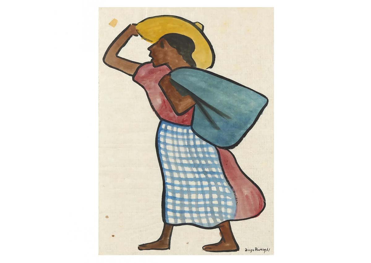
Diego Rivera and Henry Moore works on paper draw bidders to Leland Little Sept. 9
[av_heading heading=’Diego Rivera and Henry Moore works on paper draw bidders to Leland Little Sept. 9′ tag=’h1′ style=” subheading_active=” show_icon=” icon=’ue800′ font=’entypo-fontello’ size=” av-desktop-font-size-title=” av-medium-font-size-title=” av-small-font-size-title=” av-mini-font-size-title=” subheading_size=” av-desktop-font-size=” av-medium-font-size=” av-small-font-size=” av-mini-font-size=” icon_size=” av-desktop-font-size-1=” av-medium-font-size-1=” av-small-font-size-1=” av-mini-font-size-1=” color=” custom_font=” subheading_color=” seperator_color=” icon_color=” margin=’,,35px,’ av-desktop-margin=” av-desktop-margin_sync=’true’ av-medium-margin=” av-medium-margin_sync=’true’ av-small-margin=’,,20px,’ av-mini-margin=” av-mini-margin_sync=’true’ headline_padding=” headline_padding_sync=’true’ av-desktop-headline_padding=” av-desktop-headline_padding_sync=’true’ av-medium-headline_padding=” […]
Leland Little to auction estate of esteemed NC newspaper owner, Mar. 31
HILLSBOROUGH, N.C. – On Friday, March 31, at 9 am Eastern time, Leland Little will auction the estate of the late Frank Daniels, Jr. and his wife Julia Jones Daniels. The Daniels family owned and operated the Raleigh News & Observer for 101 years. Absentee and Internet live bidding will be available through LiveAuctioneers.
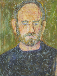
Beauford Delaney portrait on paper sets auction record at Case
KNOXVILLE, Tenn. — Bidders lavished attention and dollars on 20th-century art at Case’s Winter Auction, setting new auction highs for multiple Southern artists. The Jan. 28-29 sale was a success across categories, racking up a 98.4% sell-through rate overall and exceeding the total high estimate by $500,000.
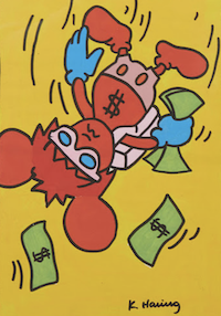
Haring work on paper leads choices at Crescent City, Jan. 20-21
NEW ORLEANS – Original paintings by renowned American artists Keith Haring (1958-1990) and George Louis Viavant (1872-1925), an 89-piece set of Herend porcelain dinnerware and a 110-piece sterling flatware set by Gorham-Alvin are a few of the expected top lots in Crescent City Auction Gallery’s Winter Estates Auction, slated for Friday, January 20 and Saturday, […]
Paper Auctions


TOP