![Cartes taride. Map of Morocco, 1919: Cartes taride. Map of Morocco Title: Cartes Taride pour cyclistes et automobilistes Description: Folding colored map, 32 panels mounted on linen. Production date: 1919. Size: 80x95 cms. Condition: som](https://p1.liveauctioneers.com/5584/333438/180036617_1_x.jpg?height=310&quality=70&version=1718743878)
![](https://p1.liveauctioneers.com/6667/334167/180576045_1_x.jpg?height=104&quality=70&version=1718993103&width=104)
![](https://p1.liveauctioneers.com/6667/334167/180576043_1_x.jpg?height=104&quality=70&version=1718993103&width=104)
![](https://p1.liveauctioneers.com/6667/334167/180576047_1_x.jpg?height=104&quality=70&version=1719266246&width=104)
Maps & Atlases
![Cartes taride. Map of Morocco, 1919: Cartes taride. Map of Morocco Title: Cartes Taride pour cyclistes et automobilistes Description: Folding colored map, 32 panels mounted on linen. Production date: 1919. Size: 80x95 cms. Condition: som](https://p1.liveauctioneers.com/5584/333438/180036617_1_x.jpg?height=310&quality=70&version=1718743878)
![Port of Cartagena, Colombia, 1705 by De Fer: Title: Port of Cartagena, Colombia, 1705 by De Fer Date/Period: 1705 Materials: Hand colored copperplate engraved Size: 15 1/2 x 10 3/4" This map of Cartagena Port by N. De Fer, published in 1705 in P](https://p1.liveauctioneers.com/5584/333309/179943851_1_x.jpg?height=310&quality=70&version=1718737084)
![1702 Homann Map of Northern Italy, Milan Included -- Belli Typus in Italia…: Title: 1702 Homann Map of Northern Italy, Milan Included -- Belli Typus in Italia… Cartographer: J Homann Year / Place: 1702 c., Nurnberg Map Dimension (in.): 19 X 22.5 in. This is a magnificent](https://p1.liveauctioneers.com/5584/333309/179943808_1_x.jpg?height=310&quality=70&version=1718737084)
![Isosahedral Map Patent Model: Joel Elmer Crouch (1899-1957), Cartographic inventor. Patented Icosahedral Map. Original box. Boxes overall 14" x 12" x 5", 12 1/2" x 15" x 6".](https://p1.liveauctioneers.com/1122/332252/179210630_1_x.jpg?height=310&quality=70&version=1717432170)
![WEST INDIES Caribbean Windward Leeward Islands Barbados Pirates? MALLET 1683 map: TITLE OF THE MAP: 'Isles Caribes' (De L'Amerique) The map covers the islands between Puerto Rico and Trinidad. DATE PRINTED: 1683 IMAGE SIZE: Approx Overall page size 13 x 21cm approximately (5 x 8 in](https://p1.liveauctioneers.com/5584/333313/179948259_1_x.jpg?height=310&quality=70&version=1718743877)
![Book & Map: "Some Account of the British Dominions Beyond the Atlantic", 1776, William D: Book & Map: "Some Account of the British Dominions Beyond the Atlantic", 1776, William D](https://p1.liveauctioneers.com/210/334214/180598994_1_x.jpg?height=310&quality=70&version=1719022527)
![COLONIAL CRAFTSMAN CIRCA 1940 MAP OF CAPE COD 21.5" x 27". Framed 23.5" x 29".: COLONIAL CRAFTSMAN CIRCA 1940 MAP OF CAPE CODShows Cape Cod, Martha's Vineyard and Nantucket, surrounded by vignettes of historic sites throughout the region.21.5" x 27". Framed 23.5" x 29".](https://p1.liveauctioneers.com/7634/333049/179792507_1_x.jpg?height=310&quality=70&version=1718199059)
![ANTIQUE MAP OF VIRGINIA.: An old copy of John Smith’s map of Virginia, the original printed in 1606. The visible sheet size 15.5” x 19.5”, Image size 12.5” x 15.25”, Framed overall under glass 22&](https://p1.liveauctioneers.com/6170/333768/180430011_1_x.jpg?height=310&quality=70&version=1718835377)
![Colton's Atlas of the World, 1856, in Two Volumes; plus Africa / Mahdist War Map: 1st and 2nd Items: COLTON'S ATLAS OF THE WORLD, George Woolworth Colton, New York: J.H. Colton and Co., 1856. Two large folio volumes, bound in publisher's brown cloth, with gilt and blind sta](https://p1.liveauctioneers.com/525/332535/179370646_1_x.jpg?height=310&quality=70&version=1717684324)
![Colonial era Virginia and Mid Atlantic, c1714, By Homann: Title: Colonial era Virginia and Mid Atlantic, c1714, By Homann Date/Period: c1714 Materials: Hand colored, copperplate engraved Size: 23 x 19 1/4” This colonial-era map, created by J. B. Homann](https://p1.liveauctioneers.com/5584/333309/179943817_1_x.jpg?height=310&quality=70&version=1718737084)
![1868 (Updated in 1947) British Admiralty Nautical Chart of Malta and Gozo: Title: 1868 (Updated in 1947) British Admiralty Nautical Chart of Malta and Gozo Cartographer: British Admiralty Year / Place: 1868 but 1947, London Map Dimension (in.): 25.8 X 38.5 in. This is excell](https://p1.liveauctioneers.com/5584/333309/179943805_1_x.jpg?height=310&quality=70&version=1718737084)
![Bahamas. Turks & Caicos. New Providence. Nassau plan. 53x67cm. STANFORD 1896 map: CAPTION PRINTED BELOW PICTURE: 'The Bahamas // Island of New Providence // Nassau' DATE PRINTED: 1896 IMAGE SIZE: Approx 53.0 x 66.0cm, 20.75 x 26 inches (Large); Please note that this is a folding ma](https://p1.liveauctioneers.com/5584/333313/179948458_1_x.jpg?height=310&quality=70&version=1718743877)
![After William Faden, Revolutionary War Map of NY: After William Faden (British, 1749-1836), "A Plan of the Operations of the Kings Army under the Command of General Sr. William Howe, K.B. in New York and East New Jersey", copy on paper, 17 1/2" x 12"](https://p1.liveauctioneers.com/7247/333484/180078520_1_x.jpg?height=310&quality=70&version=1718412243)
![Bound Map of Columbia County: Large, hand-colored bound in map, Published my Dolph & Stewart.](https://p1.liveauctioneers.com/7247/333484/180078807_1_x.jpg?height=310&quality=70&version=1718412243)
![NICHOLAS SCULL & GEORGE HEAP’S ENGRAVED MAP OF PHILADELPHIA 1777 Sheet 16" x 13.25".: NICHOLAS SCULL & GEORGE HEAP’S ENGRAVED MAP OF PHILADELPHIA1777"Plan of the City and Environs of Philadelphia". Engraved by Will Faden.Sheet 16" x 13.25".](https://p1.liveauctioneers.com/7634/333445/180037679_1_x.jpg?height=310&quality=70&version=1718397629)
![ENGRAVING SURVEY MAP OF SOUTH CAROLINA AND GEORGIA: This original engraved map is a Survey of Chart no.55 from Hunting island to Ossabaw Island from South Carolina and Georgia. Issued: 1873 Dimensions: 43"L x 35.25"H Country of Origin: UNITED STATES](https://p1.liveauctioneers.com/6087/333784/180322518_1_x.jpg?height=310&quality=70&version=1718728239)
![18th c. Hand Drawn Map of Africa: 18th c. hand drawn map of Africa. Signed ….Briggs. Sight 9 1/2" x 11 1/2", overall 11 1/2" x 13 1/2". Provenance: The Edward Herrmann Estate, Salisbury Connecticut.](https://p1.liveauctioneers.com/1122/332252/179210680_1_x.jpg?height=310&quality=70&version=1717432170)
![Vintage Wool Needlepoint Embroidered Map of Nantucket Island: Vintage Wool Needlepoint Embroidered Map of Nantucket Island, in Nantucket red, with Nantucket Island flag, and artist's signature daisy flower symbol lower left. Sight 9.5 in. x 15 in. Overall 16.5 i](https://p1.liveauctioneers.com/6681/333076/179801209_1_x.jpg?height=310&quality=70&version=1718285153)
![1593 de Jode Maps of Eastern Germany (Saxony Area) and Western Germany -- Mansfeldiae Comitatus ...: Title: 1593 de Jode Maps of Eastern Germany (Saxony Area) and Western Germany -- Mansfeldiae Comitatus ... [on sheet with] Clivensis et Iuliacensis Ducatum Cartographer: G De Jode Year / Place: 1593,](https://p1.liveauctioneers.com/5584/333309/179943845_1_x.jpg?height=310&quality=70&version=1718737084)
![1876 Bachelder View of Pickett's Charge at Gettysburg -- Battle of Gettysburg (Repulse of: Title: 1876 Bachelder View of Pickett's Charge at Gettysburg -- Battle of Gettysburg (Repulse of Longstreet's Assault) Cartographer: J Bachelder Year / Place: 1876, Boston Map Dimension (in.): 14.3 X](https://p1.liveauctioneers.com/5584/333309/179943857_1_x.jpg?height=310&quality=70&version=1718737084)
![1720 Homann Map of the Caspian Sea Region -- Provinciarum Persicarum Kilaniae nempe Chirvaniae: Title: 1720 Homann Map of the Caspian Sea Region -- Provinciarum Persicarum Kilaniae nempe Chirvaniae Dagestaniae Cartographer: J Homann Year / Place: 1720, Nurnberg Map Dimension (in.): 19.2 X 22.8 i](https://p1.liveauctioneers.com/5584/333309/179943814_1_x.jpg?height=310&quality=70&version=1718737084)
![John Speed's 1676 Map of Virginia and Maryland: John Speed's 1676 Map of Virginia and Maryland copperplate engraving with color from Speed's Atlas of America, depicting the region in and around the Chesapeake Bay, with mountains real and imagined t](https://p1.liveauctioneers.com/250/333695/180278736_1_x.jpg?height=310&quality=70&version=1718649382)
![Two Early Maps of the American Revolution's Southern Theater: Two Early Maps of the American Revolution's Southern Theater to include: A New and Accurate Map of North Carolina and Part of South Carolina with the Field of Battle between Earl Cornwallis and Genera](https://p1.liveauctioneers.com/250/333695/180278744_1_x.jpg?height=310&quality=70&version=1718649382)
![English Cartographer John Russell's Map of the American South: English Cartographer John Russell's Map of the American South (London, circa 1795) titled Map of the Southern States of America, Comprehending Maryland, Virginia, Kentucky, Territory Sth of the Ohio,](https://p1.liveauctioneers.com/250/333695/180278742_1_x.jpg?height=310&quality=70&version=1718649382)
![MAP "PLAN OF THE TOWN OF BOSTON" Circa 1775 11.75" x 5.75" sight. Framed 16.5" x 9.5".: MAP "PLAN OF THE TOWN OF BOSTON"Circa 1775"Plan of the town of Boston with the attack on Bunkers-Hill in the peninsula of Charlestown the 17th of June 1775".11.75" x 5.75" sight. Framed 16.5" x 9.5".](https://p1.liveauctioneers.com/7634/333445/180037672_1_x.jpg?height=310&quality=70&version=1718397629)
![Ortelius' landmark map of Americas: Heading: (America) Author: Ortelius, Abraham Title: Americae Sive Novi Orbis, Nova Descriptio Place Published: Antwerp Publisher: Date Published: 1579 Description: Copper-engraved m](https://p1.liveauctioneers.com/642/332628/179408734_1_x.jpg?height=310&quality=70&version=1717729056)
![CIRCA 1775 MAP OF BOSTON 10" x 7.5". Framed.: CIRCA 1775 MAP OF BOSTON"A New and Correct Plan of the Town of Boston" from the "Gentleman's Magazine", November 1775.10" x 7.5". Framed.](https://p1.liveauctioneers.com/7634/333445/180037675_1_x.jpg?height=310&quality=70&version=1718397629)
![1769 Tirion Map of Japan -- Nieuwe Kaart van't Keizerryk Japan…: Title: 1769 Tirion Map of Japan -- Nieuwe Kaart van't Keizerryk Japan… Cartographer: I Tirion Year / Place: 1769, Amsterdam Map Dimension (in.): 10.8 X 12.4 in. This is a rather handsome map of](https://p1.liveauctioneers.com/5584/333309/179943824_1_x.jpg?height=310&quality=70&version=1718737084)
![VERY RARE Map of Washington D.C & Georgetown Land Reclamation, From a Supreme Court Exhibit: Title: VERY RARE Map of Washington D.C & Georgetown Land Reclamation, From a Supreme Court Exhibit 1879-1899 Date/Period: c1879-1899 Size: 30” x 17” In Washington D.C. and Georgetown, this](https://p1.liveauctioneers.com/5584/333309/179943854_1_x.jpg?height=310&quality=70&version=1718737084)
![1645 Jansson Map of Portugal and Parts of Spain -- Portugallia et Algarbia quae olim Lusitania: Title: 1645 Jansson Map of Portugal and Parts of Spain -- Portugallia et Algarbia quae olim Lusitania Cartographer: J Jansson Year / Place: 1645, Amsterdam Map Dimension (in.): 15.1 X 19.6 in. This is](https://p1.liveauctioneers.com/5584/333309/179943827_1_x.jpg?height=310&quality=70&version=1718737084)
![EARLY MAP OF COASTAL MAINE 30" x 42" sight. Framed 32" x 45".: EARLY MAP OF COASTAL MAINEPublished by Des Barres, 1776.30" x 42" sight. Framed 32" x 45".](https://p1.liveauctioneers.com/7634/333445/180037678_1_x.jpg?height=310&quality=70&version=1718397629)
![Barcelona, Spain, 1745, By N. Tindal: Title: Barcelona, Spain, 1745, By N. Tindal Date/Period: c1745 Materials: Hand colored copperplate engraved Size: 19 x 14" This map of Barcelona, Spain, created around 1745 by N. Tindal and engraved b](https://p1.liveauctioneers.com/5584/333309/179943848_1_x.jpg?height=310&quality=70&version=1718737084)
![General Map of the West Indies'. West sheet only. Bryan EDWARDS. Caribbean 1794: CAPTION PRINTED BELOW PICTURE: 'A New Map of the West Indies for the History of the British Colonies by Bryan Edwards' DATE PRINTED: 1794 IMAGE SIZE: Approx 71.5 x 59.0cm, 28 x 23 inches (Large); Plea](https://p1.liveauctioneers.com/5584/333313/179948062_1_x.jpg?height=310&quality=70&version=1718743877)
![St. Paul’s Travels, Middle East and Parts of Europe by N. Visscher: Title: St. Paul’s Travels, Middle East and Parts of Europe by N. Visscher Date/Period: c1657 Materials: Hand colored copperplate engraved Size: 19 x 14” This map, titled "The Journey of St](https://p1.liveauctioneers.com/5584/333309/179943811_1_x.jpg?height=310&quality=70&version=1718737084)
News about Maps & Atlases
![Historic maps and atlases chart course to Swann Dec. 7](https://www.liveauctioneers.com/news/wp-content/uploads/2023/11/165833907_1_x.webp)
Historic maps and atlases chart course to Swann Dec. 7
[av_heading heading=’Historic maps and atlases chart course to Swann Dec. 7′ tag=’h1′ style=” subheading_active=” show_icon=” icon=’ue800′ font=’entypo-fontello’ size=” av-desktop-font-size-title=” av-medium-font-size-title=” av-small-font-size-title=” av-mini-font-size-title=” subheading_size=” av-desktop-font-size=” av-medium-font-size=” av-small-font-size=” av-mini-font-size=” icon_size=” av-desktop-font-size-1=” av-medium-font-size-1=” av-small-font-size-1=” av-mini-font-size-1=” color=” custom_font=” subheading_color=” seperator_color=” icon_color=” margin=’,,35px,’ av-desktop-margin=” av-desktop-margin_sync=’true’ av-medium-margin=” av-medium-margin_sync=’true’ av-small-margin=’,,20px,’ av-mini-margin=” av-mini-margin_sync=’true’ headline_padding=” headline_padding_sync=’true’ av-desktop-headline_padding=” av-desktop-headline_padding_sync=’true’ av-medium-headline_padding=” av-medium-headline_padding_sync=’true’ av-small-headline_padding=” av-small-headline_padding_sync=’true’ av-mini-headline_padding=” av-mini-headline_padding_sync=’true’ […]
![Celebration of Scottish engineering on display at Lyon & Turnbull Feb. 7](https://www.liveauctioneers.com/news/wp-content/uploads/2024/01/Screenshot-2024-01-25-at-9.14.33 AM.png)
Celebration of Scottish engineering on display at Lyon & Turnbull Feb. 7
EDINBURGH – A cache of material from a well-known Scottish engineering dynasty will be offered at Lyon & Turnbull. The Rare Books, Manuscripts, Maps & Photographs auction on Wednesday, February 7 includes 50 lots from the Stevenson family – designers across four generations of many of the U.K.’s lighthouses. Absentee and Internet live bidding will […]
![Dickens & Twain set world records at Potter & Potter Aug. 28](https://www.liveauctioneers.com/news/wp-content/uploads/2021/09/395-1.jpg)
Dickens & Twain set world records at Potter & Potter Aug. 28
CHICAGO – Potter and Potter‘s spectacular August 28 Fine Books and Manuscripts Sale was the company’s highest-grossing auction to date. After a day of spirited bidding, 107 lots realized between $1,000-4,999; 22 lots realized between $5,000-9,999; and 16 lots broke the five digit mark.
![Jasper52 vintage map auction Nov. 5 going global](https://www.liveauctioneers.com/news/wp-content/uploads/2019/10/77325761_3_x.jpg)
Jasper52 vintage map auction Nov. 5 going global
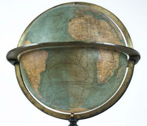
NEW YORK – A 19th century French terrestrial globe tops an auction of vintage maps that will be conducted by Jasper52 on Tuesday, Nov. 5. Fifteen globes and more than 130 maps and atlases are offered in the online auction. Bid absentee or live online exclusively through LiveAuctioneers.