


Ink Transportation & Travel Collectibles
693 Results
Sort by:
Best Match
Categories
Transportation & Travel CollectiblesMaps & Atlases
Location & Shipping
Payment Method
House Rating
Creator
Style / Period
Material / Technique
Auction House
Current Bid
Est. Price Range
Ink×


![1772 GREEK BIBLE NEW TESTAMENT antique BIBLIA LATIN text MAP NOVUM TESTAMENTUM: Lugduni Batavorum, Apud Wetstenios Londini, Apud Johannem Nourse; 1772 Size 3 3/4 by 6 1/4" Folding map [6] 699 pp. Repaired spine Some toning. Otherwise very good condition Text in Greek and Latin in](https://p1.liveauctioneers.com/5584/332364/179251568_1_x.jpg?height=310&quality=70&version=1718142848)


![Hawaii & American Samoa. Pictorial state map by Ruth Taylor White 1935 old: CAPTION PRINTED BELOW PICTURE: Territory of Hawaii // [American] Samoa DATE PRINTED: 1935 IMAGE SIZE: Approx 30.5 x 23.5cm, 12 x 9.25 inches (Large) TYPE: Vintage colour pictorial map. The buyer shoul](https://p1.liveauctioneers.com/5584/332711/179480008_1_x.jpg?height=310&quality=70&version=1718142737)


View:
24
News about Ink Transportation & Travel Collectibles
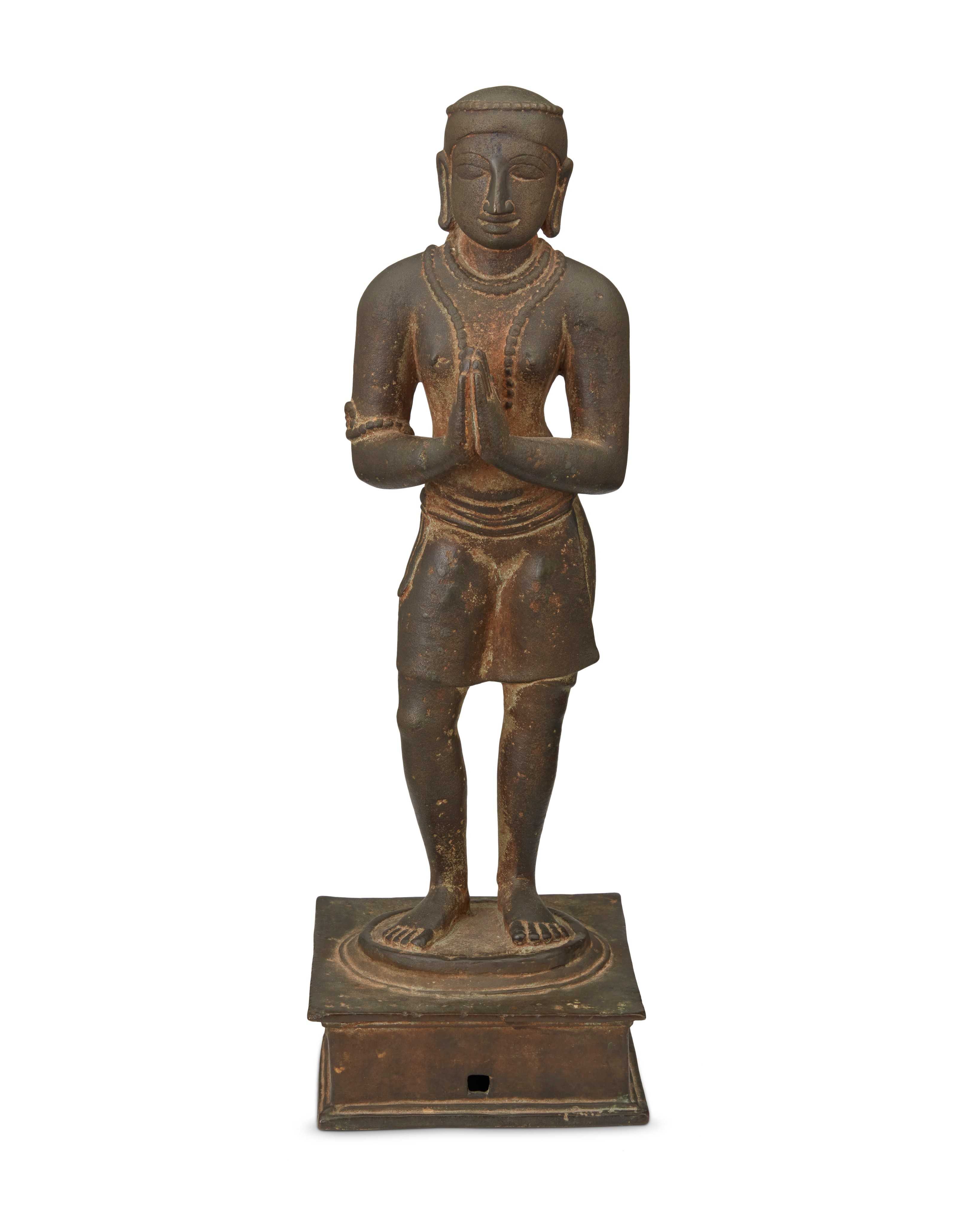
Moran to feature Spink collection of Indian art April 9-10
LOS ANGELES — John Moran Auctioneers will present The Traditional Collector: Featuring The Collection of Walter and Nesta Spink, taking place Tuesday, April 9 and Wednesday, April 10. The sale features 440 lots, including fine and decorative art, furnishings, tableware, lighting, and clocks. The catalogs are now available for viewing and bidding at LiveAuctioneers. As […]
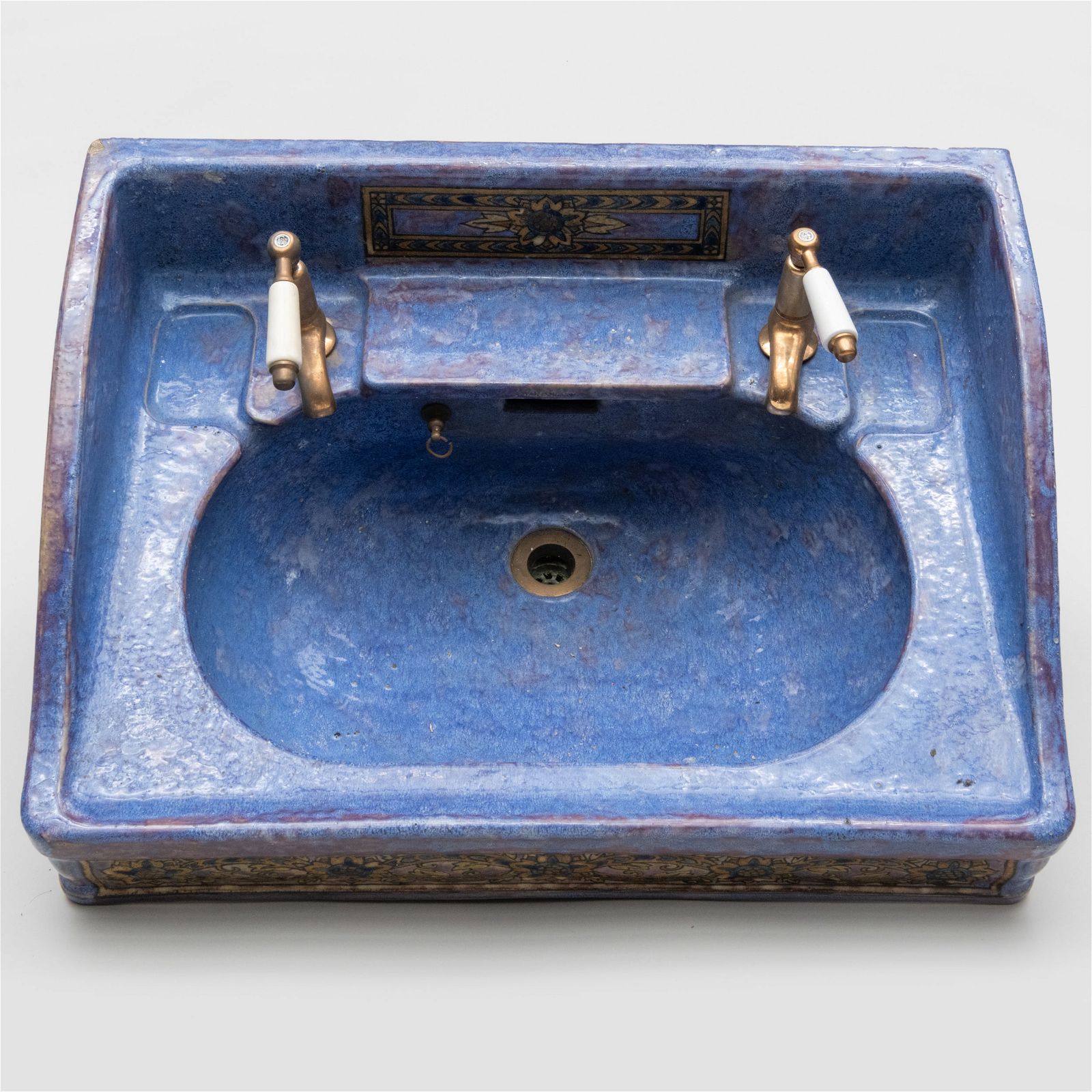
Getty collection bidders snapped up everything and the washroom sink at Stair
HUDSON, N.Y. – For those who had not yet drunk their fill of the Ann and Gordon Getty collection, there was a chance to imbibe once last time on March 1. A day later than planned, Stair Galleries sold the final 340 lots under the poetic title A Confluence of 19th and 20th Century Design. Results […]
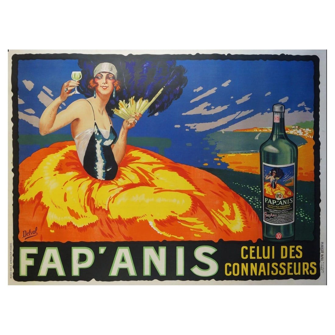
Circa-1930 poster for a French drink that didn’t exist headlines Jan. 2 sale in New York
NEW YORK – On Tuesday, January 2, starting at 6 pm Eastern time, Jasper52 will hold a sale titled The Artful Palette: Prints, Fine Art & More!, a 92-lot auction featuring just that – prints, fine art, and more. Absentee and Internet live bidding will be available through LiveAuctioneers. Leading the highlights is a circa-1930 […]
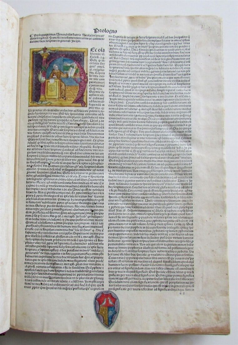
Jasper52 presents Ink of Ages: 15th-19th Century Antique Books Dec. 26
[av_heading heading=’Jasper52 presents Ink of Ages: 15th-19th Century Antique Books Dec. 26′ tag=’h1′ style=” subheading_active=” show_icon=” icon=’ue800′ font=’entypo-fontello’ size=” av-desktop-font-size-title=” av-medium-font-size-title=” av-small-font-size-title=” av-mini-font-size-title=” subheading_size=” av-desktop-font-size=” av-medium-font-size=” av-small-font-size=” av-mini-font-size=” icon_size=” av-desktop-font-size-1=” av-medium-font-size-1=” av-small-font-size-1=” av-mini-font-size-1=” color=” custom_font=” subheading_color=” seperator_color=” icon_color=” margin=’,,35px,’ av-desktop-margin=” av-desktop-margin_sync=’true’ av-medium-margin=” av-medium-margin_sync=’true’ av-small-margin=’,,20px,’ av-mini-margin=” av-mini-margin_sync=’true’ headline_padding=” headline_padding_sync=’true’ av-desktop-headline_padding=” av-desktop-headline_padding_sync=’true’ av-medium-headline_padding=” av-medium-headline_padding_sync=’true’ av-small-headline_padding=” av-small-headline_padding_sync=’true’ av-mini-headline_padding=” […]
TOP