

Done
New York, NY, United States
Auction Details
Mapping the Globe: Antique World Maps Auction
Chairish Auctions
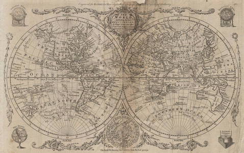
This auction offers antique maps of the Ancient and Modern Worlds, and of the Western Hemisphere and Eastern Hemisphere, including maps of the Americas, and maps straddling more than one continent. World maps on different projections including Mercator projection, Gnomic Projection, and the world in Twin Hemispheres. Maps of European Empires covering more than one continent including the British Empire, Portuguese and Spanish colonial possessions etc
LiveAuctioneers Purchase Protection
Get the confidence you need to bid on the items you love.Learn More
Complete payment via LiveAuctioneers to qualify.

0049: ARMILLARY SPHERE. Cercle Meridien. Astrolabe. MALLET 1683 old antique printEst. $90-$110Lot Passed

0050: EASTERN HEMISPHERE 'Carte Generale'. Australia coast incomplete. MALLET 1683 mapEst. $50-$60Lot Passed

0051: TALLIS ILLUSTRATED ATLAS TITLE PAGE. Figures represent four continents 1851Est. $200-$250Lot Passed

0052: AUSTRALASIA POLYNESIA PACIFIC OCEAN. On Gnomonic Projection. SDUK 1856 old mapEst. $80-$100Lot Passed

0053: WORLD COMMUNICATIONS. air/shipping routes railways. BARTHOLOMEW 1952 old mapEst. $60-$70Lot Passed

0054: World Mercator's on projection. India in relation to the British Empire 1931 mapEst. $50-$60Lot Passed
![Mappe-monde sur le plan de l’Equateur, hemisphere Méridional. BONNE 1787: TITLE/CONTENT OF MAP: Mappe-monde sur le plan de l’Equateur, hémisphère Méridional [Map of the World on the plane of the Equator, Southern hemisphere] DATE PRINTED: 1787 IMAGE](https://p1.liveauctioneers.com/5584/296524/157573019_1_x.jpg?height=310&quality=70&version=1690316768)
0055: Mappe-monde sur le plan de l’Equateur, hemisphere Méridional. BONNE 1787Est. $80-$100Lot Passed
![World on Mercator's Projection. West sheet. Americas. 67x55cm. STANFORD 1904 map: CAPTION PRINTED BELOW PICTURE: A Chart of the World on Mercator's Projection shewing the principal Ocean Steam Routes, the Submarine Telegraphs, &c. [West Sheet] DATE PRINTED: 1904 IMAGE SIZE: Approx](https://p1.liveauctioneers.com/5584/296524/157573020_1_x.jpg?height=310&quality=70&version=1690316768)
0056: World on Mercator's Projection. West sheet. Americas. 67x55cm. STANFORD 1904 mapEst. $150-$200Lot Passed

0057: WORLD ON MERCATOR'S PROJECTION Chinese Outer Manchuria SDUK 1857 old mapEst. $150-$200Lot Passed

0058: BRITISH EMPIRE. World Mercator. Currents. Steamship routes. JOHNSTON 1895 mapEst. $110-$150Lot Passed

0060: World Standard Times, Commercial languages, coinages & currencies 1927 old mapEst. $80-$100Lot Passed

0061: WORLD KNOWN TO ANCIENTS. Herodotus Ptolemy Pliny Hanno. On 2 sheets 1857 mapEst. $90-$110Lot Passed

0062: WESTERN HEMISPHERE.Falls rivers mountains.No Mt McKinley. RAPKIN/TALLIS 1851 mapEst. $350-$400Lot Passed


0064: World on Mercator's Projection by John Dower. British Empire in pink 1876 mapEst. $70-$80Lot Passed
Sold

0065: Zoological Geography. Pachydermata - thick-skinned animals distribution 1856 mapEst. $30-$40
![HEAVENS & EARTH. 5 zones according to Thales & Pythagoras. MALLET 1683 old map: TITLE OF MAP (NOT PRINTED ON THE PAGE):[Covenance des Zones du Ciel & de la Terre] (De la Sphere) Shows Australia with a very inaccurate (and incomplete) shape. Partial outline of Terra Australis,](https://p1.liveauctioneers.com/5584/296524/157573030_1_x.jpg?height=310&quality=70&version=1690316768)
0066: HEAVENS & EARTH. 5 zones according to Thales & Pythagoras. MALLET 1683 old mapEst. $40-$50Lot Passed
![Géographie Ancienne. World as known to the Ancients. MALTE-BRUN c1871 old map: TITLE/CONTENT OF MAP: 'Géographie Ancienne [Ancient World]' DATE PRINTED: c1871 IMAGE SIZE: Approx 25.5 x 34.0cm, 10 x 13.25 inches (Large) TYPE: Antique 19th century engraved atlas map with](https://p1.liveauctioneers.com/5584/296524/157573031_1_x.jpg?height=310&quality=70&version=1690316768)
0067: Géographie Ancienne. World as known to the Ancients. MALTE-BRUN c1871 old mapEst. $40-$50Lot Passed

0068: WORLD WAR 2. Neutral/Belligerent Naval bases Occupied Poland/Manchuria 1940 mapEst. $70-$80Lot Passed
![Mappe-monde sur le plan de l’Equateur, hemisphere Septentrional. BONNE 1787: TITLE/CONTENT OF MAP: Mappe-monde sur le plan de l’Equateur, hémisphère Septentrional [Map of the World on the plane of the Equator, Northern hemisphere] DATE PRINTED: 1787 IMAGE](https://p1.liveauctioneers.com/5584/296524/157573033_1_x.jpg?height=310&quality=70&version=1690316768)
0069: Mappe-monde sur le plan de l’Equateur, hemisphere Septentrional. BONNE 1787Est. $60-$70Lot Passed

0070: The World on Mercator's Projection by John Dower 1845 old antique map chartEst. $100-$120Lot Passed
![ARMILLARY SPHERE. De l'Horizon. Astrolabe. Circle circumference. MALLET 1683: TITLE OF PRINT (NOT PRINTED ON THE PAGE):[De l'Horizon] (De la Sphere) DATE PRINTED: 1683 IMAGE SIZE: Approx Overall page size 13 x 21cm approximately (5 x 8 inches); image size 10.5 x 14.5cm](https://p1.liveauctioneers.com/5584/296524/157573035_1_x.jpg?height=310&quality=70&version=1690316768)
0071: ARMILLARY SPHERE. De l'Horizon. Astrolabe. Circle circumference. MALLET 1683Est. $50-$60Lot Passed

0072: OLD WORLD. British Spanish Portuguese empires trade routes 1500 1650 1907 mapEst. $40-$50Lot Passed

0073: WORLD ON MERCATOR'S PROJECTION unusually Pacific-centred. JOHNSTON 1915 mapEst. $40-$50Lot Passed
Auction Details

Bid Increments
PriceBid Increment
$0$1
$10$5
$100$10
$200$20
$500$50
$1,000$100
$2,000$200
$5,000$500
$10,000$1,000
$20,000$2,000
TOP