

Done
New York, NY, United States
Auction Details
Mapping the Globe: Antique World Maps Auction
Chairish Auctions
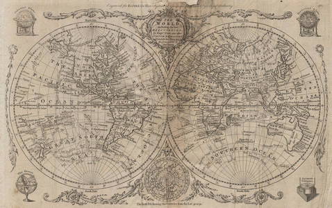
This auction offers antique maps of the Ancient and Modern Worlds, and of the Western Hemisphere and Eastern Hemisphere, including maps of the Americas, and maps straddling more than one continent. World maps on different projections including Mercator projection, Gnomic Projection, and the world in Twin Hemispheres. Maps of European Empires covering more than one continent including the British Empire, Portuguese and Spanish colonial possessions etc
LiveAuctioneers Purchase Protection
Get the confidence you need to bid on the items you love.Learn More
Complete payment via LiveAuctioneers to qualify.

0172: World chart of isothermal lines. Mean annual temperature. GEORGE AIKMAN 1856 mapEst. $40-$50Lot Passed

0173: FRENCH EMPIRE Colonial Français. French West/Equatorial Africa &c 1931 old mapEst. $100-$120Lot Passed

0174: Western Hemisphere of the Earth on a plane. Davis Land. BOWEN 1776 old mapEst. $150-$200Lot Passed

0175: World in twin Hemispheres. Mountains and Rivers. BARTHOLOMEW 1870 old mapEst. $80-$100Lot Passed

0176: Table of Mountain Chains. Main summits altitudes. Dhaulagiri. LIZARS 1842Est. $110-$150Lot Passed

0177: AMERICAS. Gnomonic Projection. Texas Republic. USA Mexico. SDUK 1846 old mapEst. $450-$550Lot Passed


0179: Western hemisphere. North & South America. Polynesia. THOMSON 1830 old mapEst. $300-$350Lot Passed

0180: Vents de Traverse. Atlantic & Indian Ocean trade winds BELLIN/SCHLEY 1763 mapEst. $80-$100Lot Passed

0181: AUSTRALASIA POLYNESIA PACIFIC OCEAN. On Gnomonic Projection. SDUK 1844 old mapEst. $90-$110Lot Passed

0182: OVERLAND ROUTE TO INDIA. Ship France Germany Euphrates.TALLIS/RAPKIN 1851 mapEst. $200-$250Lot Passed

0183: SOUTH POLE ANTARCTIC. Gnomonic Projection. To 45˚ S Latitude. SDUK 1846 mapEst. $90-$110Lot Passed

0184: WORLD. Air current & wind distribution. Hurricane tracks. Trade winds 1850 mapEst. $40-$50Lot Passed

0185: THE WORLD. 'Shewing the voyages of Captain Cook'. TALLIS/RAPKIN 1851 old mapEst. $300-$350Lot Passed

0186: Worldl. Cotidal Ocean lines currents Meteorology plants animals COLTON 1863 mapEst. $50-$60Lot Passed

0187: WORLD MERCATOR showing mail routes to British colonies. RAPKIN/TALLIS 1851 mapEst. $350-$400Lot Passed

0188: Tavola Sferica II. Earth meridians tropics poles. Trade winds. ZATTA 1779 mapEst. $200-$250Lot Passed

0189: AMERICAS Gnomonic Projection. Texas, Western US is Mexican SDUK 1844 old mapEst. $250-$300Lot Passed

0190: AFRICA South Europe Brazil Gnomonic Projection. Mountains of Kong. SDUK 1846 mapEst. $60-$70Lot Passed

0191: WORLD ON MERCATOR'S PROJECTION. Pre-Mexican-American war. SDUK 1844 old mapEst. $150-$200Lot Passed
SOLD

0192: General Chart on Mercators Projection. World. Cook's route. PAYNE 1798 old mapEst. $60-$70

0193: WORLD. Vegetation. Ocean Currents. Food crops. Agricultural commodities 1944 mapEst. $40-$50Lot Passed

0194: AMERICAS. The mountain chains of North & South America 1850 old antique mapEst. $40-$50Lot Passed

0195: EUROPEAN COLONIES.Peace Utrecht 1713; France Britain America;W Indies 1903 mapEst. $50-$60Lot Passed
Auction Details

Bid Increments
PriceBid Increment
$0$1
$10$5
$100$10
$200$20
$500$50
$1,000$100
$2,000$200
$5,000$500
$10,000$1,000
$20,000$2,000
Preview
This preview is online only.
New York, NY 10016
USA
Buyer's Premium
- 15%
Terms & Conditions
1. All bidders and buyers shall present satisfying documentation prior to the approval of this auction.
2. This auction contains items with 'no reserve' or 'reserve' pricing, as indicated in each item description. An item with 'no reserve' means there is no minimum price set, so the item is guaranteed to sell regardless of what the winning bid price is. An item containing a 'reserve' means that there is a minimum price that the bidding must reach to sell.
3. All property is sold 'as is' and neither Jasper52 nor the listing agent makes any warranties or representation or any kind or nature with respect to the property, and in no event shall they be responsible for the correctness, nor deemed to have made any representation or warranty, or description, genuineness, authorship, attribution, provenance, period, culture, source, origin, or condition of the property and no statement made at the sale, or in the bill of sale, or invoice, or in the catalog, or elsewhere shall be deemed such a warranty of representation or an assumption of liability. Prospective buyers are urged to inspect those lots in which they have an interest.
4. Jasper52 will contact the winning bidders with shipping information after the auction. Buyer pays shipping cost indicated in the auction description, as well as any applicable taxes, duties or fees for items originating from outside of the buyer's home country. For buyer's outside of the Continental United States, the Jasper52 team will provide an introduction to global parcel or white glove shipping partners upon request.
5. Except as provided in paragraph 1 above, the highest bidder as determined by Jasper52 shall be the purchaser. In the case of a disputed bid, the auctioneer shall have sole discretion in determining the purchaser and may also, at his or her election, withdraw the lot or reoffer the lot for sale. The auctioneer shall have sole discretion to refuse any bid, or refuse to acknowledge any bidder.
6. All merchandise purchased is payable directly to Jasper52 and must be paid for upon receipt of the invoice. Invoices are sent the day after the auction.. All merchandise must be removed from Jasper52 within fourteen business days of the auction, and in no event shall Jasper52 have any liability for any damage to property left on its premises for more than fourteen business days after the sale. If any property has not been removed within fourteen business days from the date of sale, at the option of Jasper52 (a) the merchandise may be transferred to and stored at a bonded warehouse and the purchaser agrees to pay all transfer and storage expenses, and/or (b) Jasper52 may place the merchandise in a subsequent auction, without reserve, to be sold to the highest bidder, and after deducting the standard commission and any additional charges that may apply, remit the proceeds to the purchaser.
7. Acceptable forms of payment are VISA, MasterCard, American Express, or Discover, payable in U.S. dollars. Invoice must be paid in full. Jasper52 reserves the right to hold merchandise purchased until the funds have cleared.
8. If the purchaser breaches any of its obligations under these Conditions of Sale, including its obligation to pay in full the purchase price of all items for which it was the highest successful bidder, Jasper52 may exercise all of its rights and remedies under the law including, without limitation, (a) canceling the sale and applying any payments made by the purchaser to the damages caused by the purchaser's breach, and/or (b) offering at public auction, without reserve, any lot or item for which the purchaser has breached any of its obligations, including its obligation to pay in full the purchase price, holding the purchaser liable for any deficiency plus all costs of sale.
9. Jasper52 may, in its discretion and at purchaser's request, package and arrange for delivery as directed by the purchaser. In such event, purchaser agrees that (a) all such packaging, handling and delivery is at the sole risk of the purchaser and that Jasper52 shall have no liability for any loss or damage to such items, and (b) purchaser shall pay in advance, all packaging expenses, including labor, materials, carrier's fees and all insurance charges. Please arrange seventy-two hours in advance for collection and delivery. Jasper52 shall not be responsible for obtaining any permits or licenses on behalf of purchaser and no sale shall be cancelled or refunded for lack of purchaser's noncompliance with permitting and licensing issues. JASPER52 WILL NOT CANCEL SALE DUE TO SHIPPING. Should items be returned to the Jasper52 listing agent due to incorrect address provided at checkout or shipping errors, the buyer will be obligated to make a 2nd payment for shipping, and will be liable for other fees and taxes that were associated with the lot(s) being directed back. Should the buyer not honor the obligation, they will violate the terms of the sale. Should the buyer want to be released from the sale after the initial payment, it is at Jasper52's discretion to honor that request. However, the shipping cost and excess fees would be withheld from the refund as services rendered.
10. A premium equal to 15% of the final bid price will be applied to each lot sold, to be paid by the buyer as part of the purchase price.
11. Bidding on any item indicates your acceptance of these terms and all other terms printed within, posted, and announced at the time of sale.
12. All sales are final and no refunds will be granted.
13. When you win an item, we will send you an invoice for it. If you have a credit card on file with LiveAuctioneers, it will be charged the balance on the invoice 24 hours after the invoice is sent.
Autopay
If you have not contacted Jasper52 to arrange payment within 3 days of the time that invoice is sent, we will charge the credit card you used to register for the auction for the amount of your invoice.
Sales Tax
Online purchases from Jasper52 may be subject to sales tax. Please see the following for more details. If you are tax-exempt, you can submit your tax-exempt certificate to prevent the collection of tax. Learn more about tax-exemption.
TOP