Sold20201842 Chart of World Mountains and RiversAuthor: Scott Title: 1842 Chart of World Mountains and Rivers Medium: Ink on Paper Dimensions: 11.5"X9" Description: Chart of world's mountains and rivers dated 1842. Copper plate chart. Engraved by RSee Sold Price
Sold20201888 World Rivers and Mountains ChartTitle: 1888 World Rivers and Mountains Chart Author: Watson Medium: Ink on Paper Dimensions: 11.5"X14" Description: Chart detailing world's river lengths and mountain heights dated 1888. Published bySee Sold Price
Sold2017Gray World Map, Mountains and Rivers, 1875Map: Gray World Mountains and Rivers - Mountains and Rivers Cartographer: O Gray Date: 1875 Origin: Philadelphia Size: 16.4 x 25 inches A very handsome and colorful double-page chart showing the majorSee Sold Price
Sold20211892 World's River and MountainsAuthor: Cram Title: 1892 World's River and Mountains Medium: Ink on Paper Dimensions: 11"X14.5" World's Rivers and Mountains chart dated 1892. Printed and published by George Cram in Chicago. Part ofSee Sold Price
Sold2017Rand McNally: Antique World Map, Rivers & MountainsMap: Rand McNally World Map and Comperative Chart of Rivers and Mountains -- The World on Mercator's Projection [verso] Western Hemisphere Cartographer: Rand McNally Year / Place: 1898, Chicago Map DiSee Sold Price
Sold2022Scarce format of Comparative Mts. & Rivers, 1864Johnson’s reimagined and re-engraved set of five comparative charts of the Mountains & Rivers of the World, presented in the very uncommon vertical format and organized by continent. Quite a deSee Sold Price
Sold2023Scarce format of Comparative Mts. & Rivers, Johnson 1865Johnson’s reimagined and re-engraved set of five comparative charts of the Mountains & Rivers of the World, presented in the very uncommon vertical format and organized by continent. Quite a depSee Sold Price
Sold2023Scarce format of Comparative Mts. & Rivers, Johnson 1864Johnson’s reimagined and re-engraved set of five comparative charts of the Mountains & Rivers of the World, presented in the very uncommon vertical format and organized by continent. Quite a depSee Sold Price
Sold2017Mitchell: Rivers & Mountains of the World, 1848Lengths of the Principal Rivers in the World, Heights of the Principal Mountains of the World, S. Augustus Mitchell, 1848. 13 x 16 inches. Interesting and very desirable chart illustrating the principSee Sold Price
Sold20201855 Johnston World Map with Comperative Chart ofTitle/Content: 1855 Johnston World Map with Comperative Chart of Rivers and Mountains -- The World in Hemispheres, with Comparative Views of the Heights of ths Principal Mountains and Lengths of the PSee Sold Price
Sold2023Ainsworth, James 1850's LG Folio Print. River and Mountain Chart"Comparative View of the Principal Rivers and Mountains of the World" Large Folio Steel Engraving (Reverse side blank) Published 1851-55, Manchester for "The Imperial Journal of Art, Science, MechanicSee Sold Price
Sold2022One of best Mts and Rivers charts from 19th century (1862)Iconic layout of the mountains and rivers of the world in surprisingly sound condition is both highly informative and pleasing to the eye. The top half displays over 40 rivers and continuous waterwaysSee Sold Price
Sold2023Thomson, John (Pub) 1825 Antique Mountain & River Chart"View of some of the principal Rivers in the World" Copper Engraved Map Published 1825 by John Thomson, Edinburgh for "The Edinburgh School Atlas" by N. R. Hewitt. Maps Engraved by Hewitt. Original OuSee Sold Price
Sold20231844 Chart of Comparative Mountains and RiversEngland, 19th century. A wonderful example of Adam & Charles Black's depiction various mountain elevations of the world. It also captures various rivers in immense detail. Overall good conditSee Sold Price
Sold20211850 Black's Illustration of World Mountains and RiversTitle: 1850 Black's Illustration of World Mountains and Rivers -- [Physical Geography] Cartographer: A & C Black Year / Place: 1850, London Map Dimension (in.): 10 X 14.5 in. This is a very attractiveSee Sold Price
Sold20191850 Black's Illustration of World Mountains and RiversTitle/Content of Map: 1850 Black's Illustration of World Mountains and Rivers Cartographer: A & C BlackDate: 1850, London Size: 10 X 14.5 in. This is a very attractive map showing the world's longestSee Sold Price
Sold20181874 McNally Chart of World Mountain Ranges and RainTitle/Content of Map: 1874 McNally Chart of World Mountain Ranges and Rain Fall Patters -- Chart of the Highlands & Lowlands of the Earth, Principal Volcanoes and Isothermal Lines Date Printed: 1874 cSee Sold Price
Sold2021Clean Mountains & Rivers, Colton 1890Title: Clean Mountains & Rivers, Colton 1890 Description: Vintage double-page pictorial map of comparative sizes of the world’s mountains and rivers in most likely the last edition of Colton’s GenSee Sold Price
Sold20201854 BlackTitle/Content of Map: 1854 Black's Illustration of World Mountains and Rivers -- Physical Geography Cartographer: A & C Black Year/Place: 1854, Edinburgh Size: 10 X 14.5 in. This is a very attractiveSee Sold Price
Sold20211864 Johnson Chart of Mountains and Rivers perTitle: 1864 Johnson Chart of Mountains and Rivers per Continent -- Johnson's Chart of Comparative Heights of Mountains and Lengths of Rivers of Africa, Asia, Europe, South America and North America CaSee Sold Price
Sold20191875 Gray Mountains and Rivers Chart -- Mountains andTitle/Content of Map: 1875 Gray Mountains and Rivers Chart -- Mountains and Rivers Date: 1875, Philadelphia Cartographer: O Gray Size: 16 X 25 in. This is a handsome double-page chart showing the majoSee Sold Price
Sold2020Encyclo. Britannica C1830 Mountain & River ChartCopper Engraved Map Published 1830-42, Edinburgh for "Encyclopedia Britannica" Seventh Edition. Centre fold as issued. Paper Size: 16 x 11 inch (40 x 28cm) Some toning, otherwise fineSee Sold Price
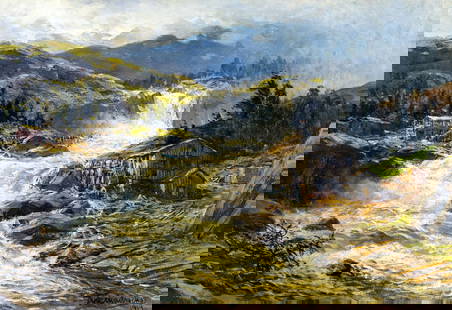
Sold2023Themistocles von Eckenbrecher (German,1842-1921) oil painting antiqueARTIST: Themistocles von Eckenbrecher (Germany, 1842 - 1921) TITLE: Mountain River Landscape YEAR: 1919 MEDIUM: oil on canvas CONDITION: Few small paint losses. No visible inpaint under UV light. ARTSee Sold Price
Sold20241839. World’s Rivers and Mountains By MoninTitle: 1839. World’s Rivers and Mountains By Monin Date/Period: 1839 Materials: Hand colored, engraved Size: 17 1/2 x 12 1/2" This map is a magnificent illustration of the world's mountains andSee Sold Price
1 day LeftRapid Estate Liquidators and Auction GalleryWarne's Bijou Gazetteer by Rosser - Antique 1883US$5
6 hrs LeftOriental Art AuctionsAL-IDRISI AND ROGER II, A MAP OF ASIA IN NUZHAT AL-MUSHTAQ, 17TH CENTURY€4,000
6 days LeftThomaston Place Auction Galleries(2 VOLS) "PICTURESQUE AMERICA" EDITED BY WILLIAM CULLEN BRYANT, 1874US$400
May 26Ararity AuctionsThomson's 1817 Hand Colored Map Comparative Heights of the World's Great MountainsUS$50
3 days LeftMusicGoldmine.comGotye ft. Kimbra "Somebody That I Used To Know" RIAA 6X Multi-Platinum Digital Single Award - NewUS$250
3 days LeftMusicGoldmine.comCoolio "Gangsta's Paradise" and Dangerous Minds OST Combo RIAA AwardUS$500
3 days LeftMusicGoldmine.comChristina Perri "Jar Of Hearts" Atlantic Records Ireland Single AwardUS$150
1 day LeftEDEN Fine Antiques Galleries1979 QIAN SONGYAN TALL MOUNTAINS AND LONG RIVERS PAINTINGUS$600(3 bids)
2 days LeftCastle Valley Art Gallery Inc. A long scroll of Chinese calligraphy and painting " Thousand Miles of Rivers and Mountains" by WangUS$1,000
11 hrs LeftEDEN Fine Antiques GalleriesQING QIANLONG FAMILLE ROSE LANDSCAPE AMPHORA VASEUS$275(4 bids)


![Rand McNally: Antique World Map, Rivers & Mountains: Map: Rand McNally World Map and Comperative Chart of Rivers and Mountains -- The World on Mercator's Projection [verso] Western Hemisphere Cartographer: Rand McNally Year / Place: 1898, Chicago Map Di](https://p1.liveauctioneers.com/5584/108569/55677982_1_x.jpg?height=310&quality=70&version=1504123318)


![1850 Black's Illustration of World Mountains and Rivers: Title: 1850 Black's Illustration of World Mountains and Rivers -- [Physical Geography] Cartographer: A & C Black Year / Place: 1850, London Map Dimension (in.): 10 X 14.5 in. This is a very attractive](https://p1.liveauctioneers.com/5584/195010/98380779_1_x.jpg?height=310&quality=70&version=1614121450)