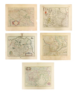
Sold2022(5) ANTIQUE MAPS, MERCATOR & DE WITT, 17TH C.(lot of 5) Antique maps, early 17th c., published by Gerardus Mercator (Belgian, 1512-1594), likely from the "Mercator Hondius Atlas," published after his death c.1619, and Fredeick De Witt (Dutch, 16See Sold Price
Sold2023Antique Map of Ireland, Frederick de WittDutch, 1629-1706..REGNI et INSULAE HIBERNIAE, latter 17th century, hand colored copper plate engraving, sight 28 x 19.5 in..toning, areas of foxing and discoloration, creases, under glass, not examineSee Sold Price
Sold2023L'Africa. DE ROSSI / SANSON 1677 old antique vintage map plan chartTITLE/CONTENT OF MAP: L'Africa [Africa] DATE PRINTED: 1677 IMAGE SIZE: Approx 42.5 x 57.0cm, 16.75 x 22.25 inches (Large) TYPE: Antique 17th century folio atlas map CONDITION: Good; suitable for framiSee Sold Price
Sold2021Eight Antique Maps by HoefnagelEight Antique Maps by Hoefnagel , 17th c., from Civitates Orbis Terrarum, 5 hand-colored, sheets 16 in. x 20 in Provenance: Property deaccessioned from the Louisiana State Museum, proceeds to be usedSee Sold Price
Sold202417TH C. MERCATOR'S MAP - SMALLER ISLANDS ANGLESEA CHANNELL ISLANDS17TH CENTURY (1636) HAND COLORED MERCATOR'S MAP OF THE SMALLER ISLANDS, ANGLESEY CHANNELL ISLANDS, ISLE OF WIGHT, JARSAY, GARNESAY - FRAME MEASURES APPROX. 21" X 17"See Sold Price
Sold2022Antique Etchings 17th Century Maps Lot Of 5Antique Maps.Lot of 5 maps are by various makers and have a range of condition issues. This item is from the estate of a gentleman from Gaton Lamps on Melrose Ave. Gaton Lamps worked on the interior oSee Sold Price
Sold2023Antique 17th C Map of Canary Islands Pierre DuvalAntique 17th C Map of Canary Islands Pierre Duval. Original proof engraved in 1653 by cartographer Pierre Duval (French, 1618 - 1683). Colored boundaries of the time. Engraving margins measure 13.5 inSee Sold Price
Sold202217C. Jodocus Hondius Map of Asia Colored EngravingAntique 17th century map of Asia by Jodocus Hondius (Belgian Dutch, 1563-1612). Colored engraving originally published in 1631. Displayed in a wooden frame. Work Size: 15 x 19.5 in.SHIPPINGHill AuctioSee Sold Price
Sold2024L'Irlanda o'vero Hibernia. Ireland. DE ROSSI 1689 old antique map plan chartTITLE/CONTENT OF MAP: L'Irlanda o'vero Hibernia [Ireland, or Hibernia] DATE PRINTED: 1689 IMAGE SIZE: Approx 59.0 x 45.0cm, 23.25 x 17.75 inches (Large) TYPE: Antique 17th century folio atlas map CONDSee Sold Price
Sold2022THREE FRAMED ENGRAVINGS.Two early 19th century German hand colored engravings of maps. 11.5"h. 10.25"w. Together with a 17th century Simon de Passe engraving on laid paper of Sir Walter Raleigh. 12.75"h. 9.75"w.See Sold Price
Sold20235 Antique Leatherbound BooksFive 17th century books. Includes Vera Zuniga Y Figueroa, Juan Antonio de "L'Histoire du Ministere du Comte-Duc" 1673; Guiglaris, Luigi "La Scuola della Verita" c. 1680; Maluezzi, Virgilio "Il RomuloSee Sold Price
Sold2017Janssonius: Antique Map of Portugal, 1645Title: Portugallia et Algarbia quae olim Lusitania. Attractive mid-17th century map of Portugal Map maker: Jan Janssonius Place and Year: Amsterdam, [c.1645] Dimensions: 38.5 x 49.5 cm (15¼ x 19½ inSee Sold Price
Sold2018Visscher: Antique Map of Africa, 1670Title: Africæ Accurata Tabula. 17th century Visscher map of Africa Map maker: Nicolas Visscher Place and Year: Amsterdam, c. 1670 Dimensions: 43.5 x 54 cm (17¼ x 21¼ in) Technique: Copperplate engrSee Sold Price
Sold20235 Antique BooksFive 17th century books. Includes Du Peyrat, Guillaume & De Sallo, Jean-Denis "Traite de l'Origine de Cardinaux du Saint Siege" 1669; Estienne, Henri "Discours Merveilleux de la Vie, Actions & DeporteSee Sold Price
Sold2024L'Europa. Europe. DE ROSSI 1677 old antique vintage map plan chartTITLE/CONTENT OF MAP: L'Europa [Europe] DATE PRINTED: 1677 IMAGE SIZE: Approx 44.0 x 56.5cm, 17.25 x 22.25 inches (Large) TYPE: Antique 17th century folio atlas map CONDITION: Good; suitable for framiSee Sold Price
Sold2017Morisot: Antique Map of North America, 1643Title: Americae Septentrionalis Circuitus. Mid-17th century French copperplate map with cartographic myths Map maker: Claude Bartholomy Morisot Place and Year: Dijon, 1643 Dimensions: 16.6 x 13.5 cm (See Sold Price
Sold2021Antique Framed Map of England / Germanic SeaAntique Framed Map of England / Germanic Sea. Circa late 17th Century & early 18th Century. Featuring "De Noort Zee" & "T Canaal". Map measures 23 inches high x 19.25 inches wide, framed measures 28.5See Sold Price
Sold202417TH C. ANTIQUE MAP SIEGE OF LA ROCHELLE, FRANCE, FRAMED"Seige et Reddition de La Rochelle, Octobre 1628", handcolored engraving on wove paper, Claes Jansz. Visscher (II), (workshop of), Germany, 1627 - 1629. In gilt molded frame, matted under UV non-glareSee Sold Price
Sold2021Antique 17th C. Norfolk England Map EngravingAntique 17th C. Norfolk, England Map Hand Colored Engraving. Described by Christopher Saxton. Augmented by I. Speede. Measures 16 inches high x 21.5 inches wide.See Sold Price
Sold202017th C. Map of ItalyCapitanata, Olim Mesapiae Et Iapygiae Pars; from Blaeu's Theatrum, 1650. Hand colored with decorative cartouche. Framed, 26" x 22.5". From Godspeed's Book Shop, Boston.See Sold Price
Sold202317th- 18th C Maps, South America West Indies (5pc)Five Small 17th-18th C. Maps: (1) Map titled "DESCRIPTION DE IUCATANE", good condition, measures: 4.5" H x 7.25" W, (1) Map titled "VILLE DE PISCO", good condition, measures: 5.75" H x 8.5" W. (1) MapSee Sold Price
Sold2021Antique 17th C Blaeu Tabula Magellanica MapAntique 17th Century Willem Blaeu (Dutch, 1571-1638) Hand Colored Tabula Magellanica Map. Map measures 16 inches high x 21 inches wide. Frame measures 17 inches high x 22.5 inches wide.See Sold Price
Sold2022A. Mallet & G. Ruscelli MapsThree 16th and 17th century hand-colored engraved maps. Includes one titled "Cercle de Bourgogne" (Circle of Burgundy) and another titled "France par Governmens Generaux" (France by General GovernmentSee Sold Price
20241620s CRIMEA HONDIUS MAP OF TAURICA CHERSONESUS copper engraving ANTIQUEEarly 17th century hand colored map of MAP OF TAURICA CHERSONESUS (CRIMEA) from English edition of Hondius atlas, c. 1620s size 5 by 6 1/2" (leaf 8 1/4 by 12 1/2") Very good condition Henricus HondiusSee Sold Price
3 days LeftJasper52MICRONESIA. 'Habitans des Isles Larrons'. People of Marianas. MALLET 1683 mapUS$40
Jun 02Nazmiyal AuctionsAntique 17th century Transylvanian Rug 5 ft 9 in x 4 ft 2 in (1.75 m x 1.27 m)US$12,000
Featured2 days LeftJasper52The flight into Egipt -Original antique engraving after G Freman, 17th century.US$65
Featured2 days LeftJasper52Solomon Wise Judgement - Original antique engraving after G Freman, 17th century.US$65
May 14Akiba Galleries(5 Pc) Antonio de SolÃs y Ribadeneyra (1610–1686) "History Of The Conquest Of Mexico"US$100
2 days LeftJasper521651 POETRY Orationes Quarum by A.Aemilius ANTIQUE VELLUM BOUND 17th CENTURYUS$190


![L'Africa. DE ROSSI / SANSON 1677 old antique vintage map plan chart: TITLE/CONTENT OF MAP: L'Africa [Africa] DATE PRINTED: 1677 IMAGE SIZE: Approx 42.5 x 57.0cm, 16.75 x 22.25 inches (Large) TYPE: Antique 17th century folio atlas map CONDITION: Good; suitable for frami](https://p1.liveauctioneers.com/5584/308981/165185503_1_x.jpg?height=310&quality=70&version=1699996168)


![L'Irlanda o'vero Hibernia. Ireland. DE ROSSI 1689 old antique map plan chart: TITLE/CONTENT OF MAP: L'Irlanda o'vero Hibernia [Ireland, or Hibernia] DATE PRINTED: 1689 IMAGE SIZE: Approx 59.0 x 45.0cm, 23.25 x 17.75 inches (Large) TYPE: Antique 17th century folio atlas map COND](https://p1.liveauctioneers.com/5584/326140/175577116_1_x.jpg?height=310&quality=70&version=1713288521)


![Janssonius: Antique Map of Portugal, 1645: Title: Portugallia et Algarbia quae olim Lusitania. Attractive mid-17th century map of Portugal Map maker: Jan Janssonius Place and Year: Amsterdam, [c.1645] Dimensions: 38.5 x 49.5 cm (15¼ x 19½ in](https://p1.liveauctioneers.com/5584/110975/56961897_1_x.jpg?height=310&quality=70&version=1508432804)


![L'Europa. Europe. DE ROSSI 1677 old antique vintage map plan chart: TITLE/CONTENT OF MAP: L'Europa [Europe] DATE PRINTED: 1677 IMAGE SIZE: Approx 44.0 x 56.5cm, 17.25 x 22.25 inches (Large) TYPE: Antique 17th century folio atlas map CONDITION: Good; suitable for frami](https://p1.liveauctioneers.com/5584/322790/173578184_1_x.jpg?height=310&quality=70&version=1710881198)


