Sold20211932 Indiana map1932 Indiana map of the influence of Native American history in Indiana, 42"H x 30"WSee Sold Price
Sold20231831 Hinton Map of Ohio and Indiana -- Map of the States of Indiana and Ohio, with Part of MichiganTitle: 1831 Hinton Map of Ohio and Indiana -- Map of the States of Indiana and Ohio, with Part of Michigan Territory Cartographer: J Hinton Year/Place: 1831, London Dimensions: 9.7 X 15.4 in. DescriptSee Sold Price
Sold2023Five Antique American MapsFive Antique American Maps, incl. "Map of Oregon and Upper California..." 1848, Charles Preuss; "map of Connecticut Showing the System of Trunk Line Highways...", 1932; "Map of the Valley of Mexico",See Sold Price
Sold2021Group of 3 Vintage MapsOhio/Indiana map (1921) measures 26.5 x 22.5 inches, Illinois/Missouri map (1921) measures 29 x 23.5 inches, Military map (1861) measures 29.5 x 23 inches with mat included. All maps are on heavy stocSee Sold Price
Sold2017Antique Tiger Maple Frame with York, PA Map.Antique Tiger Maple Mitered Frame Containing a 1932 Map of York Co., PA. 16-1/2' x 21" overall. Condition: Very good with minor wear.See Sold Price
Sold2019LATE 19th & EARLY 20th C. POCKET RAILROAD MAPSFive pocket railroad maps of Iowa, dated 1881, 1890, 1897, 1905, 1914, all Rand, McNally except for 1890 by Hamlin's Wizard Oil Co; also a 1907 Rand McNally Indiana map, and a late 19th century 'AlbumSee Sold Price
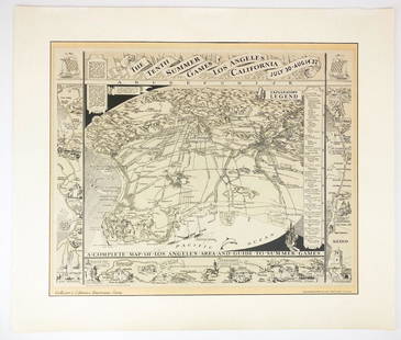
Sold20221932 Olympic Summer Games Map of Los Angeles Litho 1983The Tenth Summer Games 1932 Map of Los Angeles Lithograph (1983 Collector's Edition). Good condition. Slight paper discoloration. Approx. dimensions: 23 in. H x 27 in. W. Weight: 1 lb.See Sold Price
Sold2020Illustrated Van Loon Hand-Colored World Map, 1932Hendrik Willem Van Loon (Dutch-American, 1882-1944). Illustrated World Map, 1932. A hand colored outlined pictorial map of the world on Mercator projections with topographical relief shown pictoriallySee Sold Price
Sold2019MAP - Indiana. MendenhallIndiana. Edward Mendenhall, A New Map of Indiana Exhibiting the Counties, Townships, Cities, Villages, and Post Offices. Rail Roads, Canals, and Common Roads, 1869 (dated). Hand Color. An attractive,See Sold Price
Sold2020VINTAGE 1932 SUPERVUE MAP of NYC NEW YORK CITY, SAMUELVINTAGE 1932 SUPERVUE MAP of NYC NEW YORK CITY, SAMUEL FREEDMEN, SOUVENIR TRAVEL VINTAGE 1932 SUPERVUE MAP of NYC NEW YORK CITY, SAMUEL FREEDMEN, SOUVENIR TRAVEL Old Vintage NEW YORK CITY Tourist's MaSee Sold Price
Sold2024Late 19th century watercolor on paper of Indiana counties mapLate 19th century watercolor on paper of Indiana counties map with county seats, overall 17"T x 13"WSee Sold Price
Sold20181932 Gary Indiana Wanted PosterVery nice framed 1932 Gary Indiana wanted poster. G.L. Gates alias Henry Wycoff, James Gordon, James Gates, and Sammy Gates wanted for confidence game and robbery. Dated June, 1932. Has wear and discoSee Sold Price
Sold2023George Deem, New York, Indiana (1932 - 2008), Bruna Sevini and Whistler's Mother, 1979, lithograph,George Deem New York, Indiana (1932 - 2008) Bruna Sevini and Whistler's Mother, 1979 lithograph Signed lower right, dated verso. Biography from the Archives of askART: Best known for his "conceptual rSee Sold Price
Sold20241870 Mitchell Map of Ohio and Indiana -- County Map of Ohio and IndianaTitle: 1870 Mitchell Map of Ohio and Indiana -- County Map of Ohio and Indiana Cartographer: S Mitchell Year / Place: 1870 Philadelphia Map Dimension (in.): 11.5 X 13.8 in. This is a very nice map ofSee Sold Price
Sold20241876 Mitchell Map of Ohio and Indiana -- County Map of Indiana and OhioTitle: 1876 Mitchell Map of Ohio and Indiana -- County Map of Indiana and Ohio Cartographer: S Mitchell Year / Place: 1876 Philadelphia Map Dimension (in.): 11.5 X 13.8 in. This is a very nice map ofSee Sold Price
Sold2023George Deem, New York, Indiana (1932 - 2008), Dutch Portrait in Vermeer's Easel, 1979, lithograph,George Deem New York, Indiana (1932 - 2008) Dutch Portrait in Vermeer's Easel, 1979 lithograph Signed lower right, dated verso. Biography from the Archives of askART: Best known for his "conceptual reSee Sold Price
Sold20191932 Reprint map of Napa California, US Geological1932 Reprint map of Napa California, US Geological survey 20" x 15 1/2"See Sold Price
Sold20201932 Spinning Wheel Map of Asia and Europe on Verso --Title/Content of Map: 1932 Spinning Wheel Map of Asia and Europe on Verso -- Chart of Knowledge Cartographer: S Bocholtz / Chart of Knowledge Co. Year/Place: 1932, Boston Size: 10.2 X 10.2 in. This isSee Sold Price
Sold2020Indiana & OhioTitle/Content of Map: Indiana & Ohio Cartographer: Bradford, Thomas Gamaliel Date: 1835 Publisher: William D. Ticknor / Wiley & Long Size: 17.8Height - 10.1Width Regional map from T.G. Bradford's "A CSee Sold Price
Sold2024Indiana 1886Title/Content of Map: Indiana 1886 Date Printed: 1886 Material/Medium: Paper Size: Approx. 21."x13" Additional Info: W.H. Stewart & Co, Reserve: $45.00 Shipping: Domestic: Flat-rate of $15.00 to anywhSee Sold Price
Sold2017Tanner: Antique Map of Indiana, 1843Title/Content of Map: Indiana by Tanner Date Printed: 1843 Cartographer: based on the work of H.C. Tanner Material/Medium: Paper Size: 17" x 14" Hand colored engraved Map. From the first edition publiSee Sold Price
2021Indiana 1886Title/Content of Map: Indiana 1886 Date Printed: 1886Material/Medium: Paper Size: approx 10.5x13 inches W.H. Stewart & Co., The People's Family atlas Reserve: $30.00 Shipping: Domestic: Flat-rate ofSee Sold Price
Sold2017Bradford: Antique Map of Indiana, 1838Title/Content of Map: Indiana by Bradford Date Printed: 1838/1841 Cartographer: Thomas G. Bradford Material/Medium: Paper Size: 13" x 16 1/2" Hand colored. A General Atlas of the World with a SeparateSee Sold Price
Sold2018Antique Map of Indiana by Colton, 1859Title/Content of Map: Indiana by Colton Date Printed: 1859 Cartographer: Material/Medium: Paper Size: 14 x 17" Provenance: New York Please note that this lot has a confidential reserve. When you leaveSee Sold Price
18 hrs LeftThomaston Place Auction GalleriesCOLLECTION OF TRAVEL EPHEMERA, BROCHURES, BOOKLETS, MAPS 1900-1950$100
Jun 08Connoisseur AuctionsEarly 1900's Railway Service Map, Illinois, Ohio, Indiana, Kentucky, Tennessee$20(1 bid)
2 days LeftSloans & KenyonTOTAL ECLIPSE OF THE SUN : SEE NIGHT-TIME WHEN ITS DAY IN NEW ENGLAND WHILE YOU PLAY JOHN HELD JR$1,000
4 days LeftTrillium Antique Prints & Rare BooksKarl Bodmer - Fox River, Indiana with Carolina Parrots (Extinct) & Bald Eagle. 5$300
May 29Cedarburg Auction & Appraisals LLCSet of Four Maps Showing All of Spain and Portugal$375(2 bids)
3 days LeftEldred'sAMERICAN SCHOOL (Circa 1932,), Carmel, California seascape., Oil on board, 12" x 15.5". Unframed.$150
Jun 07Freeman's | Hindman[MAP]. TODESCHI, Pietro. [Nova et Acurata Totius Americae Tabula auct. G.I. Blaeu] America quarta$5,000
May 29Cedarburg Auction & Appraisals LLCRare 1877 Double sided map of Milwaukee and Wisconsin$40(4 bids)
Jun 19BOC AUCTION HOUSEPICASSO 1932 + Original Receipt + Provenance + Price Valuation + Support document.$65(2 bids)


![[MAP]. TODESCHI, Pietro. [Nova et Acurata Totius Americae Tabula auct. G.I. Blaeu] America quarta (1 of 1)](https://p1.liveauctioneers.com/197/329395/177650542_1_x.jpg?height=282&quality=70&version=1715364962)


