Sold2021Map LotLot (2) maps mounted on cardboard "The Supplement to / NORTH AMERICA" and "The Continent and Islands of AMERICA…", each 21" x 47 1/2".See Sold Price
Sold2023ANTIQUE FLORIDA FRAMED MAPS - LOT OF 2148268 ANTIQUE FLORIDA FRAMED MAPS - LOT OF 2 Antique Florida map framed map to include one 1853 U.S. Coast Survey Chart or Map of St. George's Sound, Florida, and one unsigned map of Florida denotedSee Sold Price
Sold2016Map LotLot (3) framed maps including "Carte De La Baye De Hudson" (sight 9 1/4" x 12 1/4"), "The River St. Laurence" (sight 10" x 14 1/2"), "A Plan of the City and Harbour of Louisburg" (sight 11" x 14 1/2")See Sold Price
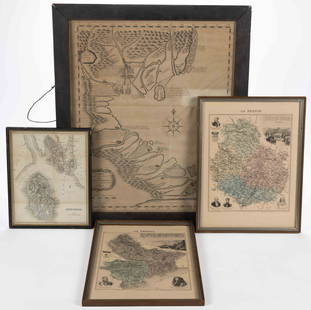
Sold2023ASSORTED EUROPEAN AND ASIAN MAPS, LOT OF FOURASSORTED EUROPEAN AND ASIAN MAPS, LOT OF FOUR, engraving on paper, three with hand-coloring, comprising a map of Buteshire in Scotland by William Home Lizars (Scottish, 1788-1859), two "LA FRANCESee Sold Price
Sold2021ROCKBRIDGE CO., SHENANDOAH VALLEY OF VIRGINIA MAPS, LOTROCKBRIDGE CO., SHENANDOAH VALLEY OF VIRGINIA MAPS, LOT OF THREE, comprising 1877 "Grays new Map of Lexington", a copy of Carmichael's "County of Rockbridge", and 1973 Hildebrand's Rockbridge County hSee Sold Price
Sold2015Map LotLot of (4) maps including "Das Herzogthum Schlesien" (sight 10" x 14 1/2"), "North America" (sight 14" x 10 1/2"), "Columbia Co." (19 1/2" x 15 1/2"), "Hillsdale Quadrangle"(sight 26 1/2" x 15").See Sold Price
Sold2022Map LotLot (5) framed maps including: "LE PAYS DES HOTTENTOTS…" (sight 10 1/2", overall 14 1/2" x 18"), "COLONY of the / CAPE of GOOD HOPE" (sight 8 1/2" x 11", overall 13 1/2" x 17"), Map of Central PSee Sold Price
Sold2020Promised Land Map LotLot of two maps of the Holy Land: 1. "A map of the Land of Promise Compiled by the Author out of the Book of Joshua". Hand-colored copperplate engraving. From: Calmet, Augustin Antoine. A historical,See Sold Price
Sold2022Map LotMap lot including: "PARIS" (9 3/4" x 12 1/4"); "BAY OF BISCAY" (10 1/2" x 13"); "GEOGRAPHICAL AND HISTORICAL MAP OF THE ROMAN EMPIRE" (18 1/2" x 22 1/2"); "AMERICA SEPTEN / TRIONA" (18" x 23"); "VERBRSee Sold Price
Sold2022Railroad Poster and Map Lot NP,GN,CPThis lot contains three 36 inhes x 25 inches posters from the Northern Pacific Railroad, titled Peaceful Paradise Valley, and are in fine condition for their age. Also included is a full color 40 inchSee Sold Price
Sold2023Map LotLot (3) framed maps including "PLAN DU CENTRE DE PARIS VOLD' OISEU" (overall in frame 28" x 38 1/2"), Spain (overall 25" x 34 1/2"), "GALLACIA REGNUM" (overall 21" x 23").See Sold Price
Sold2022Chicago, Ohio Vintage Map Lot (3)1928 Pictorial map: Illinois, Its Geography Its History. 1933 Pictorial Cartograph of Ohio. 1933 Map: Chicago and the Century of Progress. Folding as issued..See Sold Price
Sold2017Map LotLot (2) early mounted maps. Includes New York (30 1/2" x 22 1/2") and County of Essex (30 1/2" x 22 1/2").See Sold Price
Sold2023Antique English Map LotLot of antique maps, Hertfordshire, and Oxfordshire, England. Including Map of the County of Hertford, C & J. Greenwood 1834. With numerous other maps various sizes, 18th through 20th Centuries.See Sold Price
Sold2022Map LotLot of maps including "CARTE / DE LA / PALESTINE / OF / TERRE SAINTE…1841" (unframed, overall in frame 26 1/2" x 20 1/2"), "CARTE DE L ISLE DE NIEVES" (sight 9" x 6 1/2", overall 16 1/2" x 14"),See Sold Price
Sold2017Map LotLot (2) maps including Ireland (G.W. Bacon & Co. sight 8 1/2" x 12"), and "BAVARIA-HESSE/US ZONE/WURTEMBERG BADEN" (sight 23" x 20").See Sold Price
Sold2023A Grouping of 17th & 18th Century Old World Maps Lot of 6Lot Includes: The English Channel, A Map of France, North American Rivers and Lakes Between Superior and Slave Lake (2), A New map of Russia in Europe, & Nouvelle Carte Du Royaume de Bengale EngraSee Sold Price
Sold2018Vintage Auto Advertising and Map LotGMC, Gulf, Esso, Shell, Sunoco, Plymouth, 1940 Classical Lands Mediterranean Map, 1939 Atlantic Ocean map, Boston and moreSee Sold Price
Sold20178 piece map lot8 piece map lot including Ancient Havana; Mountain Railway to the Wengernalp Switzerland; 23 inches x 8 inches.See Sold Price
Sold2023[POCKET MAPS] LOT OF 3 SOLD TOGETHERPOCKET MAPS. A lot of 3 sold together. Including: MOTOR ROAD MAP OF SOUTH-EAST ENGLAND showing the new arterial and by-pass roads / ROAD MAP OF LONDON and 10 miles round showing the new arterial roadsSee Sold Price
Sold2021Mining and Geological Maps. Lot of 31 Maps.Mining and Geological Maps. Lot of 31 Maps. Edite dalla Librairie Polytchnique Ch. Béranger, fine dell’800 - inizi del 900 Il lotto si compone di15 mappe minerarie e geologiche a colori inSee Sold Price
May 25Holler and HammerMassive Lot 11 1930s-40s HI SPEED Gas Station Advertising Lot: Map, RPPC, Chek-Chart, Lubrication$25
3 hrs LeftRapid Estate Liquidators and Auction GalleryHistoric Map Of The Town Of Salem Print Copyright John T. Northey$5
5 days LeftPotter & Potter AuctionsFinlandia / Suomi. 1949. [Five copies]. Helsinki: Kustannus...$100
May 21BonhamsJ. Hutchison and J. Ph. Vogel, A History of the Panjab Hill States, 2 vols. Lahore, printed by ...£1,200


![[POCKET MAPS] LOT OF 3 SOLD TOGETHER: POCKET MAPS. A lot of 3 sold together. Including: MOTOR ROAD MAP OF SOUTH-EAST ENGLAND showing the new arterial and by-pass roads / ROAD MAP OF LONDON and 10 miles round showing the new arterial roads](https://p1.liveauctioneers.com/8124/283183/149424774_1_x.jpg?height=310&quality=70&version=1679790999)


![Finlandia / Suomi. 1949. [Five copies]. Helsinki: Kustannus... (1 of 1)](https://p1.liveauctioneers.com/928/325952/175495564_1_x.jpg?height=282&quality=70&version=1712935174)


![Prince Alexis Soltykoff (1806-59), Voyages dans L'Inde Paris, Garnier, [1851] (1 of 1)](https://p1.liveauctioneers.com/1043/328953/177308726_5_x.jpg?height=282&quality=70&version=1715163690)