Sold2024Historical Map of the State of Kentucky by Karl SmithKentucky "The Dark and Bloody Ground" Lithograph on Paper Signed Karl Smith and Dated 1933 14.75 x 23.75 (sight) 15.75 x 24.74 inches (frame) Overall good condition. Small tear mid right side of lithoSee Sold Price
Sold2024Historical Map of the State of Kentucky by Karl Smith 1933 Daniel Boone & Companions ViewHistorical Map of the State of Kentucky by Karl Smith 1933 Daniel Boone & Companions View. Frame Measure 20" X 26.5", Sight 18.3" X 25". // Provenance: PRIVATE ESTATE CENTRAL FLORIDA. PleaseSee Sold Price
Sold2022(PICTORIAL MAPS.) Karl Smith; for the Linweave Paper Company. The Growth and Development of America(PICTORIAL MAPS.) Karl Smith; for the Linweave Paper Company. The Growth and Development of America in Maps by Linweave. Portfolio of 4 color-printed pictorial maps on various paper stocks. 17½x2See Sold Price
Sold20232 Framed Historical Maps, North America & Kentucky, Carey & Lea1st item: Geographical, Statistical & Historical map of North America, 1823, published by Henry Charles Carey (1793-1879) and Isaac Lea (1792-1886) Philadelphia, illustrated by J. Yeager. From A ComplSee Sold Price
Sold20221839 Stiles, Sherman and Smith Map of Midwest United States and Kentucky -- Map of the WesternTitle: 1839 Stiles, Sherman and Smith Map of Midwest United States and Kentucky -- Map of the Western States Designed to Accompany Smith's Geography for Schools Cartographer: Stiles, Sherman and SmithSee Sold Price
Sold20163 19th cent. Maps, 1 of TN and KY, 2 of TN1st item: "Tennessee & Kentucky" Map, drawn by Thomas G. Bradford, engraved by George W. Boynton, published by William D. Ticknor, Boston, 1835. From "A Comprehensive Atlas. Geographical, Historical,See Sold Price
Sold2020KARL SMITH (1895-1986). ABRAHAM LINCOLN / A PICTORIALKARL SMITH (1895-1986) ABRAHAM LINCOLN / A PICTORIAL OUTLINE OF THE LIFE OF THE SIXTEENTH PRESIDENT OF THE UNITED STATES. 1934. 19x24 inches, 48x63 cm. Louisville, Kentucky. Condition A-: creases in mSee Sold Price
Sold2017Bradford: Antique Map of Kentucky & Tennesee, 1835Title/Content of Map: Kentucky & Tennesee by Bradford Date Printed: 1835 Cartographer: T.G. Bradford Material/Medium: Paper Size: 13" x 9 1/2" A Comprehensive Atlas Geographical, Historical & CommerciSee Sold Price
Sold2021Charles W. Smith, Pictorial Map of Virginia"A Historical Map of Virginia" by artist Charles William Smith, (1893-1987, American,) copyrighted 1930 by Charles W. Smith, Offset lithography by Garrett & Massie, Inc., Richmond, Virginia. CopiouslySee Sold Price
Sold2021John Smith, Select views in Italy, Volume 1 & 2, 1792Select views in Italy with Topographical & Historical London: T. Chapman for John Smith, William Byrne and John Emes, 1792-1796, Two volumes, with engraved title, map, and seventy-two engraved plaSee Sold Price
Sold20241886 The History of Kentucky By Z.F. SmithZ[achariah] F. Smith. The History of Kentucky. Louisville: Courier-Journal Printing Job Co., 1886. First edition. 824 pages. Rebound. Illustrated, including one fold-out map at rear. There are NO librSee Sold Price
Sold2021Charles John Smith 'Historical and LiterarySmith, Charles John 'Historical and Literary Curiosities'. Henry G. Bohn, London, 1852. Leather bound volume with marble paper covered boards and 100 plates. This volume contains 100 plates of facsimiSee Sold Price
Sold2023[MAP]. SMITH, W.H., compiler. Smith’s Brooklyn Directory, f...[MAP]. SMITH, W.H., compiler. Smith’s Brooklyn Directory, for the Year Ending May 1st, 1857. Being a Directory of the Inhabitants with an Avenue and Street Guide, and an Appendix. Brooklyn: CharSee Sold Price
Sold20231841 1ed New York State HUGE MAP Historical Collections Albany NYC Buffalo1841 1ed New York State HUGE MAP Historical Collections Albany NYC Buffalo A scarce first edition printing of the antebellum historical treatise, Historical Collections of the State of New York. CollaSee Sold Price
Sold2020[Map] Smith. Ould Virginia"Ould Virginia. A description of part of the adventures of Cap. Smith in Virginia." Circa early 1800s, on wove. Measured from neatlines 14" x 10.75". Right margin and lower margin trimmed within plateSee Sold Price
Sold2021Vintage Kentucky Map FramedVintage Kentucky Map Framed - Measures roughly 25.5" x 16.5".See Sold Price
Sold2017Sam Norkin. Pen and Ink Illustration Sgd.Signed Norkin. Nevada Smith. Karl Malden, Steve McQueen, Suzanne Pleshette, Brian Keith, Arthur Kennedy. 19" x 16"See Sold Price
Sold2023Boxed Set of Great Books Foundation First Year ReadingsBoxed set of Great Books Foundation First Year Readings. Includes The Declaration of Independence, Plato, Aristotle, St Augustine, Machiavelli, Shakespeare, Locke, Adam Smith, Karl Marx and more. PublSee Sold Price
Sold20191850 Louisiana History + Florida de Soto Expedition1850 Louisiana History + Florida de Soto Expedition French Mississippi MAP ‘Historical Collections of Louisiana’ is a rare, important work on the history of the American south. Written by historiaSee Sold Price
Sold2018Stackhouse: Historical Map of Medieval France, 1783Title/Content of Map: Historical Map of Medieval France Date Printed: 1783 Cartographer: Thomas Stackhouse Material/Medium: Paper Size: 16" x 20" Original hand color, copperplate engraved. Published iSee Sold Price
Sold2022MAP OF NORTHAMPTON COUNTY, PA 1860LINEN BACKED MAP. SMITH, GALLUP & CO. PUBLISHERS, PHILADELPHIA, 1860. MEASURES 56" X 57" Terms & Conditions: Pick-up for this Auction will be Wednesday August 3rd and Thursday August 4th from 9:00am tSee Sold Price
Sold2022Kentucky Lock Port Vintage Topography MapKentucky Lock Port Vintage Topography Map Printed in 1922, based on a survey done in 1906 of the Lockport Quadrangle in Kentucky. Map is in good condition with some tears around the edges. ApproximateSee Sold Price
Sold2018Stackhouse: Antique Historical Map of Dacia, 1783Title/Content of Map: Historical Map of Dacia Date Printed: 1783 Cartographer: Thomas Stackhouse Material/Medium: Paper Size: 16" x 20" Original hand color, copperplate engraved. Published in London iSee Sold Price
Sold2022Huge 1876 Historical Map of the U.S. by BlanchardHistoric Maps 1876 "Historical Map of the United States Showing Early Spanish, French & English Discoveries and Explorations, also Forts, Towns & Battlefields of Historic Interest" by Rufus BlanchardSee Sold Price
4 days LeftHeartland Artifact Auctions Inc5 3/8" Dovetail, Rogers COA, found in Ohio Co., Kentucky, Ex David Smith, ExStephen Limes$26(3 bids)
Oct 12JM Hobby Supply and Railroad Artifact AuctionsHammonds Map of Kentucky and Tennessee Railroads-1910$30
1 day LeftDalshire InternationalKarl Lagerfeld Signed Original Fashion Drawing - "Green One-Piece Dress on Red Hair Lady with a Bob"$30(2 bids)
9 hrs LeftJasper52Brighton & its environs by J. Pigott-Smith. 4 sheets. 112x144cm. Scarce 1826 map$2,000
6 days LeftJasper52World Map showing Dutch East India Co Possessions, c1720, CA as an island by J.Malherbe$380
BonhamsJustine Smith (British, born 1971) The Whittington Map, from Money Maps Archival Inkjet print in...£1,000
Oct 27Schilb Antiquarian Rare Books1885 General Ulysses S. Grant 1ed Civil War Memoirs Union Illustrated MAPS 2v$78(5 bids)
Oct 16Joe R. Pyle Complete Auctions & Real Estate5 Vintage License plates: 1921 Michigan, 1922 Maryland, 1924 & 1932 Kentucky, 1952 Louisiana$10(2 bids)
3 days LeftTrillium Antique Prints & Rare BooksKarl Bodmer - Massika, Saki Indian & Wakusasse, Musquake Indian. 3$300(1 bid)
3 days LeftTrillium Antique Prints & Rare BooksKarl Bodmer - Magic Pile Erected by the Assinboin Indians. 15$300
4 days LeftATTIC TO AUCTION, LLCOzzie Smith St. Louis Cardinals Autographed Baseball on Stand with Card - Gold Ink - Hall of Fame$25


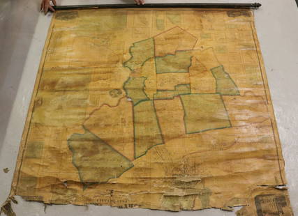
![[KENTUCKY - MAPS]. SMITH, Karl. An Historical and First Image](https://p1.liveauctioneers.com/197/227139/117328658_1_x.jpg?height=300&quality=1&version=1637622829&width=300)
![[KENTUCKY - MAPS]. SMITH, Karl. An Historical and First Image](https://p1.liveauctioneers.com/197/227139/117328658_1_x.jpg?height=300&quality=95&version=1637622829&width=300)


![1886 The History of Kentucky By Z.F. Smith: Z[achariah] F. Smith. The History of Kentucky. Louisville: Courier-Journal Printing Job Co., 1886. First edition. 824 pages. Rebound. Illustrated, including one fold-out map at rear. There are NO libr](https://p1.liveauctioneers.com/5755/336176/181789913_1_x.jpg?height=310&quality=70&version=1720647667)

![[MAP]. SMITH, W.H., compiler. Smith’s Brooklyn Directory, f...: [MAP]. SMITH, W.H., compiler. Smith’s Brooklyn Directory, for the Year Ending May 1st, 1857. Being a Directory of the Inhabitants with an Avenue and Street Guide, and an Appendix. Brooklyn: Char](https://p1.liveauctioneers.com/928/274602/144224359_1_x.jpg?height=310&quality=70&version=1673894333)

![[Map] Smith. Ould Virginia: "Ould Virginia. A description of part of the adventures of Cap. Smith in Virginia." Circa early 1800s, on wove. Measured from neatlines 14" x 10.75". Right margin and lower margin trimmed within plate](https://p1.liveauctioneers.com/3532/163584/82609292_1_x.jpg?height=310&quality=70&version=1583732116)


![[MAPS] NORTH AMERICA. LOT OF 11 SOLD TOGETHER (1 of 11)](https://p1.liveauctioneers.com/8124/343618/186530167_1_x.jpg?height=282&quality=70&version=1726178725)


