Sold2023WWII 6TH AD AACHEN ORIGINAL MILITARY FIELD MAP170298 WWII 6TH AD AACHEN ORIGINAL MILITARY FIELD MAP WWII 6th armored division Aachen Germany/Belgium original field map. Size: 20 X 26" Provenance: United StatesCondition: Perimeter slightly worn.See Sold Price
Sold20191632 Military Map the Delineation of SchmedifchenGermany, by Mattheus Marian. Well-detailed image has been nicely watercolored by hand. The piece is framed and matted. Some slight staining and there are fold lines. H10 1/4" W13 1/4"See Sold Price
Sold2021Brockhaus (Pub) 1890's Lot of 6 Maps of GermanyIncl Elberfeld, German Dialects, Military Positions, Dresden, and Bayern. Lithograph Maps Published 1892-98 by F. A. Brockhaus, Leipzig for "Brockhaus' Konversations-Lexikon" by Various. Paper Size: USee Sold Price
Sold20241869 ATLAS 42 MAPS America Africa Australia GERMANY Switzerland Sydow RARE1869 ATLAS 42 MAPS America Africa Australia GERMANY Switzerland Sydow RARE Emil von Sydow wa a 19th-century German military officer who is primarily remembered, not for his military involvement but raSee Sold Price
Sold2022Great 1863 Civil War Military Map of U. S. by Johnson & WardWhile America was involved with the Civil War, atlas publishers like Johnson and Ward produced detailed maps to capitalize on the nation’s interest in that conflict. This is the more desirable of thSee Sold Price
Sold2024A Scarce And Delicate Lot Of 12 WW1 Army Military Maps, Printed In 1919 By The Base Printing PlantA Scarce And Delicate Lot Of 12 WW1 Army Military Maps. Printed In 1919 By The Base Printing Plant, 29th Engineers, U.S. Army., Each Map Covers The Range Of Operation In Twelve European Locations InclSee Sold Price
Sold2022Civil War Military map - scarce territorial bordersThe Johnson and Ward atlas company produced two memorable, double-page Civil War maps of the United States. This is the more desirable issue, showing the state and territory borders instead of the MilSee Sold Price
Sold2022[MAPS]. A group of 26 military maps detailing the Seven Yea...[MAPS]. A group of 26 military maps detailing the Seven Years’ War. French, ca. 1811. Maps detailing military positions at various battlefields, some hand–colored. Largest 667 x 978 mm.See Sold Price
Sold2017[World War One - Maps] WWI Military Maps of North West[World War One - Maps] WWI Military Maps of North West Europe, Belgium and France, Lot of 3 Three Military maps issued by the British Army, Geographical Services. Typical topographic maps with towns,See Sold Price
Sold2017LOT (6) ASSORTED ENGRAVED MILITARY MAPS INCLUDING FT.LOT (6) ASSORTED ENGRAVED MILITARY MAPS INCLUDING FT. ST. PHILIP AND ENVIRONS, 18TH CENTURY, 14 1/2 X 9"; (3) BATTLE PLANS INCLUDING DEFRIBOURG, 1644; DETURCKEIM, 1674; D'ENSHEIM, 1674; ALL 10 X 15";See Sold Price
Sold20151 lot of 11 military maps of France for use in WWWI ?1 lot of 11 military maps of France for use in WWWI ?See Sold Price
Sold2022Barclay, James C1800 Hand Col Map. GermanyHand Colored Copper Engraved Map Published C1800 Halifax & Newcastle, England for "Barclay's Universal English Dictionary…" by James Barclay. Maps Engraved by Clerk, Milton and others. Paper Size: 1See Sold Price
Sold20224 20th Century Military MapsIncludes Hammond's and Fred Harvey. RM IMPORTANT: Before bidding, please read the terms and conditions. When you registered for the auction you agreed to these terms and will be required to comply witSee Sold Price
Sold2023Set 4 19th Century Johnson & Ward Color Maps Germany Mexico Switzerland & Central AmericaSet 4 19th Century Johnson & Ward Color Maps Germany Mexico Switzerland & Central America. Measurements in inches: 18 x 14 Condition:Has toning and tear to edges Shipping:We offer in-house shipping. ISee Sold Price
Sold2022Times Atlas 1895 Lot of 7 Maps. GermanyLithograph Map Published 1895, London for "The Times Atlas" Two with Centre fold as published. Paper Size: Up to 21 x 16 inch (53 x 41cm) A couple with centre fold splits. A few other minor faults inSee Sold Price
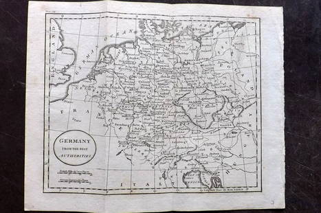
Sold2021Thomson, John (Pub) 1825 Map. GermanyCopper Engraved Map Published 1825 by John Thomson, Edinburgh for "The Edinburgh School Atlas" by N. R. Hewitt. Maps Engraved by Hewitt. Engraved Vignette in corner. Original Outline Hand Colour. RareSee Sold Price
Sold2023Thomson, John (Pub) 1825 Map. GermanyCopper Engraved Map Published 1825 by John Thomson, Edinburgh for "The Edinburgh School Atlas" by N. R. Hewitt. Maps Engraved by Hewitt. Original Outline Hand Colour. Rare. Paper Size: 10.5 x 8 inch (See Sold Price
Sold2021Guthrie, William 1806 Map. GermanyCopper Engraved Map Published 1806, London for "A New Geographical, Historical and Commercial Grammar..." by William Guthrie. The maps are by John Senex, Thomas Kitchin and others. Folds as issued. PaSee Sold Price
Sold2021Guthrie, William 1798 Map. GermanyCopper Engraved Map Published 1798, London for "A New Geographical, Historical and Commercial Grammar..." by William Guthrie. The maps are by John Senex, Thomas Kitchin and others. Folds as issued. PaSee Sold Price
Sold2020Europe 1903 Lot of 9 Maps. Germany, France, AustriaIncl France, Spain/Portugal, Netherlands/Belgium, German Empire, Norway/Sweden, and Austria/Hungary. Lithograph Maps Published 1903 by Adam & Charles Black, Edinburgh & London for "Encyclopaedia BrittSee Sold Price
Sold2019Gross, Alexander 1920 Lot of 6 Large Maps. GermanyLarge Lithograph Maps Published 1920, London for "The Daily Telegraph Victory Atlas of the World" by Alexander Gross. Centre fold as published. Paper Size: 25 x 19.5 inch (64 x 49cm) Good ConditionSee Sold Price
Sold2021Guthrie, William 1798 Map. GermanyCopper Engraved Map Published 1798, London for "A New Geographical, Historical and Commercial Grammar..." by William Guthrie. The maps are by John Senex, Thomas Kitchin and others. Folds as issued. PaSee Sold Price
Sold2022Kelly, Christopher 1816 Map. GermanyCopper Engraved Map Published 1816, London for "A New and Complete System of Universal Geography" by Christopher Kelly. Maps Engraved by Findlay, Wallis and others. Folds as issued. Paper Size: 16 x 1See Sold Price
Sold2022Guthrie & Kitchin 1782 Map. GermanyCopper Engraved Map Published 1782, London for "A New Geographical, Historical and Commercial Grammar..." by William Guthrie. The maps are by John Senex, Thomas Kitchin and others. Folds as issued. PaSee Sold Price
Jul 16BADO e MART AUCTIONSMilitary Maps. FRICX. Carte particulière des environs de Bruxelles, Louvain... & Carte du€250
5 days LeftTrillium Antique Prints & Rare BooksDe Jode, Rare, pub. 1593 - Frontispiece or Title Page with Map of Germany, Poland and the Low$100
Echoes of Glory International Military Auction HouseORIGINAL WWII issue German Military Stretcher Litter Bearer Armband Brassard (DB)$25(11 bids)
Echoes of Glory International Military Auction HouseGerman Military WWII era Bullion Sword Portapee (KDW)$55(3 bids)
Jul 08Hermann Historica GmbHTwo German maps of Bavaria and Lower Bavaria, Augsburg/Nürnberg, 1st half of the 18th century€240
Echoes of Glory International Military Auction HouseGerman Military WWII era Mess Canteen & Cup (KDW)$19(3 bids)
Echoes of Glory International Military Auction HouseGerman Military WWII era Canteen & Cup (A)$15(3 bids)
Echoes of Glory International Military Auction HouseGerman Military WWI/II era Bullion Sword or Dagger Portapee (KDW)$6(6 bids)
Toystrainsandotheroldstuff LLCTamiya 1/48 German 3 Ton 4x2 Cargo Truck in original box kit 32585$6(1 bid)
Toystrainsandotheroldstuff LLCFactory sealed Tamiya 1/48 German Towing Truck Kfz.69 in original box kit 32580$12(3 bids)


![[MAPS]. A group of 26 military maps detailing the Seven Yea...: [MAPS]. A group of 26 military maps detailing the Seven Years’ War. French, ca. 1811. Maps detailing military positions at various battlefields, some hand–colored. Largest 667 x 978 mm.](https://p1.liveauctioneers.com/928/252933/131521917_1_x.jpg?height=310&quality=70&version=1656110480)
![[World War One - Maps] WWI Military Maps of North West: [World War One - Maps] WWI Military Maps of North West Europe, Belgium and France, Lot of 3 Three Military maps issued by the British Army, Geographical Services. Typical topographic maps with towns,](https://p1.liveauctioneers.com/46/113409/58240767_1_x.jpg?height=310&quality=70&version=1512492316)